April 28 : Sandhurst (Gloucs) to Sandhurst : Foss Cross to Bibury

Bibury

The next section of our walk back to Sandhurst would pass through Fairford. As the crow flies it was a distance of about 8 miles. To reach Fairford would mean walking through one of the largest cache series we have seen (the Great Cotswold Walk or GCW series) comprising over 130 caches!

Foss Cross to Fairford caches


What to do ? Do we walk to Fairford and ignore every cache on our way ?

Do we walk to Fairford and attempt every other cache ?

We did neither. We decided to break our route at about the 4 mile mark in Bibury. This would give us about 30 caches to find and a reasonable walk too.

Coln Rogers Church

Of course there were a few other non-GCW caches to find, and after about half-a mile’s walk we reached one of these. A Church Micro set in the tiny village of Coln Rogers. A small Saxon church. In the foyer, there was a memorial plaque to the villagers who fought in WWI. But, almost as interesting was another plaque. This village lost no-one during the fighting in WWI. Such villages are known as “Thankful Villages”.

Our route away from Coln Rogers was tricky. Some of the ‘public footpath’ signage was obscured by verdant Spring hedge growth, which meant we started to walk through someone’s front garden! Whoops!

Then the sting. A fierce uphill climb, up a muddy path to reach a bridleway. The path was muddy and slippery and the tree branches were excellent tools to aid ascent.

At the bridleway we had a choice. To head South to Bibury, or North to a village called Calcot before taking a different path to Bibury. We again did neither. We headed South to find three caches (one had a high number of favourite points, but actually was a cache on a stick hidden in ivy) then return and head for Calcot. The bridleway was very muddy, but no so muddy that a horse rider galloped past us while we searching for a cache.

The bridleway yielded 4 caches, all very easy finds. In fact all the GCW series were easy finds. The cache owner gave very specific hints for each which made every find very quick. The payback for these quick and easy finds is that the majority of the caches were small film canisters, with perhaps half-a-dozen exceptions.

The highlight find of the day was in Calcot. The cache was part of the ‘Fine Pair’ series, where both a red telephone box and red post box are in very close proximity to each other. Like many of the post boxes we had seen recently this was now a mini library. Second hand books festooned shelves, and on the floor of the telephone box, was a large metal box used by children to put money in. It took us a couple of minutes to realise that this was the cache!

A Fine Pair.. and its cache!


From Calcot we walked on a small road at first, then a track, then open fields.

Mmm… best not to ask!

The GCW finds came relatively frequently and quickly found. One of the trickiest to reach was screwed into the ‘orange hat’ used to mark the underground gas pipes. We wondered how the permission had been granted for placement on such a structure!

A field of slightly-interested cows were passed, and then.. a lake. A large expanse of water covered the footpath. We had seen pictures on http://www.geocaching.com, but didn’t realise it was a semi-permanent feature. The cache owner knowing this, had placed the next cache some way from the ‘true’ footpath, so that it could be used a bearing to guide cachers around the lake. Very thoughtful.

Has anyone got a boat ?


We had seen no-one all day, then suddenly there was loud barking. We were approaching some kennels and the dogs were barking at a Duke of Edinburgh’s party heading in the opposite direction to us. As usual a collection of teenagers exhibiting little map-craft were being ‘guided’ by a leader some yards behind. We warned them of the lake and the cows!

The kennels were just outside the small village of Ablington, where we decided to go slightly off route and collect a couple of extra GCW caches. Here a bus stop seat provided us with the opportunity for a breather, and to sign the log of an adjacent cache – wedged in a squashed film canister tucked behind the village notice board, in a concrete bus shelter.

Coln Valley


We had been following, albeit from afar, the River Coln from the North, but at Ablington we crossed the river to walk on the river’s Southern bank to Bibury. We struggled with a couple of these caches – our brains must have been fading – or the GPS wasn’t as accurate as it could have been, but we arrived in Bibury having found every cache attempted.

Bibury is one of THE tourist honeypots in the Cotswolds and it was mid-afternoon, and visitors were everywhere. (You can even get a Cotswold Tuk-Tuk ride in the Cotswolds! https://www.cotswoldtuktuktours.co.uk )

Fortunately for us we could bypass the town and head in from a different direction. A cache under a horse trough and another next to the Cricket Field both retrieved with minimal muggle interference.

Bibury Church


Our final cache on our walk was, like our first, a Church Micro. This time we had some memorial stones to find and undertake a simple calculation to acquire the co-ordinates for the final hide. (The term ‘simple calculation’ doesn’t apply if its the last cache of the day!). We then discovered we had walked by GZ some 15 minutes earlier. Grr! However what a find! The cache was hidden in a coffin shaped container! A macabre end to the day’s very successful walk.

As we headed to the car, we took the obligatory photos of Bibury (now thankfully much quieter), and we realised we had equalled our best ever day’s caching. Then we remembered, there was another cache parked in a layby not far from where our other car was parked back at Foss Cross. So, on the way home, we pulled into this layby, and found, not for the first time, a film canister.. yielding us a record breaking number of 31 caches! Woo ! Woo!

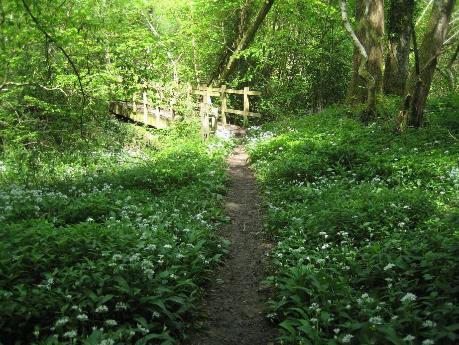
Making progress through the GCW series!

Some of the caches we found :

April 22 : Sandhurst (Gloucs) to Sandhurst : Colesbourne to Foss Cross

Hello, Mrs Hg137 here.

A night (staying nearby in Great Witcombe) had passed, and it was time for the fifth section of our epic walk from Sandhurst (Gloucestershire) home to Sandhurst (Berkshire). Starting at Colesbourne, where we finished the last walk, we were going up and across the hill tops to Chedworth, then finishing the walk where our route crossed the Fosse Way at Foss Cross (and yes, there is no consistency at all in those place names – almost everywhere else it’s ‘Fosse’ but not at ‘Foss’ Cross).

But first … a slight diversion on our way to Colesbourne. There is a puzzle cache based on the village called ‘When were these Coles Born?’ and we had solved the puzzle based on that neat turn of phrase, and stopped off to collect the cache on our way to the village. We planned to park one car at Colesbourne Church. Silly me – I had forgotten it was Sunday. No spaces at the church. We rethought, backtracked, and parked the car next to a wine wholesaler, having first checked it was closed on Sundays (unlike churches!) And off we went. The first cache on the walking route for the day was ‘Two Degrees West’, very close indeed to our starting point. The cache name made no sense till we inspected our GPS at the cache site – it was exactly 2 degrees west.

Colesbourne - 2 degrees west (exactly)

Colesbourne – 2 degrees west (exactly)

After a little bit of road walking, we headed onto tracks and into the countryside (and uphill). We found several caches as we climbed, all in good condition though some had not been found all winter. There was a bit of scrambling up banks, a bit of wildlife watching (a herd of about a dozen roe deer running across a field, and buzzards overhead), and a very, very pleasant walk through the Gloucestershire country while spring frothed and flowered around us. On the downside, Mr Hg137 snagged himself on barbed wire (the same piece, twice – he can be a slow learner!) and we both got stung by evil nettles, but that didn’t matter too much.


Spot the running deer!

Spot the running deer!


Very pleasant woodland walk

Very pleasant woodland walk


There was about a mile of road walking approaching Chedworth where there were no caches, not one, so we sped up and hastened along. Coming to a road junction, we spotted a parked car. It was a Porsche. Next to it was … another Porsche, and another, five in all. Mr Hg137 couldn’t miss this chance and rushed over to the drivers to ask what they were doing. It turned out to be a photoshoot, which will be featured in 911 & Porsche World magazine in June 2018 http://www.911porscheworld.com At least that explained why all those cars were so incredibly clean!
Porsches everywhere!

Porsches everywhere!


There was a steep descent down from the hilltops into Chedworth, and its church, almost the first dwellings of any kind that we’d seen since the start of the day’s walk. Chedworth church has an easy-to-find church micro, but the inside of the church is also worth a visit, with lots of material detailing the exploits and awards of the bellringers, and information on Elizabeth of York, Henry VII’s queen, who visited Chedworth and is depicted on a ceiling boss in the church (an early form of photo, maybe?). Elizabeth appeared again for our last cache of the day, which was based on the village sign, which included pictures of all sorts of things related to the village – Roman mosaics … English queens …
Chedworth church

Chedworth church


Chedworth village sign

Chedworth village sign


The last leg was a cacheless walk over the flat top of the Cotswolds, passing a gymkhana, over fields, under a disused railway and out onto the busy Fosse Way by the Hare and Hounds pub at Foss Cross.

And here are some of the caches we found:

April 21 : Sandhurst (Gloucs) to Sandhurst : Barrow Wake to Colesbourne

Hello, Mrs Hg137 here.

A week had passed, and we were ready for the fourth section of our epic walk from Sandhurst (Gloucestershire) home to Sandhurst (Berkshire). We *should* have driven straight along the A417 to Barrow Wake, overlooking Gloucester. But the road was closed after an accident, and a scenic tour of Gloucestershire followed, via Cirencester, Stratton, Seven Springs, Crickley and Birdlip, and arrived at our start point later than planned. Just then the traffic started flowing again…

Crossing the A417, we set off up Shab Hill past the telecoms masts and down a country lane. We were high up, following the Gloucestershire Way, with good views all round, and caches spaced at regular intervals. But, if road building programmes have their way, this will all look very different soon http://www.gloucestershirelive.co.uk/news/cheltenham-news/cotswold-motorway-plan-flatten-air-1393656

This could be a road soon!

This could be a road soon!


Our success at finding those first few caches was mixed – we found some, not others, and at least one was out in the open in an adjacent field! We spotted a seat – the first one we had seen – so stopped for an early lunch overlooking the Churn valley and Coberley long barrow. Just then a curly-haired, ginger dog appeared, soon followed by a muggle lady. We were sitting on ‘her’ seat. We shuffled up, and chatted, while the curly-haired ginger dog made covert attempts to get into our rucksack and steal our lunch leftovers.

Dog and owner walked on, and we followed them after a pause, as it gave us privacy to search for caches. It was cooler now, and not so sunny, and was that a drop of rain in the air? We reached the valley bottom, crossed the river, then the A435, and set off uphill across one of the biggest and dreariest fields we’ve ever crossed. Luckily, there was a cache at the far side of it … Unluckily, it was well wedged, and a few minutes of cursing and un-wedging ensued before we got to sign the log.
Upper Coberley

Upper Coberley


Climbing still, we walked through Upper Coberley, a prosperous looking hamlet (we looked much too shabby and muddy to be walking through here!). At the top of the hill we turned right, and the Gloucestershire Way turned left; it had served us well, but it was heading north and we were now going east.

We started on an undulating walk on tracks through the Pinswell plantation, along a ridge, through woods sprinkled with bluebells, primroses, daffodils and dandelions, and gently downhill towards Colesbourne, slowly losing the views as we went. Along our way, at regular intervals, were caches (they do help to keep you on the right track!), which were part of the Pinswell Loop series.

Expansive views ...

Expansive views …


... amid lovely old trees

… amid lovely old trees


Two caches are worthy of longer descriptions. One was sodden: water dripped onto our feet as we opened it. Inside was a geocoin: its subject – U-boats – sort of appropriate that it was underwater!

The other had many favourites: we didn’t know why. On arrival, we walked through some impressive stone gateposts and started looking for the cache. We couldn’t find it, and after about ten minutes admitted we were stuck and looked online for a spoiler photo (cheating, maybe?) We realised we had walked over the cache container several times …

We skirted the edge of the Colesbourne estate which is known for its snowdrops https://www.colesbournegardens.org.uk/ though they had finished by time of our visit. Crossing the Churn again – it was bigger now – we walked into the village and the end of this day’s walk.
River Churn, Colesbourne

River Churn, Colesbourne


We’d found thirteen of the fifteen caches we had attempted, and the threatened rain hadn’t happened. Superb walk, and a lovely bit of the Cotwolds, off the tourist trail.

Here are some of the caches we found:

April 8 : Sandhurst (Gloucs) to Sandhurst : Shurdington to Barrow Wake

After two day’s walking through the Severn Valley and the outskirts of the Cotswolds, our third day included climbing Crickley Hill. Approximately 500 feet of it.

Shurdington is at the bottom of Crickley Hill and our route would take us to the top, and then we would descend about half way to the Air Balloon pub, and then another short climb to the Barrow Wake car park overlooking the village of Birdlip.

Lots of ascent and with 10 caches to find – and heavy rain forecast for mid-afternoon – we couldn’t loiter too long.

After a short walk we left (cacheless) Shurdington and arrived at a track. This would be our route for the next hour or so. Initially flat, but rising steeply before flattening out nearer the top.

The first flat section yielded three caches. The first, GWYTHERS FARM, was part of a FARM series where cache container had a dairy connection. We had found a similar container the day before at REDDINGS FARM, but it was still a surprise to find a relatively unusual cache container.

One pint or two ?

Our next two caches were even more unusual. They were two caches in a ten cache trail based on the ‘Ships of the Culture’ series of books. (We were unaware of this series, but discovered many of the caches were based on names of spaceships in those books). The author, Ian M Banks, must have a real sense of humour as the first cache we found in the series was…a Carrot.

A Large Plastic Orange Carrot.

One of your seven a day

The second cache we found was a toilet. Yes, a small toilet. The toilet paper was of course used for logging.

Flushed with success!

Still chuckling, we started our climb started in earnest. The track became stonier and stonier. A small stream criss-crossed our path, and as we walked higher we were enclosed by trees on one side and a six foot muddy bank on the other. This muddy bank had to be climbed to reach our next cache.

Armed only with a geo-pole, a bit of endeavour and large amount of effort, Mrs Hg137 failed to climb the slippery six foot slope. Mr Hg137 noticed a slightly easier ascent route, found the cache, threw it down for Mrs Hg137 to sign, before the return throw and re-hide. That was our only scramble up the bank, as it soon became a typical Cotswold Stone Wall.

Our next two caches were relatively straightforward, one required pulling a small piece of string to extricate the cache from a hole, the other was hidden under a familiar cacher’s pile of sticks. The log of this cache was particularly wet, so we decided to have lunch and let the paper dry out for 10 minutes or so.

Pull the string!

We turned onto the Cotswold Way which would lead us to the top of Crickley Hill.

One of the flatter paths!

But first, two more caches which were some way from the main, busy footpath. One was hidden in an old bale twiner, the other in a hollow tree reached by descending a slightly too muddy path.

Eventually we arrived at the top of Crickley Hill. There are three caches at the top – a multi (which we didn’t undertake as its 9 waypoints would take us well away from out intended route), an earthcache and a standard cache.

With hindsight (Ed : hindsight being only useful when things don’t quite go to plan) we should have attempted the earthcache first. But we didn’t.

We headed straight for the standard cache, possibly on a footpath, but in all fairness not, straight down a steep, wet grassy bank. Using only a wire fence (and a geo-pole) for support we inched down the hillside to find GLORIOUS GLOUCESTERSHIRE. An easy find, once at GZ, and it was only when we were at GZ that we noticed a very much simpler footpath leading from the where the earthcache started! Whoops!

View from Glorious Gloucestershire

It was when we logged the cache, later that night, we appreciated the age of the GLORIOUS GLOUCESTERSHIRE cache. It was first hidden in August 2001. It is the UK’s 20th oldest cache, and is classified as ‘Ancient’. Our labours had found a very old cache indeed.

New container.. but an ANCIENT cache!

The other reason we should have completed the earthcache first, was not only did we have to answer questions about how a landslip had occurred, but we had to look at the many hills that we could see from Crickley Hill. Sadly, the rain clouds were rolling in, and we could barely appreciate the (what should have been) expansive view.

We rushed down the hill, passing the Air Balloon pub and arrived at our car just as the heavens opened. (The unusually named pub is allegedly named after the final landing place of one of the first UK balloon flights in 1784).

The rain deterred our visit to a puzzle cache we had solved near Barrow Wake.. that will have to wait for another day.

A couple of the other caches we found :

April 7 : Sandhurst (Gloucs) to Sandhurst : Down Hatherley to Shurdington

Hello, Mrs Hg137 here again.

The morning’s rain had passed, so in the drier afternoon we walked the second section of our epic walk from Sandhurst (Gloucestershire) home to Sandhurst (Berkshire). This section followed the Gloucestershire Way, starting from Down Hatherley Church, along the edge of a golf course, round the perimeter of Gloucester aka Staverton airport, then, in quick succession, across the A40, the Gloucester-Cheltenham railway, and the M5, before following a stream through Badgeworth and finally to Shurdington at the foot of the Cotswold scarp. Quite a varied walk!


It was some way to our first cache of the day, so we started with a pleasant walk through the silver birches fringing the golf course, watching the golfers hitting their shots with various amounts of competence. (We didn’t comment, not even on the worst efforts – honest!)

Gloucester Airport

Gloucester Airport


... and then the mud started!

… and then the mud started!


After crossing a road – no caches yet – our route led us on a fenced-in path that skirted the very edge of Gloucester Airport. And here the sticky, squelchy, slippy mud started … It sounds grim, but the airport was hidden behind a hedged bank, a skylark sang overhead, and we were walking/slithering along the reed-fringed Hatherley Brook. A while later, we emerged at an underpass which took us under the A40, and across cycle route 41. We had arrived at our first cache – Collie Capers – a series named after a favourite dog-walking route. And suddenly there were dogs (no collies though), cyclists, runners, walkers … We picked our moment, retrieved the cache, and had a coffee as they all streamed by.
Rickety railway bridge

Rickety railway bridge


On we went, following the stream. Our next target, and our next cache, was close to the main line railway from Cheltenham to Gloucester. It was called ‘The Rickety Railway Bridge’ and, oh crikey, did it live up to its name. It all looks solidly supported but I’m a bit worried that a mainline railway should be propped up like this?
Aah ... cute!

Aah … cute!


The one field between the railway line and the M5 is populated with geese and goats of all ages. The oh-so-cute goat kids (goatlets?) were totally underwhelmed by Mr Hg137 attempts to make friends.

Crossing the M5, we were immediately at our next cache. It was only as we approached we registered the Difficulty/Terrain rating (difficult, very difficult) and thought we may not attempt the cache. However, a careful up-and-over the mound of what looks like fly-tipped building rubble, and we were at GZ. Not so hard, really.

Our next few caches followed the line of a stream, along a more-or-less soggy path. They were all from the ‘Cheltenham Circular Caching Challenge’ series, which is described like this:
‘A series of in excess of 100 caches of a variety of terrains and difficulties set around the Cheltenham Circular Footpath by some of Cheltenham’s cachers

Devised by Cheltenham Borough Council, the Cheltenham Circular Walk follows a route of approx 26 miles and gives wonderful views of the Cotswolds escarpment. The walk starts and ends at Pittville Park and passes Cheltenham Racecourse and Dowdeswell Reservoir.

The Cheltenham Circular Caching Challenge of more than 100 caches follows this walk. It starts at Cheltenham Race Course with #1, and the caches are numbered clockwise. But you could of course start and stop anywhere along the route.’

Of the several caches we found from this series, one stands out: ‘No more Bull’ (the clue is in the title). We had walked through a muddy field, with cows. They seemed disinterested at first, but started to wander towards us as we walked. We speeded up, as far as is possible in ankle-deep mud. At the far end of the field was a kissing gate, and a cache. We narrowly beat the cows to the gate and slipped through to safety just in time. The cache was then retrieved under the close inspection of many big brown bovine eyes.

Just two caches remained, one, a large cache across a little stream – a bit of stream jumping was needed here, and the geo-pole came in very useful – and the other, the Church Micro in Badgeworth. We looked inside the church and had a quick refreshment stop before finding the clues. Had we realised one of the clues was right in front of us, we’d have saved ourselves some time! We argued about this clue, which asked what year in life someone was at the date of death – since if one is in one’s XXth year, one has yet to reach XX in age. (E.g. a one year old is in their second year of life). Anyway, we calculated 2 sets of coordinates, and found the cache at the first of them.

Badgeworth Church

Badgeworth Church


The description of the cache also asks for a report on something else in the churchyard – the toilets… They were closed. Apparently this is almost always so, judging by other logs!
Closed!

Closed!


And that was it for the day. Tired and muddy, we arrived at Shurdington, a little bit closer on our quest to walk home to Sandhurst from Sandhurst. Quite a varied walk!

Here are some of the caches we found:

April 6 : Sandhurst (Gloucs) to Sandhurst : Sandhurst to Down Hatherley

Last year, 2017, we set ourselves a challenge to walk from where we live in Sandhurst, Berkshire to Sandhurst, Kent. There is a third Sandhurst in the UK, which is just a few miles North of Gloucester.

This year’s challenge is to walk, (and cache of course) from Sandhurst, Gloucestershire to our home in Berkshire.
The distance is likely to be about 90 miles. As last year, we will try to walk a relatively direct route, but again like last year we do have to avoid certain obstacles such as Army Land, Airports, Rivers etc..

We are starting our challenge later this year as Winter’s short day-length coupled with a 2 hours drive would have meant very short trips. Then, the late Winter weather (“The Beast from the East” x 2!) scuppered our start dates in February/March.

So, some weeks later than planned, we booked a weekend away to start our walk and cache our way home.

St Lawrence, Sandhurst (Gloucs)

Sandhurst (Gloucs) is a relatively small, strung-out village just off the A38. There is one road in, and another out. Its location near to the River Severn means when the River floods, Sandhurst can be cut off.

We parked a car in the church car park and very quickly found our first cache. The GPS said ’17 feet away’ and before we could check the hint, the magnetic micro was in Mrs Hg137’s hand.

First cache of our journey home

Signed, replaced. Very easy. Fingers crossed for an easy ride for the next 90 miles!

Before we headed East, we wanted to see the River Severn. It had been on high flood alert (red alert), for the previous 4 days and we wanted to see how full it was. We never got there! After walking through a farm we arrived, just 2 fields away from the river-bank. But that first field was one large puddle! Water was gushing in from another field, our exit stile was in the middle of a lake. We abandoned our visit to the River Severn, though we both ended up with some of its water in our boots!

Should the River Severn really be this close ?


Sandhurst Church, where we found the first cache, is relatively old and dedicated to Saint Lawrence. It has been a place of worship since the 14th century, and also contains a 12th century font. The peace in the church was marred by roadworks going on within yards of our parked car!

No caches here!

The first couple of miles of our route were cacheless, even though we went over a couple of stiles and saw ‘useful’ trees which would have made good hosts.

In the distance … Gloucester Cathedral

Across flooded fields we glimpsed Gloucester Cathedral; shortly after we walked near to the Nature in Art Museum.

Nature in Art Museum/Gallery

The Museum acts a gallery for artists and artworks associated with Nature. As we crossed the Museum’s drive we made a navigational error. We were looking for a footpath, but we failed to realise until we had walked for 15 minutes, that there were two adjacent paths…and we had taken the wrong one.

This meant we had an extra half-mile road-walking to reach the tiny village of Twigworth. Here we crossed the busy A38,and headed for a bridge over the Hatherley Brook. We were expecting the Brook to have overflowed its banks too, but it hadn’t which meant we could try to find three caches close to its banks.

The first ‘Green Troll House’ was on one of the bridges. We took sometime to find this cache.

Somewhere on this bridge..


Magnetic. Hidden under feet, but not under the bridge.

Very specific. But we fingered the bridge all over. Young spring nettles defended (a bit too vigorously) a location or two and after 10 minutes we were about to give up. Then we saw the item, well concealed. A classic case of standing back and looking from a distance rather than fingertip searching.

…here it is!

The next cache was easier. Under a stile – one of those stiles, which now goes nowhere, as the footpath bypasses it. Everyone now walks by the cache without even realising it is there. (The stile did give Mrs Hg137 a chance to ‘relace her boots’ as a few people approached just as the cache was about to be replaced).

Our next cache was our only DNF of the day. Hidden by a kissing post – it was nowhere to be seen. We weren’t the only cachers to log a DNF, so we are fairly certain the cache has gone.

We continued following the Hatherley Brook, now adjacent to a Golf Course to Down Hatherley Church. We were on two long distance footpaths, The Glevum Way which circumnavigates Gloucester and the Gloucestershire Way which is a 100 mile path visiting Stow-on-the-Wold, Chepstow and Tewkesbury.

Two long distances footpaths at the same time!

Down Hatherley Church (St Mary and Corpus Christi) was the location for a fairly straightforward multi.

St Mary and Corpus Christi, Down Hatherley

Find two gravestones, extract a date or two, perform a simple calculation and find the cache. Most previous finders had mentioned that the co-ordinates were 30 feet out, so we went to the calculated co-ordinate site and split up. Mr Hg137 set off towards a distant tree, but Mrs Hg137 found the cache with the help of some nearby sheep!

We know where the cache is! Don’t ewe?

So we completed the first 4 miles of our ‘journey home’, found 4 caches as well as innumerable flooded fields. Fingers crossed it gets drier!

May 26 : Sandhurst to Sandhurst (Kent) : Kent border to Sandhurst

PROLOGUE

Our last caching trip on our Sandhurst (Berks) to Sandhurst (Kent) finished yards from the Kent border, and when we drove away we had thoughts of striding purposefully into Kent and onto Sandhurst… however since our last visit we were asked to undertake a small diversion while still in Sussex.

Kent, Sussex

Kent is ahead of us..but we’re not going there, yet!


The last cache we found on our previous trip contained a sheet of paper with the ‘Northings’ for the Great Wigsell Multi. Another cache, unfortunately now archived, contained the ‘Eastings’. This meant the Great Wigsell Multi was unreachable. The cache owner of these three caches contacted us with the missing information and asked, if we had time, to visit the Multi as it contained a trackable which needed to be moved on.

And so instead of heading East into Kent, we headed further South through light woodland for a 1/3 of a mile. We were pleasantly surprised on our arrival. Not only was the cache there after an eight month gap…but it was an ammo can!

We released the trackable and headed back to our car, wondering how many other cache owners we would be helping on the this holiday (see previous blog for more details).

And so to Kent.

THE SANDHURST WALK

Before finding the Great Wigsell Multi our day had not begun well. There had been a major accident and our route to the Kent border had been blocked. A plethora of side roads were also blocked with roadworks so we had had an interesting drive to our start point.

Our route was to take us 2/3 mile along a narrow country lane, unfortunately this was being used as one of the few roads open. We edged our way along, taking care watching out for traffic.

Or at least that was the agreed plan.

Sadly Mr Hg137 decided to check maps/GPS whilst walking up the pavement-less road and failed to spot a large pot-hole.

He landed considerably worse for wear, face down, lying on the tarmac.

Grazed wrists, ripped trousers, and several layers of skin removed from a lower leg. Ouch!

He limped to a gap in the roadside, where a passing motorist provided us with a few tissues which staunched the wounded leg. We both thought that having walked so far on our Sandhurst route, we would fail with just 2.5 miles to walk!

We sat. Annoyed.

Eventually Mr Hg137 stood up. The bleeding had ceased, and he could put weight on the injured leg (hidden behind the ripped trousers).

We tentatively walked on.

Kent countryside


We were following, for the last time, the Sussex Border Path, which up to that point had been brilliantly signposted. Sadly when we needed a post to show us the way to a cache 300 feet away, it was missing. No obvious track through farmland, and with some way still to go, we abandoned our search before it really got going. We knew we were getting close to our destination though as the cache belonged to a series entitled “Sandhurst Cross Circular Walk”.

The route took us through a farm. Clearly the farmer had had trouble with hikers, as there were a plethora of “Keep to the Path”, “Close the Gate” type signs. However the farmer had failed to mark the signpost clearly as we approached his back garden, and the fingerpost was angled for us to walk straight through his garden rather than a tiny path just by the fence line.

You can’t walk through Kent without seeing some of these!


It was shortly after this we found our first Kent cache on the walk. Hidden in tree roots. It had been well over an hour since our finding of the Sussex Multi so were grateful for an easy find.

Kent

Under the tree roots…

Our route took us through woodland, and around farm fields. We crossed far too many stiles for our liking (too tall for Mrs Hg137, too wobbly for Mr Hg137’s now-healing leg).

Kent

A Kentish stile!


And then we arrived at a Roman Road – and another cache. Again hidden in tree roots. Here though we had a long search. Lots of trees, and lots of roots.

Kent

Did the Romans leave this geocache for us to find ?

We were eventually successful and strode/limped purposefully the 1/4 mile into the village of Sandhurst.

A beautiful village green and fabulous clock tower. Our journey was complete.

Sandhurst, Kent

Sandhurst, Kent


Our final cache was under the clock tower, and we waited ages, for a bus driver to vacate the seat on which the cache had been placed.

Our final cache on this walk!


A fabulous setting for the end of our walk!

EPILOGUE

Sandhurst Geocachers Trail Trackable starts its quest

Sandhurst Geocachers Trail Trackable starts its quest

And so our walk was at an end. We finished in high Summer on a boiling hot day. We had started in the height of Winter, with ice on the ground. We had caught trains and buses. We had used many a long distance path including the Blackwater Path, The North Downs Way and the Sussex Border Path. We had walked beside canals, rivers and underneath a major flight path. We’d walked over Surrey’s highest hill, and walked through the claggy clay of the Weald. We’d undertaken quite a few Church Micros and learned about such diverse people as an Astronomer Royal and the founder of Ottawa. We even saw the Flying Scotsman!

The Flying Scotsman

The Flying Scotsman


We’d heard lots of birdsong and been lucky enough to see deer, a heron, an adder and a kingfisher.

Our route would have been approximately 60 miles if we had walked in a straight line but various constraints (Army land, Gatwick Airport, reservoirs) prevented this. Our convoluted route of 86 miles kept to footpaths where we could, avoided major towns and where possible picked a route with caches to find. Our route is visible here https://www.geocaching.com/track/map_gm.aspx?ID=6190539

An excellent adventure which we thoroughly enjoyed.

Sandhurst, Kent

As we noted on January 1, there is another Sandhurst, near Gloucester, a journey which we will undertake probably next year.

Do look out for that!

May 24 : Sandhurst to Sandhurst (Kent) : Stonegate Station to the Kent border

Hello, Mrs Hg137 here.

Part way through our week’s holiday in Hastings, we took a day away from sightseeing to tackle the penultimate leg of our unofficial, self-made long-distance path from Sandhurst (just in Berkshire) to Sandhurst (just in Kent). Today’s route was from Stonegate station to just a few yards from the Kent border near Hawkhurst Fish Farm.

Stonegate station

Stonegate station


Leaving the station car park (where do all the passengers come from? It’s in the middle of the countryside), we set off roughly parallel to the railway, along a farm track, stopping to talk to the farmer, and then on along a grassy path at the edge of a field to find our first cache of the day, part of the ‘Burwash Bash’ series. And it was a pretty good cache, hidden away inside the innards of a plastic creature (think ‘rivet’, ‘rivet’, ‘rivet’). Just as we replaced the cache two people came along, armed with maps and clipboards. They were researching a long-distance route of their own. We explained about our own mission, and about what we were doing, lest they thought us suspicious/mad, pointing vaguely in the direction of the cache.
What are these for?

What are these for?


We followed the two walkers, who got ahead when we stopped to find the next cache, in woodland, hidden in a fallen tree among a selection of numbered insect traps/nests? we didn’t know what they were for. Further on, we briefly crossed the railway tracks to find a cache in a gate, then returned to walk through woods, where we found … a dump of abandoned model houses … very odd.
... And why are these here?

… And why are these here?


A little further on in the woods, we came across a couple putting pieces of red tape round some of the trees. They left when we appeared. There are some strange people and things in this bit of Sussex! Two more caches were found, the first overlooked by a passing runner, and the second watched from above by a gang of railway workers. We had seen about twenty people so far; this wasn’t the quiet path in the country we had expected!
Watch out for trains!

Watch out for trains!


We turned uphill away from the railway and things went slightly wrong. There was a footpath diversion, but it was only signposted from the other direction, and, unknowing, we emerged onto a road in a place we weren’t expecting. Then we couldn’t find where the diverted path continued, and accidentally walked down a farm drive before re-finding the path. We were only certain we were back on the right path when we found the next cache. We carried on uphill, finding caches as we went and dealing with more bits of uncertain path signage. At least the series of caches was keeping us on the right route!
Signpost to ... where?

Signpost to … where?

Where's that path?

Where’s that path?

Eventually we emerged onto a road, and paused for a drink of water. We now had a long, cacheless, hot walk along roads to Hurst Green. It was time to step away from the ‘Burwash Bash’series, so time for a quick tribute to this series; we’d found thirteen caches from the series and it’s in beautiful countryside, with a variety of containers and methods of hiding; all were well maintained, with clean, dry logs in an inner pot in the cache container. Here are a selection of caches from this excellent series, in no particular order:


What a varied series!

OK – advert over – we stepped onto the tarmac, on a hot day with the early afternoon sun reflecting from the road, and walked along the road and up the hill into Hurst Green. Two and a quarter miles later, we sat on a seat in the village for another drink of water.

Somewhere in Hurst Green ...

Somewhere in Hurst Green …


Refreshed, we walked up to the A21, and found our first cache for a while just up the road. That done, we crossed the busy road, set of down a track, and were almost immediately away from the busy village and in open country once more. It was just a couple of miles more back to the car at the end of the walk, and there was one more cache to find, about midway. Called ‘Pond Bay’, it was to be our 1900th cache, so we spent quite a while looking for it; it hadn’t been found for 9 months, since August 2016, and it wasn’t quite where the GPS should have been … but find it we did.
Long lost cache, needing some TLC

Long lost cache, needing some TLC


Then it was just a mile back to the geocar as the afternoon cooled. Fifteen caches found, and just one more walk to go until the end of our quest.

May 21 : Sandhurst to Sandhurst (Kent) : Tidebrook to Stonegate Station

Hello, Mrs Hg137 here.

May 21st … the start of a week’s holiday in Hastings. We planned to look round the area, do some of the ‘tourist stuff’ was planned, and also to finish off our unofficial, self-made long distance path from Sandhurst (just in Berkshire) to Sandhurst (just in Kent).

Our journey to Hastings allowed us to complete another short section of the walk, just over five miles from Tidebrook to Stonegate Station. Setting off along a lane south from Tidebrook, we were looking for the footpath that would set us on our way. The hedge seemed impenetrable. Where was it? We asked a passing runner. She pointed to a tiny opening in the hedge. There was just room for a stile, and then we were off the road and walking through a field of sheep and lambs. Mr Hg137 tried to chat with them. They were underwhelmed. (Sometimes I worry about him …)

Lunch spot

Lunch spot

All our caches for today, except the last, were to come from the ‘Tidebrook Trail’ series. We found the first, then stopped for lunch in a pretty patch of woodland near a stream – yes, I know we had just set off, but it had been a long morning, lots of packing to do – and then set off again through fields and woods in the sunshine. My, it was getting quite hot now!

Enchanted forest

Enchanted forest

The path led on through a plantation of trees, planted in rows, upright in growth, with silvery leaves. We didn’t know what they were, but a passing muggle said they were poplars, and that she could remember them growing up over the last 30 years, and that it was like an enchanted forest.

The second cache was easy to find, though surrounded by angry stinging nettles, and then it was on to the third, in a tree overlooking a (dry) ditch. I excelled myself here (twice), first because I failed to spot the cache even when I was a hand’s distance away from it, and then because I dropped the log into the ditch. Mr Hg137 nobly retrieved the log, then spent much of the rest of the walk remarking on my ineptitude and his altruism. Pah!

We went on in the sunshine (it was quite hot now), through a mixture of fields and woods, finding more caches from the series as we went. The path went through Wadhurst deer park – the giveaway is the very high fences – I wonder why there are so may deer parks around here (there is one less than 10 miles away, near Frant). Another cache was found at the far edge of the deer park, then another at the edge of the woods. Here we turned left the Tidebrook Trail to head for the station. This cache series is excellent, one to try if you are in the area. It passes though beautiful countryside, has a variety of caches, both in hiding place and type of container, and is also well maintained by the owner, with clean/dry/not full logs.

Nice geocache!

Nice geocache!


More excellent geocaches

More excellent geocaches

From here it was just a walk downhill along a track and a mixture of quiet country lanes and tracks, more woods and fields, before we emerged onto a busier road close to Stonegate station. “Busier” meant that there was traffic, but not much, and most of it travelling to or from the station. The station itself is in the middle of the countryside, at least a mile from Stonegate village. It has quite a large car park, so I guess it is mostly used by commuters in the week. Being a station, it had its own geocache, one of the ‘Sidetracked’ series placed near current/disused stations. We took quite a while to find this cache, as we didn’t understand the hint, couldn’t work out exactly where it was, and generally behaved like two tired, hot people. Eventually we found it, behind some nettles. Ouch! And those nettles must have done a lot of growing in the week since the cache was last found, as they didn’t even get a mention then!

So that was our walk/caching done for the day, and only about 15 miles to drive to the hotel where we were staying, on the northern edge of Hastings.

May 13 : Sandhurst to Sandhurst (Kent) : Frant to Tidebrook

As with most of our trip, we had the luxury of two cars, and as usual we drove to our destination, Tidebrook first. Before joining forces and returning to Frant, in one car, we had work to do.

Frant

Frant Village Green


In Tidebrook there were, amongst a couple of other caches, 2 multis. We have been caught out before by multis when we’ve discovered that the final cache is hidden half a mile back where we’ve walked from. So this time we collected the clues to Church Micro, and a Fine Pair and discovered both GZs were within yards of our destination car. Great, save those for later.
Back to Front sorry Frant we went, to undertake our first cache of the day … another Church micro. This one was not a multi and should have been a simple find…

We had noted that the cache had been found early January 2017, and then DNFed several times since. Since our last trip we had messaged the cache owner as to whether the cache was still there, and would they like us to replace the cache if they didn’t have time. Shortly before our visit we had yet to receive a reply so we ‘nudged’ again. This time we did get a response, and authority was given to replace if not found.

So, on the day, when we arrived at St Alban’s church, we were not expecting to find the cache. We did though search lots of places (for about 15 minutes) before deciding we would hide a replacement. We took suitable photos and emailed the cache owner when we got home. That way, if WE had got it in the wrong place, they could move it!

Frant Church


We don’t always go inside every Church we visit, but this had a great history. This included the organ breaking down on Christmas Day 1966, and the subsequent discovery that organ was made by the same person who designed the organ in the Notre Dame. Also, in the Church is a memorial plaque to local resident John By, who founded a small town in Canada, renamed by Queen Victoria as Ottawa!

It was time to move on and walk the 3 miles or so to our next cache. Our route took us along the busy A267, before we turned onto a side-road which became a farm track. We thought these side roads would have no traffic, but being Saturday morning everyone was out and about!

Quiet Road (for once)


Soon though we were in open country, and we could see the valley below. We had picked up the Sussex Border Path and it led us through a field of cows (which seemed more interested in grass than us), and through a very nice wooded glen. A wooden footbridge provided an ideal spot for lunch and as we munched we admired the many insects going about their business in the dense woodland shade.

Lovely bridge, just right for lunch


We crossed the bridge and climbed to another field, again with cows. This time we skirted round the field as, standing steadfast were a mother and calf right on the official footpath. They watched anxiously as we passed by. We went through the farmyard and into another area of woodland. We were greeted with bluebells and wild garlic, which we had seen several times on our journey.

Can you smell garlic ?


The Sussex Border Path (SBP) undulated over a couple more slopes until we arrived at Beech Hill. Here we said goodbye to the SBP as we would be heading south on a minor road to our next cache.

Hidden a 4-trunked tree, this should have been easy.

The GPS took us to one. No sign of the cache. We looked at the adjacent trees.. 1 trunk, 2 trunk..3 trunk where are the 4 trunkers?

Eventually we did find it. As it turned out the ‘fourth’ trunk was behind the other three, so it was only an obvious 4-trunker on close inspection. The cache inside was wet. Sopping wet. We could just sign our name on the log, but we tipped all the water out and took a tissue and dried, as best we could, the container. Two caches down, and two sets of cache maintenance.

We were within a mile of our destination, but we had a quarter mile walk along a busy road first, before walking along a footpath (unsignposted, so we were never sure it was right) to arrive near to the Church we had visited earlier.

100 yards later we found the Church Micro – a cache which should have been 18 inches off the ground, was only 2 inches above it. (Grr, that’s three caches where the cache owner has maybe not been as vigilant as they ight have been).

Our next cache, part of the Tidebrook Trail was our easiest find of the day, under some logs. However to arrive at the cache a heavily barbed wired stile had to crossed. Sadly Mrs Hg137 failed to spot the barbed wire hazard, and her leg came slightly worse off. No major harm done (a bit of blood, a bit of grazing), but enough for us to call a halt after one more cache, the second multi whose location we had calculated earlier. Fortunately for us an easy find.