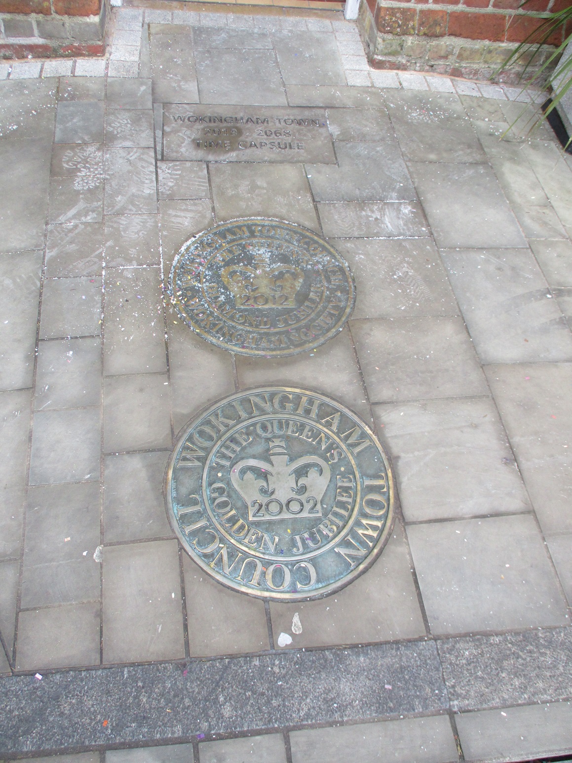
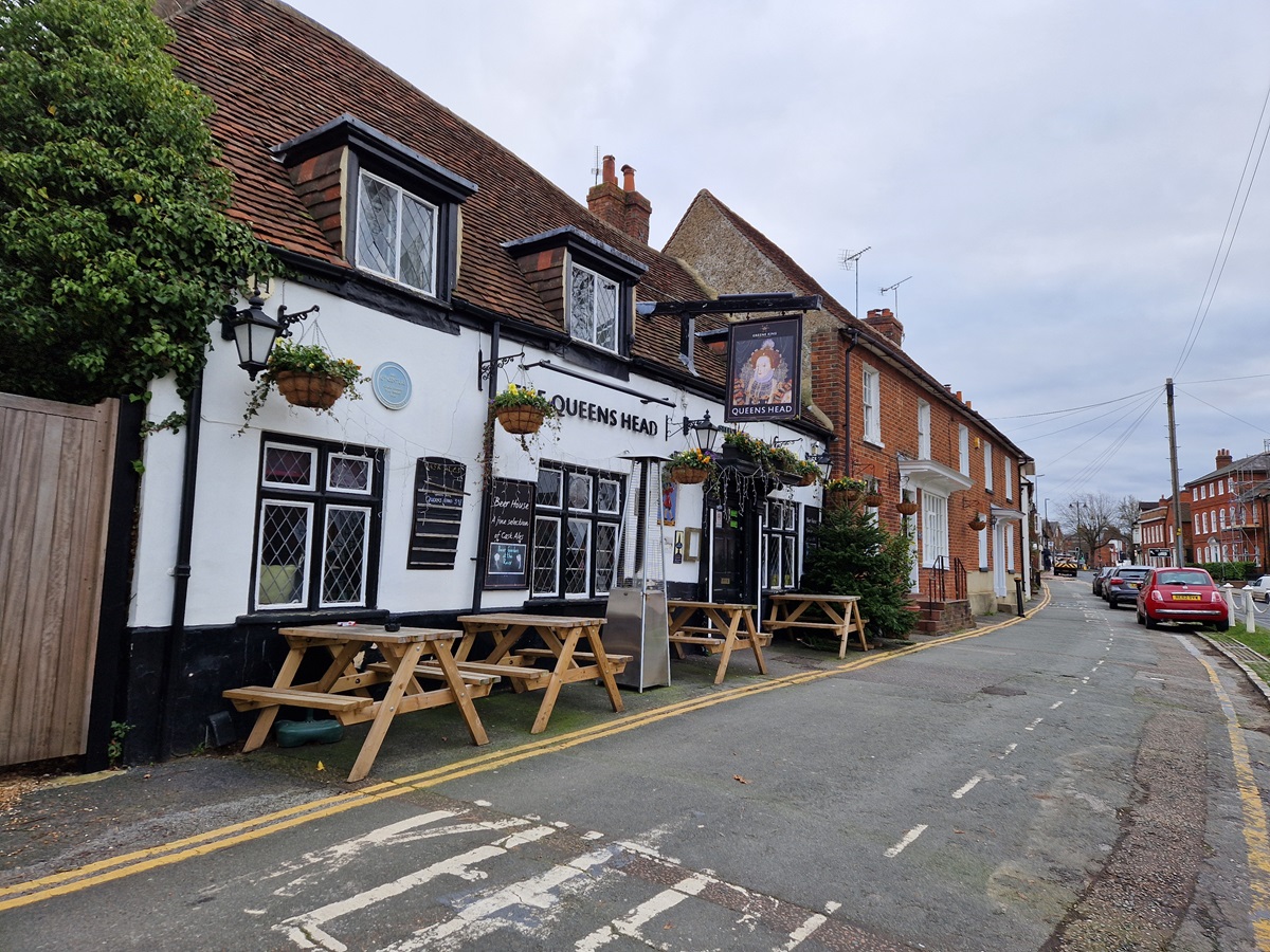
Just five days previously we had visited Wokingham in perishingly cold weather and undertook an ad lab in Wokingham Town Centre.
Simultaneously, we tried to undertake two multi-caches which shared much of the ad lab’s route.
A combination of the cold, confusion over which cache we were doing, and the pressure to return to our car before our car parking charge ran out -left us annoyed and frustrated.
Mr Hg137 knew the Town Centre well – he’d lived in the town for 30+ years, Mrs Hg137 had a reasonable knowledge too. And we still messed up.
We decided once the temperature rose (admittedly it was only a degree or two), and some improved planning of a walking route we would return.
So five days later, we started again on the two multi-caches.
One of the two multis took us on a glorified pub crawl around the Town Centre. Wokingham was once famed for having the most pubs per head of population. Sadly a combination of Wokingham’s population growth and the economic downturn of pubs, has meant this title has been lost.
Our caching walk took us to several pubs that remain and at each pub, we had to gather numbers from either a feature of the pub itself, or a nearby piece of street furniture.
Simultaneously we followed a trail of blue plaques. The ad lab we had completed visited 5 blue plaque locations, but the multi took us to many more. Indeed the cache owner didn’t let on that the waypoints were at ‘blue plaques’ as he referred to them as ‘Wotsits’ in the cache description. What made this multi harder, was that at every plaque/waypoint we had to find a number, and use that as a basis for the coordinates for the next plaque/waypoint. We had to take great care on checking every number we found, as we didn’t to miss a blue plaque.
In the end we collected a variety of numbers for both the pubs and plaques, calculated coordinates and found both ‘final’ caches. One was hidden in a set-back location, the other in a high visibility location within a car park.
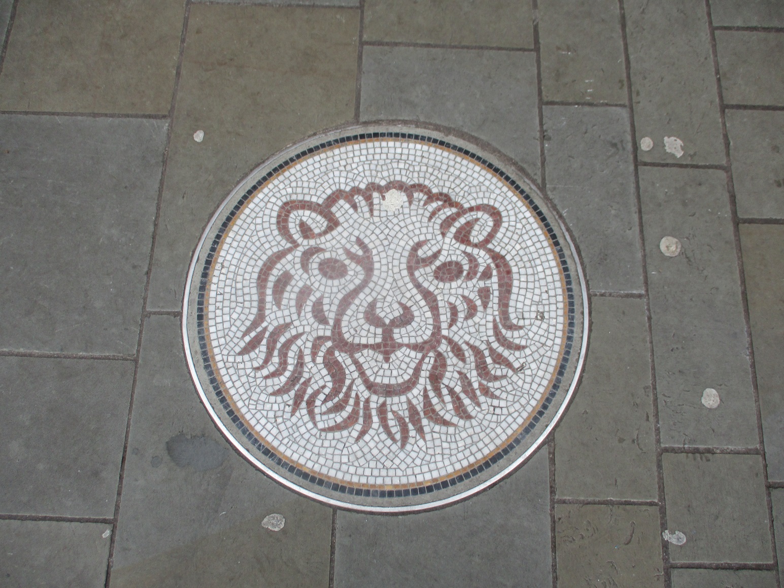
As well as a pub crawl, and a blue plaque trail, Wokingham has a ‘mosaic’ trail with mosaic laid into the pavements. We are quite sure, that in that not-to-distant future, these mosaics may well form an opportunity for another caching trail in Wokingham.
Our only disappointment of the morning was spending 15 minutes looking for a standard cache in one of Wokingham’s Parks. Sadly for us, the cache has disappeared and we registered a did-not-find. It sort of summed up the last few days in Wokingham – hard work, for very little gain.
We were in Cornwall on a guided walking holiday. We had visited many of the bays, coves and villages that Cornwall is famous for, but not done any geocaching. We have tried over the years to geocache on a guided walk, but it is near-impossible – so we now don’t try.
Our base for the week was St Ives, and on the ‘rest day’ from guided walking we set about finding some of the caches in St Ives.
We had 3 church micros (all multis), another multi based on the lifeboat station, a virtual cache where we had to email some answers to a couple of questions, a 5 stage adventure lab, an earthcache and two standard caches. We were in for quite a day!
Most of the caches were attempting were close to the seafront and we decided to start at the Eastern end (closer to our hotel) and head West. As it turned out, this was a big mistake as all but one of the muti-caches sent us in an Eastward direction retracing our steps. St Ives has many bays and beaches with the town centre about 20-30 feet higher. We descended from the hotel via some steep pavements, and some granite steps (which we would see a lot of later) and walked Eastwards to our first cache. At the far end of the town beach, the promenade zigzags up and away from the town. Having descended a lot of height from the hotel, we were disappointed we had to climb so quickly afterwards.
First cache of the day
The cache, one of only two standard caches we were to find all day, was tucked in a bush in the tight bend of a zigzag. A fairly easy find, and as we signed the log on a nearby seat – a robin came and checked what we were doing. The cache was big enough to leave the trackable Muh-Kuh. Good luck on your future journey.
We walked back down the zigzag path, and arrived the beach promenade. We had only been about 15 minutes at the cache site, and in those 15 minutes the beach had ‘woken up’ . There was more hustle and bustle about the beachside emporia, the smell of all-day breakfasts permeated the air. Children were running to the beach.
St Ives Station brings ¾ million people a year to the town and the station was the first part of the adventure lab. All we had to do was find when the station was opened (and it was over 150 years ago!). Part 1 of the ad lab complete we returned to the set of granite steps we walked down earlier.
Can you see the sparkly granite ?
These steps link the beach to the main town centre, and were quite busy. An earthcache had been set based on the granite in the steps and surrounding walls. We had to measure granite stones, compare granularity, and explain any differences in granularity all while families were struggling down the steps with buckets, spades and other beach paraphernalia.
How many clock faces ?
We walked on to the first of the Church Micro Multis. Like many such caches we had to count objects, write down dates to derive coordinates. One of the more interesting questions was ‘how many faces does the church clock have’. Is the answer four (a face on each side) or one ? Or neither!
We sat in a small garden of remembrance, calculated coordinates and realised we had to head East… back to the Granite Steps. We were looking for a magnetic cache. At GZ there was only one metal object – a rather smelly drippy drainpipe. We both shoved our hands up, in, and around the drainpipe to no avail. Remember this was next to the Granite Steps, where people are busily going up and down.
Then we remembered – geocaching coordinates are great in 2 dimensions, but NOT in 3. If we climbed the steps our coordinates would still be same, just higher. Here indeed there were more metallic objects, and after a few minutes the cache was found. It took us a lot longer to remove the rancid drainpipe smell from our hands.
Dotted along the seafront, are various plaques giving details of various tragedies at sea. On a hot benign day in June, it is hard to imagine – but on a wild winter’s night the sea needs a lot more respect.
St Ives Lifeboat Station – the start point for 3 geocaches!
This was evident at the Lifeboat station – where various plaques told us of previous rescues. It was here, that three geocaches collided. We had another ad lab question, a virtual cache question to answer, and some numbers to collect for another multi. It was possible to stand in one position and find all the answers. Having completed the virtual and ad lab, we calculated the coordinates for the multi. Back in the Easterly direction – far beyond the Granite Steps we had already spent too much time at. We decided to park this cache, until the end of the day, when we were heading back to the hotel.
We were entering the tourist/working quarter of St Ives bay. Holidaymakers were out in force, buying coffees, ice creams. There was a constant throb of diesel engines in the bay. We were grateful we didn’t have a physical cache in this stretch, as it was very busy. It was also very busy outside the Sloop Inn where we answered another ad lab question. The Sloop Inn has a webcam, which rotates between the lifeboat station, its own serving tables, the pavement, the sea front and the town quay (Smeaton’s Quay)
St Leonards Church
Our next ad lab question was at St Leonards Chapel, at the entrance to Smeaton’s Quay. St Leonards is also known as the fisherman’s church. The ad lab question was quickly answered, as was collecting some numbers for our second church micro. Unusually for us, the final was in a westward direction so at least we didn’t have to backtrack along the busy seafront. We did though walk the length of Smeaton’s Quay, as there was a small, standard cache hidden at the far end. This took us a but too long to find, as the coordinates were a little off, and the hint didn’t provide an obvious clue. The end of the quay was quite busy, so we ambled around, casually looking at potential hosts, as well as admiring the boats in the bay. Eventually we stumbled across the host and discovered the cache wasn’t even hidden – just lying in broad daylight. We decided to replace as per the hint.
We headed West, passing through a maze of old-town houses and cottages. This is where St Ives fishermen lived many years ago (and may do so now).
It is also the artists quarter, and many of the small shops were selling paintings, pottery and the like. St Ives had an artist’s movement in the first part of the 20th Century and today boasts the Tate St Ives gallery. On our walk around town we saw a Barbara Hepworth statue, and artists of tomorrow learning their craft.
After traversing the old town we arrived at a small cove. Above the cove, hidden in the rocks was the St Leonards Church cache. A surprisingly tricky find. We sat on the rocks and had lunch watching swimmers, and snorkellers in the bay below.
Two more of St Ives’ bays
Rising beyond the bay is a small hill. Atop the hill is yet another church – and of course its associate Church micro cache. On the way there, we found our last ‘standard cache’ of the day, well hidden on a slightly-too-steep-a-slope for comfort. One slip of the wet grass… and it needed good shoes to prevent some sliding towards the sea. It was here, as were checking our best means of approach to this cache, we saw one of our walking leaders of the week, we had a chat… and then continued our search. Well hidden, and our reward was a heart-shaped trackable.
The last Church of the Day, high on a hill
Our searching of the last church micro cache was hampered as a couple were ‘canoodling’ right next to where we wanted to search. We found a seat, had a quick coffee, and waited.. The couple had moved on, and we found the cache quite easily. (It would have been more appropriate if the had found the heart trackable in this cache of course!).
So our westward journey was complete, all we had to do was wander back along the seafront, through the throng of tourists, passing the granite steps, heading almost back to where we found our first cache of the day, to locate the ‘Lifeboat multi’ we had parked from earlier. Hidden in a bush, behind a seat, it didn’t take too much rummaging to find.
An interesting fact… but why did they do it ?
So a great day’s caching several multis, an earth cache, a virtual, some standard caches and a 5 stage ad lab. And given the number of times we passed the Granite Steps… we know that like the back of our hand!
With lockdown still in force, we didn’t have many options for going out, let alone geocaching. But … we needed to buy some DIY materials, a couple of miles away … so we decided to take our permitted daily exercise walk afterwards, which might just take us past the start point of a local multicache. (Editor’s note: It’s strange how so many of these walks conveniently lead us towards and past caches!)
Scotland Hill
Anyway, the DIY materials were quickly bought and stowed away in the geocar. Then off we went to the start point of the cache.
It’s a historic well, tucked away at the side of the road, halfway up Scotland Hill in Little Sandhurst. We paused, admired it, and collected the information we needed to find the cache coordinates. A muggle spotted us, stopped his gardening, and came over for a chat. He said he knew the well was originally thatched (it’s now tiled), but otherwise knew little about it. We checked later and found an old photo of the well, complete with thatched roof. He’s also correct that there is very little information indeed on that well, other than the information carved on it and repeated on a plaque: that it was built to commemorate a local resident. It caught fire at some point, possibly in the 1960s, before being listed in 1972. It was then restored, and reopened by the Mayor of Sandhurst in 2006. The local council maintain it, using funds supplied by the local freemasons, who have a picture of it on their banner. (And those few sentences are the result of a lot of online searching; this is a very secretive well!)
We strolled off after our conversation, and resumed our daily exercise with a short walk to the cache location. After signing and replacing the cache, we continued our walk with a circuit of Little Sandhurst – this end of town is quite hilly! – before returning to the geocar to transport our DIY materials homeward.
The next section of our South Downs Way walk would take us from Exton to a small off-road car parking space just a little distance from the top of Butser Hill (part of the Queen Elizabeth Country Park estate).
Meon Valley
The route would take us away from Exton, briefly following the River Meon, and then climbing and contouring around Old Winchester Hill, descending to cross the River Meon before ascending once more towards Butser Hill.
When we walked the South Downs Way (SDW) seven years ago, today’s section was one of those which enthralled us least. Today though was different. Early spring, verdant green colours abounded. Birds sang from the tree tops.
The slightly-hazy views were far reaching. And what we both remembered as a traveller’s caravan site had disappeared revealing farmer’s fields.
No caches in this tree!
The path out of Exton is quite tricky terrain. Following recent rain, the path was slightly muddy, narrow and covered with tree roots. We picked our way carefully, aware that the River Meon was only feet away. We were slowly climbing, and eventually reached the Meon Valley Cycle Trail. As we did so, we heard voices behind us, and two gentleman were approaching quite quickly.
They too, were walking the South Downs Way, and also paused at the Cycle Way. This was a slight problem as there was (or at least could have been) a cache for us to find. The cache had had many DNF’s as well as being temporarily archived. We thought it would be good to give a quick search anyway. After the two men disappeared, we undertook our search – but, of course, to no avail.
The next section of our walk involved the steep climb up Old Winchester Hill. Like our preceding visit, 7 years previously, the path was wet following the recent rain, and being chalk was very, very slippery. It was a case of two steps forward and one slither back !
Steep up, slippery mud!
About two thirds up the hill, the South Downs Way contours away the top, and the highest point of the hill is not visited. (Editor’s note : probably because the hill is Iron Age Fort and Bronze Age Cemetery). As we contoured round we passed a field full of sheep and new lambs.
Busy counting sheep!
A farmer on a quad-bike was zooming around the field, subconsciously checking the sheep, but not going close to any of them. We wondered how he was going to leave the field, as we was roaring at speed to the footpath near us. As he approached the wire fence, he stuck leg out, pushed the wire down with his foot, and drove straight over. Clearly its not always walkers that damage wire fences!
A bit higher now!
We proceeded onwards and arrived at a seat. Sadly for us, the two men we had seen earlier were there, having a brief stop. We cast our eyes further and saw another bench about 100 yards away…we went to this bench and paused ourselves for coffee. It was fortunate we were ‘forced’ to use this bench as it was a cache host! We’d walked close on 2 miles and this was our first cache of the day! The cache was called ‘Life of Bryan’ and we were expecting to find a snail cache. (We knew ‘Bryan’ was a mis-spelling, but we’ve seen worse).
But no, it was a cleverly attached cache. The reference to ‘Bryan’ was the bench marked the life, and passing, of Bryan.
Having found our first cache we had several more to find in the next mile and a half.
Is there a cache nearby ?
The first a multi which we had researched before we left. We had read the logs and discovered that if we had solved it on the walk we would have had a half-mile back-tracking to reach the final. However the cache owner had just given enough away in the cache description we could google our way to the two answers. So we arrived at GZ hopeful our internet research was correct, and when the cache hint matched our locale all we had to do was search! We found it after a couple of minutes – quite pleased we had saved ourselves a half-mile walk!
A simple descent to the farm below
As we left the Old Winchester Hill, the South Downs Way takes a large V shape to avoid a steep descent. We walked along a road, passing an enterprising man selling coffee from a van (Mon-Fri 10-3), before we had a more simple descent towards a farm by the River Meon. Halfway down we found another cache, and at the farm too our fourth find of the day was our simplest.
Lunch at the River Meon
This way!
As we crossed the River Meon, we espied some picnic tables, close to the Meon Springs Fishing Club. We chose a table furthest away from the club, as the club sold food, and we had our own. The Fishing Club, is part of the Meon Springs Experience. You can glamp in yurts or shepherds huts. You can clay pigeon shoot as well as fish. The South Downs are available to explore. There’s even self-storage units too ! A good little sideline for the farmer whose land the various activities are held on!
More up, more mud!
We saw the yurts from afar, as replete from lunch we slowly climbed out of the Meon Valley. Three caches broke our climb, one placed by the South Downs Authority, another was cracked, and broken it was full of water. The other, an ammo can, placed way back in 2006 by Esscafe. We met Esscafe at cacher’s meet in Imber shortly after we started geocaching. She was a prolific geocacher (the cacher with the most finds the UK at the time of her untimely early passing a few years ago).
Somewhere in this valley is the source of the River Meon
Esscafe’s Ammo Can
The effort climbing away from the River Meon was worth it, a slightly hazy, but recognisable view of the Solent and the Isle of Wight were visible.
Towards the top of our climb, near a pair of transmission towers, were two more caches. One was magnetic and stuck to a gatepost, the other well camouflaged as something unsavoury!
The remainder of our walk, was broadly flat, with views over the Meon Valley to the North. We passed the Sustainability Centre, which promotes greener living with various courses and wildlife sessions.
And then a major landmark on our 100 mile South Downs Walk. The 20 mile marker! Placed again by the South Downs Authority, this was the cleverest hide of the day and worthy of the favourite point we gave it.
20 mile marker!
Three of our last four caches were part of mini-trail called SOUTHDOWNS MEON VIEW 1, 2 and 3. These varied in difficulty from a barely hidden container, to a film canister squashed into a tree crack. The cache that gave us most difficulty was a bison. There were two main reasons for our problems at this cache; firstly we were expecting a film canister, secondly a family of three and two dogs parked right next to us as were searching and we had to wait some minutes for them to move on.
Our last cache, ‘The Box in a Box’ had recently been checked out by the cache owner, and the two boxes were pristine.
So in the end we found well over a dozen caches. Most yielded a great view, over the very scenic Meon Valley.
We are wimpy fair-weather folk who don’t really like getting wet if there is an alternative. On yet another weekend with rain forecast, we spotted a few hours on Sunday morning when it was both dry and sunny, and rushed out to do some local caching. Our plan was to collect some puzzle caches that we had solved over the winter, and to accompany that with other nearby caches.
The world’s biggest strawberry – resting for the winter
First was ‘Eleven’, a puzzle cache, which involved investigating a mixture of postcodes and coordinates and deriving an answer which led to the coordinates. We duly turned up at the likely location and found the cache within seconds; it was a rather weatherworn ceramic teddy bear. Next was ‘World’s Biggest Strawberry?’, a traditional (non-puzzle) cache on the fringes of Grays Farm http://www.graysfarm.co.uk/ This is an award winning pick your own fruit and veg business; we’ve been there often (to buy or pick) and the quality and value is brilliant. We wanted to find the cache here while it’s still there, as the farm will be turned into sports fields in 2018 and the cache and all those lovely fruit and veg will be gone http://www.bbc.co.uk/news/uk-england-berkshire-28582670 For now, the PYO business has two seasons left to run, and its trademark – the giant strawberry – is resting for the winter.
Ford at Gardener’s Green
Our early confidence became dented as we failed to find our next two caches, but had a pleasant few minutes pottering around the ford at Gardener’s Green – quite deep at this time of year – and sniffing at the delicious Sunday roast smells coming from the Crooked Billet pub http://www.crookedbilletwokingham.co.uk/index.php
We moved on a little way to Barkham for the next part of our little caching trip. We set off down Doles Lane, a muddy and puddle filled track, popular with muggle dogs, walkers and cyclists. All of these meant we took longer than planned to retrieve the first cache we found, amid much diversionary activity (from us) of shoelaces tying, map reading, and answering of imaginary phone calls. Turning off the track onto a quieter path, we quickly found two more puzzle caches – more of those we had solved over Christmas. The next cache, ‘Going to California’, was found even more easily as it was right out in the open and visible to anyone passing. Oops – but it might have been exposed by recent high winds. We signed the log and hid it more carefully.
One more cache to go, and its description suggested that it was teensy tiny. It turned out to be pretty small, but not quite as tiny as that. But still small enough for the geo-penknife to be needed! Final total for the morning: seven caches found out of nine: much more successful than our recent caching efforts: perhaps our searching skills are improving again after a not-especially successful January.
Crowthorne is replete with our caching failures – we have nicknamed them ‘Nemesis caches’. And on a mixed-weather morning, a local caching trip seemed just right. It was almost exactly two years, and 800 caches, since our last attempts at these caches, so maybe our searching skills have improved in the interval?
Crowthorne Church
Our first Nemesis cache was ‘Sidetracked – Crowthorne’, part of a country-wide series placed close to railway stations. So far we have found 25 of them, from Edinburgh to Lake on the Isle of Wight, and from busy London termini to tiny local stations. Maybe our searching skills really had improved, as we found the cache after only a few minutes. The cache itself was of a design we hadn’t encountered before, and which blended seamlessly into its surroundings; perhaps that was why we didn’t find it last time?
Feeling triumphant, we tackled our next ‘Nemesis cache’, opposite the gates to Wellington College. The college entrance was busy with cars and coaches coming and going to sports events, so we felt a bit … on show. This time we weren’t nearly as efficient at finding the cache, but some minutes of wandering up and down, peering in bushes, reading cache logs and generally bumbling about eventually led us to the target. Two down!
Busy Saturday at Wellington College
And here our luck ran out. On down the busy road we went to ‘Nemesis cache’ number 3. The same strategies that had worked twice already that morning were not working now. We gave up after some minutes of furtling around behind a BT box, as we were getting nowhere, and we were a bit conspicuous to folk coming and going from a side road. (Why does the entire population of Crowthorne drive about on Saturday mornings, we wondered?)
We moved on to attempt some new (to us) caches, placed since we last cached here. It didn’t get better. We didn’t find the next two caches either; three failures in a row is not good at all! (Editor’s note: one of those DNFs has now been confirmed as missing by the cache owner.) Fourth time lucky – we found another cache tucked beneath a hedge, though once again we felt slightly uncomfortable as we rootled away so close to people’s houses, which is always a problem with urban/suburban caching.
Eventually we arrived in bustling central Crowthorne, to attempt another newish cache. Once again we were unsuccessful. Actually, we didn’t feel too bad about this failure, as the cache hadn’t been found for five months up to then, and still remains unfound. Maybe it, too, is no longer there?
Where’s that cache? Not here!
We wanted to finish with a find – it’s always dispiriting when then last (or first) cache of the day is a DNF (did not find), so we re-tried another of our Nemesis caches, ‘Disappearing Berkshire #1 – Buckler Cars’ ( https://en.wikipedia.org/wiki/Buckler_Cars ) . The cache is a short multi, themed around the area where the cars were built; the cache hint had been subtly altered since our last attempt, so we were hopeful. As before, we followed the route to GZ and found ourselves in a familiar alley. Some equally familiar searching followed, followed by another DNF (they were becoming familiar, too). Oh well – Crowthorne remains replete with unfound caches … maybe we’ll return in another two years to try again?
PS Here, as ever, are some of the caches we found.
Caches that cross a multiple of 100 seem significant, and for us the number 13 is also significant so cache 1300 seemed a good one to make special.
Sadly time was a bit precious so we attempted a simple multi-cache just 2 miles from home. Normally we are wary of multis (especially those over 3 or 4 stages, as we invariably go wrong). However this one had a single stage, the questions seemed easy and the cache had received over 20 favourite points (out of 140 finds).
We drove to a car park near Crowthorne on the edge of Swinley Forest. The car park was full! Dog walkers a plenty! We inched our way into a space (avoiding the toddlers and dogs as we parked) and set off. We noticed that a dog search and rescue team were setting up, but given the frenetic nature of the car park we didn’t have time to find out more.
Walking down one of Swinley Forest’s sandy tracks we were accompanied by at least 3 dog owners and 6 dogs. This is when we realised we were perhaps heading on a slightly longer route to our first target, a former Nuclear Bunker.
We turned away from the dogs quite quickly and then passed pine and fir trees we helped to plant 4 years previously (following the great Swinley Forest fire when over 100,000 trees were lost). We turned back to take a photo and suddenly a deer ran across the path where we had been seconds before. Then another!
A lovely sight, and one we’d have missed if we hadn’t left the car park from the wrong exit or indeed looked back at the moment.
Britain is littered with Nuclear Bunkers built primarily during the Cold War, now most have been decommissioned. Mr Hg137 has lived within 5 miles of this site for most of his life and never known of its existence.
The remains of the bunker
What remains in Swinley Forest is a small hole in the ground, filled in with concrete.
To locate the final location of the cache, various questions were asked about the hole, and what can be seen in the neighbourhood. Then its a short walk to find the final cache closer to the centre of Crowthorne. Although this was only a 35mm film container, much thought has been made with its placement.
We arrived back at the car park – much, much quieter now… but the search and rescue dog team had not left! They were about to undertake a training exercise and had sent a ‘dogsbody’ off to hide. Apparently the lowland search and rescue dogs are called out about once every fortnight primarily to look for Amnesia/Alzheimer’s/elderly people who have wandered off. (www.k9-sar.com)
Lexi posing for a photo, before her work starts
Before Lexi went off to find the ‘dogsbody’ she kindly posed for a photo and we gave a donation too… one never knows when we are lost (!) and may just need the assistance of search and rescue.
So despite cache 1300 being only a 35mm film canister a bunker, a dog and a deer made it a truly memorable experience!
For today, we had a plan to park the geocar at the end of the day’s walk, use public transport aka train to get back to the start, and walk back; much searching went on to find somewhere (anywhere) in Maidenhead that had free parking and was close to the river; Google’s Streetview was most useful here and we found a spot in Ray Park Road.
A fifteen minute walk brought us to Maidenhead station and the first cache of the day, one of the Sidetracked series which are hidden near stations. On the train, we had a few minutes to sort out our walking boots and to chat to the many other walkers who were also on the train; one group of six were off on a two day outing, walking to Goring on the first day, then back along the river; we passed Goring some few weeks ago and it’s a long, long walk along the river, but not nearly so far if you cut off the big loops in the river.
Sidetracked geocache
Sidetracked geocache
Sidetracked geocache
After a twenty minute train ride we disembarked at Marlow, dawdling behind the other passengers so that we could retrieve our next cache, another Sidetracked, without being watched. The Thames Path was a short walk away, and we walked down to the river, then stepped away almost immediately for a look at Marlow Lock. This was a busy lock (they all are!) with neat gardens (they mostly are!), a fine view back to Marlow Bridge … and the answers to clues to a multi cache, another with a Dr Who theme, which we found just a little further on our way. Once under the speeding cars on the A404M we were out in the country and it was a quiet, warm sunny morning. A couple of miles walk, with not a single cache, and we arrived in Bourne End. We stepped aside to find the third Sidetracked cache of the day, near Bourne End station; we’d passed close by while we were on the train but we didn’t have quite enough time to find the cache while the train paused at the station.
Bourne End railway bridge
Just here, the Thames Path crosses to the other side of the Thames, and it does so on the railway bridge. Here, too, somewhere, is another cache. It’s a multi cache, and the description gives five possible locations, with a clue to work out which is the right one. We solved the clue, and we tried all five locations. Could we find the cache? No, reader, we could not! We paused for lunch, looking at the river. Then we had another look. Could we find the cache? No! We reluctantly gave up and moved away downstream across the meadows. It was rather hot now and we wished there was more shade. At Cookham, the path diverted from the river, to walk past some expensive houses who had kept their river frontage private. We passed the Stanley Spencer gallery, then followed the path through the churchyard, where a wedding was in progress; we’d read that Stanley Spencer’s memorial is here but we didn’t spot it.
We went down a leafy track away from the village; part way along a cheer rang out from the village. We wondered if that was the moment England won the Ashes? (Checking later, it wasn’t.)
Boulter’s Lock
Busy river!
We arrived back at the river, and the remaining caches for the day were all along the path back to Maidenhead. It was so pleasant that I walked past one by 400 feet, when I should have been watching the GPS, and we had to backtrack; grumbles, and rightly so, from Mr Hg137! Another most notable one was entitled ‘You want me to look there?’ and was close to both a litter bin and a dog poo bin. We spent some while feeling round in places where we really did not want to feel – and it was a very hot afternoon so things were … aromatic – but we found the cache close by. The final stages of the walk took us back into Maidenhead and past Boulter’s Lock, which was packed, and past a blue plaque showing that Richard Dimbleby had lived close by (he was a famous war correspondent and factual journalist).
Richard Dimbleby lived here
Then we were back at the geocar after pausing at this poem etched into a stone by the river:
Old Father Thames goes gliding by
As ripples run he winks his eye
At Cotswold cows and Oxford dons
Nodding to Windsor’s royal swans
He bears our nation’s liquid crown
By lock and weir to London town
May all that know and love his banks
Pause here awhile to offer thanks.
Ian Miles (2002)
Here are some of the caches we found:
Thames Path statistics :
Route length : 7.6
Total distance walked : 121.25 miles
Today we took the car to Marlow, parked near our end point on the Thames Path and then headed off through Marlow Town Centre to a bus stop where a bus would take us to our official start at Henley. We had so few caches on route we grabbed one in Marlow Town Centre first. It was a great start!
Frequently urban caches are magnetic nanos placed on some boring, indeterminate railings. This cache was a magnetic log book tucked away near a golden letter box.
“Read all about it ! – Cache hidden in Marlow”
British readers may recall that the Post Office painted post boxes gold to celebrate the ‘birthplace’ of GB Gold medal winners during the 2012 Olympics/Paralympics.
Marlow has one such post box and it celebrates the achievements of paralympian, Naomi Riches, part of the gold-winning Mixed Coxed Four Rowing crew (LTAMix4+). Well done Naomi (and crew)!
Celebrating Naomi Riches’ 2012 Paralympic Gold Medal
Waiting for our bus, we chatted with another rambler expecting him to be starting his day’s walking. No! He had just finished his walk (at 10am) having left Reading at 4am and watched nature take its course as dawn broke. Sounds really romantic…but just think of the lost hours sleep!
We’d found many of the Henley caches on our previous visit, so we headed straight for the Thames Path. What we hadn’t realised was this was the day of the Henley’s Town and Visitor Regatta and there were rowers/scullers from far and wide. Our progress down the path was hampered by the spectators, coaches (on bikes looking at the crews not at the walkers on the Thames Path), and our stopping to watch the constant conveyor belt of races.
With lots of trophies to be won it was very, very competitive!
We got so used to seeing the crews gently paddle to the start, circumnavigating Temple Island, and lining up for the start.. we almost walked past our next cache.
Temple Island
We had a short walk, uphill, away from the river to find it. It was hidden in woodland and we were totally misled by the clue “at the end of some parallel logs”. We looked at the ends of the parallel logs – but no cache to be found. However there was a tell-tale pile of stickoflage a few feet from the ‘parallel logs’ which we eventually saw to yield the cache! Duh! We dropped our the BadgerBaby Trackable here – good luck on your new adventures!
Badgerbaby joins the other swag in the cache!
Back to the river and after the noise of the racing, we were grateful for the peace and quiet of the riverside walk. We reached Hambleden Lock – another place where people congregate and then onto open fields. Here we saw our first painter of the walk, and a fine picture he had created too !
Painting the view!
We were in a long cache-less section which took us away from the river at Aston and through a deer park. No caches here .. I’m sure the deer would eat them!
Aston : The Flowerpot pub
Aston : Deer
This was a surprisingly quiet section but as we have discovered once a lock is approached, so do the people. Near to Hurley Lock many families were picnicking, barbecuing, and having a good time. All we had to look out for was the occasional football being mis-kicked in our direction!
Hurley was slightly off the Thames Path – but it did have a cache ! It was a multi based on a location used in a 1981 Doctor Who episode “The Visitation”. (No we didn’t remember it either!) We quickly found the all the information and more importantly, the Doctor Who themed cache container (no photo now.. wait until our end of year best-caches blog.. sorry!).
1981 Doctor Who filming location… anyone remember it ?
Hurley Lock was busy. It was THE place to be on a sunny Saturday afternoon. A campsite. An ice-cream seller. Toilets. Boats. River. Places to sit. People watching the world go by.
Hurley Lock
Here we crossed banks from Berkshire to Buckinghamshire and ambled towards Marlow. Just one more cache – magnetically hidden – but some 30 feet from the published co-ordinates. Fortunately we’d read this before we arrived at GZ, but it didn’t make our searching any easier especially as the path was narrow and busy!
So we found all four of our target caches, a gold post box, set a trackable free, and walked a further 8.5 miles down the Thames!
Marlow … here we come!
Thames Path statistics :
Route length : 8.75
Total distance walked : 113.65 miles
The theme for today is entertainment and the arts – with methods of travel thrown in as an extra.
Busy morning near Sonning Bridge …
To walk from Sonning to Henley-on-Thames along the river is simple, but getting from one to the other using public transport is not. Bus companies don’t cross the county boundary – the river – and Sonning has no train station. After much thought we decided to park at Twyford (you’re right, that’s not on the river) and catch a bus to Sonning. This gave us the chance to grab a quick cache near Twyford station, and another at a bus stop in Sonning. A stroll through the village and through the churchyard allowed us to collect the final clue for the ‘Border Crossings’ cache (a super multi-cache), where most of the clues are in one county and the final location is over the river in another county.
Border Crossing point
Sonning Bridge itself is an old, narrow bridge, built, I think, by committee, as its arches are a range of shapes and sizes, extending over the Thames and its backwaters. It’s controlled by traffic lights and the queues are legendary … An island in the middle houses Sonning Mill, which is now a theatre, specialising in farces; we’ve been there a couple of times and Mr Hg137 hooted with laughter all the way through, enough to scare any local owl!
… quiet moment near Sonning Bridge
Once across the bridge, we stepped back onto the Thames Path, to look for the ‘Sonning Bridge cache’. Could we find it? No! (It’s not been found since we attempted it.) We sat down on a log to ponder and to look back at the bridge. A passing lady muggle engaged us in conversation; she said George Clooney lived in the house opposite. Now we knew that he lived in Sonning, but didn’t know exactly where. We couldn’t see George anywhere in the gardens of the well-appointed house opposite. Maybe he was out, or was mowing the lawn just out of sight? (We’ve later found out that we were misinformed, and that Mr C’s house is on an island in the river, next to the theatre.)
Abandoning that cache, we set off downstream, and were soon away from the people, cars and cyclists and were in the country. That’s one of the good things about walking – once you are a few yards from any honeypot – it all goes quiet … It was a beautiful warm summer’s day and a pleasure to be out by the river. Near Hallmead Ait (Ait=island) we dropped off a trackable in a nice ammo can, hidden deep in not-so-lovely nettles. Time for Blubbie the fish to swim on; we’d kept him away from the river for far too long.
Shiplake Lock wasn’t much further on, and it was a great spot to eat lunch and watch the river traffic. And it was a busy day. There was a large passenger boat, packed with customers (we kept on seeing that boat all the way to the end of the walk) and many, many smaller boats. A good number of them were ‘older’ boats; the lock keeper told us there was a vintage boat festival going on at Henley. The next part of the Thames Path is away from the river as there is one resident of Shiplake who doesn’t want walkers at the bottom of his garden. We walked through the village, past Shiplake station – which advertises ‘alight here for the Thames Path’ and back towards the river.
We were heading towards a cache called ‘St Moritz-on-Thames’. Having found the cache, and dropped off our other trackable, we turned round … and there was an extensive model railway and a scale model of St Moritz station. Unexpected or what?
Soon after, we were back on the riverside, and soon after that we were at Marsh Lock, on the outskirts of Henley. And suddenly it was heaving, incredibly busy. People and boats everywhere, including that passenger boat we saw earlier. We walked on into Henley. Boats were double and triple moored along the bank, paddle steamers, motor boats, launches and rowing boats paraded up the river, and the banks, cafes, and pubs were packed with people enjoying a perfect summers’ day.
At the bridge, the end of the Thames Path section for the day, we turned aside to find the ‘Church Micro’ cache at Henley church. As so often with geocaching, we came across something we didn’t know; Dusty Springfield is buried in the churchyard and there is an impromptu shrine around her grave. Henley sometimes appears as a location in ‘Midsomer Murders’ and it was good to see an appropriately named boat moored on the river, though it was way too crowded when we were there for any of the dastardly deeds in that programme to be played out.
And finally, back to the geocar: we headed off to Henley station, at the end of the Regatta Line, and caught the train back to Twyford, where we just had time, for one more cache, the ‘Sidetracked’ cache by the station, before heading home, tired and hot and happy. (Editor’s note: Twyford, too, appears as a location in ‘Midsomer Murders’, as so does Sonning and Shiplake.)
Thames Path statistics :
Route length : 6.8 miles
Total distance walked : 104.9 miles