May 20 : The Ridgeway : Foxhill to Ashbury

We had a choice with our next section of the Ridgeway – take 2 cars and undertake a 7 mile walk with nearly 40 caches or split the distance into 2 shorter sections, with about 17-19 caches in each.

We decided to keep the distance short and number of caches to 17. (Our caching record is 34, so we knew how hard 40 would be).

Rather than take 2 cars, we opted for a there-and-back along the Ridgeway.

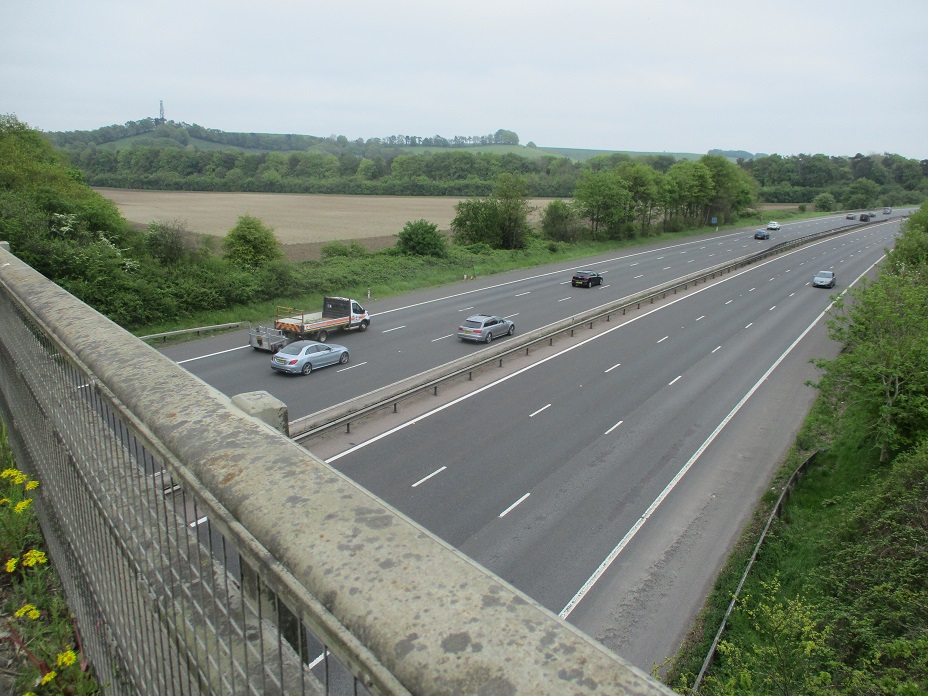
Foxhill Car Park was much quieter than the previous week (no charity checkpoint this week) and we were soon on our way, climbing up level with Foxhill Transmitter.

Our first cache had a good view of the transmitter, but little did we know that our approach to the cache would be indicative of most caches we were to attempt that day.

The cache was positioned about 6-10 feet from the Ridgeway and to reach it, we had to walk through 5-6 foot high nettles and cow parsley. An easy find, but a painful one!

Many of the caches we were undertaking were part of  a series named, or should that be numbered ‘the first’, ‘the second’… up to ‘the twenty third’. We had found ‘the second’ the week before, and our second cache of the day was in fact‘the ‘third’ !

Before we reached out next cache, we saw something nobody likes seeing in the countryside – fly tipping. Mainly sheets, coushions, mattresses. A few yards further on we saw a sign with a phone number to report fly tipping. We did our duty, and hopefully the rubbish would be cleared in a day or so.

As we walked on, generally upwards we collected more and more caches in the numerical series. The Ridgeway frequently gave views to the North and East, with more intermittent views to the South.

The views were not constant as periodically there were lines of trees or bushes, set 6-10 feet from the Ridgeway, with a protective line of nettles and cow parsley (and occasional thistles and hawthorn) in front. To find the caches, we had to brush through the hawthorn, the thistles, the cow parsley and nettles before we could undertake a search

Every cache we attempted became a struggle through the undergrowth – we tried to take in turns to locate a cache, so that we each had a few minutes respite from the stings.

This wasn’t always possible, as often there were a couple of hosts to search and we needed 2 pairs of eyes.

A warm Saturday in May brings lots of people to the Ridgeway. We saw lots of walkers like ourselves, several runners, many of whom were training for the ‘Race to the Stones’ a 50k (or 100k!) running event in early July.

Most of the fields were arable, but we did see some fields of pigs and nearby a van where the pig products are normally sold. Normally it would do a roaring trade on the Ridgeway on a Saturday, but the owner had another booking at a village fete, so we couldn’t sample the wares.

After about two-thirds of our route, we changed Cache owner, this time to Pebbles and Co who we met caching about 15 months ago in Fifield.

Her caches were split into two different types : letter box caches and ‘unusual’.

The letterbox caches contained in a stamp (a legacy from when geocaching perhaps emulated Dartmoor’s letterboxing). The first cache we found was called ‘two little ducks’. The stamp should have been a picture of two little ducks. Mrs Hg137 tried to use the stamp on spare piece of paper we had with us….what a disaster!

It smudged, badly. The ink from the inkpad went evey where. After a couple of minutes we both had blue hands! We decided after that to not try the stamp in the other letterbox caches.

As for the unusual caches, the container was simple but is was connected to unusual items… a mini bird box, a small skeleton, and a spider (A clever clue ‘8 feet up’…. A spider has 8 feet but it was only 5 feet up in a tree)

We had two failures on our outbound journey at ‘the seventh’ and ‘the thirteenth’. As we walked back to the car, we had another attempt at each. We failed at the thirteenth – a blue bison apparently – and found the seventh after some extensive searching – an old fish pot.

We found 16 out of 17 caches, and obtained some nettle stings in interesting places too.

May 13 : The Ridgeway : Ogbourne St George (Southend) to Foxhill

Hello, Mrs Hg137 here.

We’re walking the Ridgeway, west to east, from Avebury to Ivinghoe Beacon.  This our third section, was from Ogbourne St George to Foxhill.  We walked the route in pre-geocaching days, but we’re back, looking for geocaches as we go. So far, the route has changed little in the 11 years since we last came this way.

As we parked the car at the end of the section, a checkpoint was being set up in the car park, and we found out it was for the Ridgeway 40 challenge walk which is a 40-mile walk (or run) between Avebury and the Thames at Streatley.  We wondered if we would see any of the participants, but assumed we wouldn’t as they would be taking a slightly different route from us on the section we were walking.

Back at our start point, we climbed up a steep track, out of the valley of the River Og, up onto the ridge.  It was a cool, dry and slightly misty day, so there were no great views to be had.   After pausing to find a cache, we walked on, and were soon passed by a young couple, striding fast, heading south.   They said they were doing the challenge walk.  Hmm … south? … they should have been going north, and they were heading south to Marlborough.    We asked if they knew their route.   They said they did.  We asked if they had a map or GPS.   They didn’t.   Showing them our map and GPS, we spent some time convincing them that they had gone wrong, and had turned right (south) at some point when they should have turned left (north).   Ten minutes passed, and belief (and resignation) seeped in as they realised they had walked at least two miles in the wrong direction, and had all that distance to return before continuing with what was now a 44-mile walk.

I think we went the wrong way!

Having done our good deed for the day (not especially well-received by the recipients) we carried on for a mile or so, then turned off the Ridgeway to walk down to the abandoned village of Snap, which is unusual in that it was abandoned ‘recently’, in the early years of the 1900s.  Descending into a valley, we passed a lumpy bumpy field and surmised that part of the village must have been there. Then it was on to a sunken track leading into woods (the main road through the village), then into the woods themselves; we hoped to find a geocache, there weren’t many on our route today, hence the diversion.    It was all very quiet and slightly eerie.   After a while, we failed to find the cache, got well stung by nettles, had a lunch break, sitting on a log, and retraced our steps back up the hill.

The way to Snap village

Once back on the Ridgeway, we ascended gently.  Though slightly less misty, the views were better, but still not great.  We skirted a hillfort, Liddington Castle, reaching the highest point on the whole Ridgeway at just over 900 feet or 276 metres over sea level.

Liddington Castle

The rest of the day’s walk – both the terrain and the quality of the walk – was downhill all the way.   The remaining two miles of this section are not much fun.  After a steep descent from the hillfort down a chalky track, the route arrives at a busy road which links Swindon and Hungerford.  After a little way along the verge, we followed the Ridgeway as it turned away to the north-east, following a less major road.  But there was still lots of traffic: horseboxes, returning to the Lambourn Valley, and traffic heading for the weekend meet at Foxhill motocross circuit. To make things noisier still, the road crosses the M4 at this point … cars, cars everywhere we looked!

To break up the plod along the road, we stopped to find a few caches at the roadside, and down a small side track, an old road cut off by the M4.    Eventually we reached Foxhill crossroads where the Ridgeway crosses another very old road: the Roman Ermin Way, which runs from Cirencester to Silchester.   At the crossroads is the Burj Indian restaurant, which was here on our first walk along the Ridgeway in 2012 and is still going strong.

The Burj, Foxhill

After a short walk uphill, we reached Foxhill car park.  It was nearly empty now and the checkpoint for the challenge walk was packed up and gone.   We wondered how it was going for those two lost challenge walkers we had seen earlier on  – we do hope they continued and finally got to the end!

Here are some of the very few caches we found:

May 7 : Trackable : Muh-Kuh

Hello, Mrs Hg137 here.

Muh-Kuh

Why Muk-Kuh?    Well, Muh-Kuh was originally a small cow (moo? cow?) until at least 2017 but it now is a small Asian Superman figure – Samurai meets Superman maybe.   

The original Muh-Kuh

It has been around since October 2010, and has travelled over 11,000 miles since then.  Just one of the fifty trackables owned by Cirque du Freak, from Germany, this one has no stated mission.  So what it has done has been to have a jolly good roam around Europe, starting in the Canary Islands, then moving to Italy, Majorca, Spain, Austria, Germany, the Netherlands, then Belgium – I may have missed a few countries there!   It was picked up by one cacher in May 2023 in Belgium, and was then dropped off in Sussex, England, by someone else … not exactly sure how that worked, but it did.    It ended up in the hands of local (to us) cachers EL-JO, who took it round for a bit, then dropped in in a cache near Barbury Castle Iron Age fort on the Ridgeway long distance path.   We’ve carried it further on along that path and will no doubt drop it off somewhere on our way to continue its perambulations.  

Good luck to Muk-Kuh, whatever creature you are, and have fun travelling!

May 7 : The Ridgeway : Hackpen White Horse to Ogbourne St George (Southend)

Part two of our 2023 Ridgeway walk was from Hackpen White Horse (or more correctly the car park!) to the hamlet of Southend just south of Ogbourne St George.

The day was murky, and low cloud greeted us as we set off. We didn’t have too many caches to find on our 7 mile route and the first was some distance away at Barbury Castle.

On our way to the castle we passed several walkers, including three Duke of Edinburgh groups, each with a varied level of competence.

Barbury Castle,  is an ancient hillfort dating back over 2500 years ago. It is an enormous circle surrounded by steep defensive ditches. Our path took us straight through the centre of the castle (now a grassy area). Many visitors walk above the circumference of the castle on the banks above ditches.

Our first cache was a multi, based on a noticeboard at the top of the slope near the castle entrance. Information extracted, we realised the final coordinates were back down the hill. We had a brief discussion as to whether to descend the hill, find the cache and re-climb the hill or pass the cache by. With only a handful of caches to find on our day’s walk, we opted for the extra exercise of descending and reascending the hill. We found the cache, wedged under a hawthorn bush and beside a stream was an ammo can – a great find and an old cache too – it was placed way back in 2004.

The ammo can also contained two trackables, placed there by a local caching team to us in Sandhurst, EL-JO. We took the trackables, and decided not to take them to Berkshire where EL-JO has brought them from!

Barbury Castle was quite busy, and we soon realised why. About half a mile beyond the castle is a large car park. The car park was so large there was a geocache at either end of it. (And as caches have to be 1/10 th of a mile apart this gives some indication of the car park size)

The first car park cache was exactly what a cache should be (with one notable exception).

Firstly, the reason for placing the cache. There was a great view from GZ. In fact the view was so good, there was even a toposcope telling us what we could see (or rather what we couldn’t see due to the low cloud). (As an aside, the word ‘toposcope’ neither appears in the online dictionary for this blog nor a printed version, so clearly its not called a ‘toposcope’ – wonder what it is called?)

What is this called if it is not a ‘toposcope?’

The second reason we liked the cache was the hint. Rather than ‘behind post’ or ‘behind tree’ , the hint related to the ‘toposcope’. The cache was hidden ‘in the direction of’ a place on the plaque – very clever.

Thirdly the container, Well hidden, dry and well protected.

Too well protected – as it was surrounded by stinging nettles (its only detrimental point). As Mr Hg137 has found the previous cache in hawthorn astride a ditch… Mrs Hg137 took on the stinging nettle challenge… and won!

At the far end of the car park was another cache. We went the wrong side of a fence line initially, but after a few minutes we corrected our error and quickly found the cache.

Finding this second car park cache caused us to lose our bearings a little from the Ridgeway path, and it took some time to realise the path bypassed the car park, and our caching exploits had taken us 100 yards from our intended route. Whoops!

The section of the Ridgway leading away from Barbury Castle to the village of Ogbourne St George is delightful. A gently grassy slope known as Smeathe’s Ridge. Most of the Ridgeway path we had encountered was stony and flinty and the smooth grass was a delight to walk on.

We admired the views as we descended, a point to point course to our right, horse gallops to our left. Indeed we were overtaken by a horse rider, who we saw later as she rode back up the slope.

Eventually the village of Ogbourne St George came into view and we took a detour to find the Church Micro geocache. There were 2 waypoints we had to visit, and because we were entering via the back entrance to the graveyard, we undertook the waypoints in reverse. Some dates extracted from a gravestone, then we went to the front of the churchyard, to find the remaining numbers. A lady sat on a seat near the lych gate. Her dog, Millie, growled and barked as we approached. We sidled around, found our numbers, and sidled back. All under the growling watchful gaze of Millie.

We found a seat and calculated the final coordinates – fortunately for us, back towards the Ridgeway. We stood up, and Millie had one more growling moment before we disappeared.

The cache should have been here!

Sadly our cache locating skills were remiss. The previous ‘finder’ had noted the Ground Zero was being re-fenced, and our hint item (45 degree upright) made no sense with the now vertical posts. We sent a picture of  the groundworks the cache owner, who allowed us a ‘find’ as we were clearly in the correct place, but the area has been redeveloped.

We left the church area, returned to the Ridgeway, and skirted around the village of Ogbourne St George. (The river Og flows through the village, and the church named after St George).

Most of the day’s walk had been on the high Ridgeway, but now we were at the valley floor, nearer the river and the paths were muddier. Fortunately our car was parked in the picturesque hamlet of Southend, a mile of so further on so had only a short ‘mud’ walk!

A delightful 7 mile walk – with only the paucity of caches letting it down!

May 1 : The Ridgeway : the start : Overton Hill to Hackpen White Horse

Hello, Mrs Hg137 here.

Back in 2012, we walked the Ridgeway, west to east, from Avebury to Ivinghoe Beacon.  In those days we took fewer photos, and hadn’t started geocaching/blogging, so we mostly had our memories to rely on, which were … hazy.

Our plan was to walk from the official start, by the A4 on the edge of Avebury, to Hackpen Hill, about four miles away, and then back, breaking up the return leg by diverting to paths to the side of the main route. For geocaching, we hoped to find mostly caches from the Desmond Dog’s Ridgeway Romp series, plus a few others dotted along our way.

Squeezing into the free car park next to the A4, between two large motorhomes, we set off northward, climbing gently.  It was both a Bank Holiday and May 1st, when parts of the Ridgeway open to some powered traffic.  We saw walkers, runners, dogs, trail bikes, horses and riders, often several at once.   When we were on our own – not all that often –  the sense of being on an ancient route seeped in.

The geocaches were easy to find; the cache owner had been thoughtful and had made the comment: …”As this is a World Heritage Site the finds are nice and easy so as not to draw attention or incur any damage to the landscape” …  We worked our way steadily through nine of the sixteen in the series before the route turned away to the south, for us to find later in the day.   Though the finds were ‘easy’, they still gave us chances to be stung by nettles, and to poke and feel around fences, signs, and stones.   At one point we emerged from a bush and were passed by a lone walker. He turned out to be a New Zealander, now living in London, who was off to walk the Ridgeway almost on a whim. We explained what we were doing – walking the Ridgeway while geocaching – and he was amused – it explained why we had emerged, surreptitiously, from tree cover!

A little way further on we came to a group of sarsen stones at the side of the track, which made a good, comfortable seat for a picnic lunch.   We thought we were sitting on a named stone, the Polissoir (or Polisher) stone, but we were wrong, it’s the other side of the fence in a field. We then had two miles of walking to Hackpen Hill.   In places the track grew narrow, and more tree-lined, and we passed a dewpond (rare in this area).  Other places were more open, with sweeping views, and we also spotted a herd of White Park cattle – an ancient breed with impressive horns!

We could tell we were getting close to Hackpen Hill when we began to meet more people.   Once again, it wasn’t quiet and peaceful.   And it also wasn’t quiet and peaceful underfoot: the track has been maintained (a good thing) but with some large sharp stones which were rather hard underfoot (not such a good thing).  

At the top of Hackpen Hill, the car park was full to overflowing with cars and people doing … really not very much.  We had a coffee break, then found a geocache under a sign describing the White Horse Trail long-distance path (not one of that crowd of people noticed!)  The Hackpen White Horse itself isn’t visible from the Ridgeway, you have to go down the hill and look up and back.

After a little, we set off on our return journey.  After walking back part way, we headed off north to Fyfield Down, crossing some racehorse gallops, to seek an earthcache,  Glaciers in Southern England.  Earthcaches are usually about geology; this particular one is about sarsen stones, which are glacial erratics, sandstone boulders dropped by retreating glaciers after the last Ice Age.  They are known locally as Grey Wethers because they resemble a flock of sheep from a distance.   There are 25,000 stones scattered around a shallow valley, ranging from small to quite big indeed.   It was such an interesting place, bright and peaceful in the afternoon sun, but one imagines it could be a bit spooky when the mist gathers.

Sarsen Stones aka Grey Wethers

Returning to the Ridgeway, we realised that we’d mis-calculated distances and times, and didn’t have time to complete the cache series we had started in the morning, so we made our way back along the Ridgeway to our starting point (we’ll return and complete the series another time).   On returning home, I looked at the few photos from our previous visit.   Back in 2012, it had been misty – we didn’t remember the views because there weren’t any.   And we’d only walked one way, as far as the White Horse, and had then visited Avebury Manor in the afternoon.  Oh, memory is such a fickle and selective thing!

Here are some of the caches we found:

October 31 :  our 4000th geocache : Woodhenge and Durrington

Hello, Mrs Hg137 here.

Woodhenge
Woodhenge

A caching milestone was imminent – our 4000th geocache – and we felt a memorable caching trip was the right way to celebrate it.  After some thought we settled on Durrington and Woodhenge, an area close to Stonehenge, just north of the A303.  Bucketfuls of history and an iconic location, too.

There was also an excellent selection of caches to go for, and, from previous logs, many are popular with other cachers, too:

  • Plenty of caches: good to have some ‘spares’ in case we couldn’t find them all!
  • Some physical caches with logs to sign, especially for that milestone.
  • Different kinds of caches: some traditional caches, a puzzle cache, a virtual cache, and an earthcache (a chance for a bit of geology), one requiring an online jigsaw to be completed to get the coordinates, plus another where you had to pose by an object to claim the cache.
  • And, for the practical stuff, easy to get to and free parking!

On a sparkling clear autumn morning, we parked in the small car park next to Woodhenge; we’d be back for a proper look later.  Our first cache, ‘The Road to Nowhere’, came after a longish walk along a straight road with no obvious purpose or destination (a previous military use, maybe).  After searching the wrong area for a while, a brainwave led us to the right spot.  Phew, cache 3,999!  A good start, eventually.

Along a road, and past the entrance to Larkhill Barracks, we headed out into the fields on a track to look for that milestone cache.  Called ‘Near this spot’, it’s within 10 metres of a inscribed stone to Major AW Hewetson, who died nearby in 1913 when his aircraft crashed; he was inexperienced, made an ill-judged manoeuvre, and couldn’t recover from it. Having pondered the memorial, soberly, we turned our attention to the cache, which we found, with pleasure, very soon. Woo hoo – our 4000th cache and a milestone achieved.

Further on, we reached an intriguingly named, cache, ‘The Sun Gap’.  Funny name … there is a distant view through trees to Stonehenge, where the summer solstice sunrise can be seen, and this is called the sun gap .  We looked hard, but the trees have grown up and we couldn’t see far enough – or we aren’t tall enough!

On into the trees, and we reached our next objective, a puzzle cache we’d solved earlier, by solving a jigsaw.  The coordinates led to … a tree climb.  Fortunately, an ‘easy’ one, in a tree with a good selection of branches and hand and foot holds and not too high.

What now?  Aha, some real history, and an earthcache to go with it : the Cuckoo Stone, a lone fallen sarsen stone.   We followed the obvious grass paths to it, considered it in minute detail to get the answers to the earthcache, and took some pictures.   As it was Halloween, we also made a small offering (ie poured a bit of water over it) best not to upset any ghosts or beings that might be there, lurking invisibly.   Nothing much happened (or didn’t happen), so maybe the ghosts or beings weren’t there at the time.    Our fourth different cache type in five caches.

More grass paths led us to Woodhenge, a very short distance away. It’s a neolithic circle, but this one was built out of wooden posts, not stones, and short wooden posts have been placed to show the layout.   A couple were standing by the edge of the circle, reading the noticeboard, so we walked on into the circle while it was empty. After the required photos, we turned our attention to the small boards, with notices attached, that were propped against some of the stones. Did they contain vital information? Well, yes, they said ‘Take care – wet paint’ !

The couple we saw earlier had now arrived in the centre of the circle, and we had a chat, partially about geocaching. They told us they had cycled here from Salisbury (via Stonehenge, which was extremely busy – ‘Disneyland’ was their exact description), and they were about to set off for the return journey. Then they left, mounted their tandem (you don’t see many of those!) and set off southwards. We wish we’d taken a picture …

Having completed our morning’s caching with one more cache, we settled down for a picnic lunch on some handy benches within sight of Woodhenge.  It was still fairly warm, and bright, though the bright sunshine of earlier was fading.   Early autumn was hanging on … just.

To round off the day, we moved the geocar to the edge of Durrington village, about a mile away.  There’s a geocache series here of about a dozen caches, ‘Durrington Loop’, which wends its way around the village streets.   We tried four of the caches, finding three, then cut our searches short as the bright sunshine had entirely gone, it was much cooler, and occasional drops of rain were being carried on a strengthening breeze.   Late autumn had arrived … suddenly.

A great day’s caching, some history, and a fascinating area.  Good place for a milestone caching day!

Here are some of the caches we found:

September 4 : Bath

September 4th is a special day for us, and having finished our walk along the Kennet and Avon Canal to Bath, we treated ourselves to a light day in the City.

Rebecca Fountain

We were staying overnight though in Trowbridge, and on our way to Trowbridge Station, we made time to attempt a geocache. This was part of the Little Bridges series (number 1529!), and was next to a bridge over the river Biss. The River Biss, is a relatively short river of 11 miles, and part of its journey is through the centre of Trowbridge. The little bridge is hemmed in by industrial units on one bank, and a shopping centre on the other.

We found it quite hard searching for the cache, as two shop workers were on a cigarette break yards from the cache. which prevented a full-on search. We soon discovered though our GPS was playing tricks. It originally pointed to the ‘shop’ side of the bridge, but the hint alluded to items on the ‘industrial’ side. We crossed back, and quickly retrieved the cache, away from the prying eyes of the shop workers.

First cache of the Day

A short train journey later and we were in Bath.

We had been to Bath before, and had great plans to attempt some of the various caches dotted throughout the city. Our main objective though, was not geocaching but visiting Thermae Spa. We’d been there before, and as a ‘treat’ we thought we would return. It didn’t disappoint. We wallowed in the steaming open-air rooftop pool, enjoyed the lazy rivers and ‘power showers’ of an indoor pool and flitted between various steam rooms. It all sounds very relaxing, but it was surprisingly tiring.

Our two hour visit ended at lunch time, so we adjourned to a nearby square and ate lunch. We arrived just in time, as a large group of foreign students soon took over much of the seating area. As we sat, a street entertainer made his way to the centre of the square. He spent a few minutes setting up a backing track machine, then produced a trumpet… and started playing. We sat and listened for about 30 minutes before reminding ourselves we were supposed to be caching.

Live entertainment

We reviewed our options and decided to only attempt two caches. Both, as it happened, were ‘container-less’ caches. The first was an Earthcache at the Rebecca Fountain. Rebecca is a Grade II historic drinking fountain dating from 1861. The fountain depicts a life-size female figure pouring water from an urn into a bowl with the inscriptions “water is best.”

Typically Eartchcaches ask about the rocks and stones of a particular feature, and here, the questions were not of the Fountain, but of the stone supports and steps surrounding it. The stones were made from a type of Sandstone called Pennant Stone, and we had to investigate features contained within it.

Get off the steps… its important Geology!

Relatively straightforward until… several people came along and sat on the steps we were trying to evaluate!

Our next cache, a Virtual cache, was based on ‘The First King of England’. Most people do not know who the First King of England was (we didn’t). In the Dark Ages, pre 1066, England consisted of various tribal regions including Wessex and Mercia. AEthelstan somehow managed, through battles, diplomacy and good amount of luck to combine the regions into what we now call ‘England’.

Not “The First King of England”, but “The Resurrection of Christ”

Unfortunately the plaque about AEthelstan was missing, so the question posed by the cache owner could not be answered. All we had to do was take a photo to mark our presence to claim the cache. An easy cache!

With that we headed back to the station, admiring the well decorated town centre, and headed home.

It was only a few days later, we realised we had brought an unwanted guest home with us… the dreaded COVID-19 virus which took the edge off our celebratory weekend.

September 3 : Kennet and Avon Canal : Avoncliff to Bath

Hello, Mrs Hg137 here.

This was it: the final section of our walk along the Kennet and Avon canal from Reading to Bath.  We had about eight miles of towpath walking, snaking along the Avon valley, to take us from Avoncliff aqueduct to the junction of the canal with the River Avon in central Bath.

We were staying nearby, and our plan was to catch the train from Trowbridge to Avoncliff station, walk to Bath, then catch the train back.  All started well; tickets bought, boots on, and we had time for a short wander to a ‘Sidetracked’ geocache close to Trowbridge station.  (As the name suggests, this series of caches are all located at or close to existing or former stations.)

Avoncliff station - short platfroms!
Avoncliff station – short platforms!

But … plans do go wrong …   Avoncliff station *should* have been easy to reach. But we didn’t realise that the platforms are very short indeed at this station, and we were in the wrong part of the train at the crucial moment. We couldn’t get off!  We had to go to Bath, wait an hour, then catch the return train. Ho hum, we reached Avoncliff, much later and much more stressed than intended.

Leaving the station, we had another ‘Sidetracked’ cache to find.  While standing there, puzzled, a dog-walking muggle couple went by, saying to each other “geocachers, I reckon” as we examined a fence. We admitted guilt.

Hire boat (clear roof)
Residential boat (not so clear roof!)

Off we went along the towpath.  It was wide and well surfaced, and had a fair few moored boats, many of which look to be residential.  (Tip: hire boats have mostly empty roofs, there is little stored on them.  Live-aboard boats typically have all sorts of stuff stored on the roof – bicycles, wood, plants, buckets, wellies, sacks of coal … )

About a mile along the canal we reached Murhill wharf, the remains of a tramway which brought stone from nearby quarries down to the canal for transport.  There was a cache here, and on our return trip we were hailed by two muggle walkers on the towpath (the other side of the canal) who asked us if we had turned back because the path was impassable. We explained the reason for going part way (a cache) and reassured them that the path is fine both sides of the canal at this point – they were planning to incorporate it into a circular walk.

We now had a couple of miles of cache-free walking.   It was all very tranquil and pleasant; the canal clung to the sides of the valley above the River Avon.  For the most part we were walking through trees, though there were occasional views out across the valley.   The canal crossed back across the Avon at the Dundas aqueduct, and stopped to talk to the owner of a working boat which supplies coal and diesel to the boats along this stretch.   Crossing the aqueduct, we (unknowingly) also crossed counties, left Wiltshire, and were now in Somerset.  We were only two miles away from the point where the canal joins the river in central Bath, just over the hill, but over five miles walking along the towpath.

After a while we emerged onto a flatter area of ground, skirted some playing fields, and arrived at Bathampton.  We stopped for a couple of lovely icecreams from the Café on the Barge, then crossed the road to the village church, St. Nicholas.  Several notable people are buried in and around the church, including the first Governor of New South Wales and Walter Sickert, the artist.  We had a quick look but didn’t spot any of their graves: we’d ‘lost’ an hour with all the train hassle earlier on, so couldn’t linger.   We found the Church Micro cache nearby, then returned to the towpath.

St Nicholas Church, Bathampton

There were no nearby geocaches for us to find until we reached central Bath, so we just walked and watched as the city came closer and the terraces of Bath Stone houses lined the valley. We passed Undercliff urban farm, and were then among houses.

Some short tunnels, no longer than wide bridges, took us under Cleveland House, originally the offices of the canal company and past Sydney gardens.  We reached the start of the flight of six locks that drop the canal down to the river.  There used to be seven locks, but two were combined into one, Bath Deep Lock, when work was being done on the A36.  It’s the second deepest lock in the country, 19 feet 5 inches (5.92 metres) drop, and it looked scarily deep to me!  (FYI: the average lock is about 8-9 feet drop.)

Bath Deep Lock
Bath Deep Lock

And then the canal emerges onto the river with little ceremony, through a small opening almost opposite the railway station, a not terribly auspicious spot.  The Kennet and Avon goes on to Bristol, but we’d chosen to end our walk here.   After some obligatory high-fives and photos, we crossed the river and headed for the station, with just time for another ‘Sidetracked’ cache to round off the day. Maybe we’ll return and finish the remaining twenty-five miles to Bristol, but, for this year at least, time had got ahead of us.

It had been a great walk: we started just before Easter, as the days lengthened in spring and the weather warmed.  One of our first sections coincided with the Devizes-Westminster canoe race, the world’s longest non-stop canoe race (125 miles).  As the countryside bloomed into spring and then glorious early summer, we followed the Kennet up to Newbury and Hungerford, and onto the canal section.   By the end of June we’d reached the summit level, just past Crofton, where we’d seen the beam engines working away, pumping water to the top.   Then the weather turned hot … very hot … and our resolve to go walking melted away for a few weeks.    By mid-August we’d reached Devizes and walked down the massive flight of locks at Caen Hill.   The days were shortening now, and though still warm, summer was nearly over, so we needed to get on, and walked the last section, from Caen Hill into Bath over three days in late August/early September.   Seventy-five miles of great walking with lots and lots to see.  

Here are some of the (not very many) caches we found:

August 29 : Kennet and Avon Canal : Hilperton to Avoncliff

Bradford-on-Avon

Unusually for us, we were walking for two consecutive days on the Kennet and Avon Canal.

The car journeys to and from the canal had become quite long, so we decided to stay in a hotel overnight giving us an earlier than normal start for our second day.

We started at Hilperton, and set off on a shortish, and relatively cacheless, section of the canal to Avoncliff. Our first cache, part of the Little Bridge series of caches, was a short diversion away from the canal about a mile or so from Hilperton.

We wandered through a narrow path surrounded by blackberry bushes. We passed a young lad as the path widened, we wondered if he was a cacher, but no – he was just walking from the nearby houses to the canal.

Here’s the little bridge, now where’s the cache ?

A rickety-looking iron bridge stood over a stream, and we had various trees to search – but we didn’t find the cache. We suspect the cache was under a fallen tree, surrounded by brambles and nettles, but after yesterday’s ‘bloody’ adventure we were perhaps a bit too circumspect.

We’ve not had a good run of finding the first cache of the day. This was our third successive trip where we had failed at the first.

Back on the canal, the towpath had also become National Cycleway 4. The cycleway starts in West London and heads Westwards through England and Wales to Fishguard. The canal towpath had shared the route with the cycleway before, but today being a bank holiday Monday, there were more cyclists than we used to. Many of the cycles were without bells, and gave little warning for us stand aside. (In fact, the cyclists should have given way to us…but none of them did)

Cyclists weren’t the only busy people we saw. Many of the boat owners viewed the Bank Holiday as ‘one of the last days of summer’. Many were busy sawing tree branches into logs for winter fuel. Other were clearly making their boats ‘winterproof’.

Bradford-on-Avon Marina

Our first geocaching find of the day, and the only cache near to the canal, was opposite Bradford-on-Avon Marina. A gate/stile led into a field, and while Mrs Hg137 searched the gate (Hint “by gate post under stone”), Mr Hg137 walked further into the undergrowth with the GPS. It led to another gate, this one covered in bushes, and by the side a stone covered the cache! Always trust the GPS !

Just a few yards further on a road crossed the canal. We walked along the road a short way to a cache called ‘beehive’. The cache was named after a local waterside pub called ‘The Beehive’ which closed in 2017. A quick find, once we understood the hint.

We are getting closer to Bath !

Opposite the cache was another road called Moulton Road which ran parallel to the canal for some distance. We would cross or walk by Moulton Road a couple more times as we left the canal in search of caches.

The first time we left the canal was to undertake a multi. We collected the appropriate numbers from various street signs, and then walked through various alleys and cut-throughs arriving at a less-than-inspiring ground zero. A lamppost, with a bit of scruffy vegetation at its base. The sort of location our canine friends like to use. Fortunately, the cache was ok, but this was definitely one of those caches we regretted undertaking.

Our next cache was part of the ‘Supermarket Sweep’ set of caches. Again, placed some distance from the canal (a short walk along Moulton Road before crossing the canal). The Supermarket Sweep series of caches seems to have become less prevalent. Most were placed over 5 years ago – this one was placed in Sainsbury’s Car Park. This should have been an easy find, as it was hidden in the armco perimeter of the car park. We looked for about 10 minutes, until Mrs Hg137 just glimpsed the cache well tucked away.

It was late morning, and the trip to Sainsbury’s reminded us it was approaching lunchtime. We vowed that the next seat would be lunch. That seat, as it turned out, was quite a few minutes walk away, near the Bradford-on-Avon canal lock.

Why is it -there is never a seat when you want one ?

People were thronging around the canal lock, boats were jostling for mooring spots, everyone was enjoying the Bank Holiday sunshine. And as we approached, a seat became free! Amazing !

We sat and ate our lunch. Then we looked at the GPS… we were within 10 feet of another cache. Mrs Hg137 walked behind the seat and found it in the undergrowth. Mr Hg137 did his best to ‘protect’ the seat so we had a space to sign the log. Log signed and cache replaced, we finished our lunch with a quick cup of coffee. As we did so, we were aware of an elderly couple with two dogs. They stood a few yards away, feeding their dogs ‘doggy ice cream’ they had purchased from a nearby shop. Both dogs looked plaintively up every few seconds and were rewarded with the ice cream treat. As we left, the couple and dogs headed for the seat to continue the ice cream eating. We thought it a good idea too, and went to the same ice cream parlour and bought ‘human’ ice cream for ourselves. We discovered the ice cream shop had been opened by Prince Charles!

We walked on, beyond the canal lock, and the towpath was even busier. Here many of the boats were ‘trade boats’ and members of the public were buying items from the ‘floating shops’. The ‘record boat shop’ was very popular.

Just as were leaving Bradford-on-Avon we noticed below us, another waterway, The Avon. (The clue of course is in the town name). For the rest of our route to Bath, would have the Avon at our side.

The Willow Maze

We had no more caches to find, but we did take one more diversion – to a willow maze close to the Avon. Time was pressing and we didn’t want to spend too much time getting lost in a maze, so we advanced a few yards and retired quite quickly. It didn’t look that impressive at ground level, but many of the maps we have seen, has it as quite a large maze.

Avoncliff

About half a mile later the canal took a 90 degree turn at Avoncliff, and the termination of our walk. Our last 2 days had seen us walk about 13 miles from the base of Caen Hill. The weather had been fine on both days, which had brought many people out enjoying the canal.

Caches found :

August 28 :  Kennet and Avon Canal : Caen Hill to Hilperton : blood, dredging and snakes

Hello, Mrs Hg137 here.

Barge Inn, Seend
Barge Inn, Seend

Our walks along the Kennet and Avon have all been interesting, but there have not always been many geocaches to find along or close to our route.   Today promised to be different: just over twenty caches to attempt.

It started poorly: we had another try at the last cache of the previous walk.  Once again we couldn’t find it.   Oh well, never mind.  We passed the last few locks of the Caen Hill flight.  Just there, a disused railway line crosses the canal, leaving the pillars of the old bridge in mid-channel.  A cache marks the spot: ‘Over The Canal – Devizes Branch Railway ‘ so we thought we’d go and find it.   Umm, not to be.   An extract from our cache log describes what went on:

…” We hoped this was to be the first find of many in the day.  But it all went badly, horribly wrong.  First of all, we nearly got flattened by a macho cyclist on the towpath. Then it took us an age to find the path that led to the cache. We started to search among the sharp brambles. Worse followed … I got snagged by an especially fierce bramble. I put my hand down to the damp patch on my walking trousers – and it came away red. There was blood, rather a lot of it, soaking a trouser leg, sock, and both hands. The long thorn had nicked a vein.  The flow was staunched with a hanky and a spare Covid mask (second time we’ve used one for this, they work well), but not before talk of tourniquets, A&E, and abandoning the walk. The trousers, leg, and hanky were washed off under a water tap later and all seems to be well.  But we’d abandoned the cache by this time. It really hadn’t gone well.  “…

... scene of the disaster ...
… scene of the disaster …

We went on, and my trousers gradually went stiff as the blood dried.  I was an object of great interest and sniffs for every passing dog for the rest of the day; I must have smelt like dinner!   (FYI – the trousers are black so the bloodstains didn’t show.  Fortunately.)

There were fewer locks now, as the canal descended gently towards Bath, but plenty of swing bridges to slow down the boaters.   We watched, and marvelled, at some of the methods used to moor boats by the bridges (we don’t think you ram the bank either nose or stern first to moor … do you?). Several bridges had caches hidden nearby, which gave us an excuse to linger, and sometimes help with opening the bridges.  And, at one bridge, we spotted something else, a small slow-worm or snake, swimming along the edge of the canal.  Other wildlife is well catered for too: at Sells Green, part of the canal was permanently leaky, flooding adjacent fields.   The solution was to manage the flooding and turn the boggy area into a lake for wildlife.

We passed the Barge Inn at Seend and reached our first geocache series of the day, ‘Full English Breakfast’.   This series had lots of favourites on the cache logs and we were looking forward to seeing what was there.   We weren’t disappointed, they were great.  The caches all had names relating to breakfast – ‘Sunny side up’ – ‘Fried and seek’ – ‘A little shaken’ – ‘Absolute Banger’ – and each was hidden in a suitable container – a salt pot, fake egg, or plastic sausage.   Mr Hg137 found the sausage very exciting and did some extremely non-PC commenting and posing … ‘would you like to sign my’ … ‘shall I wave my … in the air’ … you get the idea!

Absolute banger!
Absolute banger!

We crossed the busy A350 on an aqueduct to reach Semington village, which is much quieter now that the main road goes elsewhere.  Just before the road bridge, there is the bricked-up entrance to the (currently derelict) Wilts and Berks Canal; like many old canals, this is under restoration, but this one has been unused for a century, there is quite some way to go.

Wilts & Berks canal entrance

Our second cache series of the day was based around dinosaurs, with a Jurassic creature attached to each of the cache containers.  Most were hidden in out of the way places, which gave Mr Hg137 the chance to re-use his ‘I wonder if they SAURUS…’ joke (several times, he has a selection of tried and tested [old] jokes, but many fewer original ones!).  A young couple were doing some bicycle repairs near one of the caches. We explained what we were doing (lest they thought we were going to steal their bikes) and showed them the cache when we had found it – great chuckles all round, they liked the container a lot.

There had been recent canal maintenance with bank clearance and reinforcement, dredging, plus attention to the brickwork around locks. I’d thought that this mostly takes place ‘out of season’ but clearly there is always work to be done, we’d passed a number of other areas being repaired along out past route.

One more cache series – based around animals (photos may well appear in our end-of-year roundup) – brought us to the end of our walk for the day, at Hilperton, on the northern edge of Trowbridge. At the end of the day we got back to our hotel in Trowbridge; this was a walking weekend, we were going out again the next day.   I had a shower and thought I would rinse out my blood-soaked, stiff walking trousers.   A good idea … but the shower did resemble a famous scene from the file Psycho

And here are just a few of the other caches we found: