May 26 : Sandhurst to Sandhurst (Kent) : Kent border to Sandhurst

PROLOGUE

Our last caching trip on our Sandhurst (Berks) to Sandhurst (Kent) finished yards from the Kent border, and when we drove away we had thoughts of striding purposefully into Kent and onto Sandhurst… however since our last visit we were asked to undertake a small diversion while still in Sussex.

Kent, Sussex

Kent is ahead of us..but we’re not going there, yet!


The last cache we found on our previous trip contained a sheet of paper with the ‘Northings’ for the Great Wigsell Multi. Another cache, unfortunately now archived, contained the ‘Eastings’. This meant the Great Wigsell Multi was unreachable. The cache owner of these three caches contacted us with the missing information and asked, if we had time, to visit the Multi as it contained a trackable which needed to be moved on.

And so instead of heading East into Kent, we headed further South through light woodland for a 1/3 of a mile. We were pleasantly surprised on our arrival. Not only was the cache there after an eight month gap…but it was an ammo can!

We released the trackable and headed back to our car, wondering how many other cache owners we would be helping on the this holiday (see previous blog for more details).

And so to Kent.

THE SANDHURST WALK

Before finding the Great Wigsell Multi our day had not begun well. There had been a major accident and our route to the Kent border had been blocked. A plethora of side roads were also blocked with roadworks so we had had an interesting drive to our start point.

Our route was to take us 2/3 mile along a narrow country lane, unfortunately this was being used as one of the few roads open. We edged our way along, taking care watching out for traffic.

Or at least that was the agreed plan.

Sadly Mr Hg137 decided to check maps/GPS whilst walking up the pavement-less road and failed to spot a large pot-hole.

He landed considerably worse for wear, face down, lying on the tarmac.

Grazed wrists, ripped trousers, and several layers of skin removed from a lower leg. Ouch!

He limped to a gap in the roadside, where a passing motorist provided us with a few tissues which staunched the wounded leg. We both thought that having walked so far on our Sandhurst route, we would fail with just 2.5 miles to walk!

We sat. Annoyed.

Eventually Mr Hg137 stood up. The bleeding had ceased, and he could put weight on the injured leg (hidden behind the ripped trousers).

We tentatively walked on.
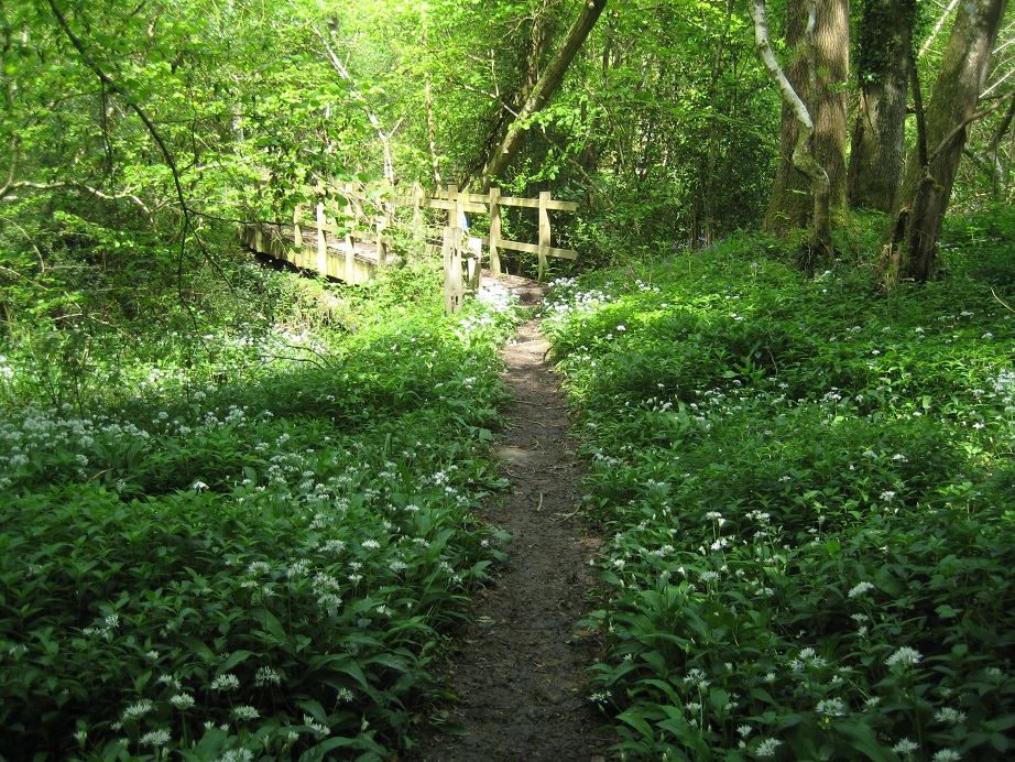
Kent countryside


We were following, for the last time, the Sussex Border Path, which up to that point had been brilliantly signposted. Sadly when we needed a post to show us the way to a cache 300 feet away, it was missing. No obvious track through farmland, and with some way still to go, we abandoned our search before it really got going. We knew we were getting close to our destination though as the cache belonged to a series entitled “Sandhurst Cross Circular Walk”.

The route took us through a farm. Clearly the farmer had had trouble with hikers, as there were a plethora of “Keep to the Path”, “Close the Gate” type signs. However the farmer had failed to mark the signpost clearly as we approached his back garden, and the fingerpost was angled for us to walk straight through his garden rather than a tiny path just by the fence line.

You can’t walk through Kent without seeing some of these!


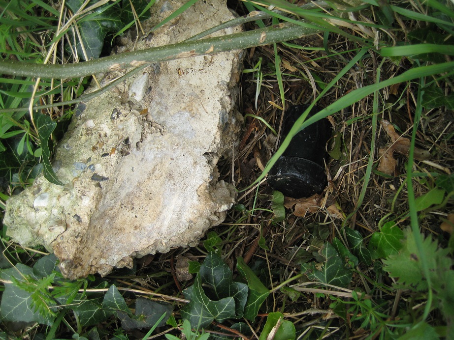
It was shortly after this we found our first Kent cache on the walk. Hidden in tree roots. It had been well over an hour since our finding of the Sussex Multi so were grateful for an easy find.

Kent

Under the tree roots…

Our route took us through woodland, and around farm fields. We crossed far too many stiles for our liking (too tall for Mrs Hg137, too wobbly for Mr Hg137’s now-healing leg).

Kent

A Kentish stile!


And then we arrived at a Roman Road – and another cache. Again hidden in tree roots. Here though we had a long search. Lots of trees, and lots of roots.

Kent

Did the Romans leave this geocache for us to find ?

We were eventually successful and strode/limped purposefully the 1/4 mile into the village of Sandhurst.

A beautiful village green and fabulous clock tower. Our journey was complete.

Sandhurst, Kent

Sandhurst, Kent


Our final cache was under the clock tower, and we waited ages, for a bus driver to vacate the seat on which the cache had been placed.

Our final cache on this walk!


A fabulous setting for the end of our walk!

EPILOGUE

Sandhurst Geocachers Trail Trackable starts its quest

Sandhurst Geocachers Trail Trackable starts its quest

And so our walk was at an end. We finished in high Summer on a boiling hot day. We had started in the height of Winter, with ice on the ground. We had caught trains and buses. We had used many a long distance path including the Blackwater Path, The North Downs Way and the Sussex Border Path. We had walked beside canals, rivers and underneath a major flight path. We’d walked over Surrey’s highest hill, and walked through the claggy clay of the Weald. We’d undertaken quite a few Church Micros and learned about such diverse people as an Astronomer Royal and the founder of Ottawa. We even saw the Flying Scotsman!

The Flying Scotsman

The Flying Scotsman


We’d heard lots of birdsong and been lucky enough to see deer, a heron, an adder and a kingfisher.

Our route would have been approximately 60 miles if we had walked in a straight line but various constraints (Army land, Gatwick Airport, reservoirs) prevented this. Our convoluted route of 86 miles kept to footpaths where we could, avoided major towns and where possible picked a route with caches to find. Our route is visible here https://www.geocaching.com/track/map_gm.aspx?ID=6190539

An excellent adventure which we thoroughly enjoyed.

Sandhurst, Kent

As we noted on January 1, there is another Sandhurst, near Gloucester, a journey which we will undertake probably next year.

Do look out for that!

May 24 : Sandhurst to Sandhurst (Kent) : Stonegate Station to the Kent border

Hello, Mrs Hg137 here.

Part way through our week’s holiday in Hastings, we took a day away from sightseeing to tackle the penultimate leg of our unofficial, self-made long-distance path from Sandhurst (just in Berkshire) to Sandhurst (just in Kent). Today’s route was from Stonegate station to just a few yards from the Kent border near Hawkhurst Fish Farm.

Stonegate station

Stonegate station


Leaving the station car park (where do all the passengers come from? It’s in the middle of the countryside), we set off roughly parallel to the railway, along a farm track, stopping to talk to the farmer, and then on along a grassy path at the edge of a field to find our first cache of the day, part of the ‘Burwash Bash’ series. And it was a pretty good cache, hidden away inside the innards of a plastic creature (think ‘rivet’, ‘rivet’, ‘rivet’). Just as we replaced the cache two people came along, armed with maps and clipboards. They were researching a long-distance route of their own. We explained about our own mission, and about what we were doing, lest they thought us suspicious/mad, pointing vaguely in the direction of the cache.
What are these for?

What are these for?


We followed the two walkers, who got ahead when we stopped to find the next cache, in woodland, hidden in a fallen tree among a selection of numbered insect traps/nests? we didn’t know what they were for. Further on, we briefly crossed the railway tracks to find a cache in a gate, then returned to walk through woods, where we found … a dump of abandoned model houses … very odd.
... And why are these here?

… And why are these here?


A little further on in the woods, we came across a couple putting pieces of red tape round some of the trees. They left when we appeared. There are some strange people and things in this bit of Sussex! Two more caches were found, the first overlooked by a passing runner, and the second watched from above by a gang of railway workers. We had seen about twenty people so far; this wasn’t the quiet path in the country we had expected!
Watch out for trains!

Watch out for trains!


We turned uphill away from the railway and things went slightly wrong. There was a footpath diversion, but it was only signposted from the other direction, and, unknowing, we emerged onto a road in a place we weren’t expecting. Then we couldn’t find where the diverted path continued, and accidentally walked down a farm drive before re-finding the path. We were only certain we were back on the right path when we found the next cache. We carried on uphill, finding caches as we went and dealing with more bits of uncertain path signage. At least the series of caches was keeping us on the right route!
Signpost to ... where?

Signpost to … where?

Where's that path?

Where’s that path?

Eventually we emerged onto a road, and paused for a drink of water. We now had a long, cacheless, hot walk along roads to Hurst Green. It was time to step away from the ‘Burwash Bash’series, so time for a quick tribute to this series; we’d found thirteen caches from the series and it’s in beautiful countryside, with a variety of containers and methods of hiding; all were well maintained, with clean, dry logs in an inner pot in the cache container. Here are a selection of caches from this excellent series, in no particular order:


What a varied series!

OK – advert over – we stepped onto the tarmac, on a hot day with the early afternoon sun reflecting from the road, and walked along the road and up the hill into Hurst Green. Two and a quarter miles later, we sat on a seat in the village for another drink of water.

Somewhere in Hurst Green ...

Somewhere in Hurst Green …


Refreshed, we walked up to the A21, and found our first cache for a while just up the road. That done, we crossed the busy road, set of down a track, and were almost immediately away from the busy village and in open country once more. It was just a couple of miles more back to the car at the end of the walk, and there was one more cache to find, about midway. Called ‘Pond Bay’, it was to be our 1900th cache, so we spent quite a while looking for it; it hadn’t been found for 9 months, since August 2016, and it wasn’t quite where the GPS should have been … but find it we did.
Long lost cache, needing some TLC

Long lost cache, needing some TLC


Then it was just a mile back to the geocar as the afternoon cooled. Fifteen caches found, and just one more walk to go until the end of our quest.

May 21 : Sandhurst to Sandhurst (Kent) : Tidebrook to Stonegate Station

Hello, Mrs Hg137 here.

May 21st … the start of a week’s holiday in Hastings. We planned to look round the area, do some of the ‘tourist stuff’ was planned, and also to finish off our unofficial, self-made long distance path from Sandhurst (just in Berkshire) to Sandhurst (just in Kent).

Our journey to Hastings allowed us to complete another short section of the walk, just over five miles from Tidebrook to Stonegate Station. Setting off along a lane south from Tidebrook, we were looking for the footpath that would set us on our way. The hedge seemed impenetrable. Where was it? We asked a passing runner. She pointed to a tiny opening in the hedge. There was just room for a stile, and then we were off the road and walking through a field of sheep and lambs. Mr Hg137 tried to chat with them. They were underwhelmed. (Sometimes I worry about him …)

Lunch spot

Lunch spot

All our caches for today, except the last, were to come from the ‘Tidebrook Trail’ series. We found the first, then stopped for lunch in a pretty patch of woodland near a stream – yes, I know we had just set off, but it had been a long morning, lots of packing to do – and then set off again through fields and woods in the sunshine. My, it was getting quite hot now!

Enchanted forest

Enchanted forest

The path led on through a plantation of trees, planted in rows, upright in growth, with silvery leaves. We didn’t know what they were, but a passing muggle said they were poplars, and that she could remember them growing up over the last 30 years, and that it was like an enchanted forest.

The second cache was easy to find, though surrounded by angry stinging nettles, and then it was on to the third, in a tree overlooking a (dry) ditch. I excelled myself here (twice), first because I failed to spot the cache even when I was a hand’s distance away from it, and then because I dropped the log into the ditch. Mr Hg137 nobly retrieved the log, then spent much of the rest of the walk remarking on my ineptitude and his altruism. Pah!

We went on in the sunshine (it was quite hot now), through a mixture of fields and woods, finding more caches from the series as we went. The path went through Wadhurst deer park – the giveaway is the very high fences – I wonder why there are so may deer parks around here (there is one less than 10 miles away, near Frant). Another cache was found at the far edge of the deer park, then another at the edge of the woods. Here we turned left the Tidebrook Trail to head for the station. This cache series is excellent, one to try if you are in the area. It passes though beautiful countryside, has a variety of caches, both in hiding place and type of container, and is also well maintained by the owner, with clean/dry/not full logs.

Nice geocache!

Nice geocache!


More excellent geocaches

More excellent geocaches

From here it was just a walk downhill along a track and a mixture of quiet country lanes and tracks, more woods and fields, before we emerged onto a busier road close to Stonegate station. “Busier” meant that there was traffic, but not much, and most of it travelling to or from the station. The station itself is in the middle of the countryside, at least a mile from Stonegate village. It has quite a large car park, so I guess it is mostly used by commuters in the week. Being a station, it had its own geocache, one of the ‘Sidetracked’ series placed near current/disused stations. We took quite a while to find this cache, as we didn’t understand the hint, couldn’t work out exactly where it was, and generally behaved like two tired, hot people. Eventually we found it, behind some nettles. Ouch! And those nettles must have done a lot of growing in the week since the cache was last found, as they didn’t even get a mention then!

So that was our walk/caching done for the day, and only about 15 miles to drive to the hotel where we were staying, on the northern edge of Hastings.

May 13 : Sandhurst to Sandhurst (Kent) : Frant to Tidebrook

As with most of our trip, we had the luxury of two cars, and as usual we drove to our destination, Tidebrook first. Before joining forces and returning to Frant, in one car, we had work to do.

Frant

Frant Village Green


In Tidebrook there were, amongst a couple of other caches, 2 multis. We have been caught out before by multis when we’ve discovered that the final cache is hidden half a mile back where we’ve walked from. So this time we collected the clues to Church Micro, and a Fine Pair and discovered both GZs were within yards of our destination car. Great, save those for later.
Back to Front sorry Frant we went, to undertake our first cache of the day … another Church micro. This one was not a multi and should have been a simple find…

We had noted that the cache had been found early January 2017, and then DNFed several times since. Since our last trip we had messaged the cache owner as to whether the cache was still there, and would they like us to replace the cache if they didn’t have time. Shortly before our visit we had yet to receive a reply so we ‘nudged’ again. This time we did get a response, and authority was given to replace if not found.

So, on the day, when we arrived at St Alban’s church, we were not expecting to find the cache. We did though search lots of places (for about 15 minutes) before deciding we would hide a replacement. We took suitable photos and emailed the cache owner when we got home. That way, if WE had got it in the wrong place, they could move it!

Frant Church


We don’t always go inside every Church we visit, but this had a great history. This included the organ breaking down on Christmas Day 1966, and the subsequent discovery that organ was made by the same person who designed the organ in the Notre Dame. Also, in the Church is a memorial plaque to local resident John By, who founded a small town in Canada, renamed by Queen Victoria as Ottawa!

It was time to move on and walk the 3 miles or so to our next cache. Our route took us along the busy A267, before we turned onto a side-road which became a farm track. We thought these side roads would have no traffic, but being Saturday morning everyone was out and about!

Quiet Road (for once)


Soon though we were in open country, and we could see the valley below. We had picked up the Sussex Border Path and it led us through a field of cows (which seemed more interested in grass than us), and through a very nice wooded glen. A wooden footbridge provided an ideal spot for lunch and as we munched we admired the many insects going about their business in the dense woodland shade.

Lovely bridge, just right for lunch


We crossed the bridge and climbed to another field, again with cows. This time we skirted round the field as, standing steadfast were a mother and calf right on the official footpath. They watched anxiously as we passed by. We went through the farmyard and into another area of woodland. We were greeted with bluebells and wild garlic, which we had seen several times on our journey.

Can you smell garlic ?


The Sussex Border Path (SBP) undulated over a couple more slopes until we arrived at Beech Hill. Here we said goodbye to the SBP as we would be heading south on a minor road to our next cache.

Hidden a 4-trunked tree, this should have been easy.

The GPS took us to one. No sign of the cache. We looked at the adjacent trees.. 1 trunk, 2 trunk..3 trunk where are the 4 trunkers?

Eventually we did find it. As it turned out the ‘fourth’ trunk was behind the other three, so it was only an obvious 4-trunker on close inspection. The cache inside was wet. Sopping wet. We could just sign our name on the log, but we tipped all the water out and took a tissue and dried, as best we could, the container. Two caches down, and two sets of cache maintenance.

We were within a mile of our destination, but we had a quarter mile walk along a busy road first, before walking along a footpath (unsignposted, so we were never sure it was right) to arrive near to the Church we had visited earlier.

100 yards later we found the Church Micro – a cache which should have been 18 inches off the ground, was only 2 inches above it. (Grr, that’s three caches where the cache owner has maybe not been as vigilant as they ight have been).

Our next cache, part of the Tidebrook Trail was our easiest find of the day, under some logs. However to arrive at the cache a heavily barbed wired stile had to crossed. Sadly Mrs Hg137 failed to spot the barbed wire hazard, and her leg came slightly worse off. No major harm done (a bit of blood, a bit of grazing), but enough for us to call a halt after one more cache, the second multi whose location we had calculated earlier. Fortunately for us an easy find.

April 29 : Sandhurst to Sandhurst (Kent) : Withyham to Frant : deer and snakes

Hello, Mrs Hg137 here.

The next stage of our unofficial, self-made long distance path from Sandhurst (just in Berkshire) to Sandhurst (just in Kent) would take us across the Weald from Withyham to Frant.

We’d checked our route for geocaches – and there weren’t that many – so we couldn’t simply walk from cache to cache, following the GPS. And, for much of the way, we weren’t following an official waymarked route, so a bit more navigation was going to be needed. Plenty of scope for getting lost here!

We set off from the disused Withyham station. There was a cache here – or rather, there was the first part of a multi-cache here, with the final cache location a short walk away, unfortunately not in the direction we planned to go. We backtracked and found the cache after much furtling around in tree roots. While doing this we were passed by a young couple, out walking … then we passed them again, while searching … then again. Eventually we explained what we were doing, as they were probably wondering what we were doing. Close by was another cache; we found that too.

Good, so that was two caches found, and we hadn’t even started the walk properly yet. Now what? Lunch! We’d had a not-very-good journey to the start of the walk – I’d got lost THREE times on the way, mostly in Tunbridge Wells (why are there no useful road signs there, none at all?) so we were rather late setting off, about, ummm, an hour later than we intended. There were no more caches to be found for three miles, so we had a chance to catch up with a cacheless walk. Why are there so few caches in this area? No idea.

Springtime in the Weald

Springtime in the Weald


Leaving the railway line, we headed uphill, over a road and across country to Motts Mill, then joined the High Weald Landscape Trail https://en.wikipedia.org/wiki/High_Weald_Landscape_Trail We headed towards Eridge station, which is a curious mixture – one line is a British Rail station, the other is a heritage steam railway. We heard a train arrive then depart, and saw two people walking towards us. One was carrying … it was enormous … what? A mattress? We had no idea, so we stopped to ask, and the ‘mattress’ was duly unzipped and displayed to us. It was a very large foam mat. The people were climbers, heading for Harrison’s Rocks, a well known (not to us!) climbing site http://www.cumc.org.uk/crags/harrisons.html The mat was to provide a softish landing in case the climbing went wrong.

We, too paused at Eridge station, which is an interesting place – as with the trains, one platform is all modern signage, metal seats, automated announcements, today’s world, and the other platform, just the other side of the tracks, has a slightly different colour scheme, wooden seats, signs on chalk boards, and exudes a completely different time and character.

Eridge station

Eridge station


We went under the busy A26, then crossed again (twice) at road level, to find a cache at Eridge rocks, which are tucked away in woods by the road. A good little rocky outcrop, with shapes in the rocks and trees that resemble animals and faces. You really would not know that there was anything unusual there, so well is it hidden. And that was the third and last cache of the day.


But we still had some way to go to Frant, the end of the walk. As soon as we left the A21, the traffic noise died away and it was a bright warm spring afternoon. Loverly! We left the tarmac and walked through woods. Somewhere here Mr Hg137 disturbed a shrew/vole, and let out one of his ‘all purpose distress squeaks’ while the shrew/vole ran away, fast.
Eridge Park

Eridge Park


We went through a gate in a high fence into more open ground. There were isolated trees, bracken, and fenced-off copses of trees, and I was just remarking that this looked quite a lot like a deer park when … some deer ran across our path. Mr Hg137 let out a more muted ‘all purpose distress squeak’, then we went still and quiet and watched the deer for some while before they melted into the trees. A bit of research later on showed that we were in Eridge deer park, which has oodles of history and once belonged to Odo,the brother of William the Conqueror, http://eridgepark.co.uk/the-estate/history
Deer - look carefully, they are there!

Deer – look carefully, they are there!


On we went, climbing steadily towards Frant. Suddenly another, much louder ‘all purpose distress squeak’ rang out, followed by “SNAKE!” A yellow and black snake, about the length of my arm and a little thicker than my thumb, was sunning itself on the dusty path. We watched the adder from a pace or so away, and it slithered away into the grass without urgency. A steep climb out of the deer park brought us to journey’s end, Frant village, where the geocar was parked by the cricket pitch.
Snake !!!

Snake !!!


Not many caches on this walk, but a good, scenic route, with loads of wildlife, varied terrain, and some cracking views, especially from Frant.

Here are a couple of the caches we found:

April 20 : Sandhurst to Sandhurst (Kent) : Forest Row to Withyham

Hello, Mrs Hg137 here.


It was a ‘short’ walk today, just 6 miles, as we had an evening engagement. And an easy walk too, as virtually all of it was along an old railway line, the Forest Way http://www.eastsussex.gov.uk/leisureandtourism/countryside/walks/forestway

We caught the 291 Metrobus to Forest Row, walked out of the village, collecting the first cache of the day, a black-tape covered pot under a lump of concrete (we would see quite a lot of those!) and we were up on the old line. It was a Thursday and we were expecting it to be quiet, but the path was full of walkers, dogs, joggers, and cyclists, some out for a stroll, and some using the old track as a route to somewhere else. As we cleared the outskirts of Forest Row, the people thinned out and we were nearly alone, save for cyclists, for this is also long-distance cycleway 21, 94 miles from Greenwich to Eastbourne http://www.sustrans.org.uk/ncn/map/route/route-21 and also part of the Avenue Verte which links London to Paris via the Newhaven-Dieppe ferry.

Forest Way aka Cycle route 21 aka Avenue Verte

Forest Way aka Cycle route 21 aka Avenue Verte


And the geocaches … well, there are a lot of excellent cache series around here, which weave in and out of each other. We found caches from the Forest Row, Hartfield, and Withyham Link series, and the Pooh Trail (for this is part of Ashdown Forest, home of Winnie the Pooh, Piglet and Eeyore). Almost the caches were film pots, hidden under bricks, lumps of concrete, or railway clinker, and were very easy to find, but that didn’t matter at all, for it was a glorious spring day with the trees frothing into leaf, bluebells in flower at the side of the track, and spring bursting out all over.
Winnie the Pooh country!

Winnie the Pooh country!


After about four miles walk along the railway, we approached Hartfield, and took a short diversion into the village http://www.hartfieldonline.com As we walked uphill from the old railway line and the valley of the infant River Medway, we were overtaken by six teenagers with huge rucksacks. Aha! Duke of Edinburgh award time again! The village is compact and attractive, with timber and tile-hung houses, and the first oast house we had seen. We were obviously approaching Kent at last!
The first oast house of the walk

The first oast house of the walk


Hartfield church sits atop the hill. We chose this as a good spot to eat lunch, on a seat in the churchyard in the warm spring sun, listening to the children in the adjoining school. We meandered back through the village, passing the pub http://www.anchorhartfield.com and the village shop, then returning to the railway line near the disused Hartfield station, now a private house.
Hartfield Church

Hartfield Church

Unusual local sports!

Unusual local sports!


It was now only a couple of miles to Withyham. Leaving the railway line at another disused station, we walked the short distance back to the geocar for the drive home. Eighteen caches found, and a lovely walk in the Sussex countryside.

Here are some of the caches we found:

April 15 : Sandhurst to Sandhurst (Berks) : Crawley Down to Forest Row

PROLOGUE :

“That was nice to see”.

We were travelling on a bus, from Forest Row to Crawley Down to start our days walk. Two lads, both less than 10, had got on the bus, unaccompanied, paid their fare, placed their pedestrian scooters in the luggage rack and climbed to the top deck with no fuss at all.

Before Mrs Hg137 could reply, an elderly lady in front us replied “Did you see the Flying Scotsman then?”

We looked at her strangely, and marked her down as one of those weird, old, women of Sussex.

The Flying Scotsman

The Flying Scotsman

The bus dropped us at the centre of Crawley Down. Next to a small war memorial. Crawley Down appears to have two war memorials, one is a traditional six foot cross about half a mile away, but this smaller memorial has been used for the last 3 years to mark the centenary of each individual Crawley Down soldier’s death during WWI. Indeed a service had taken place, just the day before. A sobering thought that a 100 years previously there was much sadness in the village, and we, a hundred years later, were out in a bright Spring morning enjoying ourselves.

Crawley Down War Memorial

Crawley Down War Memorial

We initially climbed out of the village on a tarmacked private road. Lots of big houses, and occasional views of advancing new housing estates on the edge of village. We found a couple of caches on the road (double wrapped film pots) and then suddenly we were in open country. A wide vista of fields and downland opened up and we felt we had the countryside to ourselves. We retrieved the next cache (and unearthed a small one inch frog too) and no sooner than we were replacing the cache then we saw an approaching family.

We rushed the to the next cache (another double film pot, easily found) but let the family pass shortly after. They were on a mission.. to feed the ducks and swans at a nearby fishing lake. We overtook them as slice upon slice of bread was being inexpertly tossed into the water by the two young sons. Out of view of the family we approached our next cache. One that had been reported missing a few days earlier. We failed to find it either – our first fail of the day.

Bluebells

Bluebells

Wild Garlic

Wild Garlic

Orchid

Orchid

Our route then took us through woodland (with bluebells and wild garlic in abundance) and farmland, where we were able to find two more caches. One of these caches was part of the Sussex ABC Series – we found ‘K’ (Kingscote). As we approached this cache we became aware of lots of ‘Police No Parking’ signs. Most seemed centred on Kingscote Station (one of the stations on the vintage railway, the Bluebell Line.)

We took a slight route deviation to the Station Car Park to find out what was going on.. (we suspected a wedding, or charity cycle event), but we were told THE FLYING SCOTSMAN is coming through today!

Kingscote Station

Kingscote Station

So the weird, old woman of Sussex was not so weird after all. It all made sense. She knew about the train, and assumed the statement “That was nice to see” related to the train and not the two lads.

We enquired when the Flying Scotsman would be next passing. We had an hour to wait. Fortunately our route would take us parallel to the tracks for the next half-mile or so, and we would be in prime spotting position. This gave us time to find another cache (an ammo box, placed in March 2007), have our picnic lunch and wait. We waited, with 50 or so train fiends, each armed with various notebooks, cameras and air of expectation. We were not disappointed. At 1315 it came past. We took photos, we waved, we snapped some more! An unexpected bonus on our geocaching trip.

We had lots more caches to undertake, so we decided NOT to wait until the Flying Scotsman’s return journey at 1400. As we proceeded we passed various people waiting by the line, others rushing to the line to see the 1400 steam-by. As you can imagine the paths were unusually busy, and for once we were grateful we had a mile without caches, as it meant we didn’t have to play ‘dodge the muggle’.

The terrain suddenly changed from open countryside with clay soil to sandstone. Now Sussex is not renowned for sandstone, but suddenly sandstone abounded. Huge stacks were being assaulted by climbers, and our next cache was near the top of one such stack. We hadn’t bought our climbing boots with us, but we found a grassy pathway to the top avoiding a precarious climb. Here, a small cache had been wedged into a tree-trunk, and with a bright orange cap should have been easy to find. It wasn’t, and after about 10 minutes perched over a sandstone ‘cliff’ we saw the flash of orange, and the log was signed.

Somewhere up there... is a cache!

Somewhere up there… is a cache!

The sandstone was to provide us with another ‘cache’ too, an Earthcache. We had to visit 4 separate sandstone outcrops compare the colours, strata layers and in one case guess what animal the sandstone shape made! All very interesting, but as we went from outcrop to outcrop we were passing two other caches, and somehow we had to keep track of what we were actually doing (and in fairness, we didn’t do it that well, as we failed to take a single picture of a sandstone outcrop… whoops!)

The caches we attempted during the Earthcache were part of a ‘Trick or Treat’ series. Each one was themed on a ‘Halloween’ theme… we had flying witches, scary door knockers etc as well as a spider. The spider was scary in its own right, as it was in a grassy corridor between two fields. As we were replacing the cache, a herd of cows, including calves and a bull, decided they wanted to use the corridor and move from one field to the next. Some of the cows went by peacefully, others gave us the ‘hard look of doom’ and with nowhere for us to run to, it was all just a little unsettling. We are quite sure that cache owner didn’t mean that sort of scary when the caches were placed.

We were now walking along the banks of a reservoir, but with dense undergrowth between us and the water we barely got to see it. Our eyes though were watching the GPS very, very carefully. Somewhere soon we would cross the Greenwich Meridian and into the Eastern Hemisphere. We walked ever slower, waiting, watching and the finally all the Westerly (or was it Easterly) co-ordinates read zero!

Crossing the Meridian

Crossing the Meridian

We still had a couple of miles to reach Forest Row and another few caches to undertake. The first, an old ice cream container was hidden under a log in shortish undergrowth. In a few weeks this cache will be tricky to reach, so we were glad we arrived before the main Spring/Summer hedgerow growth.

We undertook a multi based on the ruins of Brambletye House (a Grade II* very ruined mansion built during the reign of James I) and finished the day with a series of double-wrapped film pots in exactly the same way as the day had started.

Brambletye House

Brambletye House


We walked about 10 miles, crossed into the Eastern Hemisphere, found 18 caches, including an Earthcache, a flying witch, a 10 year old Ammo can and of course… saw The Flying Scotsman! Phew!

Don’t see many of these!

April 1 : Sandhurst to Sandhurst (Kent) : Horley to Crawley Down (aka ‘Under the Flightpath’)

Hello, Mrs Hg137 here.

We were back on our self-invented long distance walk from Sandhurst (Berkshire, home of the Sandhurst Military Academy) to Sandhurst (Kent, near Bodiam Castle). Starting from where we left off, we had a short walk through a suburban estate, with the smell of aviation fuel, the roar of jets taxiing, and low flying planes overhead. I don’t think I would like to live here! Crossing the railway line very close to Gatwick Station, we reached fields, though it was still just as noisy as we were walking parallel to the M23 spur leading to the airport.

Trains ...

Trains …

planes overhead...

planes overhead…

and automobiles too!

and automobiles too!


A mile or so on, we reached the first two caches of the day, around the perimeter of a field containing two horses. While retrieving these, there was a loud metallic clatter from the motorway, the horses galloped away in fear, and we looked up to see the traffic at a halt and people running up the hard shoulder to collect something from the carriageway. It looked as though something had fallen off a trailer, but there was no harm done except for a short traffic hold up.
Under the M23

Under the M23

and into the country

and into the country


At last we crossed under the M23 and started to walk away from it, and the road noise began to diminish … to be replaced by aeroplane noise. We were right underneath the flightpath for planes landing at Gatwick. They were low enough, and close enough, that we could read the airline names, the company identification (mostly FlyBe) and count the windows on the side of the planes. Emerging onto a small lane, we spent quite a few minutes looking for three more caches – one in plain view, if we had just looked in the right direction – one at full fingertip stretch up a road sign – and one under a bridge over a stream, which we declined as we didn’t fancy wading.

Our next destination was Burstow, a hamlet with a stone built church with a wooden belltower – apparently the tower moves when the bells are rung. A Church Micro accompanies the location, so we sat on a seat to eat our lunch and to work out the coordinates for the cache. It was peaceful but not quiet, as planes roared overhead every few minutes. Apart from the moving church tower, the church had a famous rector, who is buried in the chancel – he was John Flamsteed, first Astronomer Royal.

Burstow Church

Burstow Church


Further on we emerged onto a busy country road with grass verges, and dodged traffic while finding the next cache – I always feel a bit uneasy about caches in those sorts of places, as you need to keep an eye on both the object of the search and your own safety. The colourful cache was part of a series placed by ‘Toxic Pens’, whose mission
statement is as follows:
‘The Toxic Pens have been brightening up logs one cache at a time with their luminous script.
Known for their colourful stationary and vibrant pens….
Colourful caching.
Why be dull when you can be Toxic.’

Not long after, we turned off the busy road (phew!) and found/failed to find more colourful caches from the same series. They did add a splash of colour to the usual camouflaged caches that one finds, but some of them were a quite … visible … but a nice twist on the caching theme. And part way through the bright series – ‘Toxic Birch’ – we reached our 1800th cache, so a small celebration took place, unoverlooked, on a rural path.

Sussex Border Path

Sussex Border Path


By now it was quiet. We weren’t under the flightpath any more. We next walked down a quiet, empty country lane towards our next cache, another Church Micro based on the school chapel of a private school. There do seem to be a lot of private schools around here!
Worth Way

Worth Way


We had about two miles left to the end of the day’s walk to Crawley Down, and all had ‘Rowfant’ somewhere in the title. Rowfant House a nearby Tudor mansion https://historicengland.org.uk/listing/the-list/list-entry/1354912 At one time it even had its own railway station, though the line is now closed and forms part of the Worth Way https://en.wikipedia.org/wiki/Worth_Way This is popular with walkers, dog walkers, and cyclists, and leads all the way into Crawley Down, the end of our route for the day.

(Editor’s note: I was promised a ‘shorter’ walk after the last two 11-mile ‘mudathons’. I was told that this was indeed a shorter walk – but it turned out to be 10 and a half miles. Oh well, I suppose it was shorter – slightly!)

Here are a few of the other caches we found:

March 11 : Sandhurst to Sandhurst (Kent) : Beare Green to Horley/Gatwick Airport

Newdigate Church

Newdigate Church

This year we have been fairly lucky with our caching. We have found nearly every cache we have attempted.

Today…well today..

…was DNF DAY !

It started badly and never really recovered.

The village of Beare Green, as we noted in our last Sandhurst to Sandhurst post, has several caches hidden in its boundaries. We attempted three and failed on each one !

A muddy path.. but will it lead to a cache ?


The first was a Sidetracked Multi. We had collected the information on our prior visit, and set off down a muddy footpath, and arrived at two likely hosts (and since the hint was ‘multi-trunked-tree’) we split up and searched both.

And searched.

And searched.

To no avail. This cache hadn’t been attempted since last October, so maybe the Autumn and Winter had been unkind to it. Sadly the cache would have contained the co-ordinates to another cache..so a double-DNF-whammy!

We moved our car to where we had parked previously on our walk and set off. Our last cache of that walk was ‘Mad Hatter’ and our next three caches were to be part of an ‘Alice in Wonderland’ series. Sadly our attempt to find ‘Caterpillar’ or the ‘Queen of Hearts’ resulted in DNFs. (Both have since been archived as they had both been DNFed by many cachers for the last 8 months!)

It was therefore with some trepidation that we arrived at Ground Zero for ‘White Rabbit’.

Hidden in a camo bag, in a pile of mud was indeed … A WHITE RABBIT. We pulled the rabbit out of the hat, sorry bag, and gratefully signed the log.

White Rabbit

White Rabbit

Our route then took us away from the ‘Alice’ series, and after walking through some very muddy woodland, jumping over a deep drainage ditch onto a lane, walking across a field and then realising the footpath we wanted wasn’t signposted, we somehow found ourselves on a farmyard track. (As well as failing to find caches, we were failing to find footpaths too!).

After a somewhat poor start, we decide to stop for coffee. Compose ourselves, and say..’caching can only get better’.

And it did.

Our next 3 finds were fortunately straightforward. These three caches were part of a 10 cache series between the villages of Newdigate and Capel. There is also a 10 cache series, using different paths back from Capel to Newdigate. What a great idea!

On a late Saturday morning, the village of Newdigate was quite busy. Farm vehicles sortied slowly up and down the main street; parked cars narrowed the road to single line traffic; people were scurrying about their business.

We had two targets in Newdigate. The first a simple Church Micro multi. We ascertained the final cache was on our route out of Newdigate, so went in search of the other cache – (hint : ‘magnetic’). Here the GPS gods decided not to play ball with us. The GPS led us to a metal sign, roadside, in a bush, next to the busy and congested highway. We searched, and failed to find. What we couldn’t see from our ill-chosen and dangerous position that behind a line of trees surrounding the bush was another metal host object which is where the cache was. We only discovered this on our return home.

Churches are great places for lunch. Normally there are seats outside, and here we ate lunch before finding (yes, really!) the Church Micro cache whose co-ordinates we had calculated a few minutes previously. We were grateful for the find, as we had about a mile and half walk before our next cluster of caches.

Newdigate Church

Newdigate Church Micro.. Found!

The mile and a half was predominately tarmac walking, mainly on small lanes. We passed modern barns, a variety of ponds, and a mobile home park before arriving at a grassy field. Here we were met by horses, so we paused while we were sniffed and checked all over.

Modern Barns along the way

No mud here…no caches either

We were eventually allowed to pass by, and we arrived our first (of four) Star Trek themed caches. We had mixed results at these caches as we found two quite easily, but the other two completed eluded us. The cache owner has subsequently told us what we missed, but with the DNF day we were having, we would have missed seeing a red-double-decker bus as well as the minute nanos hidden in both bridge and stile.

Somewhere on or near this stile is a cache! But we didn’t find it!


Charlwood was our last major town/village before the mass sprawl of Gatwick. Here there were plenty of caches for us to try. The first was a Church Micro multi. However the final coordinates, were half-a-mile back in the direction we had just come ! We both decided not to walk back! (More of a Did Not Attempt, rather than Did Not Find, but it still hurt our egos)

The next cache was a pleasant find, part of the ‘Poppies on Parade’ series where the cache was (just about) visible from the war memorial. We continued through Charlwood and then found a long distance footpath that would be the backbone for much of our remaining route to Sandhurst: The Sussex Border Path.

Martlets, Sussex

Martlets, the symbol for Sussex, mark the Sussex Border Path


The path broadly follows the Sussex county boundary, weaving in and out of adjacent counties on its journey of 111 miles. Charlwood is still in Surrey, our destination car was parked in Surrey, but the path would take us today on a short half-mile section into Sussex.

But first we had a few more Charlwood caches to find. The first on a footpath..in a tree, rather too close to a dog-poo bin for comfort. (Definitely a poor day, when caches are either DNFed or next to dog-poo bins.)

We passed on another Church Micro multi as yet again it led us away from our route. However as we left Charlwood we found two caches in the pudding series (we found ‘Mums Apple Pie’ and ‘Rhubarb Crumble’ !). One of which needed careful extrication from under a water trough and through a hedge.

Gatwick

Getting close to Gatwick!


Our last mile of walking took us close to the flight path of Gatwick Airport. Although the noise level had increased, we were pleasantly surprised to find the noise level was not too imposing.

Our last cache of the day was near the car. This was quite a sneaky hide, as the hint mentioned ‘tree roots’. There was a huge fallen tree with a large hole with roots showing. But no cache visible. Next to the fallen tree was a smaller bush, with intricate roots, and hidden amongst it was our final find of the day. We released the ‘Hamburg’ trackable here, as given its proximity to Gatwick Airport, it might get back to Germany quite quickly.

We covered well over 10 miles on our route, but probably just as many miles wandering the pathways looking for a myriad of DNF caches. Roll on next time… when hopefully we will fare a little better.

Surprisingly, given it was a DNF day… we did find these caches :


February 26 : Sandhurst to Sandhurst (Kent) : Winterfold Heath to Beare Green

Firstly, we don’t often do large caching expeditions on Sundays.

As as the weather forecast was less favourable on the Saturday we ventured out on a Sunday. When our double car journey (of driving the end with two cars, parking one, driving to the start with the other) should have been quicker.

Wrong.

Somehow we found the slowest ‘A’ road in Surrey, a bus (on a Sunday, really?!) we couldn’t overtake, then a learner we couldn’t overtake … and so we parked the first car a little later than anticipated.

Then we discovered Storm Doris has blown a tree down within half a mile of where we wanted to park our second car. A 5 mile diversion later and we were then much, much later starting than we had planned.

Our first cache was one we had failed to attempt from our previous visit to Winterfold Heath. Hidden under a pile of logs, we were grateful for a quick find to eventually start our day.

Our next cache was slightly troublesome, but the cache owner had helpfully provided two sets of coordinates and we found the second most useful. However accessing the cache was slightly harder, as a stream of mountain bikers whizzed past. (‘Whizzed’ is a slightly misnomer as the track was exceedingly muddy and the cyclists were going uphill). Being a Sunday, the footpaths and bridleways were much in use. For much of the day we were accompanied by ramblers, runners, cyclists and dog walkers. Not the usual quiet footpaths we are used to on Saturdays.

We were following the Greensand Way which zigzagged its away across the ridge line. The waymarking could be best described as ‘haphazard’, and frequently we found ourselves on a similar, but wrong, path. Fortunately it did take us past Ewhurst Mill.

Ewhurst Mill

Ewhurst Mill


Almost in the shadow of the white mill was our next target cache, under a fallen white trunk of a silver birch. An easy find, but quite a hard approach through ankle high brambles.

Our fourth cache of the day was in a tree hole. The tree was on a slight slope so access was tricky, the hole was deep and Mrs HG137 was up to her elbows retrieving the small plastic container. We walked away from the cache and paused for coffee.

Then we heard the father of a young family exclaim “There’s Treasure nearby… shall we go and find it ?”
The two children shouted “yes” unanimously and off they ran.
We just had time to tell the father that we had just found the cache, and it roughly where it was.

We finished our coffee, but it was obvious that the family had NOT found the cache. It couldn’t have gone missing in the short time we had been away so Mr Hg137 ran up to them and nudged them towards the dark forbidding hole in the tree. At first the young son didn’t want to put his hands in the hole, but he did, but sadly his small arms weren’t big enough to fully retrieve the cache. The father though, was able to, and the family eventually found the cache!

Green Sand Rock

Green Sand Rock


That was to be our last cache for some while, as the Greensand Way undulated for 2 miles with no caches for us to attempt. (There were a couple of unsolved puzzle caches and some very long multis, but no ‘easy’ traditionals). The path yielded fine views across the Weald to the South Downs as well as dropping steeply through the grounds of the Duke of Kent School only for us to climb steeply up the far side of the valley.

Across the Weald to the South Downs

Across the Weald to the South Downs


Eventually we arrived at a cache to find. The GPS and the hint item seemed at first out by 100 feet, so we walked on, but after much futile searching arrived back at the hint item, where the GPS now said 6 feet! A large yew, and a small film canister. What a shame a larger container couldn’t have been hidden.

We were now on flattish, but gently rising terrain. We claimed a quick find for our next cache, and even added some new paper as the log book was full. A few short strides later and we arrived at the top of Leith Hill and Leith Tower in particular. Leith Hill is the highest point in Southern England and 14 counties should have been visible. By now low cloud was forming over the South Downs some 15-20 miles away, so not the best day for county-counting.

Leith Hill Tower

Leith Hill Tower

We had 2 caches to find near the top of the hill.. but Mr Hg137 made a schoolboy error in the order we attempted them …

First we attempted to find a puzzle cache, one we had solved a few days earlier and involved solving several “Christmas Cracker Riddles” :

“What do you call a Polar Bear in a Desert ?
Answer : Lost.

To find the cache we had to walk a fair way down one of the Leith Hill slopes. It was then we discovered that a traditional cache was back at the top! So we re-climbed the slope, and found that cache too. We admired the view for the second time, only to discover the low cloud had enveloped much of the Weald and there was no view at all from the top of the hill!

We still had two miles to walk, in ever worsening gloom. We descended the hill for the second time and walked across roads, very muddy fields, crossing a railway line – pausing only to go over stiles (one of which was being impressively guarded by a horse).

Thank goodness – no more mud!

Eventually gloom gave way to the lights of Beare Green, and we knew our 10 mile walk would soon be concluded. We had one more cache to find, underneath a small footbridge. An easy find, and a pleasant end to the walk. There are a few more caches to find in Beare Green, but we will leave those for another time when hopefully Sunday traffic and gloomy weather won’t conspire against us.