January 29 : Ryde

We have mentioned on this blog before, that as well as geocaching we both play competitive Scrabble. Every year, around late January there is a 20 game tournament held on the Isle of Wight. This year was no exception, and we duly attended, competed and failed to trouble to the prize-winners. On our way back, we treated ourselves to some geocaching.

The Isle of Wight has hundreds of caches and we tend to focus on simple urban caches somewhere between the Scrabble venue on the South Coast, and the ferry terminal of Fishbourne in the North. We stick to urban caches, as we don’t have walking boots with us, and urban caching provides a level of bad-weather protection too.

This year we cached in Ryde. We have cached in Ryde several times before, but this time we would approach from the South East, head towards the sea, hopefully collect a couple of promenade caches, before heading back to our car.

Our first cache was on a crossroads of two paved footpaths. A smallish cache hidden in a tree, but the endless dogwalkers made searching tricky. Fortunately there was a handy ‘tourist information board’ nearby, where we could stand, sign the log, and more importantly wait for passers-by to, er, pass by before replacing the cache.

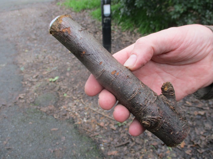
Our main walk initially took us away from Ryde passing through Appley Park. Here a cache had been planted in some tree roots –  how we found and replaced the cache without being spotted by a couple of dog walkers we don’t know. We had to pass the dog walkers soon after, and one of the dogs knew how to interact with strangers. A ball was dropped by Mr Hg137’s feet. “Throw it” the dog begged. Without a plastic ball thrower, Mr Hg137 was not going to pick up a wet, dog-slathered, ball, so he kicked it. Perhaps a bit too strongly, but the ball ran away at great pace. The path was slightly downhill, and the ball gathered so much momentum the dog had to run a long way before retrieving it. This gave us a minute or two to head down a side path, to our next cache. Sadly we didn’t find it! It was supposed behind a road sign (of which there were two obvious candidates some distance apart). The local council had also undertaken some hedge clipping near one of the signs, and we suspect the cache had disappeared.

What was interesting about this non-cache was that it was originally placed by Robb-Inn, a caching couple who used to live near us, and who moved to the Isle of Wight some years ago. The cache is now looked after by someone else.

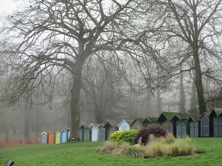
We were on our furthest point from Ryde and we looped back behind an archery field, revisiting the park we left earlier. The path descended to the shoreline, where there were a number of seats – one of which hosted a cache. Of course we scoured the wrong seats to start with and when we found the cache, decided to break for coffee whilst signing the log. Here more dog walkers appeared. We counted about 4-5 people and 7-8 dogs. All the humans were standing around chatting, with dogs getting more and more impatient. One dog had worked out how gravity worked, and walked slightly uphill (within the confined of its lead), dropped a ball, watched it roll downhill, and then walked down and collected it, before heading a few doggy paces uphill before dropping the ball again!

A good tarmac path led us to Ryde, but first we diverted into some woodland to find another cache. The cache was hidden near a ‘photo opportunity’ of Appley Tower, a folly built on the Appley estate by the then owners in the late 1870s. Sadly there was scaffolding around the tower, which rather diminished the photo opportunity!

Our next cache was our hardest of the day. Called “A Loo with a view”. We expected the cache to be in front of the public conveniences with a view overlooking the sea. We searched the front and sides of the building, and found nothing. Eventually we found the cache behind the loos attached to the outer drainage pipes. Hardly a view!

We then had our second DNF of the morning, A cache we had failed to find back in 2018 and we failed to find it yet again. The GPS took us to some trees, many of the photos on www.geocaching.com show a brick wall. We were totally flummoxed, maybe in a year or so… we will get third time lucky here!

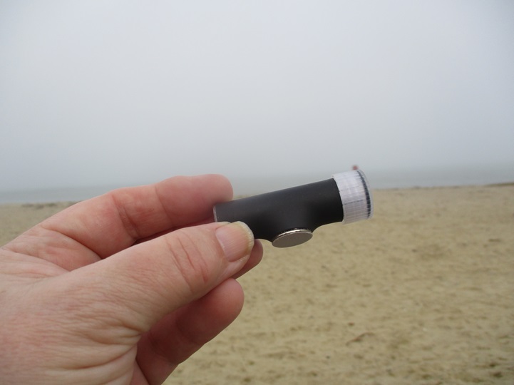
A few yards back from the sea front in Ryde is an ornamental pond. The pond contained a variety of birdlife, and nearby a group of artists were busy sketching and painting. Having passed the lake, we crossed to the sea front, and to one of the pay-to-view telescopes you see at the seaside. A magnetic cache was hidden underneath. This location is quite exposed, and we imagine in the Summer, when the tourist season is in full swing, this cache is difficult to attempt without being seen.

Time was drawing on, and we headed inland following a footpath towards our car. Our route took us past one more cache. It should have been a magnetic nut-and-bolt cache, but only half remained – fortunately the half with the log in. This took a bit of searching, as there were several metal structures that a magnet could have been affixed to.

In all we found 7 Caches, had 2 DNFs, but more importantly a pleasant walk in Winter sunshine after a couple of days sitting down exercising our brain. Roll on next year!

January 24 : Seaview, Isle of Wight

Hello, Mrs Hg137 here.

Our ferry back to the ‘North Island’ (aka UK mainland) from the Isle of Wight was booked for 14:00.  That gave us time for a morning’s geocaching.   We chose Seaview, a part of the island we hadn’t visited before, which was also on the way to the ferry (ish), on the north-eastern edge of the island.

‘Beware of the Grockles’ – said the first cache name.   Not many around today, it was grey and chilly, about 5C and there was a bracing wind.  No grockles in sight (too cold) and not much looking was required, it was yards from our start point, overlooking the sea near close to a memorial about the D Day landings.

From there a narrow path between houses and beach led to Pier Road.   ‘There Was Once a Pier…..’ – said the second cache name.  From a bit of research, Seaview Pier was an elegant structure, but it’s no longer there.   And neither was the cache, though we searched high and low.   We stopped for coffee on an open area which was likely once the entrance to the pier; the coffee was lovely and warm, but the cold was beginning to seep in.   We scooted back into town and bought some sandwiches for lunch at Lily’s Coffee Shop.  It was busy and bright inside and … warm.

Lily's Coffee Shop
Lily’s Coffee Shop

We went out into the cold again and went a couple of streets across town to find a Church Micro cache.   Then, after some dodgy route finding (the cold was seeping further in) we arrived at the corner of the delightfully named Fairy Road.  There was a cache to be found here, and, once again, the cache name came with instructions:  ‘Beware – Mexican Redknee!’    There was really only one place to look.   I put my fingers in … carefully … and emerged clutching a vicious plastic creature.  Luckily, it wasn’t wriggling, but it was a very, very cold morning!

Arrgghh - SPIDER !!!
Arrgghh – SPIDER !!!

We returned to the seafront and had a chilly walk along the raised sea defences of the Duver, which used to be a toll road.  At the far end, near where the toll house stood, is a cache, which is hidden in a fake rock amongst other rocks.  We had a reasonable idea of the kind of rock we were looking for (other pictures later confirmed our hunch), but we failed to spot the correct rock despite turning over what seemed to be almost every suitably-sized rock at the location.  And there were lots.  Lots and lots.

Oh well … we’d spent far too long looking at rocks.  We walked back along the sea wall and stopped for a short while to eat those lovely sandwiches we had bought earlier.  Great lunch, but we got colder still, our toes and fingers were going numb.   We hastened back to the geocar; ferry time was calling.  

A cold end for a winter’s trip to the lovely Isle of Wight. We’d come to the island to take part in a Scrabble tournament, and had both emerged clutching prize-money; the caching had been a bit more variable, but we’d done OK there, too

January 21 : Ryde (Isle of Wight)

Regular readers of this blog may recall that as well as geocaching, we are keen Scrabble players. Over the last 2 years, the Scrabble tournament scene has laid dormant, but over the weekend of 21-23 January, a Scrabble tournament was being held in Shanklin, Isle of Wight.

Ryde Pier and Hovercraft Terminal

In previous visits to the Isle of Wight we have found many geocaches, including all those in Shanklin. so we decided to travel to Ryde and cache there on route to Shanklin. We have cached in Ryde before, but we saw several new-ish caches we could attempt.

Our first difficulty was finding somewhere to park. The main car parks seemed expensive for the short time we would be caching, and it took us some time (and a couple of trips around the one-way system) before we found some free on-street parking. Initially it seemed a bit too far away from the Town Centre, but we soon realised we were only 200 yards from one of our target caches. We agreed to leave the haversack (containing drinks, food and a trackable) in the car and move the car nearer the town centre after we located the cache.

A short walk later and we arrived at a front garden. A raised bed with a couple of rocks which shielded a reasonable sized container. We signed the log, and realised the trackable would fit inside. Of course it was back at the car. Annoyed, we headed back to the car to collect the haversack.

Big container, but we’d forgotten the trackable to put in it!

We reviewed the time we had spent circling Ryde and now backtracking and thought maybe we should walk everywhere and leave the car. We headed off again to another cache. This was a puzzle cache which started like this …

Amelie, Bertie and Charlie arranged baby clothes. Dolores, Edgar and Freddie danced every Friday. Georgia, Hermione and India galloped horses impetuously. Juliet, Keith and Lawrence joined keen lumberjacks….

It took us some time at home to solve this cache, and determine the coordinates. The hint, also alphabetical read :

And Behold Cache Deviously Ensconced in Ferrous Gatepost

And indeed it was. Opposite some temporary traffic lights, and as we searched cars pulled up and waited. We moved away. The cars moved away. We returned and so the game of hunt and pause continued…until we found the cache.

This ‘Gothic Cottage’ isn’t a cache site even though there ferrous materials nearby!

The cache and puzzle were quite clever so we left this log on http://www.geocaching.com hopefully mimicking the cache owner’s style :

A bijou cache discovered early Friday.
Great hiding-place in joinery.
Keep looking!
Many nanoseconds occupied puzzle.
Quite ridiculously simple to unearth very well x-rated yet zingy.

Perhaps not the cleverest log, but our word power was needed later and we didn’t want to overtax it too soon.

A view of the sea… before we went looking for a Curry House

Our third Ryde cache was a multi and part of the ‘Curry Micro’ series, where curry houses are the linking feature. This was our first cache in this series and required us to note down the curry house’s phone number and a couple of numbers from nearby postboxes. A quick calculation and we we had the coordinates for the cache’s hiding place. The cache was quickly found behind some street furniture, but also behind the furniture sadly was lots of rubbish – ironically take-away cartons! Almost apt being a ‘curry’ cache!

Ryde Esplanade Station…but no cache !

We had one more cache to find. On the seafront, next to the hovercraft terminal and Ryde Esplanade Station. Ryde has another station, Ryde Pierhead and we failed to find a cache there many years ago. Today…was no different. The cache at Ryde Esplanade was missing. It was there early January, but since then there have been a few DNFs by other cachers. Again the cache site had litter nearby, and it is perfectly possible the cache had been cleared away by over-zealous workmen.

One day we will find a cache near a Ryde railway station, but time was pressing and we had a 20 minute walk back to the car before our drive to Shanklin.

A standard cache, a puzzle cache, a multi and a DNF – a mixed morning’s caching…and we still had a trackable to drop off. This will have to wait until after the Shanklin Scrabble.

June 6 : Isles of Scilly : St Mary’s part 4 : the way home … stranded …

Hello, Mrs Hg137 here.

Visibility - Not Great
Visibility – Not Great

We were due to leave the Isles of Scilly on June 5th, but our travel plans imploded.  We were due to fly back to Exeter from St Mary’s, but dense fog had descended overnight and there were no planes, none at all.

If the top of the Telegraph Tower isn’t visible, the planes don’t fly … and we couldn’t even see across the runway!  

We sat around for the morning, as more and more hopeful/desperate passengers appeared through the mist and joined those in the airport terminal.  After three hours, visibility was still zero and our flight was cancelled.  The ferry was already fully booked.   At this time of year, there are no planes and no ferries on Sundays.   So we were stranded.  Some hundreds of us were stranded.

About now, the Isles of Scilly emergency procedure swung into action.   (We suspect it is regularly used, though no-one would say so.)   Travellers are advised to return to the place they last stayed and hope that there is still space for them.  That was easy for us, our hotel was only a five-minute minibus ride away, and a phone call established that there would be a room available (but they didn’t yet know which).  But some families faced a trip to the quay, a boat ride to an off island, and a night in a borrowed tent.  And yet others would have no bed for the night, as new visitors would have arrived by boat to take their places.  For them, the sports hall opened up as emergency accommodation, and islanders opened up their homes to offer beds for the night.

Meanwhile, other things had been happening.  By now, an extra sailing of the Scillonian ferry had been arranged for Sunday and we were to be repatriated to the mainland by boat.  And then there would be coaches to transport us back to our airport of departure.  Slick, or what?

Feeling slightly happier, we found seats in a minibus and returned to our hotel.  We dumped our luggage in the store and went for a walk around Hugh Town.  It was grey, gloomy, and misty; a big, big change from the sunny week before.  After an hour or so we went back to our hotel, went to the room we now had, and went to sleep – it had been a stressful day.

By Sunday morning, it was a bright clear day, as if the fog had never happened.  Our ferry was due around lunchtime, so we had one final morning on St. Mary’s.   We decided on another walk around the Garrison.  On a caching trip there two days before, there had been a cache we couldn’t find.   Another cacher had logged the cache not long before, and we messaged them for assistance, but sadly got no reply.  We decided to have another look anyway.  It made no difference – we still couldn’t find it (it has since been temporarily archived).

Scillonian arrives!
Scillonian arrives!

Then it was down to the quay with out luggage to wait for a boat.  A queue of stranded folk turned up, and we were all happy when the Scillonian arrived just after midday.  We were soon on board and the ferry left an hour or so later.   The ferry ride can be notoriously rough, but we were lucky and it was calm, with seagulls and dolphins following the boat.

A row of coaches was waiting for us at Penzance, and we were transported on to Exeter.   Our car park overstay was waived: we were asked if we had travelled from Scilly and the barrier magically lifted.  We arrived home, so tired, a mere 30 hours late – what a journey!

June 2 : Isles of Scilly : (St) Agnes and Gugh

Hello, Mrs Hg137 here.

It was a grey, misty morning as we climbed aboard the boat which would take us to St Agnes, the smallest and quietest of the inhabited islands of the Isles of Scilly.   To the islanders, it is simply “Agnes”, from the Cornish Agenys, and the prefix was added at some point to bring it in line the islands of St Mary’s and St Martin’s. And it’s not one island, but two, as it’s joined to another island, Gugh, by a sandbar which is exposed at low tide.  

The waves were just breaking over the sandbar when we left the quay; not to worry, we would be able to cross it later when the tide was lower.  Our group of fifteen set off clockwise around the island, crossing the bumpy cricket pitch outfield and arriving at the tiny church.  Many victims of shipwrecks are buried close to here (some of those bumps!), and the graveyard includes a victim of the Schiller shipwreck , Germany’s equivalent to the Titanic.   Although there’s a Church Micro here, we decided to take caching opportunities as they arose, so as not to hold up our group.

A little further on, we came to Troytown Farm, the most southwesterly settlement in England.  It’s also known for its icecream, sold all round the islands (of course we tried it, and it’s lovely).  The name comes from the turf and stone labyrinth which is just beyond the farm.   Records mentioning it go back to the 1720s but it may be much older.

It was still misty and quiet, and the island had an entirely different character.  The blue skies and turquoise seas were invisible, and the mist and granite rock formations gave a feeling of Dartmoor.  We worked our way round the coast, stopped for lunch at the Coastguard Café , then returned to the Coast Path, crossing Wingletang Down to reach the southernmost point of the island.   By now, Mr Hg137 had got the GPS out and here is what happened, from our cache log:

… “The GPS was pointing to a large stack of rocks. And a family were there… looking… ‘are they cachers?’  Our walking group ‘marched on’…
Then from some distance away we heard the triumphant ‘Found it !’ Yes, they were cachers. Now the race was on, could we get to the cache before our group climbed the second stile.
Yes !   Sorry our chat was brief Beach44Rock – happy caching!  “…

As we rounded the tip of the island, the weather magic happened, too.   The mist gradually lifted, the sea and the horizon appeared, and the sun gradually broke through.   Passing through the main settlement, Middle Town, with its disused lighthouse, listed phonebox (we simply forgot to look for the cache hidden here!), and post office/shop, we had almost finished our circuit of the island.

Middle Town
Middle Town

The only shop ...
The only shop …

Now the tide was lower, we could see the sandbar (tombolo is the proper word)   and we walked down to the beach and across the bar to Gugh.    Our party forged ahead across the sand as we swiftly gathered the information we needed for ‘The most popular bar in Scilly’ earthcache, then we caught them up on the far side. 


We explored Gugh, too, with its heather, moor, standing stones and nesting birds (there are no rats on either island, and the ground-nesting birds thrive).    

The most south-westerly pub in the UK

Back across the tombolo to Agnes, it was a short walk to another bar, at the most south-westerly pub in the UK, the Turk’s Head   I stopped for a pint, and Mr Hg137 had a cooling J2O.   It had a good view down to the quay, so had a good view of the approaching boat, coming to take us back to St Mary’s, and another good view of the Scillonian, heading back to Penzance.

May 31 : Isles of Scilly : St Mary’s part 2 : Around the Island

Our walking holiday was going well, but our geocaching wasn’t.

We were walking in a group of 15 with a leader stopping at places on route, to point out various items of interest. This makes geocaching difficult, as it is tricky to wander yards away from a path, search for a minute or so, open a cache, sign the log, and re-hide without losing the rest of the group. We had walked around two of the Islands (Bryher and St Martins) without the opportunity to find a cache.

Taylor’s Island – a tidal island just off St Mary’s

Today though, we were circumnavigating (-ish) St Mary’s – the largest of the Scillies. Our route of about 9 miles would visit many of the Island’s places of interest.

There are many beaches to explore, there is an airport runway to cross, Roman ruins to find, and several Iron Age burial chambers to look at. Our walking leader is an expert in such burial chambers, and we had seen a few on our previous walks. So, when she stopped at Innisidgens Burial Chamber we had an opportunity to locate a geocache called ‘Innisidgens View’. The cache location was a few yards on from the chamber, but with a hint of ‘where a seat used to be’, we surmised the location would be close to the footpath.

One of the many Iron Age Burial Chambers on Scilly

Indeed it was, and although the cache was hidden in an unexpected way, we were able to open the cache (a film canister) and attempt to sign the cache before our group walked by. The word ‘attempt’ is key here, as the log was very, very sodden, so we photographed it, and re-hid it. It was a shame that this cache was at the poorer-quality end of caches as a few of our walking group were ‘vaguely interested’, and showing a sodden piece of paper and film canister hardly piqued their interest. Still a cache is a cache – irrespective of container.

Our route took us around the Northern tip of the Island passing several other caches. We thought we had time to attempt another during lunch, but when we combined the distance we would have to walk, and that the cache was a ‘tree-climb’ , we left it.

Memorial stone to
Sir Cloudesley Shovell

As we walked we were told about shipwrecks, and in particular the loss of HMS Association and its fleet of accompanying ships. 2000 sailors lost their lives in November 1707 – one of the worst maritime disasters in the UK. The Admiral of the Fleet, Sir Cloudesley Shovell, and his step-sons all perished in the wreck. A monument to him has been placed to close to where his body was found, he is buried at Westminster Abbey.

From shipwrecks to aircraft, and our route took us by the end of St Mary’s Runway – making sure we could cross the runway by observing a green light on ‘the only traffic lights on the island’.

Old Town, St Mary’s

Heading back to Hugh Town, a much older, small settlement exists called Old Town, The group paused for a refreshment break, and we had another opportunity to go caching. A few yards away, in a raised flower bed, was another cache. It took us some time to locate it, as the hint ‘under a rock’, seemed to apply to every object in the flower bed, except the plants!

Harold Wilson lived here !

Old Town also boasts a Church (a 5 stage Church Micro) and the grave of former Prime Minister Harold Wilson. He loved Scilly and came often and stayed in a cottage near to the Church. The cottage is opposite our final cache of the day ‘Harold Wilson lived near here’. This was an easy spot as the vegetation covering the cache had recently been chopped back, and the cache was very visible. About half the group had extended the day’s walk from Hugh Town around Peninnis Head, we ambled back to the hotel separately enabling us to find the cache with little fuss.

A great 9 mile walk around St Mary’s, but only 3 caches found on route!

May 28 : Isles of Scilly : St Mary’s part 1 : Hugh Town

Hello, Mrs Hg137 here.

2020’s summer holiday had finally arrived – almost a year late.  But we had finally, finally made it to the Isles of Scilly, flying in on a tiny plane with 17 seats (full) and 3 dog kennels (not full).   FYI – it’s the “Isles of Scilly”, or “Scilly” – it is not, most definitely not, the “Scilly Isles” – you will be gently rebuked if you get it wrong!

We were going for a walking holiday, visiting all the inhabited islands, and staying on for a couple of days afterwards.  Fresh off the plane on St Mary’s, the largest of the islands, we found our hotel, the Bell Rock in the centre of Hugh Town, dumped our bags, and set off for a recce to get our bearings.

Bell Rock Hotel, Hugh Town

Having found two of the most vital places on the island, the quay (for inter-island travel) and the Co-op (the only supermarket on the islands and an extremely popular place), we walked around the town, the beaches, and the harbour (with the Scillonian at the quay), admiring the sub-tropical vegetation, the granite buildings, and the sea views. After a while we’d done enough wandering and decided on attempting two Church Micro caches, both located a little way apart on Church Street, just over the road from our hotel.

The first cache featured the Methodist Church.  Mr Hg137 collated numbers and came up with coordinates while I wandered around, taking pictures of the harbour.  With a final location decided, we went for a short walk around the coast path overlooking the beach  (there are two beaches with 200m to the north and south of the Methodist Church so this is not much of a hint!). We arrived at GZ, a spot with an excellent sea view (lots of those on the islands!) and spotted the cache very quickly.

We returned to Church Street and headed for the second church, a little way up the hill.  This, like the Methodist Church and most of the older buildings in the town, is built with granite, the island rock. On arrival, some muggles were deep in conversation on the church steps. We went away for a bit (there were plenty of interesting things to look at). On our return, we assembled almost all the numbers but simply couldn’t spot a blue door mentioned in one of the questions. Anyway, we did some thinking, derived some plausible coordinates, and went off for another walk by the sea.   On arrival, there was another lovely sea view and another cache found very quickly.

It was only mid-afternoon, but we were tiring.  The early start, a lot of travelling and the host of new things had worn us out.  We went back to the hotel for a nap.  Tomorrow, away to the off islands …

And here is a look at the caches we found:

February 3 : Shanklin Chine, Isle of Wight

Hello, Mrs Hg137 here.

We were in Shanklin to play in a Scrabble tournament (20 games over 3 days). The tournament had finished, but our losses had continued to outnumber our wins, and neither of us won any prizes. After the prizegiving, we left the hotel just after sunset, as the light began to fade, heading for – we hoped – the final location of the Smuggler’s Path multicache, based around Shanklin Chine https://www.shanklinchine.co.uk We’d had a look along the beach at lunchtime, and had decided that the tide would be OK to make an attempt on the cache.

Passing the end of the esplanade, and the beach huts, we continued along the beach, hopping over the groynes and skirting large puddles of seawater. It was still dusk but it became much, much darker once we left the beach to scramble into woodland to our destination, an ammo box chained to a tree. We needed to undo a combination padlock to get into the box/cache. And we couldn’t manage it. We put in what we thought was the correct combination (we checked later, yes, it was OK) but we could barely see the numbers on the lock in the gloom, and we couldn’t wrestle the lock open. After a few minutes we gave up and came out onto the beach again.

It was much, much darker now, and the light had faded by the time we returned to the entrance to Shanklin Chine and climbed up to the top of the cliffs, overlooking the beach. There’s a good path along here, and we walked along the clifftop, passing the cliff lift, which is shut in February, and shut anyway at night. There’s another cache along here, and we attempted it in almost total darkness, stopping as muggles loomed out of the night, and getting well scratched by brambles, and before Mr Hg127 finally grabbed the object we were looking for.

Night caching ...

Night caching …


We returned to our hotel, down the steps by the cliff lift, which are ‘interesting’ at night, as they aren’t well lit all the way down, and back onto the seafront for a chance to reflect upon our efforts.

Postscript: if conditions were suitable, we intended to go back to that cache we had failed to unlock. But they weren’t. Next morning, a gale was blowing, and the tide was being pushed high up the beach.

Perhaps we won't go and get that cache this morning?

Perhaps we won’t go and get that cache this morning?


The cache has been added to our ‘caches with a good idea of the solution’ list for a future attempt: perhaps when we return next year?

February 2 : Shanklin, Isle of Wight

On our previous blog we mentioned that we were going to Shanklin to play in a Scrabble Tournament. (20 games over 3 days).

Shanklin Sea Front

Sadly, by Saturday lunchtime, our Scrabble losses far outweighed our wins, so we decided to break off for a few minutes and locate a simple cache just 300 feet from the hotel.

The day was fine, and the warm winter sunshine had brought people flocking to the sea-front. Our plan of a quick ‘cache and dash’ was thwarted by a family at Ground Zero.

We paused.

Admired the view.

We noticed a plethora of plaques nearby.

We read that Shanklin pier was destroyed in the Great Storm of October 1987.

Remnant of Shanklin Pier

We read that from where we stood PLUTO left the UK during WWII. (PLUTO stands for PipeLine Under The Ocean and was used to pump fuel from the UK to France to support the D-Day landings).

PLUTO left the UK here

We read that a time capsule had been placed here in 2000. Not to be opened until 2050.

Although less than 20 years ago, the year 2000 was a different place.
Most people didn’t own a home PC, even less an internet connection.
GPS technology hadn’t been turned on. (And no geocaches had been placed!)
And a mobile phone was.. just a mobile phone.

Where would you hide a cache here ?

As we reminisced (2000 was a special year for Mr and Mrs Hg137 too) GZ had become free.
We stood around – looking as innocent and nonchalant as only geocachers can – grabbed the cache, signed the log, replaced the cache in unseemly haste – and headed back to the Scrabble hotel!

September 1 : Isle of Wight : Freshwater Bay

Our walking holiday was at an end. We had packed our bags and loaded the car. But…

Freshwater Bay

… we had yet to find the three nearest caches to where we were staying. We had a couple of hours before our ferry home, so this was the ideal time to find these caches.

It was early morning (0910) as we walked along the foreshore at Freshwater Bay. (We made a tentative, rockpool scramble towards a terrain 4.5 cache – we had no intention of finding it, as access is only possible at the lowest of low tides) and then headed towards the lifeboat station. Unlike many lifeboat stations around the UK, it is NOT run by the RNLI but independently run and independently funded. As we headed across the beach, we noticed several early morning swimmers. One man charged into the sea, and his dog obediently and joyfully followed. A trio of ladies walked in but their dog was afraid of the waves, and barked incessantly from the dry shore edge.

Beyond these rocks and in some caves lies a difficulty 4.5 cache…


The cache (lifeboat view) was a relatively straightforward find. The hint ‘WD3’ had our minds racing, and since all the footpaths on the Isle of Wight were numbered, we assumed it was attached to a footpath sign. How wrong we were!

We then walked up the grassy slope onto Tennyson Down (for either the third or was it fourth time that week?), to arrive at a fence line, a stile, and some trees. We could see these from our hotel room, and knew the cache (Tennyson’s) was close by.

Up there, at the top of the hill, near the trees. is a cache!

We circled round the small copse (Mrs Hg137 somehow managed to find the largest, heaviest branch to hit her head against!)

Where ‘ouch’ moments occur!

and then a few minutes later found the elusive container we could almost see from our room.

Our final cache was called Julia Margaret Cameron, the 19th century photographer. She lived and undertook much of her pioneering photography at her house, Dimbola Lodge, now a museum.

Dimbola Lodge

We had been fortunate to visit the museum one evening and seen examples of her work. Her style, was very ethereal, Ancient World classical, and involved her subjects being dressed up representing Shakespearean characters as well as Ancient Greek and Roman gods/goddesses. The museum also housed some pictures and accounts from the first three Isle of Wight pop festivals (1968 – 1970). Outside the museum stood a statue of Jimi Hendrix, whose last live performance was at the 1970 festival venue less than a mile from the museum.

Jimi Hendrix

The cache was a multi, and during the week we had collected information about the museum, Julia and Jimi and we discovered that the cache was on the route down from the Tennyson’s cache. A simple find, and a great way to finish a walking holiday – with a bit of geocaching thrown in – on the Isle of Wight.