November 24 : Kingsclere village

Hello, Mrs Hg137 here.

St Mary's, Kingsclere
St Mary’s, Kingsclere

Kingsclere : as described by a local resident and fellow geocacher, TadleyTrailblazers:  

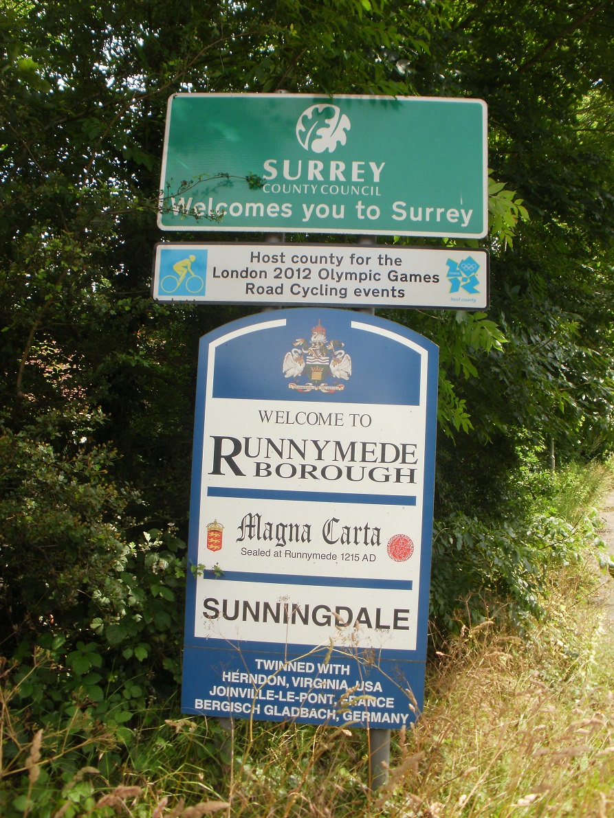
Kingsclere has a Post Office, three pubs, two local stores, a library, hairdresser, butchers, and art gallery, everything a small community could want in this north Hampshire village.  A bustling parish with strong community ties and a unique, friendly atmosphere, Kingsclere is a fantastic place to sample the surrounding views and neighbouring villages. This area inspired the novelist Richard Adams to create the world-famous story of Watership Down.  ‘Clere’ is thought to have derived from the Saxon and may possibly mean ‘bright’ or ‘clearing’; there is evidence to suggest that Kingsclere belonged to King Alfred between the years of 872 to 888 with the full name being referenced in a chart.

We began our visit to the village with an AdLab cache, which gave us a guided tour of the highlights of the older part of the village.   We inspected the Old House (once an impressive solicitor’s office), then, closer to the village centre, two locations linked with brewing, the Malt House, and Popes Mill, and two more associated with drinking, the Golden Falcon and the Crown Inn (all, except the last, are now private houses).

A few doors from the pub was a Methodist chapel, and opposite was the village church, St Mary’s.   Crossing the road, we passed toilets, a coffee shop, a convenience store and the local butchers, then went into the churchyard, musing to ourselves that almost all of our spiritual and physical needs were provided for in this small area!    Our thoughts were interrupted as it began to rain, hard and cold – this hadn’t been in the weather forecast!   We took refuge in the church, had a warming cup of coffee, then headed outside again, where it was no longer raining, but noticeably colder.

A short walk took us past yet another, now unused church, so now we had coordinates for three Church Micro caches to find later on. Next we followed a track uphill to the Recreation Ground, which has a hilltop view over the village, and towards Watership Down in the other direction.  After finding two geocaches around the edges of the field, we descended a steep flight of steps to Hollowshot Lane, a straight track running roughly east-west.   We had quickly gone from village to countryside, and the sunshine was returning.

Here we had a dilemma:  a geoache lay some hundreds of yards away to the east, off our route, so an out-and-back diversion would be needed.  AND – said cache hadn’t been found for 5 months, so we could have a long detour for something that was no longer there.  After consideration, we decided to try to find it anyway.  Once there, we spent some while peering around fruitlessly, then leant on a nearby gate to read previous logs … looking down … we spotted something lying out in the open.  Aha!  Found it at last.  That made the return trip much happier.

Park House Stables gallops

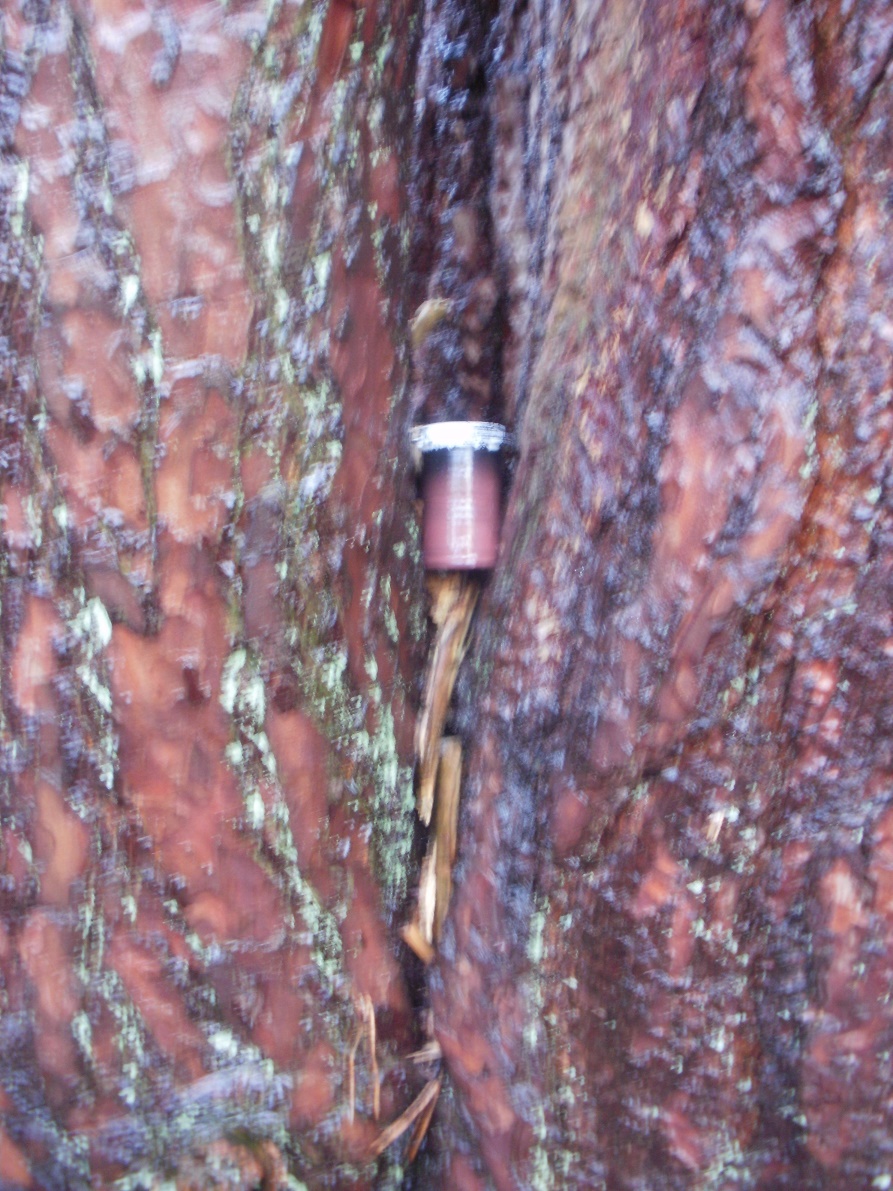
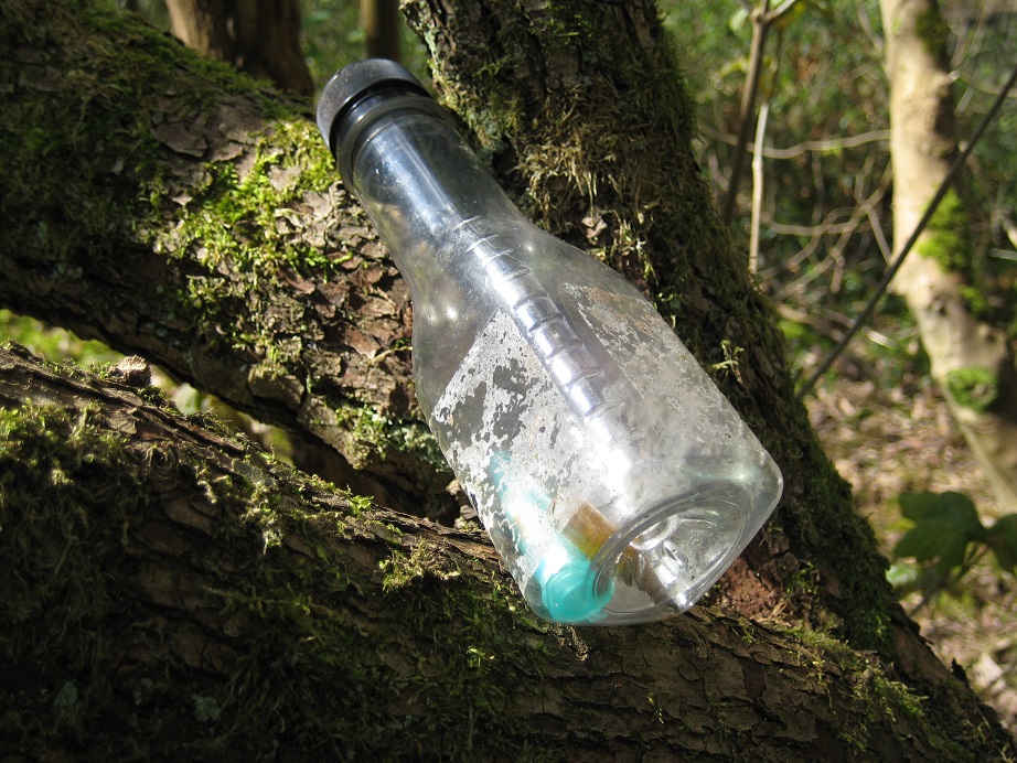
Reaching the road at the end of the track, we made our way back towards the village.  We had more detours and diversions to make, this time to look for the cache containers associated with those churches we had passed earlier.   In no particular order – one was along a woodland path, one tucked into a concrete post, and the third was in a delightful spot along a stream running through the village.

Park House Stables and their immaculate gallops lay to our left – no racehorses visible today: wrong time of year, wrong time of day.  

Our walk concluded along the same clear chalk stream. The rain was gone now, and we finished the day in clear, cold sunshine.

PS And the butchers , which we passed earlier … we went back, went in and bought some lovely venison sausages.  Not cheap, but delicious!

Here are some of the caches we found:

August 8 : Crowthorne

Hello, Mrs Hg137 here.

We had an errand to run in Crowthorne and decided to combine that with a short afternoon caching trip.  It had been a showery weekend and we hoped to fit our activities between showers.  The errand went smoothly, so we were then free to grovel around in bushes looking for caches …

Our first target was from the ‘Counting Vowels ’ series, in Napier Woods.  On checking previous logs, we saw that the cache had not been found for about six months, with a previous log saying it might be missing.  We contacted the cache owner, mikes54, who was part way through a maintenance run on his caches, but hadn’t reached this one yet.  He gave us detailed information on the cache and its location, and permission to replace it if missing.

We found the entrance to the woods very easily – we didn’t know this was here – and walked through the woods checking the waypoints. All was present and correct so far, and we paused to work out the coordinates and set a location into the GPS. Then we set off to walk to the cache location, and it began to rain hard.  We took shelter under a tree, then moved to bigger trees as the rain continued. After it stopped, we went on our merry way to the cache location.  There were two possible locations, one more likely than the other, and we checked them both thoroughly. No cache in either.  We replaced the cache with a like-for-like of what was there before, and sent photos to the cache owner showing what we did.  (The cache has been found since, so we helped things along.)

Replacement cache
Replacement cache

We returned to the centre of Crowthorne, for another attempt on a cache we had failed to find five and a half years before, ‘This piece of road is below 30’.   We hoped our finding skills had grown in that time.  (Hmmm- maybe!)  At the location – the vegetation seems to have grown a bit in the interim – we rummaged around with no success. After a bit we gave up and walked away. And then I made a casual remark about the location, which set Mr Hg17 thinking. We returned, and rummaged around some more.  I spotted something mentioned in the cache details, but didn’t find the cache. Mr Hg137 searched around and retired, bleeding, after some of the prickly vegetation spiked him.  Again, we have been in touch with the cache owner, have done some detailed searching on Google, and now have some additional information which will enable us to have a third attempt, when we’ve assembled some PPE against that dastardly vegetation!

So far, so not-so-good; we’d tried two caches, replacing one and not finding the other.  We went for a third attempt – a puzzle cache, ‘Down Two then Left’.  We’d solved this one a few days ago: a combination of the title and some of the less obvious pictures led to an ‘aha’ moment, and the rest of the solution was quick and easy.  We walked off to the cache location, soon spotted the cache container, and signed the log.   Finally, a cache log we could sign!

More rain clouds approaching, so we scooted back to the geocar, hiding in a bus shelter when it rained, again.   An interesting but not entirely successful afternoon!

September 24 : Dorchester in the rain

Hello, Mrs Hg137 here.

Our long weekend in Dorset had not started well. Having left home in bright sunshine, we arrived in Dorchester with rain falling and thunder rumbling, then spent some time struggling at the hotel … how to make the lift work? (key card) … food in the hotel restaurant (no, sorry, we’re closed) … how to make the wifi work (sign in using only Internet Explorer!) … how to get into/out of the underground car park (gates / key card / lift) … how to cope with the Covid measures (aarrggh plus face masks!). After an hour or so or that, all was solved but we were both rather grumpy, so we decided to walk into town, see how things were, and maybe find a few caches too.

After a short walk, we arrived at the war memorial, ready to find the cache associated with it. And it began to rain again. Hard. We decided that inspecting the memorial closely during a rainstorm would be no fun, so took shelter outside a nearby coffee shop. The rain eased after a bit, so we continued on our way, collecting some coordinates for a Church Micro as we went (the cache was a little way away, we’d find it later).

We passed a house where the ‘Mayor of Casterbridge’ lived in the eponymous Thomas Hardy book – it’s Barclay’s Bank now. There are Thomas Hardy related items all over Dorchester, you could spend a weekend just doing ‘Hardy stuff’ – there are statues, a school / shopping arcade / pub / his houses – plus the various locations mentioned in the books http://www.dorchesterdorset.com/blog/thomas-hardy/thomas-hardy%E2%80%99s-dorchester

Dorchester High Street in the rain

Dorchester High Street in the rain


We arrived at the High Street to collect more coordinates from another Church Micro, one of many in Dorchester. The heavens opened – again – as we reached the church. We worked out the coordinates on a soggy piece of paper. The rain relented as we walked to the final location, then came down with renewed vigour while we searched for the cache. We took way too long over finding it, getting soaked, but find it we did, before we retreated to a bit of cover to wait for the rain to stop … back at the coffee shop.

This meant we were back at the War Memorial. We didn’t do the cache here before, but it was a bit drier now. We circled the memorial, collecting numbers, did the sums (which matched the checksum – great!) then found a likely hiding place nearby. A feel around, and the cache was located.

Our next cache was at Dorchester South station, so close to our hotel that it’s almost visible in the picture on the cache description. After a few laps of the platforms, bridge, and car park, we had some coordinates, and then the cache. This was the only cache of the afternoon where we didn’t get soaked either while working out the numbers or while collecting the cache, or both!

Maumbury Rings

Maumbury Rings


Just south of the station is Maumbury Rings, a Neolithic / Roman / Civil War earthwork (it’s been re-used several times) https://www.dorchesterdorset.com/maumbury.php The original route for the railway was intended to go straight through it, but was ever so slightly re-routed after a campaign to save it. It’s an impressive place, still used today for outdoor concerts, plays and the like. And a little further on was the final cache of the day – the cache for one of those Church Micros we’d solved earlier on in the rain.
It's stopped raining!
And that was it for the afternoon – we had started off soaked, complaining, under grey skies, and finished in the clear bright sunshine of an autumn afternoon. Apart from the damp pavements, it was as if it had never rained!

Here are a couple of the caches we found:

February 29 : Leap Year Day : Church Crookham and Fleet

Hello, Mrs Hg137 here.


Leap Year Day started with rain (again). But by afternoon it had improved into bright sunshine and scattered showers and we decided to risk a drenching and go out for some caching. Off we went to north-east Hampshire, between Church Crookham and Fleet, and parked near Basingbourne Park, roughly in the middle of the area we planned to cache. We had chosen a mixture of ordinary caches and puzzle caches, and had spent some time solving the puzzle caches during a previous rainy day.

Our first cache was a puzzle cache, ‘Square Cache’, one of those we had solved earlier. Counterintuitively, the cache was hidden in a circular place … We left the area and walked towards our second cache and the sun went in and it got colder and darker and then began to hail, then rain. We took refuge behind bushes and trees a short distance from the cache, watched the muggle dog walkers plod, heads down, into the rain, and waited till the squall passed. The rain stopped, we emerged and walked up to the next cache; there was something ‘not quite right’ which just had to be the cache. At first we couldn’t extricate it, and though it was a ‘real’ object. But no, a second attempt removed the cache container. Very cleverly done!

Basingbourne Heath

Basingbourne Heath


Strange springy path!

Strange springy path!


We left the tarmac paths and entered a wooded area. But were we off tarmac? The paths beneath our feet looked like tarmac but were weirdly bouncy – we wondered if they were made from recycled tyres. We weaved through the woods, passing a small patch of rather soggy heathland (we weren’t expecting that!) and also finding two of the three caches in the ‘Basingbourne’ series; two were straightforward finds but we gave up on the third. There had been a great deal of rain recently and the area for some way around the cache was very wet indeed. We tried approaching from a couple of directions but without success. We were wearing walking boots, not wellies, so we decided to keep our feet dry and leave this cache for another day.
Too soggy to go in there!

Too soggy to go in there!


Back to the puzzle caches, and we found three more of these in the area between Basingbourne Park and the B3013 which runs south from Fleet. As before, we had mixed fortunes with finding the caches; the hiding place for one could be spotted from the other end of the street; another required a good rummage among roadside bushes and tree roots; and the third needed a long, scratchy and dispiriting search among bushes and small trees, where we were about to give up at the time we finally, finally spotted the cache. (Editor’s note: no, I’m not saying exactly where they were, you need to solve the puzzles yourselves.)
An unusual pet?

An unusual pet?


And then we got the last cache very wrong. It was a challenge cache and we had checked and knew we qualified (we needed to have found a selection of caches with a connection to water). We were so smug at all this that we had mentally already found the cache and signed the log that we hadn’t read all the way to the bottom of the cache description where the actual location of the cache was specified, not at the published coordinates but at a waypoint listed alongside the cache. And so we searched in the wrong place – then approached from another angle, and searched again – and again – and didn’t find the cache. Eventually we gave up, went home, and found out the real location when we re-read the cache description, properly, at home. Grrr.

Here are some of the caches we found:

December 21 : Wellesley Woodlands

Wellesley Woodlands are on the border of Farnborough and Aldershot on former Army land. Named after the 1st Duke of Wellington (Arthur Wellesley), the woods comprise 110 hectares of mixed woodland (https://thelandtrust.org.uk/space/wellesley-woodlands/?doing_wp_cron=1577458134.5638270378112792968750).

Welcome to Wellesley Woodlands

There are many woodland trails named after the various trees (Oak Trail, Sycamore Trail etc) and our route would follow these around the woods, passing a large monument to Wellington and returning to the car. The woods also extended to, and beyond, the Basingstoke Canal where after moving our car we would look for two more caches.

Various wood walks


That was the plan.

We got off to a very inauspicious start as we made a couple of navigational errors driving to the car park (‘We were never lost …just not sure of where we were”). We eventually booted up and strode away from the car, and headed for our first cache – a travel bug hotel. We had just entered the woodland when it started to rain. Now, common sense would have said..’head back to the car and wait for it to pass over’.

Nope. Let’s continue.

The rain stopped. Clearly we had made the right decision. Onwards.

Then the rain started again, heavier, colder this time. Almost hail. Aaargh! The bare winter trees provided no shelter at all! We got absolutely soaked.

No shelter here …


… or here !


The footpaths became quagmires, and the dog walkers we passed were all wrapped up and their dogs were more like bundles of fur covered in mud. They all had the right idea…head to the car. We seemingly had no sense whatsoever.

We arrived the travel bug hotel, and found the log almost too wet to sign – not due to the prevailing weather, but months previously the cache had let water in, and had still not dried out. We etched our signature and headed back to join our main target, the 5 cache Wellesley Woodlands series.

Travel Bug Hotel


Some distance away a few park runners/fun runners jogged by (how protective their Santa hats were we weren’t sure) and one lone dog walker passed us. The rain had eased slightly, but we were still very cold.

We joined the Wellesley Woodlands series at cache 4 and it should have been a simple find. The GPS took us the correct tree, but we decided to overthink the hint, and walk 10 yards further to examine a different, and better looking host. (What does ‘double tree’ mean ? Two adjacent trees or a twin-trunked tree ?)

Eventually we trusted the GPS and found the cache under its tell-tale pile of sticks.

We were cold, wet, and bordering on the irritable. The car was relatively close by so we adjourned for some coffee and took stock. After surveying different options, we decided on abandoning the Wellesley Woodlands series (we had numbers 1,2,3 and 5 left which formed a good discrete mini-series for another day) and drove the mile or so to another car park to find two caches by the canal.

Footbridge over the canal…


…and the peaceful canal underneath


The first of these caches was a Challenge/Mystery cache with a Beatles theme. Qualification for finding the cache was depending on finding 20 caches each with a word with a Beatles connection. (There were over 60 words to select from and we had spent some time the night before validating our 2950+ finds against this master list. We subsequently discovered there was a Challenge Checker on https://project-gc.com/ which would have saved us time.) The words we had in our cache finds included ‘John’, ‘George’, ‘Beatles’, ‘Liverpool’, ‘Help!’, ‘Lady’ (Madonna), ‘Yellow’ (Submarine), ‘Abbey’ (Road).

The cache was hidden next to the canal towpath next in, according to the hint, some silver birches. This is quite an old cache (January 2014), and since then various silver birches have been cut down. It took us some time to locate the correct location and then several prods of the geopole to find the superb, and apt, cache container.


We walked along the towpath to our final cache. As we did so, we saw a couple of geese, and couple of runners, and some speeding kayakers.

Graceful and slow…


…graceful and fast

The cache was called for some reason ‘Yesterdays Onions’ and was again hidden in a silver birch. We hadn’t learnt any lessons, as for the third time in as many caches, we looked at the most obvious location first, oblivious to a better host nearby.

Still find it we did, which brought our finds for the day to 4 out of 4. Although the weather had brightened, we were still damp and slightly cold, and had left a mini-series for better caching weather.

December 14 : Counting Vowels on Wildmoor Heath

Hello, Mrs Hg137 here.

The Counting Vowels geocache series started out in November 2017 and now comprises around 60 caches, and it’s growing all the time. To solve the caches, you need to visit a number of waypoints and note certain words on signs; after a few locations you have a selection of words e.g. ‘weighbridge’, ‘public’, ‘giraffe’ (OK, we haven’t found one of those, yet!), and then add up the vowels in the words, come up with a total for each of A/E/I/O/U and use those numbers to come up with the coordinates of the cache container.

This sign?

This sign?

This one?

This one?

Or maybe this one?

Or maybe this one?


Wildmoor Heath, between Sandhurst and Crowthorne, is the location for three of the Counting Vowels caches, and we thought they would be a good choice for a Saturday morning caching trip. Each had four or five stages over about a mile, plus a walk to the final location, and were described as requiring 45-60 minutes each to complete.

All three caches start from the car park at Wildmoor Heath, then go in different directions and our GPS showed a plethora of waypoints, all mixed up together as the GPS orders them by distance. We decided to solve the caches in numerical order, #34 first, then #35, and finally #57. First was the Wellington Nature Trail (#34), which skirts the edge of Wellington College and heads off westwards along the Three Castles Path https://www.ldwa.org.uk/ldp/members/show_path.php?path_name=Three+Castles+Path+%28England%29 Off we went from the car park, pausing briefly to note the information for one of the stages of a later cache (More about this later …)
It's going to rain in a minute!

It’s going to rain in a minute!


We went through woodland, then out onto open heath. Just as we had collected the last bit of information, and had reached open, treeless ground, the sky darkened, the wind rose, and a squall of rain / snow / sleet rattled through; we backtracked, and sheltered behind the largest tree we could find, and worked out the coordinates for the cache. It passed by after about 15 minutes, leaving blue skies and sunshine, and it was as if it had never happened. We came out from behind the tree and set off for the cache location, finding it very quickly.

Back at the car park, we grabbed a cup of coffee from the thermos we had stashed in the geocar, then set off again for the second cache, the Three Castles Path (Counting Vowels #35). This was the first ever long distance path we walked, back in 2010, and it was good to revisit familiar territory on such a sparkling bright morning. This time round, it didn’t seem to take very long to visit all the required ‘things with words’, to count the vowels, and to find the cache. So far so good …

Just one cache to go, Wildmoor Heath (South), a newish cache placed only a few weeks ago, and number 57 in the Counting Vowels series. We had already noted down the first clue for this cache earlier on, and we decided we would take a short cut to the second waypoint. All proceeded steadily, and we soon had a set of coordinates for the final cache. The coordinates looked plausible and we set off towards them. We arrived at the road, and we still hadn’t arrived at the cache. Oh dear, something wasn’t right. Never mind, maybe the cache was over the road. We crossed, and investigated the boundary of Eagle House School. But we still weren’t quite at the right place, which looked to be on private school land, in the middle of the cricket pitch. This just wasn’t right … we checked our calculations, then checked them again, but couldn’t work out where we had gone wrong. By now, lunchtime was passing by, and we were hungry and grumpy. We had failed. We stumped gloomily up the road and back to the car park, and did a re-check on that first waypoint we had noted down at the start of the day. AND WE HAD WRITTEN IT DOWN WRONGLY! Rats! We re-did our calculations, which gave us a new location … 600 metres away. By now, hunger had overcome our desire to walk an extra 1200m there and back so we returned home for a very late lunch.

But we weren’t giving up …

    The return

Happily, the cache owner had been in touch the previous day to confirm that our revised coordinates were correct. Next morning, we returned to Wildmoor Heath. As there was a 5k and 10k Muddy Welly race taking place close to the Wildmoor Heath car park, we parked elsewhere and walked through woods and across boardwalks to reach the final waypoint for this cache. This time the GPS led us to a place that matched the hint, and, after a short search, the nice new cache was unearthed. The moral is to read (and more importantly, correctly transcribe) what is written on the noticeboards; it went wrong for us because we didn’t.

    The postscript

How do we know that the Counting Vowels series started in November 2017? We were the First to Find (FTF) on the very first cache in the series and spent a morning wandering hither and thither around Wokingham to find it. https://sandhurstgeocachers.wordpress.com/2017/11/10/november-10-ftf-wokingham-chestnut-avenue/

And here are some not especially revealing pictures of caches:

July 2 : Sunningdale

Many of our recent caching trips had been some distance from home. We realised we hadn’t found many caches within 10 miles of our house for some time! Today, with bad weather forecast, was the morning to put that right.

Sunningdale Church

Sunningdale Church


A small series in Sunningdale, Berkshire was our target and what a fine series it was. We loaded lots of other Sunningdale caches into our GPS thinking that if we were quick finders (Ed : wishful thinking !), or the rain held off (Ed : even more wishful thinking!) we would have plenty to do.

Our first target was a puzzle cache in the ‘Famous Berkshire Residents series’. We had solved the puzzle before setting out, and realised the co-ordinates were near a handy parking space yards from the Sunningdale circuit. We parked up, and searched. Read the hint. Searched some more. Re-read the hint. Searched again. Nothing. The advantage of parking so close to the mystery GZ, was that we could have another attempt later.

On route to Coworth Polo

On route to Coworth Polo


And so onto the ‘Sunningdale Circuit’. This was a very well thought out circuit in a predominantly semi-urban area. Most of the route was by roads mainly minor, but did include the notoriously busy A30! There were some footpaths too, most of which were very passable given the rain we had had recently.

The first cache was near a bowling club, and we just about got away with finding the cache while bowlers were arriving at their venue. Our slight problem here, was the cache was embedded in a road sign, we initially looked at the wrong one, and then it was ages before we found the cache in the correct location. (This series wasn’t going to be easy).

Our next WAS an easy find. The cache log was hidden within a very life-like brick. With a small amount of rubble around it, it was very well hidden. Then to a gate. Here again we started our search at the wrong end, but once we had swapped ends, the cache was easy. A disappointing feature of the whole series was the smallness of caches, no space for goodies or trackables.

The gate lead to a footpath, which soon opened out to the Coworth Park Polo fields. Very scenic and totally unexpected given the narrow lanes we had been on earlier. Here there were supposed to be 2 caches, but one had been disabled since 28/5/16 and has yet to be replaced. The other a very devilish bison hanging in a tree. These caches are always really easy to spot when you know where they are, but until you spot them, every branch needs close examination. We felt a bit exposed here, as there was a fete (or similar) being set up and lots of people busy with all the tasks that fetes entail.

Coworth Polo - Fete

Coworth Polo – Fete


We walked around the fete field, and arrived at a beautiful footpath with overhanging trees. This was the best view all day, and best of all there was a cache to find. In amongst tree roots, but so many of the trees had long roots leading into the sunken lane.

Sunningdale

Sunken lane in Sunningdale

The sunken lane led to the A30, and its roar got louder as we approached. Just as stepped out on the A30 pavement we felt rain. At first just a little and we were able to use the many overhanging trees as shelter. A short diversion to find a cache right on the Berkshire/Surrey border and then back to the A30.

Berkshire/Surrey border

Berkshire/Surrey border

Surrey border

Proud of the county history


A very wet A30!

A very wet A30!

Our next cache find was straightforward, but as we removed the cache from its hidey-hole, the heavens well and truly opened. A nearby rhododendron bush yards from the cache provided us with shelter for some 15 minutes. During that time we saw several wet walkers, some very wet dogs, and even wetter runners go by. Most didn’t see us at all, hiding from the intense rain. We decided that we could get to the car by finding just 2 more caches and eventually when the rain eased, we set off again.

Our last footpath of the day was now quite wet and muddy, but we found the next cache fairly easily. Our final cache of the day – one of those false stone caches – was hidden behind other stone objects near to a Sunningdale church.
Not surprisingly given our searching prowess, we yet again we failed to find it on our initial search.

We arrived at the car, and gave the ‘Berkshire Resident’ one final look. But our look was cut short, when a large back cloud came ominously into view.

So with the exception of the puzzle cache, we found all the Sunningdale Circuit caches we attempted, although by the end of the morning it felt more like the Rainingdale circuit!

Caches found included :

April 9 : FLAB in Maidenhead

Hello, Mrs Hg137 here.

FLAB – not an especially nice term … But FLAB : Footpaths, Lanes And Bridleways is a series of 17 caches over approx. 3.5 miles, sandwiched between the A4, the Bristol-London main railway line, and the A404M. And that description does it no justice at all – it is really easy to get to, has good, free (!) parking, and is in a rural little patch of country.
OLYMPUS DIGITAL CAMERA
First of all: why did we choose it? We had an appointment between home and the cache series, and our plan was to keep the appointment and then move on to the geocaching. And, like all good plans … it went wrong. As we completed our appointment, Mr Hg137 realised he did not have his wallet; it is normally welded to his person when he is not at home, so he began to worry. Thus we returned home, retrieved the wallet, and set off again, passing the venue of our appointment (that saved some mileage, didn’t it?) before arriving at the excellent little parking place at the start of the caching series. At this point I realised I had forgotten to pack my walking boots, so I had a choice of another, much longer, round trip to collect them, or going round the route in my wussy, soft, non-waterproof trainers. I chose the latter. Actually they performed much better than that, so I had no need to worry.

Wussy driving trainers

Wussy driving trainers


Leaving our start point, we set off in the April sunshine into light woodland. The caches were easy to spot in the dappled shade (no rootling in thick undergrowth or head-high nettles needed at this time of year), and after five quick(ish) finds, we emerged from the path onto a country lane. We came upon a seat, placed next to the village noticeboard for White Waltham. It was the first seat we had seen, it was lunchtime, so it was a good spot to sit in the sun, eat our sandwiches, and watch the world go by. After lunch, we went further on down the lane, before turning off the road onto a track across fields. Suddenly it wasn’t so sunny, and the wind was getting up. We dawdled as a muggle family passed, then dived behind a telegraph pole to retrieve a cache; we expected the cache to be on the ground, but it was at head height, so we spent a while in the right place, but looking in the wrong direction. At the end of the track, we were back on a road, this time with a pavement, and pleasant flower-strewn verges, heading towards the railway line and a business park close to White Waltham airfield. Just before the railway, we diverted down a path across fields, accompanied by frequent trains in the shallow cutting alongside, and watching light aircraft practising take-offs and landings. Just here we found another cache – nothing very unusual about it, exactly where the GPS said it should be, and not very hard to find – but the previous logs said that it had not been found for some time and must be missing – that was most definitely wrong!

On we went, along a quiet section of dead-end road and onto another path. By now, we could both feel occasional raindrops. We tried to ignore them, but had to admit we were likely to get wet. Very soon. And so it proved. Our next cache was hidden amongst bushes and trees on a sheltered section of path, and it began to rain, hard, as we retrieved the cache. But it was a good place to be at that moment – possibly the most sheltered part of the entire walk – so we skulked in relative dryness under the trees while the rain pelted down and gusty winds swirled about. And then the rain was gone, almost as soon as it had arrived. A little further on, we emerged into a residential road, then turned onto a more major road which took us back to the geocar. I was quite happy for the paths to be paved by now, for my wussy driving trainers would not have fared well on those rural paths, once they were wetted by rain.The last two caches took us a while to find, as they weren’t where the description said they should be, but we got them eventually – a full house of 17 caches.

So, a roundup of the 17 caches. We found them all, which is quite rare for us; actually, very rare for us, there is usually something we don’t find. Most were very easy to find (as the description says they should be) though there were a few that weren’t quite where they should be (e.g. one hint said ‘in armpit of tree’ while we found it ‘in toe of tree’) or which needed some attention(e.g. container lid missing). We made notes on those and sent a detailed list out to the cache owner afterwards; as they said, the series is often done by beginner or inexperienced cachers, which might well explain some of the problems. We felt like grizzled old lags at that point!

Here are a selection of the caches we found, in no particular order:

OLYMPUS DIGITAL CAMERA

February 22 : A wet morning on the Wight

Hello, Mrs Hg137 here.

St Helen's Old Church

St Helen’s Old Church


Before boarding the ferry to take us back from the Isle of Wight back to the ‘Big Island’ to the north, we had a morning in which to fit … some more caching. We headed north-east in the drizzle along the coast from Sandown, stopping first at the ‘Up and over TB hotel’. This cache is right next to Bembridge airfield, a grass strip where one plane had also done an ‘up and over’ !
Bad landing?

Bad landing?


A mile or so away is the village of Bembridge, where we found another two caches. On the second, we had just started our search, when a muggle came out of his house to move his dustbin, spotted us, and came over to see what we were up to. We had been rumbled! But he was friendly and we explained about geocaching, found the cache, and showed it to him (it was hidden by the wall of next door’s garden). For the future, he will know what is up when suspicious-looking folk appear and start rootling around at the end of his drive.
Bembridge Church

Bembridge Church


Leaving Bembridge, we moved onwards to St Helens, heading for the harbour but stopping along the way to find a cache at St Helen’s Quay. This is a new record for us; at -1 metres, this cache has the lowest elevation we have yet done. (Editor’s note: it seemed above sea level to me!) The drizzle had now turned to rain, the cloud base was not much higher than us, and it was a high spring tide, so we never found out if the next cache merited its title ‘Beautiful Beaches’. Nearby, right by the sea, is an interesting building, half church tower, half whitewashed landmark. This is the remaining part of old St Helen’s Church http://www.sthelensparishcouncil.org.uk/history.php and legend says that it was Admiral Lord Nelson’s last view of England, as HMS Victory anchored here to take on water before sailing off to the Battle of Trafalgar.
A wet morning's caching

A wet morning’s caching


‘The Old Links’ was our next cache. A number of the previous logs had mentioned MUD, so we were prepared, with walking boots, geopole, etc. Those logs were not wrong; we slithered and sploshed around for some minutes before finding the cache right where the GPS said it should be. Covered in mud we arrived back at the geocar; I’d seen quite a bit of the island’s geology over the weekend, and mostly it had ended up stuck to me! Luckily, I had stayed upright, so the mud was only on my feet, and not everywhere else too. (Editor’s note 1: my walking trousers are not nearly as waterproof as I would like them to be!) (Editor’s note 2: mud is very cold indeed if you sit down in it on a cold rainy day!)
MUD!

MUD!


We had time for one final cache, and a coffee break, in a pleasant spot overlooking Bembridge harbour, before driving back to Fishbourne to catch the 13:00 ferry. We arrived a bit early and asked if we could catch the 12:30 ferry instead – there wasn’t one, so we sat and watched the rain through a steamed up car windscreen, reflecting on a successful, though wet, morning’s efforts.

Here are a few of the caches we found during the morning:

June 13 Thames Path : Shillingford to Cholsey

Hello, Mrs Hg137 here.

Recently, we’d tried a couple of circular walks, but we weren’t progressing down the river very quickly, and it was back to linear walks. So – how to get from one end of the walk to the other? We decided to try the local buses. And very efficient they were too. A quick cache on the way to the bus stop, a bus to Wallingford, and second bus to Shillingford Bridge; excellent website, Thames Travel! ( http://www.thames-travel.co.uk/timetables-fares/oxfordshire-and-reading )

Shillingford Bridge

Shillingford Bridge


We got talking to one of the other bus passengers.  He was a Morris dancer – yes, we could tell, as he was in costume – on his way to Oxford.  We know some Morris dancers – Berkshire Bedlam – as, most years we take part in their ceilidh in late autumn. This particular person happened to be one of the musicians in a ceilidh band, and had been up on stage performing at some of the events we had attended, could remember the caller and the fancy dress themes ( it’s best not to ask about that, but the website gives the ecccentric details http://www.berkshirebedlam.org/ ).  What a coincidence!  A person met at random, in a random place, had been to some of the same events, some time and some distance ago.  It’s a small world …
Wet Wallingford

Wet Wallingford


It was drizzling in Wallingford, and raining by the time we reached Shillingford. This wasn’t in the plan. We couldn’t find the first cache we attempted on the Thames Path; all those leaves were soggy and we couldn’t get a fix on the location, so we moved on. We had more success with the next cache, where we swapped the ‘Lady Bug’ trackable for another, ‘Biltmore or Bust’. Then there were another couple of caches in the nettles, and by the river, and another failed attempt in a dripping hedge, and we arrived at Benson Lock and boatyard. It was still raining, so we had an early lunch in a shelter overlooking the river, sharing rather more than we’d intended with a pair of ducks, and watching the hire boats depart.

Mr Hg137 didn’t like the rain and was getting a bit grumpy by now,so we agreed to abandon the walk if it was still raining when we reached Wallingford. At the rather scary Benson Weir, we crossed over the Thames. Mr Hg137 kept stopping for a chat (why? I couldn’t hear anything he was saying over the roar of the water), but I just wanted to get to the other side away from all that rushing water.

Scary Benson Weir

Scary Benson Weir

Benson Lock

Benson Lock


And on the other side, past the lock, was another cache, hidden beside one of the many pillboxes along the river. And in the cache, another trackable, ‘Blubbie the fish’ It stopped raining as we walked past the ruins of Wallingford Castle and through the town, so no early finish for Mr Hg137.
Wallingford Bridge

Wallingford Bridge


After a couple of urban/suburban caches, including one of the BIKERZ series near the church, we were quickly out in the country once again.
Wallingford Church

Wallingford Church


Then we came to the ‘Katie’s Floater’ cache; we’d not come across one like this before but we knew what was needed – to block up some holes in the outer cache container, then fill it with water to float the cache up to the top. Sadly, we didn’t have enough water, couldn’t find a container to top up our stocks from the river, and didn’t have a friendly octopus with us to block up all those holes; another time … Just a few caches till the end, and we didn’t get some of them; the nettles were high enough, and the GPS fixes vague enough, to put us off (the owners have subsequently checked them and they are there, so it was just our poor finding skills, again). Luckily, we found the last cache of the day on our walk up Ferry Lane to the geocar. It’s always good to find the last one, as it ends the day on a positive note.

Thames Path statistics : Route length : 5.4 miles Total distance walked : 78.55 miles

Caches found : 8 Total caches found : 157

Here are some of the caches we found: