On our geocaching trip in St Ives we found a trackable, Travel Heart.
We are one of the first people to have seen, or moved, the trackable.
It was placed in a cache in Copenhagen in November 2022. Its mission ? To travel the 42km to Malmo ! The shortest distance is across the Oresund Bridge, but of course being a trackable it is taking the long way round! It was picked up from the Copenhagen cache in January 2023. And then the cacher didn’t find another cache for 6 months. The next cache they found was the St Ives cache, which we found a day after them!
So we took the trackable, decided that the Western Edge of Cornwall is not the right direction for Malmo and will take it with us on our walk along the Ridgeway (on the North East outskirts of London).
We were in Cornwall on a guided walking holiday. We had visited many of the bays, coves and villages that Cornwall is famous for, but not done any geocaching. We have tried over the years to geocache on a guided walk, but it is near-impossible – so we now don’t try.
Our base for the week was St Ives, and on the ‘rest day’ from guided walking we set about finding some of the caches in St Ives.
We had 3 church micros (all multis), another multi based on the lifeboat station, a virtual cache where we had to email some answers to a couple of questions, a 5 stage adventure lab, an earthcache and two standard caches. We were in for quite a day!
Most of the caches were attempting were close to the seafront and we decided to start at the Eastern end (closer to our hotel) and head West. As it turned out, this was a big mistake as all but one of the muti-caches sent us in an Eastward direction retracing our steps. St Ives has many bays and beaches with the town centre about 20-30 feet higher. We descended from the hotel via some steep pavements, and some granite steps (which we would see a lot of later) and walked Eastwards to our first cache. At the far end of the town beach, the promenade zigzags up and away from the town. Having descended a lot of height from the hotel, we were disappointed we had to climb so quickly afterwards.
First cache of the day
The cache, one of only two standard caches we were to find all day, was tucked in a bush in the tight bend of a zigzag. A fairly easy find, and as we signed the log on a nearby seat – a robin came and checked what we were doing. The cache was big enough to leave the trackable Muh-Kuh. Good luck on your future journey.
We walked back down the zigzag path, and arrived the beach promenade. We had only been about 15 minutes at the cache site, and in those 15 minutes the beach had ‘woken up’ . There was more hustle and bustle about the beachside emporia, the smell of all-day breakfasts permeated the air. Children were running to the beach.
St Ives Station brings ¾ million people a year to the town and the station was the first part of the adventure lab. All we had to do was find when the station was opened (and it was over 150 years ago!). Part 1 of the ad lab complete we returned to the set of granite steps we walked down earlier.
Can you see the sparkly granite ?
These steps link the beach to the main town centre, and were quite busy. An earthcache had been set based on the granite in the steps and surrounding walls. We had to measure granite stones, compare granularity, and explain any differences in granularity all while families were struggling down the steps with buckets, spades and other beach paraphernalia.
How many clock faces ?
We walked on to the first of the Church Micro Multis. Like many such caches we had to count objects, write down dates to derive coordinates. One of the more interesting questions was ‘how many faces does the church clock have’. Is the answer four (a face on each side) or one ? Or neither!
We sat in a small garden of remembrance, calculated coordinates and realised we had to head East… back to the Granite Steps. We were looking for a magnetic cache. At GZ there was only one metal object – a rather smelly drippy drainpipe. We both shoved our hands up, in, and around the drainpipe to no avail. Remember this was next to the Granite Steps, where people are busily going up and down.
Then we remembered – geocaching coordinates are great in 2 dimensions, but NOT in 3. If we climbed the steps our coordinates would still be same, just higher. Here indeed there were more metallic objects, and after a few minutes the cache was found. It took us a lot longer to remove the rancid drainpipe smell from our hands.
Dotted along the seafront, are various plaques giving details of various tragedies at sea. On a hot benign day in June, it is hard to imagine – but on a wild winter’s night the sea needs a lot more respect.
St Ives Lifeboat Station – the start point for 3 geocaches!
This was evident at the Lifeboat station – where various plaques told us of previous rescues. It was here, that three geocaches collided. We had another ad lab question, a virtual cache question to answer, and some numbers to collect for another multi. It was possible to stand in one position and find all the answers. Having completed the virtual and ad lab, we calculated the coordinates for the multi. Back in the Easterly direction – far beyond the Granite Steps we had already spent too much time at. We decided to park this cache, until the end of the day, when we were heading back to the hotel.
We were entering the tourist/working quarter of St Ives bay. Holidaymakers were out in force, buying coffees, ice creams. There was a constant throb of diesel engines in the bay. We were grateful we didn’t have a physical cache in this stretch, as it was very busy. It was also very busy outside the Sloop Inn where we answered another ad lab question. The Sloop Inn has a webcam, which rotates between the lifeboat station, its own serving tables, the pavement, the sea front and the town quay (Smeaton’s Quay)
St Leonards Church
Our next ad lab question was at St Leonards Chapel, at the entrance to Smeaton’s Quay. St Leonards is also known as the fisherman’s church. The ad lab question was quickly answered, as was collecting some numbers for our second church micro. Unusually for us, the final was in a westward direction so at least we didn’t have to backtrack along the busy seafront. We did though walk the length of Smeaton’s Quay, as there was a small, standard cache hidden at the far end. This took us a but too long to find, as the coordinates were a little off, and the hint didn’t provide an obvious clue. The end of the quay was quite busy, so we ambled around, casually looking at potential hosts, as well as admiring the boats in the bay. Eventually we stumbled across the host and discovered the cache wasn’t even hidden – just lying in broad daylight. We decided to replace as per the hint.
We headed West, passing through a maze of old-town houses and cottages. This is where St Ives fishermen lived many years ago (and may do so now).
It is also the artists quarter, and many of the small shops were selling paintings, pottery and the like. St Ives had an artist’s movement in the first part of the 20th Century and today boasts the Tate St Ives gallery. On our walk around town we saw a Barbara Hepworth statue, and artists of tomorrow learning their craft.
After traversing the old town we arrived at a small cove. Above the cove, hidden in the rocks was the St Leonards Church cache. A surprisingly tricky find. We sat on the rocks and had lunch watching swimmers, and snorkellers in the bay below.
Two more of St Ives’ bays
Rising beyond the bay is a small hill. Atop the hill is yet another church – and of course its associate Church micro cache. On the way there, we found our last ‘standard cache’ of the day, well hidden on a slightly-too-steep-a-slope for comfort. One slip of the wet grass… and it needed good shoes to prevent some sliding towards the sea. It was here, as were checking our best means of approach to this cache, we saw one of our walking leaders of the week, we had a chat… and then continued our search. Well hidden, and our reward was a heart-shaped trackable.
The last Church of the Day, high on a hill
Our searching of the last church micro cache was hampered as a couple were ‘canoodling’ right next to where we wanted to search. We found a seat, had a quick coffee, and waited.. The couple had moved on, and we found the cache quite easily. (It would have been more appropriate if the had found the heart trackable in this cache of course!).
So our westward journey was complete, all we had to do was wander back along the seafront, through the throng of tourists, passing the granite steps, heading almost back to where we found our first cache of the day, to locate the ‘Lifeboat multi’ we had parked from earlier. Hidden in a bush, behind a seat, it didn’t take too much rummaging to find.
An interesting fact… but why did they do it ?
So a great day’s caching several multis, an earth cache, a virtual, some standard caches and a 5 stage ad lab. And given the number of times we passed the Granite Steps… we know that like the back of our hand!
We were travelling to St Ives, Cornwall, for a week’s walking, and broke our journey close to our destination for a geocaching wander around Hayle. (Actually, the real reason was that we were very early, and our room would not have been ready …)
We’d not been here before and it’s a lovely little place. It used to be much more industrial: a mining port, with iron and copper smelting, plus shipbuilding, but that has all disappeared, and today it was simply warm and sundrenched.
Parking near the harbour, we crossed a road and were immediately on the quayside. Our first cache, titled ‘a ships parking brake’ was very close by. We pondered what that might mean … then all became clear.
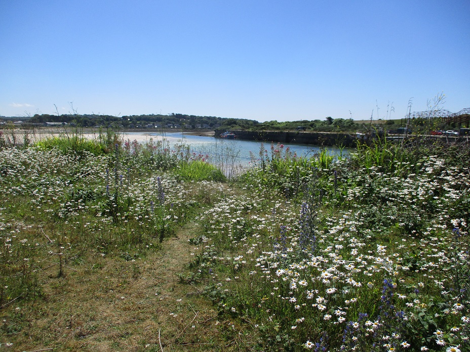
We followed a ribbon of land between the harbour and Carnsew Pool, an RSPB nature reserve. The area widened into an area of short, tussucky, flower-strewn grassland, which looked to have been used for industry at one time. We hoped to find a cache here, somewhere among the grass and bushes, but searched round and round in the bright sunshine without success. Two people passed by and asked: “Are you geocachers? No, we couldn’t find it either!” Hello to Toucan62 – we were sort of glad it wasn’t just us!
Toucan62
Walked on to the end of the pier, where there was another cache, plus a handy seat on which to eat lunch. It was so bright … sunshine … blue sea … pale sand stretching out of view … distant waves. This was such a nice place to be on a warm summer afternoon.
Sandwiches eaten, we began to walk back towards the harbour and the town. While in this area, we passed a man flying a drone. He’s from Paul Hudson Photography and has a presence on Facebook. We’ve looked at some of the shots he took of Hayle while we were there and they are really, really good. We’ve considered buying a couple to remind us of this lovely summer’s day once winter draws in…
Our final destination – and final cache – was Penpol Quay, the oldest quay in the harbour, built when the industrial use of the area was getting going, and not much altered now. Much feeling around in small crevices found our final cache – that was four out of five, with the only failure being the one on that pesky piece of bumpy, tussocky grassland.
Returning to the geocar, we resumed our journey to St Ives, not many miles away. About now, I began to regret the lack of sun protection during that lovely walk. I was getting a bit … pink. By the evening, I was almost as red as the red T-shirt I had been wearing, and it was long-sleeved shirts and a hat for the next few days.
We were booked on a week’s guided walking holiday in St Ives, and rather than drive the full distance in one go, we opted for an overnight stay in Liskeard.
Driving down on the A303 – The Gateway to the Sun – we paused for lunch. We had sandwiches with us, and decided – on a whim – to turn off the A303 and head to Ilchester. Ideally we were looking for a nice park, perhaps with a picturesque view of the village, and a seat on which we could eat.
Sorry Ilchester, we never found a beautiful park, but this bus stop was great for lunch
We drove through the village looking, scouring, for a park, to no avail. Eventually we settled on a layby, behind a bus stop, on the road out of Ilchester. We left the car and sat on the bus stop seat.
We decided partway through our sandwiches to check for caches. Was there a ‘bus stop bedlam’ geoecache under the seat ? No.. but there was a church micro yards away. The church was tucked away from the road, and we drove right by it. We finished our sandwiches and went searching. Ugh!
A slightly grotty pole, surrounded by stinging nettles, and our geopole was in the car. Gingerly we grabbed the cache and signed the log.
We drove onto Liskeard, thinking maybe pulling off to a village – on a whim – doesn’t always work well.
We had stayed in Liskeard in 2016, and cached much of the town. Since our previous visit, a new cache had appeared. Set near our hotel it was part of the UK Toll House Series.
The Toll House was part of series of Turnpikes on the A38 from 1761. Now the A38 is a fast dual carriageway … with no tolls to pay! The Toll House is now a private residence.
A short walk from the hotel, we found the cache quite quickly before driving off into the far reaches of Cornwall.
The Hog’s Back is chalk ridge, part of the North Downs, which runs from Farnham to Guildford. There are fine views looking both North and South, but much of the ridge top is the busy A31.
As the Hogs Back approaches Guildford, the A31 heads North East and the ridge slowly descends towards the River Wey. It was this part of the Hog’s Back we were caching today.
Our first problem was finding somewhere to park, and it took us a few minutes to park in a small housing estate without blocking any houses or driveways. Our next problem was the ‘ascent’ to the ridge top. Not too far to climb, but the wet slippery chalk made for an ‘interesting’ (!) start to the walk.
Once on the ridge we were rewarded with excellent views. The day was clear and we could see for miles. The skyscrapers of London were visible as was the rolling downland of Northern Surrey.
On top of the Hog’s Back
There were several paths all running parallel at the top, each separated by lines of trees. These trees frequently blocked the fine view, but they did give excellent places to hide geocaches. Our first 3 finds were in these trees. Various sized containers, including an ammo can, all of which took ‘just slightly longer to spot than we might have expected’.
As we approached Guildford town, we passed Henley Fort, a former Victorian fort, now used as an Outdoor Educational Centre. We could see canoes and a rock climbing wall, and later on we saw a group of children being led on a ‘mini-ramble’.
We walked on to find a rare ‘virtual cache’. This cache involved finding an engraved stone, and emailing the cache owner about some information on it. The stone was erected in 1997 to mark 500th anniversary of a skirmish between Cornish tin miners and the Royalist Troops of Henry VII. Henry VII wanted to raise taxes for battles ‘in the North’, which the Cornish tin miners objected to as they would have no benefit. An interesting piece of history, and for us a very old cache as it set in November 2001.
We had arrived at a square grassy area known The Mount. We were at the top of the Mount, and our next cache was at the bottom in the North West corner of the square. So we descended the grassy slope to a small gate, where we paused to let a dog-walker through, before grabbing the cache.
We then walked on a pavement, parallel to the Hog’s Back, to locate a magnetic cache on a green telecoms box. The cache wasn’t that well hidden – we could see it some minutes before we arrived- and the log inside was too wet to sign. We replaced it with a dry piece of paper instead.
We returned the Mount, this time at the North East corner, and started to re-ascend the Hog’s Back. Two caches to find, one at the base of our climb, the other at the top. As we climbed we had excellent views of Guildford Cathedral in the City Centre.
Cliimbing the Hog’s Back (again!)Surveying the Mount
We paused for a refreshment break, and realised we has just one more cache to find at the Guildford End of the Hog’s Back. A multi, set in the Mount Cemetery. All we had to do was visit the cemetery, find a sign, convert some letters to numbers and derive some coordinates for the final find. However, in our research before setting out, we noted that a few weeks previously the cemetery had been closed for ‘essential resurfacing’, and we had seen no notice of it re-opening. The cache description also said that the sign we needed to derive coordinates from occasionally ‘goes missing’ and is placed near to a shed that ‘you can just about see from the gate’. Hmm.
As it turned out, we needn’t have worried, the sign was there and the fresh tarmac was good to walk on. This was excellent news, as it gave us the opportunity to visit one of the graves… that of Reverend Charles Lutwidge Dodgson, better known as Lewis Carroll. We assumed that given his rich Oxford Don history he was buried there, but no he spend the latter years of his life on Guildford. A porcelain white rabbit has been added to his grave!
We paid our respects, found other ‘Dodgson’ graves, and that of poet and philosopher, Edward Carpenter, before setting off to locate the final cache. It had been placed near Booker’s Tower.
Booker’s Tower is a Grade II listed octagonal building, commissioned by a 19th Century mayor of Guildford as a memory to his two sons who both died at the age of 15.
Booker’s Tower
We walked back to the car, on one of the cacheless paths near the top of the Hog’s Back. Driving home, we stopped to collect another cache, part of the ‘Hog’s Back series which had been re-placed since we undertook the Hog’s Back series of 20 caches back in 2014. Parking again was an issue, so Mr Hg137 stayed with the car, while Mrs Hg137 went hunting at a tree stump. She came back after a few minutes having not found the cache. We swapped roles, and Mr Hg137 when hunting at the same stump, and after a few minutes he had found the cache – hidden in a very unusual, but obvious way! (Sorry no spoilers!)
So many places to hide a geocache!
We found 10 caches out of 10, including a very old ‘virtual’ cache and an ammo can. We discovered history we didn’t know – and we had fine views too – exactly what geocaching should be about!
Our holiday was over and we were on our way home. A simple, if long, drive up the A30, then the A303, then the M3 … but … then again, there were yet more geocaching targets that we could achieve, without altering our journey very much. We had equalled our maximum caching streak (consecutive number of consecutive days caching). And we had never found a cache in Dorset. Aha! Two more targets to aim at. And a handy place to break for lunch. And a way to indulge our love of numbers and counting things and statistics.
We happily agreed on those new targets and Mr Hg137 selected three caches on the outskirts of Shaftesbury. We packed up and left Liskeard, and Cornwall, and drove eastwards through Devon, Somerset, and Wiltshire. As lunchtime approached we turned aside and drove south just a little way into Dorset. The first two caches of the three chosen were from the ‘There and Back’ series. The first of these was hidden somewhere near a stile – or was it? We spent a while looking under, around, and beside it, but couldn’t spot anything that might be a geocache.
Never mind, we still had two caches in reserve to get to our targets. The next cache we attempted was from the same series, placed in a side-road on the edge of the town. I was sent out to search while Mr Hg137 turned the geocar around. As I unsuccessfully examined all sides of the likely location, Mr Hg137 wound down the car window and pointed … there it was! I felt rather unobservant and small. But we’d found a cache in Dorset, and extended our caching streak to eight days.
At last, a cache in Dorset!
We paused for lunch, eaten within sight of that – so far only – successful cache find. Once refreshed, we had one more cache to try for, ‘Lions Mouth’. We weren’t quite sure what to expect here, but it turned out to be a drinking trough for horses, topped by a decorative lion’s head. And the cache? We couldn’t find it. We looked around the trough, around the hedge behind (where the GPS said it should be) and round and about, but if it was there, we couldn’t find it. Wasn’t it lucky that we’d loaded three caches, not one? Yes indeed! Shafted in Shaftesbury? Nearly.
Back into the car we went, and home. Time to do the washing, and catch up on our sleep. It had been quite a week, geocaching-wise – most days (8) caching consecutively, most finds (30) in a day, best week’s caching (69 finds), most finds in a month (82, up to this day), most southerly cache, most westerly cache, and a chance to dip into one of the biggest geocache series in the UK. Yes, it was quite a week!
Our Cornish holiday was at an end, and with the exception of our drive home, we have yet to blog about our adventures on the Cornish Compass Series.
Cornish Compass Series
As we have remarked on earlier blogs, the series comprises of 360 puzzle caches. Each cache has a puzzle to solve to yield the final co-ordinates. On the map, the puzzle route looks circular, and although the solved co-ordinates produce a continuous loop, it is definitely not circular. The puzzles are easy to solve, and with a little help from Excel the final co-ordinates can all be derived before attempting the circuit. (We plotted every 20th cache on a map, before we left, we strongly urge plotting a lot more than this to give a very clear driving route).
This is a very popular series. When we were in Cornwall two joint teams from the Lake District and the Midlands were attempting the series. Although the series is barely a year old, it already seems to have reached iconic status.
Some cachers attempt the series in a 24 hour period, others take their time, perhaps 20-30 caches a day. It really is a huge undertaking. Many of their exploits can be found at Cache 001.
Other than the sheer size, the Cornish roads hinder progress. Much of the journey is on very narrow lanes with passing places. Many of the caches are in/near these passing places, but at busy times it doesn’t seem right to hold up traffic whilst looking for tupperware!
Narrow roads
We found caches on 4 days in Cornwall. These were never our primary targets for the day, but because of our pre-plotted map we had a good idea when we were close to the series.
Our first day – on Bodmin Moor – we found 6 hides all very traditional ie under stones, by fences. Width-wise the roads were ok, and there were opportunities to park a car, and walk to find 2-3 caches in safety. With most caches about 1/10 a mile apart, this meant about half-a-mile of road walking.
Spacious views, and space to park a car!
Our second day – near Liskeard – was harder. The roads were narrower and by the time we started to cache, evening peak-time was approaching, which meant there were more vehicles trying to use the narrow lanes. The parking spaces were not quite so convenient, our best pull in was just feet from a farm house. This section also yielded our only DNF – probably more of a Did Not Attempt as had blocked a resident’s drive to park our car within seconds of the resident returning! One cache which Mrs Hg137 had to find was 12 feet up a slippery bank. The nearest parking area meant we had to leave a person with the car… we really should have reversed roles here!
This picture doesn’t show the effort to climb up a 12 foot slippery bank!
Another was very cunningly hidden in some street furniture (and we not going to tell you how!). That day we found 5 Compass Caches, but must have driven past many more with no easy means of safely stopping. We eventually gave up, when a huge tractor came bearing down on the spot we had chosen to leave our car for a brief moment! All too stressful!
Where’s the cache ?
Our third day – on the way to Tintagel – we found one cache. We had hoped to find more, but our route (and we are still not sure if it was on the Cornish circle) was so narrow at one point Mr Hg137 had to reverse (slightly ineptly if truth be told) to allow a van and three other cars to squeeze past with inches to spare. Once free of the congestion, we paused to collect our thoughts in a very large layby. Turned on the GPS and we were 17 feet from a cache! An easy find.
After two days of squeezing the car through seeming smaller and smaller lanes, we only returned to the Cornish Compass series three days later.
We weren’t really planning to undertake any of the Compass caches that day… but we realised after finishing the ‘Drive on the Moor’ series we were just a few finds short of some personal records. Mrs Hg137 remembered passing a road sign which bore a strong similarity to one of the cache hints… so that’s where we went to first! We needed just three finds to break our daily record of 29 caches. The first in the road sign was simple. A busy road junction, and a muggle listening to the cricket in a nearby car.
The next cache up a slight bank and attached by various wires to a telegraph pole… and so to our record breaking 30th cache of the day. A very simple find, with thankfully easy parking opposite! Thirty caches in a day .. our new record.
Record equalling cache
Record breaking cache
So in the end we only found 15 Compass caches.
If you like driving – and stopping every 1/10th of a mile – around narrow, sometimes high-banked, Cornish lanes this route is for you. Preparation though is key. Work out all the co-ordinates beforehand, drive the route (using Googlemaps) to ascertain parking spots and to experience the narrowness of roads. If you don’t like narrow lanes (and we had our moments of dislike) you can still enjoy the route, but you may need to selective where you drive.
It is fun…but hard work! Our hearty congratulations to those that success in finding all 360 caches… you have far better stamina than us!
This trackable was the second we had found in under 30 minutes – sometimes you don’t see a trackable for months and sometimes they arrive one after the other…
Tilly the Hedgehog
Tilly is described as a curious hedgehog who wants to see the world. She set off near the centre of Rome in October 2014, and within two days had been picked up and taken back to England. She has spent most of her time since then in England and north Wales, with a short, exotic foray to Tanzania, the Serengeti, and the NgoroNgoro crater. Having travelled over 12,000 miles in total, she has now arrived in Cornwall and has been doing the rounds of the many marvellous places this has to offer.
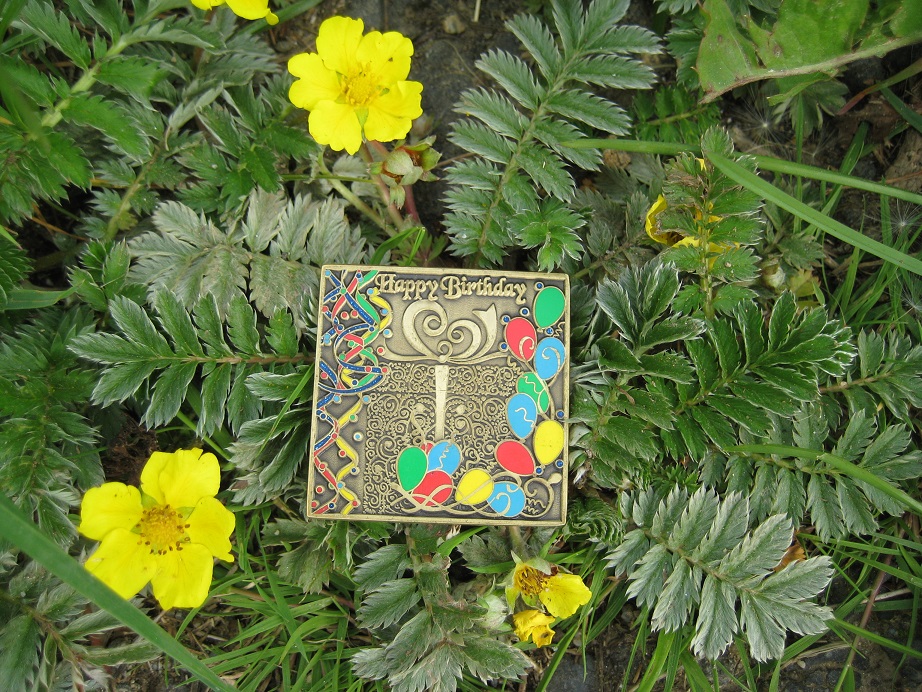
This coin was a birthday present from Caterfly to Butterpillar back in April 2011. (Aren’t those good caching handles?)
Suzies Birthday Geocoin 2011
Butterpillar wants this coin to travel extensively in Cornwall, to beautiful places – it has – and to visit the Isles of Scilly – it has, at least once, very soon after its release. There is a request for it to remain in Cornwall. Some folk have moved it out of Cornwall, and it set off from Milton Keynes, or thereabouts, but so far it has always made it back to Cornwall. We will honour the request. We picked the coin out of an ammo can at Jamaica Inn, overlooking a packed A30, and would hope to drop it off somewhere a little more peaceful. But this is the last full day of our holiday in Cornwall, so options are limited …
It was the final day of our full-on geocaching/walking/sightseeing holiday before we headed home (to recover?), and we thought we would do a ‘proper’ day’s caching, rather than caches found as we saw the sights. But first – how to reach Bolventor without ending up in a Bank Holiday traffic queue? We went the back way, past Golitha Falls (http://www.bedknobs.co.uk/golitha-falls.htm very pretty, worth a visit, but needing scrambling as well as walking skills for the last bit) and then beside the River Fowey up to Jamaica Inn. A car driver stopped us near the Inn. ‘The A30’s rammed!’ he said. He was right.
Where’s the cache? Just visible!
We pulled in to an equally rammed car park at Jamaica Inn http://www.jamaicainn.co.uk and pulled up near a granite post. Crikey, we were at GZ, and it was less than 3 feet from our geocar bumper! It didn’t take long to locate the cache, and we also retrieved a trackable (it wanted to stay in Cornwall – we have honoured that). A good start to the caching day!
Busy day on the A30! The geocache at Jamaica Inn
‘A Drive on the Moor’, a series of about 60 caches, was our main goal for the day; all the caches are billed as being within 50 feet of the road/car park, and this was true. We planned to do the northernmost half of the series, heading south first of all, then looping back to the north to finish not far from our start point. It had been billed as having ‘next to non-existent traffic’ and we were looking forward to empty roads. It was not to be. Car after van after trailer after caravan was heading away from the stationary traffic on the A30. We found a small spot to park and retrieved the first cache, and a hedgehog trackable from Holland, as the cars went by. Trackables are like buses – you don’t see one for ages, then two turn up within minutes of each other… We couldn’t even attempt the next cache as the stream of traffic escaping the A30 went by and we couldn’t stop.
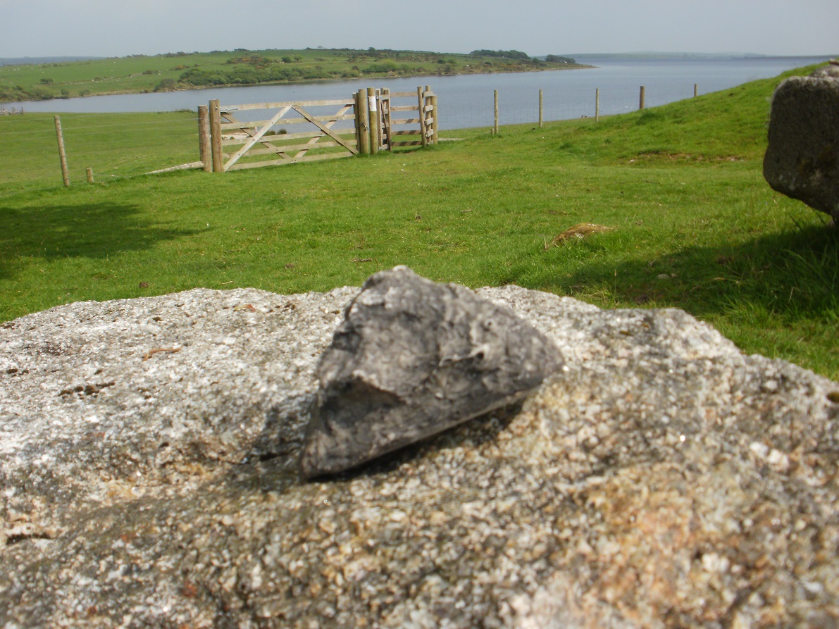
Dozmary Pool
A little further on was a cache a little way away from the road and across the moor, overlooking Dozmary Pool http://www.legendofkingarthur.co.uk/cornwall/dozmary.htm This is alleged to be the place where King Arthur’s sword, Excalibur, was thrown after Arthur was mortally wounded in battle. The pool is variously described as mysterious / enchanted / atmospheric, and that is probably so on a misty day, but on this day the bright sunshine and extra traffic meant it wasn’t overly mysterious, but it is a beautiful spot with good views over the pool and the moor.
The next two caches were: drive-find-log-dash on, and the third was in such a busy spot that I was sent to find the cache while Mr Hg137 cowered by the geocar. There were good views over Colliford Lake and up to the A30 where the traffic jam still stretched from horizon to horizon. For the next cache, the roles were reversed, and Mr Hg137 did the finding. During the few minutes it took to find those two caches, maybe one-eighth of a mile apart, twenty-seven cars, one Land Rover, and a caravan came by – this really wasn’t the quiet road we had hoped for! After bypassing the next two caches – the traffic was way too much for this little country road – the next two finds were quick and simple, and, better, we had now moved away from the section of road that was being used as a rat run by all those drivers … and it was now much quieter (phew, that was a relief).
By now we had passed by the dam at the bottom of the lake (actually, it’s a reservoir https://en.wikipedia.org/wiki/Colliford_Lake ) and there was a handy car park where we could stop for a pleasant picnic lunch, then search for the next cache in the series. Well, the lunch and the car park were agreeable, but we didn’t find the cache (and it hasn’t been found since). And another less agreeable thing – the area where the cache was likely to be looked to be used for something else – “walking the dog” – a colleague helpfully described it – as there were racy magazines and other …items … dotted about. We moved on.
Don’t frighten the horses!
Heading north now back towards the A30, we followed the western side of the lake without always being close to it. The scenery became more open moorland, and we stopped to find (or sometimes, not find) caches at intervals. At one point, one of us acted as decoy to keep the attention of some ponies and foals while the other sneaked in behind to find a cache.
Colliford Lake
And then there was another car park, with a view down over the lake. We pulled in for a coffee break, to take in the view, and find another cache. But this one was special. It was to be our 1500th cache. Woo hoo! We approached, subtly, so as not to excite notice from a couple picnicking nearby. It didn’t work; as we got closer and bent to retrieve the cache … ‘We know what you’re doing!’ We’d been rumbled – those picnickers were two other cachers, Squirrel &Stinky, on their way home after a holiday … so that’s six geocachers we’d met this week … We swapped tales of caching adventures – (they’ve been MUCH further afield than us) and offered them the log to sign; they did so, but never did log the cache; they did say that it wasn’t ‘proper’ to log something they hadn’t found.
Geocache number 1500!
On we went, heading north back towards the A30, finding more caches as we went. We met more traffic, but this time it was coming from the opposite direction, and the road was wider, so it was less troublesome. Except for one moment while I was signing a cache log while tucked into a storm drain as traffic rushed past, uncomfortably close.
The sunshine had turned hazy, cumulus clouds were massing to the north, and it was appreciably cooler and windier; if we didn’t hurry, we would get very wet. We sped up our caching; we could hear rumbles of thunder, and it got darker; the traffic escaping the A30 now had lights on. Once again, a passing muggle driver stopped to chat. We found out from him that it was possible to turn right onto the A30 at the end of this lane – we weren’t sure it was possible till then, didn’t want to join the holiday traffic jam, and were preparing to turn round – so that was good to know. We were close to the A30 now, and could see all the queuing holiday traffic – not a good afternoon for them at all. The last two caches in the series were accomplished in gathering gloom amid rumbles of thunder; we had finished just in time. This was a super series in beautiful countryside and equally beautiful weather (except at the very end). Our one mistake was to choose the Saturday before a Bank Holiday to attempt the series, when the lanes are much busier than usual!
The A30’s still rammed …
By now, it was late afternoon and we were heading back to our hotel in Liskeard, having found 26 caches, a good haul. About this time we both realised that our record number of caches for a day was 29 – and we were passing very close to the ‘Compass 360’ cache series. Suddenly there were extra caches available. And the rest of this post is elsewhere, in the forthcoming ‘Compass 360 post’. Did we break our record? Wait and see…