February 11 : Ascot Heath

Hello, Mrs Hg137 here.

Ascot Heath is located in the centre of Royal Ascot racecourse.  Home to the famous Royal Ascot meeting every June, Ascot Racecourse sits in the centre of the town and contains an impressive grandstand that was rebuilt in 2007.  There has been racing here for over 300 years, and there are now 26 days of racing each year.  The heath is open for public access from 6:30am to 7:30pm on non-race days. The heath is open grassland with lots of hedges and ditches which are home to rabbits and plenty of birds. It contains a helipad, a small cricket club and a playground along with a small but deep reservoir.   A wide tarmac path leads around the inside of the racetrack, and other surfaced tracks cross the centre.

Having checked that racing wasn’t on, we set off for the Heath, pausing to collect a Church Micro cache at All Saints Church, on the main road close to the course.  We arrived at the church shortly before a drama class was due to start in the church hall, and wandered off around the churchyard while the drama students were going elsewhere.  We assembled the coordinates – with only a minor disagreement on what exactly constituted ‘a window’ – so set off with a small selection of locations to check; one (happily) was the correct one. 

Further on, we parked the geocar and walked through an underpass, underneath the road and the racetrack and out onto the heath.   We were most definitely not alone – it seemed as if every dog walker, runner, cyclist or walker in the area was also out to take the air.  We had a great walk across the heath, inspecting the jumps, past the cricket pitch, up to the imposing grandstand, and finally through a very long underpass taking us out to the entrance to the stands.  By now, we had also done all five (virtual) stages of an AdLab cache, and had assembled the coordinates for the (physical) bonus cache associated with it. 

We decided that the cache was likely to be somewhere along the New Mile course.  Regardless of the name, this is no longer part of the racecourse; the mile course was straightened and moved about 50 metres to the north about 2005, when the grandstand was also rebuilt and the underpass we’d used earlier was also constructed.   The track still remains as a long, grassy area edged by trees, sometimes used for overflow car parking.

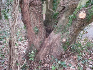
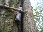
As for the bonus cache … we were thwarted.  Maintenance work had gone on around the target tree, removing ivy, and the cache container had disappeared with it.  We looked futilely around on the ground but gave up after a while.   (FYI the cache has now been replaced.)

No cache here any more!

Disappointed at only finding one log to sign, we took a detour around the northern edge of the course, to find an additional cache named ‘Ascot Heath’ – which aptly summed up the morning.

March 12 : Oxshott Heath

Hello, Mrs Hg137 here.

Oxshott – a most prosperous place, home of the rich and famous

Oxshott Heath – 200 acres of sandy heath and woods – a magnet for dog walkers.

And today – a destination for us, too, as there’s a geocache series around the heath, plus more in the village.

We started at Sandy Lane car park, on the northern edge of the heath, which was busy with dog walkers and runners.   Our first cache was near a Coal Post; about 200 of them survive, in a ring around London, and they are connected with the historical collection of duties and taxes.   We admired the post, then searched around nearby for the nearby geocache.

Oxshott Heath Sand Pit
Oxshott Heath War Memorial

Once on the heath and away from the road, the character of the area changed.  We were walking through woods, interspersed with open areas of grass or sandy heath.   The cache route was mostly arranged around the fringes of the heath, in the woods, with occasional diversions into the centre to visit points of interest.  We passed a huge depression, a Victorian sand pit (reopened in WW2 for filling sandbags) and took a second detour to the war memorial.  It’s in a prominent position on the edge of a ridge, with a marvellous view.   And all around were people, and dogs … so many happy, excited bouncy dogs!  Near one cache, a man with a dog walked past … and paused … and looked at his phone. Was he a geocacher? We waited: he moved on: no, a passing muggle.

Almost all the caches were in good condition, but at one – oh dear – there was a problem. The plastic bag that should have held the log was nearby, and full of water, the cache container was lidless and full of water, with the log inside which was rather wet. Oops. We took the whole assembly off to a nearby seat for some TLC. The plastic bag was dried out (a spare Covid mask makes a good blotter!), and the log was carefully unrolled and blotted till almost dry.  We carry some spare geocaching ‘bits’ so we replaced the lid of the container and supplied a new dry log. We replaced both new and old logs (separately wrapped) back in the container so all is in better order than we found it.

And, while we were doing this, we were visited by dogs four times.   All were more muddy, or less muddy, and all thought we had food with us.   Well, we did, but it wasn’t in a wet geocache container!  All dogs went away disappointed.

At the edge of the heath, two geocache series met: a cache from the Sidetracked series (near railway stations) had been combined with the series we were doing.   We admired the daffodils at the nearby road junction, then dived in quickly to retrieve the cache during a quiet moment; woo-hoo, our fifty-sixth Sidetracked cache! Our route then took us along a track parallel to the railway tracks, and, after a little way we crossed the railway on a footbridge to take us into the village (for those who are into such things, this is the oldest surviving reinforced concrete footbridge over a railway in the UK and was built in 1910).   

Up there?  Really???
Up there? Really???

Close to the railway line is a cache in a tree.  Some way up the tree. We found the place, we spotted the cache guardian (a plastic pigeon), and we considered the climb. And bottled it. It was a long way up on a tree that was well damp from recent rain, so we decided it was a slippery climb too far.

Further into the village, and past some very expensive houses, we came to the locations of two other caches.   The first was a multicache based on the village sign, which was erected in 2019 and which features a selection of items relating to the village, including that railway bridge and a selection of sports, including tennis (lots of sports people live in Oxshott, Sir Andy Murray amongst them).  

And, just across the road, was St Andrew’s Church, the start point for another multicache … it would have been rude not to do them both, they were so close to each other!   We walked around the church in the spring sunshine to gather information for the cache coordinates, then walked some way up the road to find the cache container, our 158th Church Micro cache.

St Andrew's Church, Oxshott
St Andrew’s Church, Oxshott

Returning to the heath, we passed the tree climb again – and decided again not to climb the tree – then went back over the bridge and back onto the heath.   We had a few more caches to find, all placed around the edges of the heath, and we worked our way steadily around them while climbing gently back to the car park.  

Did we see any of the famous residents on our walk?  No-one we recognised, though we weren’t looking very hard.   We were concentrating on the pleasant walk in the spring sunshine, the views, and finding the caches.   It was a great place for a morning’s walking and caching.

Here are just a few of the caches we found:

November 20 : Broxhead Common

Hello, Mrs Hg137 here.

It was a misty November weekend and we had driven south into Hampshire to Broxhead Common, just north of Bordon.

This area of sandy heathland, trees and ponds is now open access land, but was used for almost all the 20th century for Army training.   Some of it is an SSSI, and it’s popular with dog walkers and bird watchers. It’s an area we have driven past many, many times, without ever stopping to explore. So – today was that day for exploring … and there was a series of 12 caches to find (now down to 11, one has gone missing) plus one other cache that seemed ‘interesting’.

We parked the geocar in a layby, crossed the road, and were immediately on a sandy track overlooking a pond.   We followed the track northwards, then climbed into a small hillock where there was a trig point, plus a nearby cache.    We were slightly elevated, and there were misty views, but how to see past the trees to the next nearest trig point? Hmm, perhaps the trees have grown since it was placed!

Having found our first cache, we then meandered around the common in an anticlockwise direction, finding three more caches and spotted a number of dog walkers and a selection of seasonal fungi; we took care that no fungi were hurt by us during the course of our efforts.  After that, we left the path and went downhill into a (fairly) secluded spot where there is another cache, ‘Grandma We Love You!’   The description says it all:

…” This is a traditional cache with a slight twist.
The idea is to play along and upload a picture to the site when you record your visit. Inside the cache is 5 items, all 5 items should be worn as intended and not just held.
You will probably need at least two people to do the cache one to do the deed one to take the picture LOL…”

There are/were five ‘dressing up’ items in the cache container – a nightie, handbag, lipstick, scarf, and glasses – and the idea is that one dresses in these to resemble a granny.   The scarf and glasses have gone missing, but we took turns in donning the other items and posing (!) for pictures.   And a fashion note – the nightie is beautifully clean and smells as if it has been newly laundered.

Moving on … we made our way cross-country, passing a family playing in their lockdown den / swing as we did so, and rejoining one of the tracks across the heath, to find a couple more caches.  We passed various bits of unidentifiable military structures and shimmied down some concrete walls, disturbing two roe deer as we did so.  It took us a while to find the caches, as the GPS didn’t seem as accurate as usual, and pointed around all over the place.   Maybe there’s a lot of metal round here?

What's this structure for?   Dunno!
What’s this structure for? Dunno!

Crossing a road, we walked up the drive of Grayshott Cricket Club and into a more wooded part of the Common, joining the Shipwright’s Way for a short way.  Caches were hidden in some of the gnarly old oaks in the woods, but the GPS and the cache locations still weren’t matching up, and we found one of the caches 25m away from the published location, after a very long search.   The hint said ‘Base of impressive oak tree‘ and we looked at a great many of them before we found the right one!

Going uphill, we emerged from the trees and were back on the common.  The cloud was now so low that we were walking through the drizzly bottom edge.  A final two caches and a walk along sandy, gorsy paths took us back to our start point, overlooking a small pond near the trig point.  On a sunnier day, this would have been a great spot for a picnic, but it wasn’t to be on a damp November day, so we returned to the geocar and set off home through the gathering gloom.

And here are some of the caches we found, for which we didn’t need to dress up!

November 21 : Yateley Common (revisited)

In mid-October we undertook some caches on Yateley Common, but we were interrupted by a phone call which meant we only found 4 of the 11 caches we had planned.

Yateley Common


Today was the day for the remaining 7. We weren’t sure about geocaching during the second lockdown, but we could see on http://www.geocaching.com many cachers were out and about, and Yateley Common was only about 5 miles from home (though we did take the car to the start of the walk!).

Our route this time started by a cemetery where there was adequate parking (even allowing for the odd muddy, bottomless pothole). We went by two of the caches we had found on our previous trip (checking they still there, obviously!) and headed deeper into the Common.

Yateley Common is predominantly scrub and supports mainly evergreen trees, gorse and scrubby bushes. Sandy tracks criss-cross the common which made ‘walking on a bearing’ out of the question. We had to go where the paths took us. Yateley Common sustains rare-ish wildlife and periodically on our route we saw pictures of snakes and nightjars.


On route to our first cache we followed two ladies, out for a lockdown walk and natter. Their pace was just a bit slow for us, but we took our time overtaking them as we didn’t want to ‘rush’ by and then promptly stop at a cache site and be quizzed on what we were doing.

We were looking forward to the first cache, as it involved water. We had to tip water into a ‘leaky’ container faster than the water left it, so that the cache inside would rise. We had water with us, but realised we could acquire the cache without resorting to water treatment. This meant we didn’t get wet on a cool Autumn morning.

The Common provides good rides for horses and several times we paused as riders trotted by. Horse riders weren’t the only people we saw as cyclists, dog walkers and runners were also using the footpaths.

With the footpaths so busy, we were grateful for easy-ish finds. On one occasion the cache had been wedged in the tiny roots of a tree; on another the cache holder was dangling cleverly in a tree bole.

The Common is bisected by a road, and we crossed it to find 2 more caches. Here the gorse was much thicker and higher and we wondered when a footpath would appear for us head cache-wards. This particular cache was well hidden behind a tree, and was large enough for us to deposit the Gecko trackable we had with us. The tree was also large enough to shed copious branches and leaves on Mrs Hg137 as she retrieved and replaced the cache.

A short walk to our next cache, again we wondered when a footpath would appear, but it did …as did a giant wigwam next to GZ. In fact so close to GZ, we wondered how often this cache goes missing.

Brandy Bottom


And so we returned to the first part of the Common, arriving at an area known as ‘Brandy Bottom’. There are a few cottages here, some of which have grazing rights on the Common. Nearby was a cache. The hint we were given was a 4 digit number. We were expecting this number to be on a lamp-post or telegraph pole, but of course it was neither. It took is some time to find the number, but once we found a couple of similar numbers we were able to narrow our search to a small area. At GZ, Mr Hg137 spotted the cache and called Mrs Hg137 over – even though the cache was directly in her eyeline…she still couldn’t see it ! This seems to happen a lot to us!

All quiet at the fishing pond


We had one cache left, near to a fishing pond. Fortunately for us the sole angler left the area as we arrived, and we could search without drawing attention to our ineptitude. Because we were inept ! Or at least the GPS was inept! We couldn’t see the cache. The hint mentioned ‘birch’, and there were several around. The tree nearest to the ‘GPS coordinates’ had fallen to the ground with no sign of the cache. We tried to convince ourselves the cache had been lost when the tree fell…but something niggled…there were other trees to search. We searched several, eventually Mr Hg137 noticed something strange behind a birch, ignored it and moved away. Seconds later Mrs Hg137 saw the same strange object…and gave Mr Hg137 the same strange look he had given her at the previous cache! Honours even!

So 7 caches found out of 7, giving us the full 11 over the 2 trips.

Yateley Common provides a great place to explore, and by coincidence much of our caching route(s) are covered in the January 2021 edition of Country Walking magazine. Why not explore yourself ?

October 10 : Yateley Common

Hello, Mrs Hg137 here.

Wyndham's Pool, Yateley Common

Wyndham’s Pool, Yateley Common

It was a bit-below-average-weather Saturday, and we had an appointment later on. We decided to fill the time beforehand with a short and local caching trip, that way we could always go home if the weather turned further-below-average. We chose Yateley Common, a place we last visited as lockdown was easing but caching wasn’t then happening. Much more autumnal today, not nearly as warm and sunny …

We parked in the little car park at Wyndham’s Pool and immediately started our first cache, one from the ‘Counting Vowels’ series (to solve these, you visit several locations, make a note of word(s), total the various vowels in the words, then use those numbers to derive the cache coordinates). We did the clues for this cache in a random order, ending up near the final location. A quick diversion into the autumnal undergrowth showed us a spot which would have looked completely natural to a passing muggle (assuming they were passing that particular bit of autumnal undergrowth, which would be fairly unlikely) but which shouted CACHE! to a cacher. And there it was, a nice cache, colourful interior container, success!


Our next cache, a trackable hotel, lay across the common. (Editor’s note: trackable hotels are fairly large caches, usually easy to find, which act as drop off and collection points for trackables, though these can be placed in any cache large enough to hold them.) The small lane near the cache was busy with dog walkers, horse riders, runners, cyclists and walkers, all out for a morning’s exercise. First, we ventured along an obvious – but wrong – path, could see the likely target, but couldn’t reach it, so backtracked and went round a different way. The cache was an easy find and replace and we left a trackable – good luck to Bernadette the Black bear on her travels.


About now, the phone rang. Oh dear: our appointment had just been moved forward by about four hours and we no longer had time to find all the caches we had planned. But two were on our route back to the car park, so, surely, no harm in finding those? We turned around and set off, back across the heath. As we neared the likely location, two muggles plus dogs were approaching. We passed them by, also the cache, so we didn’t look too suspicious. Then we turned around and retraced our steps, oh so slowly, till we got back to the cache location and could do a proper search. We spotted the cache, out of my reach, but gained with a stretch by Mr Hg137.

A rather wet path!

A rather wet path!

A few minutes more walking brought us back to Wyndham’s Pool, and we took the long way round to reach our final cache, avoiding the soggy paths at one end of the pond. All was quiet, even the fishermen on the far bank, save for the occasional very loud SPLOSH. We thought it might be a large fish (or a small crocodile) but we watched for a little while and saw that it was acorns, falling into the water from a height. After a short walk poolside, we found the cache quickly – yay, all found! – then returned to the geocar for a quick dash homeward.

Here are some of the caches we found:

February 29 : Leap Year Day : Church Crookham and Fleet

Hello, Mrs Hg137 here.


Leap Year Day started with rain (again). But by afternoon it had improved into bright sunshine and scattered showers and we decided to risk a drenching and go out for some caching. Off we went to north-east Hampshire, between Church Crookham and Fleet, and parked near Basingbourne Park, roughly in the middle of the area we planned to cache. We had chosen a mixture of ordinary caches and puzzle caches, and had spent some time solving the puzzle caches during a previous rainy day.

Our first cache was a puzzle cache, ‘Square Cache’, one of those we had solved earlier. Counterintuitively, the cache was hidden in a circular place … We left the area and walked towards our second cache and the sun went in and it got colder and darker and then began to hail, then rain. We took refuge behind bushes and trees a short distance from the cache, watched the muggle dog walkers plod, heads down, into the rain, and waited till the squall passed. The rain stopped, we emerged and walked up to the next cache; there was something ‘not quite right’ which just had to be the cache. At first we couldn’t extricate it, and though it was a ‘real’ object. But no, a second attempt removed the cache container. Very cleverly done!

Basingbourne Heath

Basingbourne Heath


Strange springy path!

Strange springy path!


We left the tarmac paths and entered a wooded area. But were we off tarmac? The paths beneath our feet looked like tarmac but were weirdly bouncy – we wondered if they were made from recycled tyres. We weaved through the woods, passing a small patch of rather soggy heathland (we weren’t expecting that!) and also finding two of the three caches in the ‘Basingbourne’ series; two were straightforward finds but we gave up on the third. There had been a great deal of rain recently and the area for some way around the cache was very wet indeed. We tried approaching from a couple of directions but without success. We were wearing walking boots, not wellies, so we decided to keep our feet dry and leave this cache for another day.
Too soggy to go in there!

Too soggy to go in there!


Back to the puzzle caches, and we found three more of these in the area between Basingbourne Park and the B3013 which runs south from Fleet. As before, we had mixed fortunes with finding the caches; the hiding place for one could be spotted from the other end of the street; another required a good rummage among roadside bushes and tree roots; and the third needed a long, scratchy and dispiriting search among bushes and small trees, where we were about to give up at the time we finally, finally spotted the cache. (Editor’s note: no, I’m not saying exactly where they were, you need to solve the puzzles yourselves.)
An unusual pet?

An unusual pet?


And then we got the last cache very wrong. It was a challenge cache and we had checked and knew we qualified (we needed to have found a selection of caches with a connection to water). We were so smug at all this that we had mentally already found the cache and signed the log that we hadn’t read all the way to the bottom of the cache description where the actual location of the cache was specified, not at the published coordinates but at a waypoint listed alongside the cache. And so we searched in the wrong place – then approached from another angle, and searched again – and again – and didn’t find the cache. Eventually we gave up, went home, and found out the real location when we re-read the cache description, properly, at home. Grrr.

Here are some of the caches we found:

December 28 : Tilford

Hello, Mrs Hg137 here.

Frensham Little Pond

Frensham Little Pond


Tilford is just south of Farnham in Surrey, where the two main branches of the River Wey meet. The Tilford Traipse cache series had been on our to-do list for a little while, but parts of it had been inaccessible (aka flooded) after heavy rain earlier in the month. After a quite dry week we decided it was a good day to go and cache.
Wey Bridge East - somewhere under the scaffolding

Wey Bridge East – somewhere under the scaffolding


Wey Bridge West

Wey Bridge West


The ‘road closed’ signs on all routes to the village were slightly worrying, but the reason was that Wey Bridge East is closed for some months for major maintenance https://www.surreycc.gov.uk/roads-and-transport/roadworks-and-maintenance/our-major-maintenance-projects/repair-of-tilford-east-bridge-on-tilford-street and in the meantime that branch of the river can only be crossed on a temporary footbridge – and that had just reopened after the floods.
Tilford Village Hall

Tilford Village Hall


Before starting the cache series, we walked down to the village green/cricket pitch (the boundaries are VERY short!). A man was out for a run, crossing the green. Was he Sebastian Coe? (we think he lives in Tilford). But no – definitely not him. We wanted to find a Church Micro, another multicache based on the church, and a third multi centred on the large, impressive, Lutyens-designed Village Hall. http://www.tilfordinstitute.co.uk/?page_id=56 After some hiccups with counting the number of chimneys on the Village Hall, we worked out three locations for the final caches and visited the “other” bridge over the Wey, a location on the edge of the village, and a track leading to Hankley Common, used in 2012 as a location for the Bond film Skyfall https://markoconnell.co.uk/a-day-on-the-set-of-skyfalls-titular-lodge-at-hankley-common-surrey-march-2012/

Eventually we set out on the Tilford Traipse. Our route was all to the west of the village, so we weren’t bothered by bridge closures. We set off on a track, soft and damp and sandy, through pine woods and farmland, heading south and west towards Frensham Little Pond. https://www.nationaltrust.org.uk/frensham-little-pond We were watched by curious cows, somnolent sheep, and perky pigs, and had to jump smartly off the track several times while groups of four or five off-road motorcyclists rushed by (you can hear them coming, it’s not a problem, you just have to be far enough from the track not to get splashed). We crossed a ford, and stopped to watch bikes (pedalled and motorised) and 4x4s negotiate it; all got across safely (well, no-one fell in while we were watching).


We arrived at the car park for Frensham Little Pond and collected the numbers we needed for the single multicache in the series. It wasn’t strictly part of our route, but we walked down to the edge of the lake and ate our festive ham / turkey, cranberry and stuffing sandwiches (yum) on a bench overlooking the water. It’s a pleasant spot and very popular with walkers and especially popular with dogs, who all like to get in the water; they clearly haven’t read the extensive list of “don’ts” on a nearby sign: no camping, swimming, barbecuing, paddling, boating …

Lunch over, we set out on our return leg, looping to the north of our outward route. One of our first tasks was to cross the River Wey at another ford (there’s a bridge) and it was here that we hoped to find the multicache container. Alas, we failed, undone by bottomless, slippy mud; we have since found out that the cache coordinates are approx. 55 feet out, and we normally search a radius of about 40 feet, so we don’t feel so bad about that. Annoyingly, the cache is probably hidden by one of the fence posts visible in the photo below!

River Wey (South Branch)

River Wey (South Branch)


Up a slight slope from the river, we walked through Pierrepont Farm https://www.countrysiderestorationtrust.com/properties/pierrepont-farm/pierrepont-project/ It already has a brewery (yum) https://www.craftbrews.uk/gallery, it will soon have a cheese factory (yum, yum) https://www.cheeseonthewey.co.uk/ and it has information boards everywhere, about all sorts of random things. One of the most interesting was about two horse chestnut trees, grown from seeds collected from the battlefield at Verdun https://en.wikipedia.org/wiki/Verdun_tree

Climbing away from the farm, we emerged onto a track across sandy heathland at Tankersford Common. We weren’t expecting this, such a contrast to the woods we had walked through earlier. We heard voices and jingling metal behind us, and stepped off the track yet again as a group (herd?) of about ten horses and riders went by, slowing as they passed, then cantering away into the distance.

We emerged from the heathland onto a narrow, but quite busy road; maybe the traffic flows are all different because a bridge is closed? Stopping in a gateway, we realised that we had found all but two of the Tilford Traipse series, and had amassed enough clues from the series to be able to find the bonus cache. Luckily for us, as the grey day was turning steadily darker, it was very near where we had parked the geocar, so we returned to base and found the cache at the same time.

And, as we removed our muddy boots, some of those off-road motorcyclists were packing up. We asked where they had been, and were told that about 150 of them had converged on Haslemere, from all directions, to have their own Christmas meet of mince pies and coffee. They, and us, had spent an enjoyable post-Christmas day out in the country!

Postscript: after logging the caches, we realised that our all-time total was 2996. The 3000-cache milestone was close. Maybe we could get there by the end of the year?

And here are some of the caches we found:

December 14 : Counting Vowels on Wildmoor Heath

Hello, Mrs Hg137 here.

The Counting Vowels geocache series started out in November 2017 and now comprises around 60 caches, and it’s growing all the time. To solve the caches, you need to visit a number of waypoints and note certain words on signs; after a few locations you have a selection of words e.g. ‘weighbridge’, ‘public’, ‘giraffe’ (OK, we haven’t found one of those, yet!), and then add up the vowels in the words, come up with a total for each of A/E/I/O/U and use those numbers to come up with the coordinates of the cache container.

This sign?

This sign?

This one?

This one?

Or maybe this one?

Or maybe this one?


Wildmoor Heath, between Sandhurst and Crowthorne, is the location for three of the Counting Vowels caches, and we thought they would be a good choice for a Saturday morning caching trip. Each had four or five stages over about a mile, plus a walk to the final location, and were described as requiring 45-60 minutes each to complete.

All three caches start from the car park at Wildmoor Heath, then go in different directions and our GPS showed a plethora of waypoints, all mixed up together as the GPS orders them by distance. We decided to solve the caches in numerical order, #34 first, then #35, and finally #57. First was the Wellington Nature Trail (#34), which skirts the edge of Wellington College and heads off westwards along the Three Castles Path https://www.ldwa.org.uk/ldp/members/show_path.php?path_name=Three+Castles+Path+%28England%29 Off we went from the car park, pausing briefly to note the information for one of the stages of a later cache (More about this later …)
It's going to rain in a minute!

It’s going to rain in a minute!


We went through woodland, then out onto open heath. Just as we had collected the last bit of information, and had reached open, treeless ground, the sky darkened, the wind rose, and a squall of rain / snow / sleet rattled through; we backtracked, and sheltered behind the largest tree we could find, and worked out the coordinates for the cache. It passed by after about 15 minutes, leaving blue skies and sunshine, and it was as if it had never happened. We came out from behind the tree and set off for the cache location, finding it very quickly.

Back at the car park, we grabbed a cup of coffee from the thermos we had stashed in the geocar, then set off again for the second cache, the Three Castles Path (Counting Vowels #35). This was the first ever long distance path we walked, back in 2010, and it was good to revisit familiar territory on such a sparkling bright morning. This time round, it didn’t seem to take very long to visit all the required ‘things with words’, to count the vowels, and to find the cache. So far so good …

Just one cache to go, Wildmoor Heath (South), a newish cache placed only a few weeks ago, and number 57 in the Counting Vowels series. We had already noted down the first clue for this cache earlier on, and we decided we would take a short cut to the second waypoint. All proceeded steadily, and we soon had a set of coordinates for the final cache. The coordinates looked plausible and we set off towards them. We arrived at the road, and we still hadn’t arrived at the cache. Oh dear, something wasn’t right. Never mind, maybe the cache was over the road. We crossed, and investigated the boundary of Eagle House School. But we still weren’t quite at the right place, which looked to be on private school land, in the middle of the cricket pitch. This just wasn’t right … we checked our calculations, then checked them again, but couldn’t work out where we had gone wrong. By now, lunchtime was passing by, and we were hungry and grumpy. We had failed. We stumped gloomily up the road and back to the car park, and did a re-check on that first waypoint we had noted down at the start of the day. AND WE HAD WRITTEN IT DOWN WRONGLY! Rats! We re-did our calculations, which gave us a new location … 600 metres away. By now, hunger had overcome our desire to walk an extra 1200m there and back so we returned home for a very late lunch.

But we weren’t giving up …

    The return

Happily, the cache owner had been in touch the previous day to confirm that our revised coordinates were correct. Next morning, we returned to Wildmoor Heath. As there was a 5k and 10k Muddy Welly race taking place close to the Wildmoor Heath car park, we parked elsewhere and walked through woods and across boardwalks to reach the final waypoint for this cache. This time the GPS led us to a place that matched the hint, and, after a short search, the nice new cache was unearthed. The moral is to read (and more importantly, correctly transcribe) what is written on the noticeboards; it went wrong for us because we didn’t.

    The postscript

How do we know that the Counting Vowels series started in November 2017? We were the First to Find (FTF) on the very first cache in the series and spent a morning wandering hither and thither around Wokingham to find it. https://sandhurstgeocachers.wordpress.com/2017/11/10/november-10-ftf-wokingham-chestnut-avenue/

And here are some not especially revealing pictures of caches:

March 24 : Ockham Common, A Semaphore Tower and Mausoleum

Semaphore Tower

Semaphore Tower


We don’t often go caching on Thursday, but it was Maundy Thursday and neither of us were working. The weather promised a reasonable morning with rain later so we planned a double activity morning of caching and a trip to RHS Wisley.

We had cached near to Wisley in the past, but there was one series of 10 caches we had not attempted – the Ockham Common Series. (We had found Ockham Common 1 previously, but not the other 9). There was also another cache called “Chestnut” and a multi-part cache leading to a Trackable Hotel.

We parked near the multi to establish the co-ordinates of where the final cache would be hidden.

(Travellers note : if you are travelling on the M25/A3 junction 10, there is an ample car park just off the A3 Southbound sliproad, with a café/shack, toilets and a few caches to find)

We had struggled to find the first part of the multi before, and with the hint “Magnetic” we knew it was attached to one of the plethora of metal structures at GZ. We gave ourselves 5 minutes to have another look, and this time, armed with the experience that finding over 1300 caches brings, we found the elusive first part. The co-ordinates for the final gave us cause for concern… they pointed to the major M25/A3 roundabout, some half-a-mile away! Something to think about for later, maybe!

Onto the Ockham Common series. Because we had already found Ockham Common 1, it was a fair trek to Ockham Common 2. It was pleasant walk through slightly sandy heathland.

Lots of trees, and many a footpath crossed our ‘direct’ route so we had to wisely chose a footpath at each intersection.
Occasional pockets of daffodils were under trees, and using one’s imagination one could visualise the bluebells and azaleas that would no doubt flower in a few week’s time.

The first cache, when we did arrive was worth the walk. Hidden high in a tall broken stump/tree and well hidden under barkoflage.

As the cache was quite large we dropped off the trackable “Just Ducky” to continue its adventures. We were just leaving the cache when a walker with her Shetland pony (and dog) came by. A lovely and unexpected sight!

Most of the Ockham Common series were typical woodland hides: sometimes under fallen branches, sometimes in trees, sometimes under the ubiquitous pile of twigs or stones. In fact a very simple but effective series of caches. We had just got into the relaxed easy nature of the caches when suddenly he came upon… a mausoleum!

An unexpected Mausoleum

An unexpected Mausoleum

The mausoleum was built early in the 20th century for the re-interment of Sir Bernhard Samuelson(1820-1905), his wife Caroline (1821-1886) and their daughter Florence (1857-1881). It was designed and built by Sir Bernhard and Caroline’s son, Henry, so that they could all be buried together when he passed away. However he (Henry) was interred elsewhere and the chest-tomb has subsequently been stolen. An impressive structure and not one we would have found with geocaching to lead us there!

We paused for reflection (sorry, coffee) here and then continued on. The mausoleum was at the furthest point away from the busy A3/M25 so it was quiet(ish). The noise levels rose as we approached our final few caches. One of these was hidden in a Chestnut tree (though as many of the trees were still winter-dormant, it was tricky to verify whether it was a chestnut or not. The tree did stand next to another impressive structure, a Semaphore Tower.

The tower was built just after the Napoleonic Wars as part of a chain of towers linking London to the naval city of Portsmouth. Messages could be relayed much quicker than horseback using semaphore between the towers, and was the forerunner of the electric telegraph system of communication.
This particular tower is now owned by Surrey Historic Buildings Trust
and is open certain Sundays during the Summer.

Our final three caches were easy straightforward which left is with the tricky decision whether to attempt the final part of the multi-part cache…or head for Wisley. With shower clouds threatening, Wisley won and the multi-cache will again wait for yet another day!

Wisley

Wisley

Some of the caches we found :

January 10 – Connie the Crab and friend

Hello, Mrs Hg137 here.

We don’t find many trackables – and then three come along at once!

Connie the Crab and friend

Connie the Crab and friend


The third of the three trackables we found in a cache on Wildmoor Heath was ‘Connie the Crab and friend’. Connie is a red metal crab, accompanied by a brown plastic/rubber crabby friend. She set off from Texas in February 2015, but went ‘walkabout’ for over three months in the summer. She was picked up from a cache in Texas in early June, and next appeared on the last day of September in a cache near Havant in southern England. As the trackable log says,

” Well this little fella has pitched up in a cache in the UK, who knows how it got here from Texas.”

How indeed?

Connie likes beaches, so we plan to drop her off somewhere near the coast on a trip we have planned in the next few weeks.

PS I thought I’d include some instructions (in a separate post) on how to log a trackable, as this has been missed several times for more than one of the trackables we found.