October 8 : TACT series, Lower Barnsfold, North Sussex

We hadn’t been on a long geocaching trip for ages.

Beautiful Sussex Countryside

We noticed a 30 cache series about an hour’s drive away in North Sussex – called TACT. The cache owner   AnTsInRpAnTs named the series The AnTs’ Caching Trail and abbreviated the full name to TACT. We had undertaken some of his(/her?) caches before and enjoyed what we encountered – we were expecting a great day out.

Let’s hope there isn’t a cache in there!

The 30 caches were mainly set in woodland. In each cache there was a bonus number, and using the bonus numbers we would be able to calculate the coordinates to locate a bonus cache, TACT31. Frequently bonus numbers are hidden randomly throughout the route, but this time the Cache Owner had hidden the same bonus number in caches 1-3, another number in caches 4-6, etc and the tenth number was in caches 28-30. This meant providing we found a reasonable number of consecutive caches, we should have the numbers for the bonus.

The entrance to the woodland near cache 9, fortunately we didn’t see any tree felling

The Cache Owner had suggested 2 car parking spaces. The first near cache 1, seemed very small when we checked it on Googlemaps, so we decided to park at the other suggested location which was closer to cache 9.

This gave is a problem as the bonus cache, cache 31, was likely to be close to cache 30 (the end of the series) or near to cache 1 (the recommended parking).

“A little deviation”… read “climb over a few branches”

But with a little deviation from the suggested route, we thought we could get most of the bonus numbers before arriving at the likely hiding spot for the bonus. Our route was cache 9, 10-14, a short diversion to cache 6, then continue from cache 15 to 30.  This would mean we would only be missing the bonus number from caches 1-3.

The woods are very quiet. Many cachers mention in their logs that they don’t see a soul all day. We weren’t quite that lucky, as we saw possibly 3-4 dog walkers and a couple of other ramblers. Most of the times we weren’t near any caches.

The first exception to this was when we were at the only multicache on the route. Most multis take you to a spot and then you collect some numbers to derive the further coordinates. This multi was different. Hidden deep in a fallen tree root were about 10 plastic carrots. We had to ‘pick’ each carrot, examine it and discover the hidden numbers inside. Of course, the carrots we initially ‘picked’ yielded nothing, and it was the final two carrots which were profitable. As were putting the new coordinates in our GPS we were we aware of some dog walkers about 40 yards away. Fortunately they didn’t ask what we were doing, as it would have been a tricky story to make up armed with a plastic carrot in our hand.

Pick a carrot, any carrot

Most of the hints were straightforward and yielded a relatively standard cache container. However, just occasionally the hint had to be ‘interpreted’. Two such hints were ‘in line with the bridge’ and ‘French starters’.

The first of these made sense as we walked over one of the many plank bridges as a large tree was directly opposite. ‘French starters’… yielded a snail!

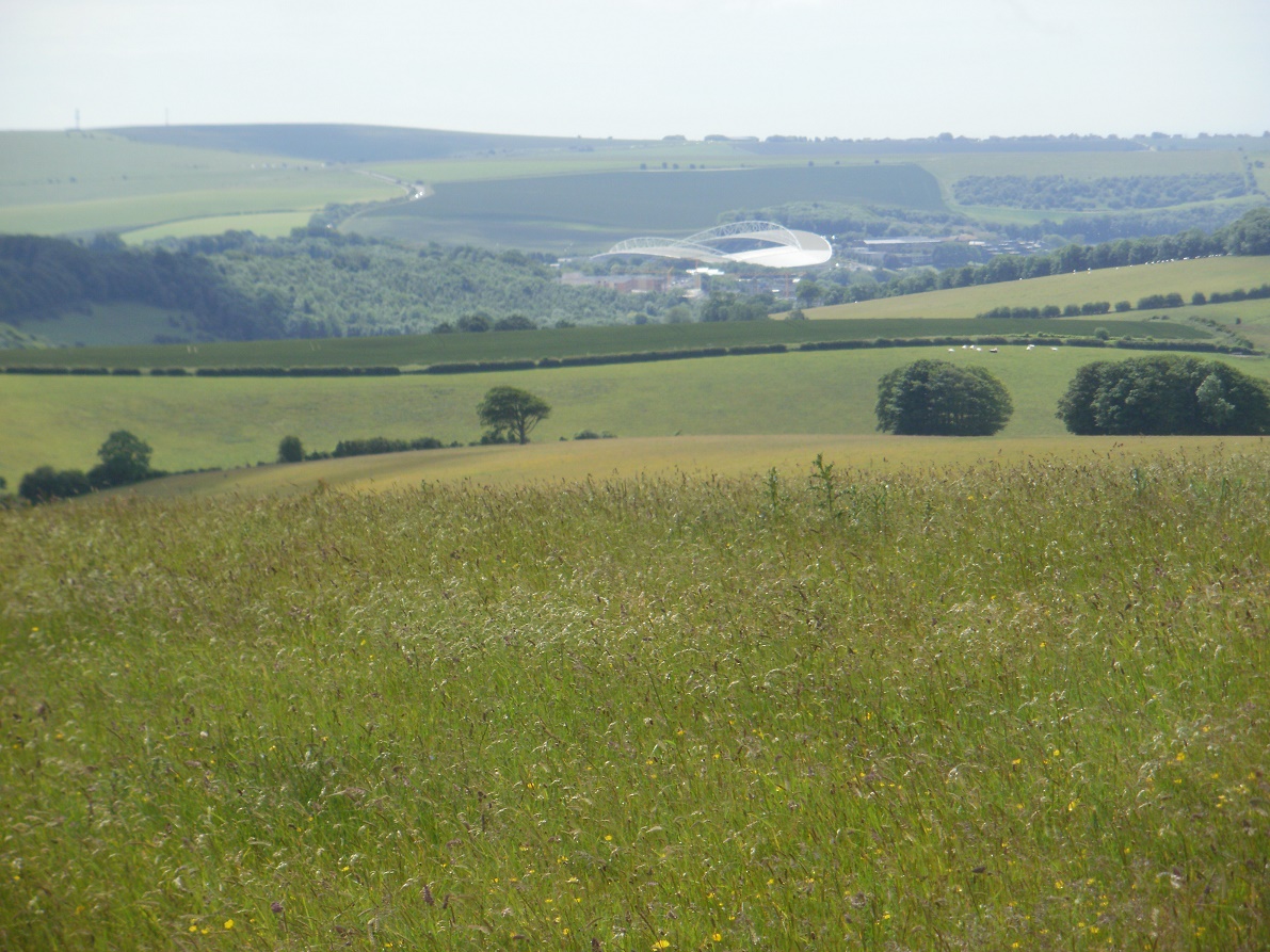
The weather was very good for early October. We could still believe we were still in late Summer temperature-wise, but the brown leaves on many of the trees hinted to the correct season.

All but one the caches had been found a few weeks before our trip. We decided to have a good search for this previously ‘unfound’ cache. It had been logged as ‘Did not Find – too many brambles’, so we took heed of this comments and managed to find a small path which went behind most of the brambles and led to an easy find.

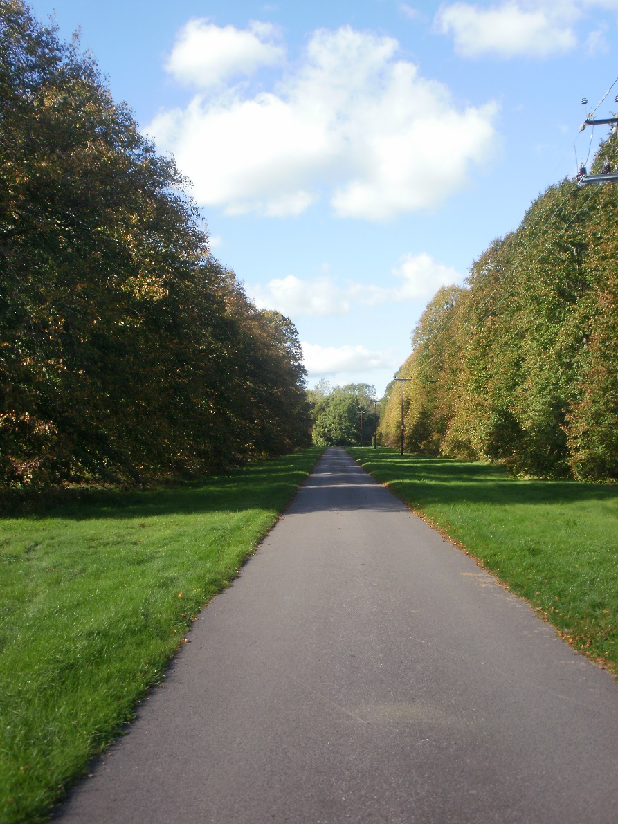
Shortly after the we joined the Sussex Border Path – a path we walked part of during our Sandhurst (Berkshire) to Sandhurst (Kent) walk in 2018.  This section of the path cuts through the grounds of the Rikkyo school (A Japanese School), and shortly after a war memorial to a WWII plane crash overhead.

Our pause for reflection at the memorial stone, must have affected our navigational skills. As, shortly after leaving it, we totally lost the footpath ! The GPS pointed yards into a vast thicket of brambles, but no footpath could we see. Eventually we found something better than brambles, and it was a relief to find the cache too, which meant we were back on route!

We were approaching caches 28-30, which would yield the last of the bonus numbers we could find without recourse to caches 1-3. We did some quick calculations to verify the bonus cache was not in the vicinity of caches 29-30 (it wasn’t), and continued our walk to cache 30.

A rare section on tarmac

At this point we had found every cache we had attempted. (A rarity!) We didn’t want to DNF a cache this late in the trail.

But cache 30 caused us some angst. A familiar hiding place. A stile surrounded by bushes. The bushes lent themselves to ‘hanging’ a cache. But we couldn’t find the cache. We checked both sides, we checked the stile, we checked the GPS, we checked previous logs, we checked the stile again, the checked the bushes again… and eventually on our fourth check, we found the cache! Phew!

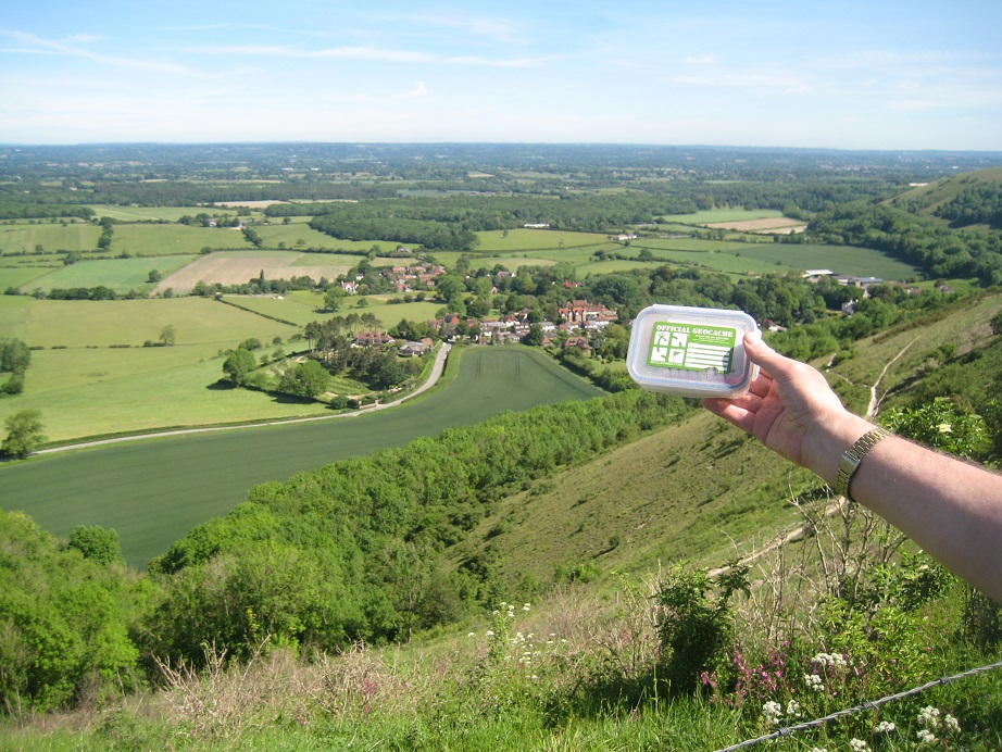
Having found cache 30, we had a good idea that the bonus – cache 31 – would be nearby. We were still missing one number (because we hadn’t found the number in caches 1-3), but we could make some appropriate guesses. We tried one number and drew a blank, We guessed at another. Another blank. At our third attempt we were pointed at a very reasonable hiding place. We both looked, and after a few seconds Mr Hg137 saw the cache – an ammo can! Well worth finding the bonus!

After our successful find, we had only a few more caches to find (1-3, 4,5, 6 and 7). Most were straightforward finds, though one did require walking some yards past the cache and walking back and going up a steep bank).

When we finished we had found 31 caches. This equalled our second highest number of caches found in a day. No wonder we were quite exhausted ! It took our total caches found to 3998. So close to 4000 !

A couple of the other caches we found were :

November 16 : Trackable : Dark Pirates Heart

During our walk around Grazeley we exchanged one of our trackables for another : Dark Pirates Heart.

Dark Pirates Heart

A metallic skull and crossbones attached to a coloured glass heart. Both pieces attractive, in their own way.

When we got home we checked out the trackable’s journey. Had it come from a location rich in pirates or smuggling ? Perhaps Cornwall or maybe the West Indies ?

Neither.

This small trackable had started its travels by visiting some of the caches in the Crawley Down series in Sussex. (Predominantly visiting low numbers in the series; interestingly we undertook some of the high numbers in the series when we walked from Sandhurst in Berkshire to Sandhurst in Kent in 2016.) Sadly none of the caches the Crawley Down series were big enough to take the trackable and it eventually was dropped off, at the beginning of October 2019, at a cache near to the Bedgebury National Pinetum again in Sussex.

There the mystery starts.

Because we were the next finders of the Dark Pirates Heart – in a cache in Berkshire – some 60 miles away.
We have looked at cachers who have visited the Sussex caches and the Berkshire caches…and there is no overlap, no discernible link that moved the Heart 60 miles.

Maybe the Heart was captured by Pirates in Sussex…and placed as secret booty in Berkshire ?

We will try to move it on quickly…and help it achieve its mission of ‘crossing the seven seas’ !

August 2 : South Downs Way : Southease to Alfriston

Hello, Mrs Hg137 here.

Five weeks had passed since we last walked the South Downs Way, and much had happened in that time. Early summer had turned to harvest-time: the freshly-shorn sheep had regrown their fleeces; we had replaced our trusty old GPS, which fell to pieces in our hands as we finished that last walk; we visited London for some caching along the Thames and a visit to the Globe Theatre; we spent a weekend in Cardiff with lots and lots of caching; and we had fitted in a few caches elsewhere too.

Back to the South Downs Way: we parked the geocar in the road next to the Youth Hostel https://www.yha.org.uk/hostel/yha-south-downs , and set off to the footbridge which crosses the busy A26 . There’s a cache here, Itford Bridge, easy enough to find once you had walked to the closest point suggested by the GPS , in the middle of the bridge deck, and that sort of suggested that the cache was below, which it was.

After that, there’s 150 metres of ascent, zigzagging up the hill, with views back along the crest of the downs towards Chanctonbury Ring, and out to sea past Newhaven towards Brighton. Very near the top of the hill we arrived at our next cache, ERB. We could see paragliders ahead, and, closer by, a young lady wandering about on the grass taking selfies with various expansive backgrounds, but quite close to where we wanted to search. Luckily, she was concentrating so hard on her photos that she didn’t notice us … Mrs Hg137 delved into the hint item, removed some camouflage, and came out, slightly scratched, with the cache. Once signed, it was replaced by Mr Hg137 – and we still hadn’t been spotted! And why the name for the cache, “ERB”?

"ERB"

“ERB”


Here’s an extract from the cache description:
“ERB”
Ernest Ronald Beale was born 2nd December 1939 in Woodstock, Oxfordshire. He passed away on 27th October 2014. … He loved the Downs, especially Firle Beacon, and this is one of his final resting places, what a view!

We skirted round a flock of sheep ...

We skirted round a flock of sheep …


Reaching the ridge, we passed the telecommunications masts on Beddingham Hill, and skirted the sheep who like the smallest amounts of shade cast by the towers and fences. There is very little shade and shelter up here, so those sheep must have been so, so hot during the recent heatwave! This section of the South Downs Way is one of the most open (bleak? bare?) of the whole 100-mile route, with no trees at all along the ridge between Southease and Alfriston, only a few hawthorn bushes.

We arrived at the ridge-top car park near Firle Beacon, where paragliders were taking off and landing, radio-controlled gliders were being flown, and real gliders soared overhead. There’s another cache near here, also the final locations of another two puzzle caches. We were successful with two of those, but the third was overwhelmed by nettles and brambles while the farmer was harvesting grain in a field not very far away. We felt exposed and a bit uncomfortable (having read logs about the farmer turning others away) so we gave up after a while and went on our way.
A Marvellous Place To Sit - for lunch!

A Marvellous Place To Sit – for lunch!


We circumnavigated a herd of cows crowded together on the path, giving them plenty of room (much more room than the sheep!), and gradually climbed up the ridge to the trig point at 217m at the summit of Firle Beacon. (Editor’s note: Firle Beacon is a Marilyn – “a hill of any height with a drop of 150 metres (nearly 500 ft) or more on all sides”, so it is relatively high compared to its surroundings)
... and we skirted round a herd of cows ...

… and we skirted round a herd of cows …


Like the car park, the trig point is a popular place, with folk queueing up to stand on the trig point, touch the trig point, admire the view from the trig point … we, too, touched the trig point (you have to, don’t you?) We sat down on the grass, had a cup of coffee, and waited for all those people to go away, because there was a cache concealed *in* the trig point and we needed to be unobserved while we found it. And find it we did; it was a cache from the SDGT (South Downs Geo Tour) series, placed by the National Park rangers. We’ve done a few of these caches in our walk and all of them have been inventively and unusually hidden and well worth finding. See more about the Tour here https://www.southdowns.gov.uk/enjoy/geocaching/
... and finally we skirted round some ponies

… and finally we skirted round some ponies


From here it was an airy walk along the treeless, open ridge, gradually turning south, with views towards the Seven Sisters, the final leg of the South Downs Way. We skirted a herd of ponies, grazing on the path – there seemed to be herds of all sorts of farm creatures in our way today! After a couple of miles, we reached the edge of the village of Alfriston. We took a diversion from the South Downs Way to find a cache, Alfriston Wander, which is down a chalky track into the village. But for us, there was a problem: there were two parallel chalky tracks: which one to choose? Reader, we inevitably chose the wrong one, and had an undignified scramble between chalky tracks, when Mr Hg137 pulled me up by my rucksack and I fell flat on my face, followed by a rootle around various fence posts before we found the correct place for the hidden cache.
Clergy House. Alfriston

Clergy House. Alfriston


We went back up the (other) chalky track, then followed the South Downs Way down a surfaced track into the village. We were quickly away from the bare downs and amongst houses, and then in the old centre of the village, filled with people. We crossed the main street, walked down an alley, and arrived at a green edged by the Clergy House, the first property ever bought by the National Trust https://www.nationaltrust.org.uk/alfriston-clergy-house/features/history-of-alfriston-clergy-house
St Andrew's church, Alfriston

St Andrew’s church, Alfriston


The church is here, too, and we had come here to find the Church Micro based there. We examined a noticeboard, a gravestone in the churchyard, and had our coordinates. We stepped round the shingles being used to retile (re-shingle?) the spire – FYI, they work up from the bottom. It was not far to the final cache location, still in sight of the church; once there, there were several possibilities. Mr Hg137 went for feeling inside each location, while Mrs Hg137 opted for peering into each place, which worked because the cache was tucked back just over a finger-length from the opening. From there, it was a short walk back to the car park to retrieve the other geocar and make our way home.

Here are some of the caches we found:

June 15 : South Downs Way : Jack and Jill windmills to the A27

On our previous section of the South Downs Way we had many caches to find, today very few.
The day was cool, and heavy rain forecast for later, so the lack of caches would enable us to (hopefully) finish our walk in the dry.

We’ve walked all that way!


Jack and Jill Windmills, are partway up the hill, so much of the morning’s climb had been undertaken in the car. The car park was quite full as we parked. A group of ladies were preparing to leave on a half-day ramble.

“Excuse us ladies, can we come by ?”


As it turned out, our first half mile was spent overtaking a few of the ladies, they overtook us as we stopped to take pictures, we overtook them, they overtook us.. Eventually one of the slower ladies asked US, if THEY were coming back the same way. She thought we (including Mr Hg137, a man, was part of their ladies walking group!).

Coffee Spot..at a Dew Pond


We played the overtaking game several more times before we stopped for one of two caches in the morning. It was near a dew pond, and the shallow indentation was just enough for us to be out of the wind for a few minutes and drink some coffee. The cache was, we thought behind a long gorse bush and we couldn’t see a way in. Behind the gorse bush was a barbed wire fence, and that was the cache host. We used our coffee break to read more about the cache, and discovered there was only one way to get behind the gorse bush…using a gate half a mile away ! We would have a mile’s walk to get to within yards of where we sat! We remembered the weather forecast, and disappointingly left cacheless.

We walked on, and as we approached a gate, a cyclist approached from the other side. We walked quicker so we could open the gate for him, which would prevent him stopping. He did though slow down, and as he did so, a large black crow flew from his body.

Cyclist and Crow (left of picture)

The crow was hitching a lift on the cyclist! It turned out the crow was semi-tame, and had been rescued by a chimney-sweep. Although free to go, the crow enjoyed being chauffeured, and flew to the ground to eat some small undetectable insects. We chatted with the cyclist for a few minutes, and then watched as he cycled off with his feathered friend firmly perched on his shoulder once more.

Ditchling Beacon

Our highest point of the day was Ditchling Beacon, at 248 metres the equal highest point on the South Downs Way. Unlike the great pyramidal Butser Hill (the other 248er), Ditchling Beacon is more of a ‘bobble’ on the long undulating West-East ridge line, and there is little sense of height distinction between the top and surrounding area. It is possible to drive to the top of the Beacon as a road comes from both the North and South. The gradients on these roads average about 1:7 so it is very steep. Yet, at the top we saw a group of cyclists, tired but elated…they had just cycled to the top. Phew!

Ditchling Beacon Car Park – cyclists and ice cream van!

The London to Brighton Cycle Ride was due to take place a day later and it too goes up and over Ditchling Beacon. The cyclists we met were not taking part in that event, but it meant they had the roads to themselves, as the following day hundreds of cyclists collapse at the Beacon before the descent into Brighton.

Dew Pond near Ditchling Beacon

Planted near to the road, and very close to an oddly draining dew pond was a cache! Our first after 2 miles of walking! The cache was part of the ‘Ponds, Dew Ponds and Lakes in Sussex’ series – in fact it was the first one to be placed back in December 2006.

Distant Views of the Amex Community Stadium (Brighton and Hove FC)


It was getting close to lunchtime, and we were looking for a sheltered spot. We paused at various places, but eventually settled on a small patch of grass with trees either side, and a tarmac road leading to the village below. As we ate, we saw several orchids including (we think!) common spotted and bee orchids.

Bee Orchid

A couple approached just as finished taking photos of the flowers, the lady dressed in a ‘fifties-style dress’ and trainers. The man was more casually clothed. They checked the tarmac road, unsure of whether to descend or not. We chatted and discovered they were part of a wedding reception party. The group had been to the wedding, bussed (we assume) to Ditchling Beacon, and the guests then had to walk about half a mile across the South Downs and then descend to the reception !

Which way to the Wedding?


We walked on, but looked back every so often. Our couple had walked too far and were heading back towards Ditchling Beacon to re-join the rest of their group. So we never got to see what all the other guests were wearing!

The South Downs Way up to this point had been following the Northern Edge of the South Downs. We had had views of the flat Weald to our left (the North) and hills (other parts of the South Downs) to the South. As the South Downs Way approached Lewes, our path would take a 90 degree south turn. We would be leaving views of the Weald and heading for the coast (albeit some miles away).

Heading South to the Coast

The official route down was relatively cacheless, but we espied a parallel path through a valley called Ashcombe Bottom which had a few caches on. We took the deviation and walked through wonderful woodland. We thought we would have the path to ourselves, but two groups of people passed us. The first, a Duke of Edinburgh instructor (who had temporarily lost his party !), said this valley was ‘a little magic kingdom’ – and we agreed with him. The second group were seemingly going up and over the South Downs on foot to visit a garden centre.

‘A Little Magic Kingdom’

More from the ‘Little Magic Kingdom’

The caches made a pleasant diversion. One was hidden in the hollow created by fallen tree roots, another couple in the roots and boles of tree. A fourth wedged in a nettle/bramble bush, which Mrs Hg137 acquired relatively painlessly.

Our path would though lead us back to the South Downs Way, but sadly for us our caching diversion meant we were no longer ahead of the forecast rain clouds. We were in them! We suddenly got drenched as we found another cache high in a tree, and another near another Dew Pond. The steep downhill chalk path was quite slippery, so we took our time as we got wetter and wetter. A small copse partway down proved some shelter (and another cache!) but after 30 minutes rain were sodden.

Fortunately our destination car was nearby and we hastened, as best we could, to it to dry out.

So a curious day, with a long cacheless section punctuated by ladies who thought Mr Hg137 was a woman, a cyclist carrying a crow and an odd wedding reception. Many of the caches we found were off the South Downs Way and probably our caching greed was the main reason we finished very, very wet!

June 1 : South Downs Way : Devil’s Dyke to Jack and Jill windmills

Hello, Mrs Hg137 here.

This post is a tale of straining and strained muscles: straining, because it was the day of the South Downs running relay: and strained, because I tore a muscle in my leg early on and limped the rest of the way.


Parking at the Devil’s Dyke car park ( £3 all day!), we saw paragliders preparing for take-off, admired the superb view in the sunshine, then turned away and went into the trees, to look for the first cache of the day. Mr Hg137, holding the GPS, surged ahead, while I followed. And here was where it all went wrong for me; I tripped on a tree root and tore a calf muscle. Meanwhile, Mr Hg137 ignored the pained cries and strode on to find the cache, hidden in a rather wet cleft in a tree.

We moved on to a cache from the SDGT (South Downs Geo Tour) series, placed at the remains of the top end of the funicular railway which carried Victorian folk up to the Dyke. Although we have both been here before – especially Mr Hg137, whose family comes from Brighton – neither of us have ever been to this spot with its brilliant view. Next, we found a multicache based on the trig point at Devil’s Dyke, with the final cache located at one of the less-visited areas around the Devil’s Dyke. After this, we stopped for a coffee (and painkillers for me!) before a look down the dry valley of the Dyke.

We had one cache to do before we left the Dyke, one which had been on our ‘to do’ list for some time. It’s Church Micro 666 … but where’s the church? … and the name of the place isn’t on the side of the angels, either. To overcome those deficiencies, the cache owner has set and described the cache as follows:
”The number 666 has many sinister connections and so was not really suitable for a normal church, it needed to be hidden somewhere a bit more devilish.
The Devils Dyke seemed such a place but as anyone with local knowledge will realise, there is one small but important flaw here, that is the lack of a church, although maybe there used to be as local folklore explains the valley as the work of the devil. The legend holds that the devil was digging a trench to allow the sea to flood the many churches in the Weald of Sussex. The digging disturbed an old woman who lit a candle, or angere causing a rooster to crow, making the devil believe the morning was fast approaching. The devil then fled, leaving his trench uncompleted.
To overcome this minor hiccup I have gone to the trouble of building a church myself, have fun.”

We found the cache, and, yes, it’s well worth it!

South Downs relay race

South Downs relay race


South Downs relay race, changeover point at Saddlescombe

South Downs relay race, changeover point at Saddlescombe


We now had a downhill section to a road crossing at Saddlescombe. There were no caches along here, but we had the South Downs Relay to watch as we walked http://www.southdownsrelay.com/rules/ This is a running event, usually held on the first Saturday in June; there are 18 legs covering almost the entire length of the South Downs Way, from Beachy Head, near Eastbourne to Chilcomb, near Winchester, and each of the team of 6 runners tackle 3 stages. It takes them 12-14 hours to run the whole 97 miles, including 13,500 feet of ascent and descent. Phew!

Several runners came by during our descent, and we stopped for a short while at the road crossing to watch the changeover point between legs 6 and 7. Having crossed the road, we started the climb back up the other side, keeping well out of the way of the runners charging down the hill. It was getting hot now, and it was good to be climbing the hill in the shade of trees; I didn’t envy those runners, pounding up the bare hillsides in the burning sun!

Along the next part of our route, we were looking for some of the caches from the TC (Treble Clef) series. These are a set of 35 puzzle caches, based just north of Brighton, and with a selection of music-themed puzzles, which we had solved before setting out – the final caches are in a variety of places, some of which were on, or close to, our route. We tackled nine of the caches from the series, finding five of them. (Editor’s note: Mr Hg137 tried all nine caches, while I wimped out of some of them, as my pulled leg muscle just wasn’t up to scrambling up banks and I was trying to minimise ‘extra’ walking, where possible.)

Apart from the runners and their support teams, there was also a steady stream of walkers and cyclists. It was, after all, a warm, sunny, summer weekend. We met two people doing a butterfly survey, and also came across a father and ten year old son resting in the shade of a tree. They had walked from Winchester in five days, and they planned to reach Eastbourne in two more days, which is pretty good going whatever your age.

Down to Pyecombe

Down to Pyecombe


After a few miles, we left the caches from the TC series behind us and started a long descent into Pyecombe. The police helicopter flew over, low and slow, which generally doesn’t bode well. We reached the A23, a very busy dual carriageway, and crossed it on a bridge. Quite a few people were there, watching the rather average-looking traffic. There must be more interesting things to do on a beautiful summer’s afternoon, so we asked why. Earlier that day, hundreds of Hell’s Angels had held a mass “ride out” down the A23 to Brighton to celebrate their 50th anniversary in the UK, under police escort and watched by the helicopter. All became clear … https://www.bbc.co.uk/news/uk-england-48482042
Church of the Transfiguration, Pyecomber

Church of the Transfiguration, Pyecombe


Once over the A23, we were in Pyecombe, which is now a quiet little village sandwiched between the A23 and A283. The Church of the Transfiguration is in the centre of the village; it’s Grade-1 listed, dates back to 1170 and has a tapsel gate. But, for two hot, thirsty geocachers, it also has a kitchen inside, with water, fruit squash, and tea or coffee, all available for a donation; and it has a Church Micro geocache.
Tapsel gate, Pyecombe Church

Tapsel gate, Pyecombe Church


( Editor’s note: tapsel gates hinge in the middle, not the side, to make it easier to carry coffins through. They are only found in Sussex, and there are only six altogether. There’s another on the South Downs Way at Botolphs. https://en.wikipedia.org/wiki/Tapsel_gate )
Jack and Jill windmills

Jack and Jill windmills


Not far to go now, but it was all up. We crossed the A283, went through the car park of Pyecombe Golf Club, then yomped (or limped) straight up the hill, to retrieve the geocar, parked in the (free) car park next to the Jack and Jill windmills. (Editor’s note: Jill is the white windmill with the sails, Jack is the sail-less black windmill. ) It had been a beautiful summer’s day, with grand views, but my leg was hurting now and I was quite glad to finish. It was only later, as I went pink from sunburn, that I found out how patchy I had been at applying suncream …

Here are some of the caches we found:


May 25 : Duck Racing in Sussex

Every year, since 2008, the UK has held an Mega event. These event are attended with hundreds of cachers attending. The events are held in different parts of the UK. Last year the Mega was held in Yorkshire, this year it will be held in Aberdeenshire and next year, 2020, it will be held in Sussex. (The Sussex Mega has its own website https://www.mega2020.org.uk/ )

Velosaurus Welcomes Us to the Duck Racing!

These are not just one day events. The focus, and best attended, is the Saturday event but throughout the preceding week, many activities – caching and non-caching related – take place. All of these events cost money, and the Mega team have to acquire the money in the run-up their event.

The 2020 Sussex Mega team are no different. They have been selling merchandise, running raffles, and holding events for many months. The event on May 25th caught our eye. Duck racing!

Attendees of the event could buy (for £2) a numbered duck that would race with 99 other ducks down a river. The winning ducks, and last place (!) would win a small prize. The rest of the money would help the Mega fund!

We said we would attend a few days before the event…but all the ducks had been pre-sold. We decided to attend anyway, and hoped there would be a second race.

Before we arrived at the event, we stopped at the nearest town, Forest Row. We had cached here before on our Sandhurst to Sandhurst walk (April 2017) so knew the road layout and free parking. We had time to undertake a couple of caches which had been placed since 2017.

Forest Row Village Hall…


…. and its cache


The first cache was part of the Village Hall series, a short walk from the car. The Village Hall was surrounded by seats and it was one of those that hosted the cache. Being a Saturday, there was a constant procession of people going in and out of the Hall – we managed to pick a quiet couple of seconds to grab the cache.

Forest Row Church

Our next, was a Church Micro, and in typical style, we had locate a date or two from a plaque and calculate the final coordinates. We knew from the cache description it would be a little walk away, and a very pleasant one it was too.
We were expecting to find a film canister tucked under a pile of logs or stones, so we quite amused to find this.. a great diversion.

Onto the duck race!

We were greeted by a large inflatable duck aka cacher, Velosaurus who did much of the orchestrating throughout the day!

Mrs Hg137 signs the unusual log book

The final log book

There were about 50 other people present, and lots to do beside the duck racing. A tombola, ‘guess the number of ducks in a box’, cakes, home made caches etc.. All good fun! And an unusual shaped log-book to sign!

How many ducks were in the box ? Really ?

A couple of cachers had brought their dogs along, and two cachers had even brought their cats along on a lead too! Good job it wasn’t real ducks being raced!

One of the two very well behaved cats!

There were two races and we got two ducks in the second race. Sadly we didn’t win, probably because we didn’t roar and cheer our ducks as vociferously as other duck owners. Or maybe our ducks were caught up in some minor river debris and lost pace with the leaders! Either way.. great fun !

The Sussex Mega 2020 Team may well run this event again… so look out for it! It was a great way to raise money!

Here are photos from the races ! Well done to the winners!

They’re off!

The Finishing Line

Well done to the Winners!

May 20: Souris

Hello, Mrs Hg137 here.

Souris

Souris


Almost all the geocaches on our walk along the South Downs Way between between Botolphs and Devil’s Dyke were small letterbox caches, just big enough to hold the cache log and a stamp for the letterbox. But one was larger – a clip lock box hidden under a water trough, and inside was a trackable, neatly tucked inside a small plastic bag. We had found Souris.

At the time we found Souris, we were unsure what species we had found: a hamster or a mouse? A girl, or a boy? (Editor’s note: we now know that Souris is a mouse but we are still unsure of the sex.)

Back home, we have had chance to research more about the trackable. Souris started off from Namur, in Belgium, in the first few days of 2019, and has travelled 1100 miles since then. From Belgium, there was a brief foray into France, and another visit to Germany, all in the company of Airhic1, the owner. Finally, in mid-April, Souris was placed where we found him/her, with the touching farewell log:

Please take care of my TB.
Farewell little mouse.

And we were the next people to collect Souris, and intend to honour that request, and also the mission of the trackable, which is …”to walk and rest”…

May 20 : South Downs Way : Botolphs to Devil’s Dyke

Hello, Mrs Hg137 here.

On the fourth and last day of our 4-day walking mini-break, we had a short (well, shortish) walk planned, from Botolphs, by the River Adur, up to the Devil’s Dyke, just north of Brighton.

Crossing the A283, we set off up the hill towards masts close to Truleigh Hill Youth Hostel. It was a steady climb out of the valley and the views became bigger and more distant as we went up. Turning round, we could see almost all of the previous day’s route outlined behind us in the hazy sunshine, as far back as Chanctonbury Ring and beyond.

There were geocaches to find as we climbed, all letterbox caches (containing an ink stamp) from the SWALK series. (Editor’s note: these give a handy reason for a ‘short rest’ every so often while climbing the hill). We emerged onto a lane, still climbing, more gently now, with views out over the Weald to the north, and continued on and up, with more short pauses to find caches, now from the accurately named Truleigh Beautiful series hidden (mostly) under little piles of flints by fence posts, or (once) magnetically attached to a metal gate amongst sprays of brambles and thickets of nettles. (Editor’s note: I think you can guess that it was me who was chosen to find the last cache described!)

Part way up the lane, we came to a section where the road had been lifted and re-laid. The reason became obvious when we saw the sign saying that the 150Kv cable from the Rampion windfarm passes through here; it’s out at sea to the south. https://en.wikipedia.org/wiki/Rampion_Wind_Farm

Just before the top of the hill was Truleigh Hill Youth Hostel, hidden amongst trees. https://www.yha.org.uk/hostel/yha-truleigh-hill We sat on a bench for a rest, had a quick look inside one of the two yurts outside, and checked the water tap (as of May 2019 it’s working, not so with all taps on the South Downs Way). Memories play tricks – both of us had thought the hostel was to be nearer the start of the walk, neither of us recalled the walk up the lane, but we both remembered the water tap.

We continued along the lane, which became a chalky track, very reflective and bright in the sunshine. Spotting a handy bench, we decided on an early lunch and sitting, basking in the hot sunshine and looking out at the view and watching the ponies in the field over the track. We’re still not sure if that bench was in someone’s front garden!
Lunch completed, it was time to start our third geocache series of the day, the Tottington Totter. These, too, came at regular intervals, were generally easy to find, and punctuated the walk nicely.

Geocaching is interesting to cows, too!

Geocaching is interesting to cows, too!


One particular cache was slightly different, hidden under a concrete block at the path’s edge: on problem was that there were quite a few such blocks, hidden on both sides of the track, and the GPS wasn’t being exact enough to decide which one: a second problem was the farmer whizzing back and forth along the track on a very large tractor: and a third problem was the large, male cow in an adjacent field which took an increasing interest in Mr Hg137’s searches from just the other side of the fence: but the cache was found and all was well in the end.
Yet more cows!

Yet more cows!


(Editor’s note: the Tottington Totter series was archived a few days after our visit and has now been replaced with a new cache series, so we were the very last people to record finds for these caches.)
Trouble ahead!

Trouble ahead!


We could just see the end of our route, about two miles away, high on the top of the ridge at Devil’s Dyke, but something about the view ahead was beginning to concern us. Black, black clouds were massing ahead. The sunshine became weaker, then vanished altogether and it was immediately much cooler. As we stopped to sign a cache log, a few spots of rain began to fall. The spots became larger and more frequent as we walked to the next cache, where we put on our waterproofs as we signed the log. Hoods went up, zips were closed and the last cache of the day was a very quick find indeed, followed by a very wet and dispiriting walk across the grass to the Devil’s Dyke car park in heavy rain and increasing wind.

Ah well, a downbeat note to end with, but a four-day break of walking in great countryside, (mixed weather), interesting people and places, and a chance to be out on the beautiful South Downs at one of the best times of the year.

Here, as usual, are some of the caches we found (there are quite a number of them!):

May 19 : South Downs Way : Washington to Botolphs

The Washington to Botolphs section of the South Downs Way, is about 7 miles, of which the first mile or two is up quite a steep slope to Chanctonbury Ring, and then the remaining five miles is all down hill!
We were still staying just a few miles away with HF Holidays, which meant we were parking our destination car shortly after 9. The relatively spacious layby at Botolphs on the A283 was practically full at this time! Fortunately though we squeezed a car into the layby, and drove our other car back to the start at Washington.

Our target… Chanctonbury Ring

A steep ascent up to Chanctonbury Ring awaited us, but partway up we had a cache to find. It was a multi, which we thought we had resolved before setting off. Part of the ‘Sussex Trig Point’ series, it involved working out the co-ordinates based on the metal numbered ‘base plate’ fixed to the trig point. These base plate numbers can be found using Google, and it was a good that we used that tool before we set off, as we wouldn’t have liked the long walk back downhill if we had attempted the cache without the aid of the internet.

Sadly for us, we didn’t find the cache. It was supposed to be an ammo can, hidden under sticks. There were lots of piles of sticks, logs and leaf litter for us to rummage around, but after 15 minutes we gave up. During that time we’d been asked by three separate SDW walkers what we were doing, and disturbed a tiny wren.

Near to the top of Chanctonbury Ring, and yards from the trig point is a Dew pond. This was also our first find of the day and part of the ‘Ponds, Dew Ponds and Lakes of Sussex’ series of caches. We paused for coffee – fully merited by the steep ascent – and attempted to dry out the wet log sheet on a nearby hawthorn bush.
As we stood drinking, various dog walkers passed by and each of the canines charged to the lip of the pond expecting to run into, and drink from, a pond full of water. Sadly the pond was dry, and we could see each of the dog’s faces droop when their anticipated water reward was not forthcoming.

A cache.. and a dry dew pond!


The reason the Dew Pond was dry, was, we discovered from one of the dog walkers, that the South Downs Authority have established a few of the dew-ponds as ‘wildlife havens’ by planting bushes around the outside. A great idea, but the roots of the bushes extract what little water the Dew Pond holds. Meaning that there is little water to see at the surface.

Chanctonbury Ring Trig Point


Our highpoint, Chanctonbury Ring, was clearly visible. Although it is a few yards away from the SDW we walked inside the prominent tree feature. Planted as a series of concentric rings back in 1760, by the then land-owner Charles Goring, the rings are very dark and allegedly haunted.

Inside Chanctonbury Ring

Various legends abound about the ring … if you walk anti-clockwise around the ring 7 times on a moonless night, the Devil will appear and serve you porridge. Alternatively if you count all the trees Julius Caesar will appear or thirdly, if you run clockwise around the trees three times a lady on a white horse will appear and you can ride down! I know which I’d prefer!

Sadly the trees today are not the original trees. The Great Storm of October 1987 blew down every tree at the summit and for a few years the top was tree-less. Since then the Goring family have replanted, and the trees visible are the result of the planting 30 years ago.

Farewell Chanctonbury Ring

A little further down the hill from Chanctonbury ring was another cache. This one tucked into a small, less-imposing copse which we took an age to find. The GPS wobbled, there were several hint items, but eventually we found the cache.

Our long downhill awaited, punctuated by many caches in very quick succession. These were all marked as ‘letter box’ caches and each contained a stamp and some ink as well as a log book. Most were relatively small in size, but all were part of a ‘Sealed with a Loving Kiss’ series. Each of the caches was named after a stamp from around the world. We found caches named after an 1852 25 centime Blue, Louis Napoleon from France, an 1871 Telegraph stamp from Brazil, a 1913 Albanian stamp and many more. It would fun to Google these stamps and see the differences across the world (but with over 150 caches in the full series, this could take some time!). We found 15 ‘stamp caches’ during the day so there are many more for us to find. (It should have been 16 but one of the stiles, used as a hiding place for one of the caches, was being used for a rambler’s lunch, so we didn’t even try finding the cache!)

A Rocket Stamp

We paused ourselves for lunch next to a cache. As we ate, a group of Duke of Edinburgh teenagers stopped. Paused for a drink and walked on. We chatted with them, they were aiming for Cissbury Ring (an ancient Iron Age hill-fort a few miles away). We wished them well…little did we know our paths would touch again later…

Duke of Edinburgh Group heading to Cissbury Ring
(we have deliberately blanked a face).

One of the few other non-stamp caches we found was another ‘Trig Series’ multi. Here, the Trig Point was no longer accessible to read the ‘base plate’ so the cache owner provided the final co-ordinates without us having to do any arithmetical calculations. The final cache was adjacent to a farmer’s field, where the farming team were busy penning, and sorting, sheep. It was a little distance from the South Downs Way and as we turned away a small animal – we guess a stoat – ran across our path. We were grateful of the diversion, as another stamp cache awaited us at a busy memorial ‘bench’ which we passed by, but minutes later as we returned, was free for us to pause for a welcome drink.

Memorial to Walter and Mollie Langmead

The next mile or so of our walk skirted around Steyning Bowl, a dry chalk bowl presumably gouged by the last Ice Age.

Looking across Steyning Bowl…

… and the top of the bowl in the other direction

Part way along, we had an Earthcache to answer. Unusually the questions were not geared around the geology of the area, but of the agriculture (or lack of!), and industry. Besides the agriculture of crop growing, we were yards away from a large, noisy pig farm. Sty upon sty, sow upon sow, piglet upon piglet. Some running around, most lying down, resting. Never have we seen so many pigs!


We descended further until the track gave way to a tarmac road, and here we spotted several sheets of paper lying by the roadside. We picked them up, as they looked important. They were. Described over a number of sheets of paper was a Duke of Edinburgh expedition from Botolphs to Cissbury Ring. It belonged to the DoE party we saw earlier!

There was a contact number on the sheets, which we phoned. The organisers said that the group had just finished and admitted to their crime (!) and asked us to shred the sheets, which we did.

Peaceful River Adur


Our final mile was walking along the River Adur, and here we found our last ‘stamp’ cache, and a tiny nano hidden around the Adur footbridge.

A great 7 mile walk – with loads of caches, lots of myths, legends and… pigs! Oink ! Oink ! Oink !

May 18: 7 Deadly Ducks Tag – LUST

Hello, Mrs Hg137 here.

7 Deadly Ducks Tag - LUST

7 Deadly Ducks Tag – LUST


Back in the summer of 2016, Geocaching HQ in Seattle ran a trackable race called the HQ Duck Dash. For this, duck shaped trackables (and others) needed to travel as far as possible within a month, between July 20th and August 20th 2016. This one took part, then carried on afterwards.

This one, Lust, took part in the race, with the official goal:
Official goal: to be found and moved to another location.

But it has continued since, with another goal:
Unofficial sub-goal: to be photographed with other ducks.

Starting in Nebraska, it journeyed around the USA for a while, but had reached Iceland a year later. Then it moved to Germany, where it spent some while, had a brief holiday in Egypt, returned to Germany, and was dropped off in Krakow, Poland, in late 2018. It was collected from there and taken to England in early 2019. Since then, it has journeyed around the southern and eastern part of England, never (yet) going north of Birmingham or west of Southampton. We found it high on the ridge of the South Downs in Sussex, just east of Amberley.

We’ll take the duck further on its travels, and we have something duck-themed in mind that will suit it perfectly! More of that in a future post …