August 3 part 2 : Naunton

Hello, Mrs Hg137 here again.

The Black Horse, Naunton

The Black Horse, Naunton


Our journey home from our weekend in and around Bourton on the Water started with a short drive to Naunton, a small village further up the River Windrush. I used to go on holiday here as a teenager, staying in the farmhouse adjacent to the Black Horse pub https://theblackhorsenaunton.co.uk/ Farmhouse, village, and pub have changed little in the last few decades – even the design on the pub sign is the same, though the car park has now become a beer garden, and the village shop is now a house.
St Andrews Church, Naunton

St Andrews Church, Naunton


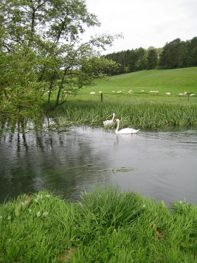
We walked through the village, crossed the river, and reached a small green by the village church, St Andrews. There’s an ingeniously hidden Church Micro cache here, so we spent a few minutes working out where it was, then had a picnic lunch on a millennium bench on the green. After a quick look inside the church, we returned along a grassy path close to the river, following the Warden’s Way, which links the Oxfordshire Way at Bourton and the Cotswold Way at Winchcombe https://www.ldwa.org.uk/ldp/members/show_path.php?path_name=Wardens%27++Way

A footbridge took us back across the River Windrush, and close by on one side is another cache, ‘Pooh Sticks’; the cache is next to the bridge, and quite close to the water. It hadn’t been found for a couple of months and we weren’t sure if it was still there, but it was bravely retrieved by Mr Hg137, who emerged from the undergrowth with only a few nettle stings and scratches.
Naunton Dovecote

Naunton Dovecote


Inside Naunton Dovecote

Inside Naunton Dovecote


Also close to the river, in a little field, is a dovecote. There is a dovecote trust but I couldn’t find a website. Anyway, the dovecote was built around 1660, has had a variety of uses – as a mill, and animal stabling, apart from the obvious. But now it is back to housing doves, and it had cooing residents in some of its 903 nestholes when we looked inside.
Naunton Cricket Pitch - the outfield is a little long!

Naunton Cricket Pitch – the outfield is a little long!


We had one more cache to find, ‘Naunton Cricket Field’. But where was the cricket field and how could we get to it? After a little aimless wandering, we found our way around the back of the village hall and up a slope onto the cricket field. There’s been no play here for a bit and the outfield is a bit long! The cache was hidden at the edge of the pitch in a bit of cricket ‘furniture’.
Naunton - my teenage holiday destination

Naunton – my teenage holiday destination


As we returned to the geocars, I mused on my memories of my holidays in Naunton long ago. The village looks so similar, and pub, and its sign, look much the same, but the sign must have been repainted or replaced, surely?. But I don’t recall visiting the church or the dovecote, and didn’t even know about the cricket pitch and the village hall, assuming they were there at the time. We used to stay in a farmhouse owned by the Hanks, next to the pub, and I noticed the same surname cropping up on the cricket club website, so maybe there is a family connection there. Mmm, much to think on as we started our journey home.

Here are some caches we found:

August 3 part 1 : Bourton on the Water

Hello, Mrs Hg137 here.

Our long weekend in the Cotswolds was over, and we packed up, ready to depart. But, after breakfast and before setting off, we went for a caching walk around Bourton. The village had been packed at the weekend and we hoped it would be less busy early on a Monday morning. And it was.

Harrington House, Bourton on the Water

Harrington House, Bourton on the Water


We had been staying at Harrington House and we left the geocars there (with permission – cheaper!), crossed the road, and followed the Windrush Way between houses https://www.ldwa.org.uk/ldp/members/show_path.php?path_name=Windrush+Way The path suddenly came out from between the close-packed village houses and onto the riverside, a lovely little spot. It was also a hiding place for a cache, ‘Hole in the Wall’, which had only been placed at the end of June; we think this is the youngest cache we’ve found (so far).

Our remaining caches were all from the ‘Bourton On The Water’ series. We had mixed success, as in we attempted four, and found one. Bourton is a very busy and popular place and caches set here go missing very regularly; but we were still disappointed. And, while we made our only find, we were discovered by a (very poshly and politely spoken) muggle, who asked what we were doing. The cache was on HER property, and she didn’t know about it. We showed her the cache and the log, explained about geocaching, and we hope she was happy.

Part way round our non-cache-finding segment, we broke off from the caching, and did our one touristy thing of the week – the Dragonfly Maze https://www.bourtoninfo.com/attractions/dragonfly-maze/ We like mazes, so we would have come here anyway, but it did help that it wasn’t necessary to book in advance (a necessary/annoying, post-pandemic thing), it was outdoors, and numbers were controlled by pausing admission once the maze was full (23 people!). It’s a traditional hedge maze, but with a twist: there are clues to collect around the maze which help with the unveiling of something at the centre of the maze. We were in the queue ten minutes before opening time, and second party through the gate. But we were first to the centre of the maze, and solved the puzzle! We unveiled the solution, and left, providing a few clues to the family following us; they were first through the gate, but we got the solution first; we saw them later on in the village and they solved the puzzle too.

And that was Bourton: we returned to the geocars and drove away.

One cache we found:

August 2 : Adlestrop

Yes. I remember Adlestrop
The name, because one afternoon
Of heat, the express-train drew up there
Unwontedly. It was late June.

The steam hissed. Someone cleared his throat.
No one left and no one came
On the bare platform. What I saw
Was Adlestrop—only the name

And willows, willow-herb, and grass,
And meadowsweet, and haycocks dry,
No whit less still and lonely fair
Than the high cloudlets in the sky.

And for that minute a blackbird sang
Close by, and round him, mistier,
Farther and farther, all the birds
Of Oxfordshire and Gloucestershire.

Adlestrop, immortalised by the poet Edward Thomas. The poem is based on a journey Thomas took in June 1914. He wrote the poem some months later, and has come to symbolise the peacefulness and tranquility prior to World War I. The poem was never published in Thomas’ lifetime, he was killed in 1917 shortly before an anthology, called Poems was due for publication.

Adlestrop no longer has a railway station (closed in 1966), but the station still lives on, in the form of the poem and the shelter/seat/name which is now sited in the village centre.

The shelter also hosts the poem on its seat, a geocache, and for us a relatively quick find.

Adlestrop doesn’t have the same look-and-feel as other Cotswold villages. The stones are slightly darker, the minor roads criss-cross the village but the major A roads completely bypass the village.

St Mary Magdelene Church stands proudly a little walk away from the Adlestrop Railway Shelter. The church has a 13th chancel but most other parts of the church have been built or rebuilt over the centuries. Just inside the graveyard was something very modern, and formed the first part of the Church Micro multicache.

How many graveyards have one of these ?

We extracted the information and extra details from a nearby churchyard seat. The co-ordinates took us a little out of the village, to a footpath by a large bush. Somewhere in the bush was the cache. Luckily we found the cache relatively quickly.

Then tiredness set in.

Around Adlestrop is an 11 cache series. We didn’t have time to undertake all 11, so decided to attempt number 1, then cut across some footpaths arriving at caches 10 and 11. That was the plan, and in fairness we achieved the plan. But we would have earned few marks in the plan’s execution.

Village Water Supply until the mid 1950s

Cache 1 of the Adlestrop Amble was in a ribbon of woodland adjacent to a minor road. We ignored the footpath sign which pointed into the woodland (for some reason we thought the footpath sign pointed the wrong way into the copse – leastways that’s our excuse and we are sticking by it). When we arrived parallel with the cache we then had to undertake some minor bushwhacking to enter the woodland to find the cache. An easy find, but poor footpath finding.

Our short-cut to Cache 10 was unnerving. We had to walk up a private drive. Were we trespassing ? We felt much better once we saw a footpath leading away from the drive and into a paddock area. We arrived at a footpath (or so we thought) and soon discovered this was a path to a farm.

We retraced our steps, and worked out a route to cache 10. We walked along the Macmillan Way passing an unusual ridge and furrow field. Ridge and Furrow was a means of ploughing and land management from about the 5th to 17th centuries. The Ridges rise like waves on the sea, and furrows are the dips between the waves. Usually complete fields have parallel waves across them, but this particular field had ridges and furrows in one direction for half the field and the other half the ridges and furrows were turned through 90 degrees.

Cache 10 was by a gate, and it took us some time to find. Cache 11 took us a lot longer.

At Cache 11, the GPS didn’t settle and the hint ‘top of hedge’ didn’t help when the hedge had grown to 12 feet high. We could approach the hedge from 2 directions, and it was from one of these that Mrs Hg137 saw the cache…but couldn’t reach it. Mr Hg137 leant in from the other direction, avoiding some but not all, of the protective nettles, gorse and bramble. The vegetation meant he couldn’t see the cache and was totally reliant on Mrs Hg137’s expert instructions.

Cache retrieved and signed, we admired our scratches and returned to our car having found 5 caches and explored this poetic village.

August 2 : Snowshill

Hello, Mrs Hg137 here.

Snowshill is a small and pretty village in the Cotswolds https://en.wikipedia.org/wiki/Snowshill with a National Trust property, Snowshill Manor. The owner of the Manor, Charles Wade, was a tad eccentric, living in a small cottage while filling his manor with an eclectic selection of collections (I remember a room of bicycles and another dark scary one filled with samurai armour). Anyway, we weren’t visiting, the house wasn’t open, only the gardens, but it was still likely to be popular, so we arrived early and parked in the small village car park. It was filling already, many of the cars with Lycra-clad cyclists unloading bikes from roof racks, ready for a ride in the country.

Snowshill church ...

Snowshill church …


... and the village pub

… and the village pub


It wasn’t far to the village green, with the church on one side, the Snowshill Arms http://snowshillarms.co.uk/ on another and the gates to the Manor close by. There are four caches based in the centre of the village, and we decided to do these first before setting out on our caching circuit/country walk, as the arithmetic needed to find the coordinates for multicaches is easier when you are fresh! ‘Snowshill Calling……’ was the first, based on a (still operational) phone box, then we sat on a handy seat on the green to work out the coordinates for the other three caches. Two of they lay in roughly the same direction, uphill out of the village (many of the ways out of the village lead uphill, so that’s not much of a clue!), and, as it’s a very small village, we were soon out in the country, searching, with mixed success, finding one and not finding the other, which has since been marked as missing.

Back down the hill. we found the fourth and last of our ‘starter’ caches and passed the small village car park, which was now full … and the National Trust car park was also filling fast. We were following the SN series ( aka Snowshill or Summer Nights series); there are nine caches in the series, with handy names like ‘Hinge’, ‘Tree Hole’, ‘Vista’, ‘Branch’ which give handy clues to the locations where the caches can be found. First of all, we followed the Winchcombe Way https://www.ldwa.org.uk/ldp/members/show_path.php?path_name=Winchcombe+Way downhill into fields, then crossed a small stream where a family were splashing about, oblivious to our caching activities. Next came a warm, steep climb through woods and along the edge of fields, before reaching a lane which contoured along the hillside, with great views (a vista!) back to Snowshill across the valley. There were many walkers, all out enjoying the sunshine, and many of our cache searches started with a pause to let a group of people go by.


Lunchtime was approaching, and we sought out a spot in the shade to eat our picnic lunch and to watch the steady stream of muggle walkers and muggle dogs passing by. After that, we started the return leg, back across the valley to Snowshill. After a steep downhill (to match that steep uphill earlier on) we followed a shaded track which went past a fishing lake and then started uphill, again. Along here somewhere is the most notable cache in the series, an ammo can: there are not very many of these about, as they are large and not the easiest to hide, but they last very well indeed and quite a few of the oldest caches are ammo cans.

The uphill track emerged onto a road, and we were suddenly back in Snowshill, not far from the village green where we had started. But there was no chance to sit on the seat on the green now, it was well filled with cyclists enjoying a drink from the pub over the road, and lots of other folk were out too, walking around the village and enjoying the summer. We made our way back to the geocar, in a full car park; as we left our space was immediately claimed.

Here are some of the caches we found:

August 1 : Cotswold Way Chipping Campden to Broadway

For our first full day’s walking in the Cotswolds we would undertake the first 5 miles of the Cotswold Way. The Cotswold Way is a 100 long distance footpath starting in Chipping Campden and finishing in Bath.

The day didn’t start well. We had driven some miles from our hotel base in Bourton-on-the-Water to Broadway to park our destination car, and then we couldn’t find the GPS. It should have been in Mr Hg137’s haversack so we searched that. Nothing. We decided it must be back at the hotel, so we drove back to Bourton (in the car we were going to leave a Chipping Campden). We searched our bedroom, the car park and all places in between. We re-searched the haversack.. and found the GPS ! Grateful for finding GPS but annoyed at our stupidity.. if we couldn’t find a bright yellow GPS in a haversack what chance had we finding geocaches!

So, about 90 minutes later than intended we started our walk from Chipping Campden. (We parked in a road called ‘Back Ends’ which Mrs Hg137 believes is the only such road name in the country… unless of course you know different !)
In these 90 minutes, the temperature had risen quite appreciably, and with a 250 foot ascent to start our walk, we decided to postpone it further by locating our first geocache of the day; a nearby Church Micro.

St Catherine’s, Chipping Campden

A relatively quick find.

Then the ascent.

Nearly at the top!


Our energy levels weren’t high after the trauma of the morning and the exertions of the previous day’s walk. We were passed on the climb by several groups of people, dogs and children. The ascent was worth it! We were rewarded with fine views over the Vale of Evesham from both the trig point and a toposcope.

Dover’s Hill Trig Point

There was a multi based on these two features, but after some calculations we realised the final meant retracing our steps some distance, so we moved on.

Toposcope Number 1


The top of Dover’s Hill was the site of the Cotswold Olimpicks held on the Thursday and Friday after Whitsun from 1612. The events included wrestling,leaping,dancing,pitching the bar,leapfrog and walking on the hands,together with the peculiar Cotswold pastimes of singlestick fighting and shin kicking. As this weekend should have been the start of the (postponed) Tokyo Olympics – this all seemed rather apt.

Our next successful find celebrated the Cotswold Olimpians, and we celebrated too as we had finished climbing! This was a letterbox cache, and had an unusual twist.

Is this a letterbox cache ?


Our route then followed, albeit on footpaths, Mile Drive. Mrs Hg137 had walked this section of the Cotswold Way before, and remembered it wasn’t the most scenic. In the context of 100 mile footpath with lavish views, Mile Drive could never be described as a highlight, but as a tranquil, wide area of grassland (great for social distancing) it ticked a few boxes.

Mile Drive


We found three caches along Mile Drive; we also failed to find the first stage of a three part multi!

The Cotswold Way was relatively busy, and we found ourselves behind a slowish group of walkers. Just as we caught them up, we paused for a cache, they walked on, we caught them up, found a cache…until we came to a barley field. We walked behind from a distance but left the main path to undertake a rarity, an Earthcache. We gleaned information from another toposcope and then went searching for a rock outcrop which we had to photograph. A short diversion which told us much about the underlying limestone of the region.

Toposcope Number 2


We dropped down to a picnic area and located a standard cache, and again passed on a multi which pushed us back on the path we had just walked.

Broadway Tower


And then our final ascent of the day. Far gentler than the earlier ascent, we walked up a grassy slope to Broadway Tower. From the Tower 13 counties are supposedly visible, slightly more from the top of the 65ft tower. We hadn’t booked tickets to go up the Tower, and the queue was quite long, so we set about calculating the co-ordinates for yet another multi. And yet again the final was in the wrong direction for us. All these calculations and not a cache found!

The descent went by a Deer Park but the narrow footpath wasn’t the best for ‘deer watching’ and ‘social distancing’. Leaving the Tower we were going downhill for the last time, to the town/village of Broadway.

Its a long way down!

As we descended the sky became blacker and blacker. This gave us an excuse to omit a couple of standard caches which were 400 yards away from our route down.

Broadway


Gentle rain was falling as we arrived in the pretty town/village of Broadway. Broadway hosts a plethora of Church Micros and we collected two on the short walk back to our car. Two straightforward finds hidden in street furniture.

We drove back to Chipping Campden and as we did so the skies brightened slightly so we explored the town before returning to Bourton-on-the-Water. We walked along the main high street reaching the official start (or end) of the Cotswold Way at the Market Hall. This was near our last find of the day in/under/near a water trough!

Market Hall, Chipping Campden


So a busy day,fraught at the beginning, and several fruitless multis. We did find 10 caches, most of which are shown below :

July 31 : Trackable : Hoolegans Navi-Gator

Hello, Mrs Hg137 here.

Hoolegans Navi-Gator

Hoolegans Navi-Gator


It’s a while since we found a trackable – we stopped caching during lockdown – but we came across one while sweating our way along the MacMillan Way on the hottest day of the year.
It’s Hoolegans Navi-Gator, an alligator attached to a model of ET’s head (hmm, an unusual pairing). But this pair have been around since August 2012 and are going strong, having travelled just under 24,000 miles in that time. Having said that, the trackable has undertaken a very few, very long journeys, and a myriad of short ones in between.

It started in California in August 2012, then went to Canada – the Yukon, then Alberta – in spring 2013. Then it went off to England, and has stayed there ever since, with one exception. It has been repeatedly to London, Oxford (it must have visited every cache in Oxford!), Eastern England, and South West England. There was a patch between February 2015 and August 2017 where not a single log was recorded; perhaps it was in some cacher’s rucksack, just waiting …

But what of that one exception – the trackable made a very short trip to Rio de Janeiro in November 2018, when the person holding it was doing two week’s field work in Brazil, and found time to do just one earthcache. What a long way there and back for one cache! Then it was back to England, and the time in between has been occupied with more visits to Oxford, London, and South West England. There was one brief foray to the Chilterns to take in England’s oldest cache, ‘View from Coombe Hill’, which we remember finding on our very first day’s caching in September 2012, and which we simply didn’t realise to be special.

And finally – it went off to South West England again, for us to find it in the Cotswolds on the last day of July 2020. We’ll carry it around with us for a bit, as it hasn’t seen very much of Southern England yet, then we’ll release it on its travels. It’s mission is to ‘Crawl from cache to cache, in constant search of a swamp’ and we’ll try to find something appropriate!

July 31 : Chedworth – a village, a villa, a railway and a bat

Hello, Mrs Hg137 here.

We were off for a long weekend’s walking and caching (hooray, at last!), staying in the Cotswolds. Near the end of our journey, we stopped for a short walk and a little bit of caching. But scorchio! It was already 30C as the geocar was parked in the (free, National Trust) car park in the woods close to Chedworth Roman Villa.

We planned to follow the Monarch’s Way over the hill to Chedworth village, just over a mile away (no caches until the outskirts of Chedworth) then return, over the hill again, along the Macmillan Way to the Roman Villa, following the Chedworth Wood Ramble (CWR) cache series. This had seemed like a wonderful idea when we planned the walk, but it was much cooler then…

Anyway, it was a pleasant, if hot, walk up through the woods, then over the hilltop to the outskirts of Chedworth. It was so very quiet, the birds were barely singing and there was not an animal to be heard.

Church view

Church view


We arrived at our first cache, ‘Church View’, which does indeed have a fine view of the church. As for the cache – we struggled to locate it and it took two goes from both of us before we finally laid our fingers on the cache container. It was hot and our brains were fried…

Moving on steeply downhill, we were on the village streets, and could see our next target, ‘Green’ (a grit bin), as we plodded along the blazing hot tarmac. A search again produced no cache, just an ‘out of place’ object and it was only a second look at that which told us it was the cache. All this while being watched by the postman and one of the residents – slightly embarrassing!

Chedworth  church

Chedworth church


... sundial on the side of the church

… sundial on the side of the church


There was a nice shady patch of grass by the churchyard wall and we sat down to eat our picnic lunch and watch the world go by. We’d passed by this spot before in April 2018 when we were walking between Sandhurst, Gloucestershire, and Sandhurst, Berkshire https://sandhurstgeocachers.wordpress.com/2018/04/22/april-22-sandhurst-gloucs-to-sandhurst-colesbourne-to-foss-cross/ Reluctantly, we stepped back into the sunshine to start the walk back to the Roman Villa. It was not far to the edge of the village, and we were out in open fields with the hill stretching before us (sigh). Part way across the field was a cache, which managed to be part of two series at once, the CWR series we had been following, and also the Little Bridges Series https://littlebridgesseries.wordpress.com/about-series/ It looked like a bridge across grass, but maybe there is a stream in the winter? I searched for the cache, which was protected by some of the angriest and stingiest nettles in Gloucestershire, and emerged with it, tingling, cursing and grumbling. (And I pushed it back using a walking pole, one set of stings was plenty.)
Little Bridge

Little Bridge


With me still tingling, we walked across the field, slope steepening as we went, till we reached a belt of trees. The slope steepened still further into steps, and we panted our way up to the top. And that was it, the climb was done, and we were on the top of the hill again. Another cache was there, and two more followed as we descended gently into the woods.

The path turned right and began to descend more steeply, this bit must be muddy in the winter. The embankment for the disused Midland and South Western Junction Railway loomed up ahead https://en.wikipedia.org/wiki/Chedworth_Halt_railway_station This area doesn’t seem the most obvious for building such a thing, it’s rather hilly. We found another cache, ‘Can you hear the ghost train?’, then dived into the cool tunnel under the old track. There were great acoustics in the tunnel – we tried train noises, howling wolf noises and a few owl hoots and all worked very well! (FYI we are both – supposedly – mature, sensible adults – but it had to be done!)

Chedworth Roman Villa

Chedworth Roman Villa


Emerging on the downhill side of the tunnel, we were immediately at Chedworth Roman Villa https://en.wikipedia.org/wiki/Chedworth_Roman_Villa Pre-booked tickets only, no cafe, and no ice-creams (oh, how we would have loved an ice-cream). Disappointed, we continued through the car park to find two National Trust people staring at something on the ground. It was a baby short-eared bat, about the size of a mouse, and it shouldn’t have been there, it should have been in the cooler bushes rather than being hot and confused in the sun. The NT people tried, futilely, to get the little bat to climb onto a stick, but it didn’t want to, and bit the stick (FYI, you can’t touch bats without a licence, they’re protected). So Mrs Hg137 exercised her bat herding skills and drove/shepherded the little bat into the hedge using a couple of large leaves and a bit of looming over it, but absolutely no touching. (Editor’s note: we’ve both held bats before during nature talks and they are NOT scary, they are warm and velvety and really rather nice.)
Short eared bat

Short eared bat


There was a final cache to find, ‘Roman Villa’ (seemed appropriate) before returning to the geocar, which now said it was 34C, and went on our way to our weekend destination, Bourton on the Water.

Here are some of the caches we found:

May 11 : Sandhurst (Gloucs) to Sandhurst : Bibury to Fairford

Hello, Mrs Hg137 here.

River Coln, Gloucestershire

River Coln, Gloucestershire


Spring was two weeks further advanced, and we were set to do the next section of our epic walk from Sandhurst (Gloucestershire) home to Sandhurst (Berkshire). This section followed the Coln valley downstream from Bibury to Fairford. And, good for our navigation, the route also followed more of the largest cache series we have ever seen (the Great Cotswold Walk or GCW series) which comprises over 130 caches. Just follow the arrow on the GPS!

Start point of our walk


We set off from the riverside overlooking Arlington Row in Bibury, where we finished our last walk. It was early on a weekday morning, but the tourists were already out in numbers. Luckily, they were all clustered around that one small area, and we were soon away from people as we stepped onto the track leading away from the village. It was about 3 miles to the next village, Quenington, walking roughly parallel to the river, along paths and tracks, through fields and woods, all very attractive and spring-like. By then we had found just under 20 caches, almost all of them from the GCW series, and all straightforward finds with accurate hints to assist our searches.


One of the caches not in the GCW series was Old Ent, a cache set in a venerable hollow tree close to the footpath. We sort of expected the cache to be hidden in the hollow trunk of the tree, but no … a search ensued and we were eventually successful.
Old Ent

Old Ent


Our arrival in Quenington coincided with lunchtime, and we sat on one of the many seats on the village green, ate our sandwiches, and watched the world go by. The green was freshly mown and all was very tidy: it was the village fete the very next day. There were two multicaches in the village: one from the Fine Pair series (where a red telephone box is visible from a post box), and another from the Church Micro series, St. Swithin’s Church https://www.britainexpress.com/attractions.htm?attraction=1565. We found them both, criss-crossing the village and the village green several times on the way.
Quenington - village green

Quenington – village green


Quenington - a Fine Pair - red phone box and postbox

Quenington – a Fine Pair – red phone box and postbox


Quenington - St Swithin's Church

Quenington – St Swithin’s Church


Eventually we decided we had ‘done’ the caches of Quenington, striking out towards Fairford. We trundled onwards by the river, finding yet more caches as we went. While finding one cache in the woods, we were passed by a fisherman, who wanted to know what we were doing; a long explanation was provided by Mr Hg137. Later, having just found a cache, we were passed by a lone walker. We stopped to chat about inconsequential things, then both moved on. Strange that he also had a GPS … We looked back, to see the lone walker disappearing into the same hedge that we had just left. Aha! Another cacher: hello, Muriel the Pluriel.
Approaching Fairford

Approaching Fairford


We walked on, more and more caches were found, and we approached Fairford. It turned out that we had been following a permissive path along the river (FYI – it’s closed on Tuesdays!) (Editor’s note: but we had thought we would have at least two miles of road walking and this is MUCH better.) http://ernestcooktrust.org.uk/wp-content/uploads/2013/04/the_pitham_brook_permissive_footpath_map.pdf As we reached the geocar in the (free) car park, we totted up the number we had found that day. Thirty five !!! A new daily record for us (albeit that our previous record had been set only two weeks before, on the very same cache series …)
Our route from Foss Cross to Fairford

Our route from Foss Cross to Fairford


Here are some of the very many caches we found:

April 28 : Sandhurst (Gloucs) to Sandhurst : Foss Cross to Bibury

Bibury

The next section of our walk back to Sandhurst would pass through Fairford. As the crow flies it was a distance of about 8 miles. To reach Fairford would mean walking through one of the largest cache series we have seen (the Great Cotswold Walk or GCW series) comprising over 130 caches!

Foss Cross to Fairford caches


What to do ? Do we walk to Fairford and ignore every cache on our way ?

Do we walk to Fairford and attempt every other cache ?

We did neither. We decided to break our route at about the 4 mile mark in Bibury. This would give us about 30 caches to find and a reasonable walk too.

Coln Rogers Church

Of course there were a few other non-GCW caches to find, and after about half-a mile’s walk we reached one of these. A Church Micro set in the tiny village of Coln Rogers. A small Saxon church. In the foyer, there was a memorial plaque to the villagers who fought in WWI. But, almost as interesting was another plaque. This village lost no-one during the fighting in WWI. Such villages are known as “Thankful Villages”.

Our route away from Coln Rogers was tricky. Some of the ‘public footpath’ signage was obscured by verdant Spring hedge growth, which meant we started to walk through someone’s front garden! Whoops!

Then the sting. A fierce uphill climb, up a muddy path to reach a bridleway. The path was muddy and slippery and the tree branches were excellent tools to aid ascent.

At the bridleway we had a choice. To head South to Bibury, or North to a village called Calcot before taking a different path to Bibury. We again did neither. We headed South to find three caches (one had a high number of favourite points, but actually was a cache on a stick hidden in ivy) then return and head for Calcot. The bridleway was very muddy, but no so muddy that a horse rider galloped past us while we searching for a cache.

The bridleway yielded 4 caches, all very easy finds. In fact all the GCW series were easy finds. The cache owner gave very specific hints for each which made every find very quick. The payback for these quick and easy finds is that the majority of the caches were small film canisters, with perhaps half-a-dozen exceptions.

The highlight find of the day was in Calcot. The cache was part of the ‘Fine Pair’ series, where both a red telephone box and red post box are in very close proximity to each other. Like many of the post boxes we had seen recently this was now a mini library. Second hand books festooned shelves, and on the floor of the telephone box, was a large metal box used by children to put money in. It took us a couple of minutes to realise that this was the cache!

A Fine Pair.. and its cache!


From Calcot we walked on a small road at first, then a track, then open fields.

Mmm… best not to ask!

The GCW finds came relatively frequently and quickly found. One of the trickiest to reach was screwed into the ‘orange hat’ used to mark the underground gas pipes. We wondered how the permission had been granted for placement on such a structure!

A field of slightly-interested cows were passed, and then.. a lake. A large expanse of water covered the footpath. We had seen pictures on http://www.geocaching.com, but didn’t realise it was a semi-permanent feature. The cache owner knowing this, had placed the next cache some way from the ‘true’ footpath, so that it could be used a bearing to guide cachers around the lake. Very thoughtful.

Has anyone got a boat ?


We had seen no-one all day, then suddenly there was loud barking. We were approaching some kennels and the dogs were barking at a Duke of Edinburgh’s party heading in the opposite direction to us. As usual a collection of teenagers exhibiting little map-craft were being ‘guided’ by a leader some yards behind. We warned them of the lake and the cows!

The kennels were just outside the small village of Ablington, where we decided to go slightly off route and collect a couple of extra GCW caches. Here a bus stop seat provided us with the opportunity for a breather, and to sign the log of an adjacent cache – wedged in a squashed film canister tucked behind the village notice board, in a concrete bus shelter.

Coln Valley


We had been following, albeit from afar, the River Coln from the North, but at Ablington we crossed the river to walk on the river’s Southern bank to Bibury. We struggled with a couple of these caches – our brains must have been fading – or the GPS wasn’t as accurate as it could have been, but we arrived in Bibury having found every cache attempted.

Bibury is one of THE tourist honeypots in the Cotswolds and it was mid-afternoon, and visitors were everywhere. (You can even get a Cotswold Tuk-Tuk ride in the Cotswolds! https://www.cotswoldtuktuktours.co.uk )

Fortunately for us we could bypass the town and head in from a different direction. A cache under a horse trough and another next to the Cricket Field both retrieved with minimal muggle interference.

Bibury Church


Our final cache on our walk was, like our first, a Church Micro. This time we had some memorial stones to find and undertake a simple calculation to acquire the co-ordinates for the final hide. (The term ‘simple calculation’ doesn’t apply if its the last cache of the day!). We then discovered we had walked by GZ some 15 minutes earlier. Grr! However what a find! The cache was hidden in a coffin shaped container! A macabre end to the day’s very successful walk.

As we headed to the car, we took the obligatory photos of Bibury (now thankfully much quieter), and we realised we had equalled our best ever day’s caching. Then we remembered, there was another cache parked in a layby not far from where our other car was parked back at Foss Cross. So, on the way home, we pulled into this layby, and found, not for the first time, a film canister.. yielding us a record breaking number of 31 caches! Woo ! Woo!

Making progress through the GCW series!

Some of the caches we found :

January 24 Thames Path : Cricklade (revisited)

or perhaps subtitled :

A Snail, Two Socks, Four Wellingtons, and an Inability to use a GPS!

Last week we abandoned our walk along the Thames Path as our feet suffered as we waded through icy water. This week we were prepared … we took Wellington boots as well as Walking boots. Yay – no wet feet!

Of course the simplest thing to do, was to restart our caching adventures from where we had left off. This would have meant walking through the township of Cricklade and not undertaking any of the caches. Were we going to do that? Of course not !

And so we started with the St Sampson’s Church Micro. A quick walk around the churchyard, examining graves and benches, collecting dates and ages. We discovered a Second World War pilot who died aged 19, a prominent local High Bailiff and more besides. We worked out the final co-ordinates, and entered them into our GPS. The destination was some distance away, but we were expecting that. And knew we’d collect it later.

St Sampson's Church, Cricklade

St Sampson’s Church, Cricklade

Our next cache was called “Gary the Snail” and this was a really wonderful cache. Well hidden, and although we knew what we were expecting, it was very, very well created. We have not included a picture here as you really must find it for yourselves!

We then attempted three very urban caches. These three were connected unusually in that two were positioned in front gardens and two were contained in Walking Socks. Walking Socks ! Really ! We seriously thought if we had collected these caches last week, we’d have swapped our soaking cold wet socks for these cache containers!

"Sock it and See!"

“Sock it and See!”

And so to the Church Micro final destination.. we walked on… argued over how to get to GZ.. and then realised after 20 minutes we were walking out of Cricklade! Something was very wrong! We gave up and headed for the Thames Path.

We walked up an old railway line (used in former times to transport milk … hence its local name of “Milky Way”) collected a Puzzle cache we’d solved before we left and reached the Thames Path where we abandoned it last week.

The Flooded Fields from last week

The Flooded Fields from last week

The less Flooded Fields this week

The less Flooded Fields this week

The river looked less flooded and so we kept our walking boots on! Oh dear, oh dear! Within 10 minutes we were faced with a flooded footpath. On with the wellies! Then we were advised by other walkers, the water was 2 foot deep! Too deep for our wellies! The walkers told us of an alternative route, and how to reach the opposite bank. And so, with our Wellingtons we retraced our steps, and followed the Thames from the other bank. In all honesty we were trespassing, but given the well worn footpath, clearly we were not the first to do so!

The Thames Path is the "lake!" beyond the bush

The Thames Path is the “lake!” beyond the bush

Nor indeed were we the last! As we left the left the field we arrived at our first Thames Path cache of the day. It marked where the Berks(hire) and Wilts(hire) Canal connected the Thames to the Thames and Severn Canal many years ago. (It closed just after World War I). At the GZ, we met several people most of whom were struggling with the terrain or their maps. (One couple didn’t even realise they were standing on a bridge over the Thames!)

We did think about walking along the former Berks and Wilts canal, but time was pressing, and the path was really, really muddy. Another day perhaps.

Our remaining caches of the day followed the Thames through wettish and muddy-ish meadows including North Meadow famed for its Spring flowers (none of course in January!) until we arrived back on the outskirts of Cricklade at North Wall. This is where the Romans built their crossing across the Thames. We went past our geo-car, and collected a couple of other Thames caches, which will hopefully save us a few minutes on our next journey.

If you are enjoying our blogs please don’t forget to ‘subscribe’ or ‘follow’.

Thames Path statistics :
Route length : 2.2 miles Total distance walked : 13.2 miles
Caches found : 12 Total caches found : 44

Some of the caches we found included (in no particular order) :

PS reverting back to the Church Micro, we noticed when we got home, we had mis-entered the co-ordinates into the GPS (what an idiot Mr HG137 is!).