Two days before Christmas … the turkey was defrosting, the homemade Christmas pudding had been checked (a year old but fine), and all was pretty much under control, Christmas-wise. On a dry, bright morning we made our way to Kingsclere in north Hampshire for some geocaching in the countryside around the village. We planned to find the caches in the Kingsclere Kaper series, and maybe add in a few others as we went.
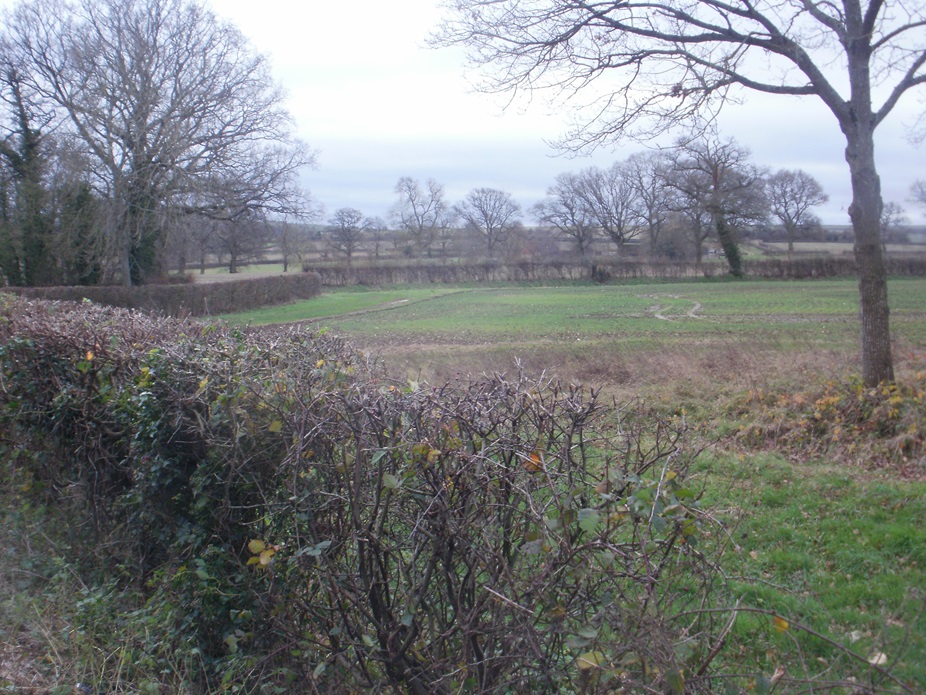
From the Fieldgate Centre on the edge of the village, we made our way uphill along a country lane and into the bare, wintry country, hearing the bangs of guns from a distant shoot ahead of us (luckily, not on our route, we don’t like being shot at). Just before turning onto a bridleway, we were hailed by an elderly countryman, and stopped to pass the time of day. He said he was on his way home – from where? no idea. He was also clutching a laden carrier bag – we had suspicions that it contained pheasant(s) “obtained” from the shoot going on a little way ahead of us – but we can’t prove that!
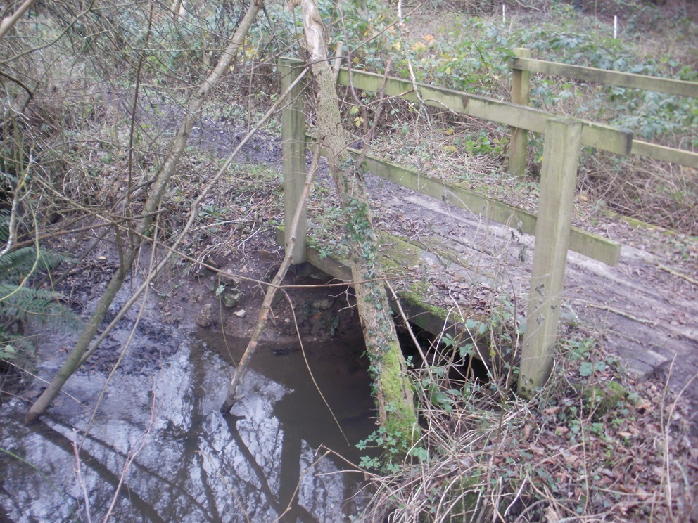
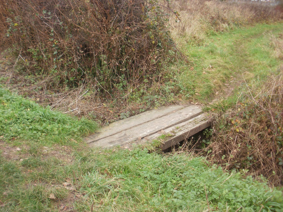
Once off the tarmac, it was damper underfoot, but a lovely walk through trees, part of the Brenda Parker Way, a long-distance footpath. We skirted a fishery, crossed a little bridge – there are lots of small footbridges on this route – and emerged onto fields. Other people had the same idea as us and were out for a pre-Christmas walk: most were very clean and tidy and we wondered if that would still be so once they’d negotiated the muddy path! Geocaching-wise, we were doing well, we’d already found eight caches, all but one from the Kaper series, and were making steady progress.
We emerged onto the A339, the main road between Basingstoke and Newbury. At the Star Inn, we saw that, again, other people were out for a pre-Christmas meal … but they weren’t watching us as we stopped to find a cache.
From here, we followed paths and field edges and made our way through the edge of the village. It was lunchtime, so we found a seat in a quiet spot for a picnic. (As an aside, this was one of our better lunch spots, overlooking the playground and allotments: we’ve previously had lunch in leaky bus shelters, industrial estates, graveyards …) Afterwards, we walked back out into the country, passing the community orchard : much better seats here, we shouldn’t have stopped so soon!
We walked in a loop through the countryside to the north, crossing a few more of those little bridges on the way. A brief furtle for a cache behind the postbox, then we made our way to the end of our walk along the delightfully named Frog’s Hole, following a little stream back up the hill; and a chance to cross yet more of those ‘little bridges’ that abound in Kingsclere.
Here are just a few of the many interesting caches we found:
A morning of reminiscing for Mr Hg137 who used to live about a mile or so from Buckhurst Meadow, on the outskirts of Wokingham. Back then the area was known as Buckhurst Farm and in the late 90s, the area could have been made the stadium for Wokingham Town FC. Instead local residents complained, the football club move was vetoed, and an estate of 620 houses was built.
As well as the housing estate much of the farmland has been turned into a 30-acre country park ideal for walking around and of course geocaching!
Normally our diaries are quite busy on a Thursday, but today, a few days before Christmas, our bookings had been cancelled – do we need a better excuse to go geocaching ?
Well the weather could have been better ! A misty, murky day greeted us as we set out. The December rain had made much of the grass very wet, but the paths otherwise were more or less good. Occasionally we stepped away from the path to find a cache.
The first cache brought back memories of the first cache we found just 5 days previously. Tucked near a post, behind a bramble bush. Fortunately this time the bush was relatively easy to lean over, yielding us a quick find.
Most of the caches we were looking for were set by local cacher, Mikes54, who gives very specific hints. We were grateful of this at the next cache where we had to find a cache at the base of a tree – the hint made sure we looked at the correct one from a choice of 4! We couldn’t grab this cache immediately as the tree was close to an intersection of footpaths, and a constant series of dogwalkers!
Fortunately our next cache took us away from the dog-friendly footpaths and into a hazel coppice. Here we had not only had to find a ‘knobbly tree’ but then count coppiced hazels to find the cache. We were grateful we hidden from prying eyes when we did this.
The Mikes54 caches had all been placed barely a month before our visit, but our next cache was much older having been placed in 2009. This was deep in area called ‘Big Wood’ which straddles the Wokingham and Bracknell boundary. We found some caches in the Bracknell side of Big Wood back in September 2022. The 2009 Wokingham cache was a quite easy find, albeit the GPS was 30 feet out. (We do find that the older the cache, the less accurate the GPS is – any ideas why ?)
We returned to Buckhurst Meadows and we should really have read the cache notes before we headed for cache 4 in the series. It advised, that after heavy rain, from cache 3 we should walk into the centre of the park via the central butterfly statue and take a different path to cache 4. We didn’t, and soon discovered the perimeter path was underwater. We waded through and around the puddle-cum-lake to arrive at a seat near Ground Zero. We gave a quick search for the cache but couldn’t find it. We saw a ‘cache-size hole’ at the front of a tree, and assumed the cache was missing. Then in the gloom, 300 yards away we saw a dog-walker approaching. Should we move on ? Continue searching ? The man turned away, and we resumed our search, and after few more minutes we had the cache in hand.
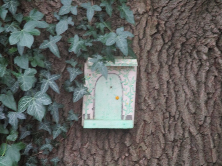
Our final cache in the Buckhurst Meadows series was closer to the car, so we took a path out of the meadows, passing a playground, a school and a pond. We arrived at Clay Lane – an enclosed wooded footpath Mr Hg137 remembered well as he sometimes walked their family dog there. Unsurprisingly, the lane had altered slightly in 40 years, many of the saplings had grown, the new estate provided less tree-cover on one side. On the other many of the gardens set back from the tree-line now had gates giving access to Clay Lane and Buckhurst Meadows.
In those intervening years, fairies have visited Clay Lane too. Their tiny houses nestled at the base of trees. We were admiring many of them… and walked by a cache. After walking a few yards, we retraced our steps, and after quite a lengthy search -found the cache. Another old cache as it placed in 2008!
We returned to Buckhurst Meadows and found the last cache snugly hidden behind a lifebuoy post, again near a junction of footpaths – so stealth was needed.
Close to Buckhurst Meadows were 2 more caches – both near the busy A329M. The first in a cul-de-sac that led to a hotel (in Mr Hg137’s time, the hotel was a nunnery!). The GPS wavered here but we soon found the tree the cache had been placed behind.
We crossed the A329 to find a most unusual cache called “It’s a Letterbox”. Letterbox caches, are named, after the ‘letterboxes’ found on Dartmoor. Geocaches of this type tend to have an ink stamp inside. The size of letterbox caches tends to be slightly larger than average, to accommodate the ink stamp, but the size of this cache caught us by surprise!
Somehow three weeks had elapsed since our last walk along the Ridgeway. Today’s section would bring back happy memories of an event that happened 11 years previously and we hoped we would be able to celebrate it with a photo.
We had 8 caches to find, over about a 7.5 mile mile walk – most of those caches were very close to the Ridgeway, but one or two required a small diversion.
At first we had a pavement walk of about a mile around the outskirts of Princes Risborough with no caches to find. Eventually though we turned onto a footpath, passing the time of day with an elderly man out with his three dogs, and slowly climbed uphill.
Definitely not the most scenic stretch of the Ridgeway
We were soon alongside a football pitch and a seat pitchside. We paused for coffee. On an adjacent seat a young couple were tending a newly-born baby – in fact it was only 3 days old! We wished them well and walked on. The path became steeper as we approached our first cache.
Sometime geocachers have the mantra ‘trust the GPS’ and other times ‘read the hint’. We decided to ignore the hint ‘Behind an information sign’ and strode away from an information board following the GPS a further 92 feet. Of course there was no information board there, and we searched high and low, in various bushes looking for something that wasn’t there. We returned to the information board, more in hope than expectation, and saw the cache’s hiding place. The coordinates of this cache must rank as one of the worst we have found. So much for ‘trusting the GPS’.
Then a very steep uphill. Very steep, with wooden steps winding upwards. The path was surrounded by trees, so the phrase ‘I’m pausing to admire the view’ (a euphemism for ‘I need a rest’) didn’t hold true.
Eventually though the woodland gave way to a flattish (another euphemism meaning ‘still going up, but a lot less steeply’) open green area with a seat. We walked on, and saw a couple more seats near a toposcope. This was close to the top, and just before the path continued through woodland. We slowed our pace to allow two ladies and (another) baby to leave before sitting down, admiring the view, and having an early lunch.
As we munched we were aware of someone running, or trying to run, through the undergrowth to our left. Strange. A few minutes later the runner came by us, heading downwards at great pace.
We had become so interested in watching the antics of the runner we hadn’t noticed a man approaching uphill towards us. ‘Are you up here to see the runners ? ‘ he asked.
We knew nothing of runners, so he explained that today was the Ridgeway 86. An ultra running race across the full length of the Ridgeway – we had just seen the lead runner! We then saw a further half dozen runners, each running through the undergrowth before finding the Ridgeway. We looked at the nearby Ridgeway sign, it pointed in a slightly wrong direction … into the undergrowth!
After finishing our lunch, applauding and encouraging the runners, we continued on the Ridgeway, and arrived at one of the checkpoints for the race. We informed the marshals of the poor signage, and they left to investigate further.
For the next 2-3 miles we encouraged the runners, pausing to find 2 caches each about 200-400 yards from the Ridgeway. Then we discovered that our strenuous ascent in the morning was nothing compared to the runner’s ascent. Much steeper, muddier and no helpful wooden steps. Most of the runners were understandably walking this section of their route.
The Ridgeway descended to a pub, The Plough at Cadsden. This was the pub where Prime Minister David Cameron accidentally left one of his children behind, and also where he entertained Chinese President Xi Jinping. Unsurprisingly on a warm September lunchtime the pub was doing a roaring trade, both inside and in the adjoining garden.
We crossed the road by the pub, and started to climb again, this time through an open meadow – the late summer flowers were still visible – a pleasant change from the dense woodland of earlier. At the edge of the meadow was a relatively new cache – found relatively easily. As we were locating the cache, the last of the Ridgeway 86 runners started their descent through the meadow.
We then had a 1-2 mile cacheless section. This section is cacheless for a very good reason. It borders the Prime Minister’s Country Retreat, Chequers. Formally a 16th century house, it passed through various families with nods to royalty (Lady Mary Grey, sister of Lady Jane Grey, was confined there for marrying without Queen Elizabeth I’s permission), and non-royalty as it has a lot of connections to Oliver Cromwell. It was gifted as a prime ministerial retreat in 1921. Our route passed the edge of the grounds, and we were very aware of high security cameras throughout our route.
Lots of stickoflage here !
As we left the outskirts of Chequers, the Ridgeway entered more woodland. Here there was a handy stump for us have a coffee break. As we did so, the two ladies and baby that we had seen earlier walked by. We had overtaken them when they were in the Plough at Cadsden!
The last mile or so of our journey was through beech woodland, we found a couple of caches – including one the size of a dustbin! … and then our 11 year re-enactment.
We re-found our very first cache!
This was our very first cache find…11 years ago!
Back in 2012, we were walking the Ridgeway for the first time. Also that year Mr Hg137 was given a GPS for his birthday in July – but it took us until September to suss the geocaching website, the GPS, pluck up enough courage to go hunting etc.. So our first cache, RIDGEWAY RUN – Linton’s Wood was about 50 miles from home, unlike most people who find their first cache a short distance from home!
This is what we wrote then…
Our very first cache – seemed straightforward – great introduction – thanks.
Our memory played some tricks on us, and we thought the cache was an ammo can, this is what we wrote 11 years later !
Continuing our 2023 walk along the Ridgeway. This time from Saunderton to Coombe Hill.
Back in 2012 we walked the Ridgeway too, we gained our first GPS in July (birthday gift to Mr Hg137) and with other commitments did not try geocaching until September as part of our 2012 Ridgeway walk.
This was our very first cache back in 2012. (Our memory says it was an ammo can, but we did remember the host correctly)
Thank you for maintaining this cache all this time. We re-signed the log book.
Since our first find we write blogs about our geocaching exploits and today’s trip down memory lane will be mentioned soon on https://sandhurstgeocachers.wordpress.com
The car park was close by, and we had one more cache to find. This took a bit of doing, as the obvious route to the cache was blocked by a barbed wire fence, but we found another way, although it did involve scrambling over three large fallen tree trunks!
So an eventful walk – watching ultra-marathon runners, seeing two babies, finding new caches and reminding us of our very first cache! Quite an eventful day on the Ridgeway!
Every week, for many years in the early 2000s, we would travel between Wokingham in Berkshire to Hinckley in Leicestershire. Our route took us around the Southern Bypass of Coventry, and only a short distance away from that bypass is Brandon Wood.
When we had an opportunity to participate in a Scrabble tournament in Coventry it seemed too good an opportunity to miss. Remind ourselves of journeys past, and to go geocaching in some woods well away from our normal circuit.
So after 10 games of competitive Scrabble (played in less than 22 hours) – and Mrs Hg137 winning her division – we arrived at Brandon Wood. (Admittedly Mr Hg137 took a couple of wrong turnings from the Scrabble venue to Brandon Wood, but we’ll gloss over that).
Brandon Wood has had an interesting history. It can be dated back to prehistoric times and was left standing by both Neolithic tribes and the Roman invasion. It is also mentioned in the Domesday Book.
During the Middle Ages, timber was used for housebuilding, during the Georgian/Victorian times the wood was used as a shooting venue. The Beech Family took it over in 1844, and eventually had to cut down many of the established trees post World War Two to pay for death duties.
The Forestry Commission took over the Wood over shortly after, and were about to sell the woodland for gravel extraction in the 1980s but the Friends of Brandon Wood had other ideas. They agreed to run the woodland (as volunteers) and saved the wood for a few years. It was the first community woodland in England. The Forestry Commission did sell the Wood, in 1996, to the Friends of Brandon Wood for £100,000. The woodland will remain in the hands of the community in perpetuity.
Over the years the Friends have reinstalled and repaired paths, coppiced trees, and made it a delightful place to wander around, and in our case, geocache.
There are about 20 caches dotted throughout the wood, We limited ourselves to 10, which would make an excellent couple of hours exploring. Many of the caches were small ‘insects’ wedged into trees. We hadn’t realised this at first, and so our first find took some time. But once we had the modus operandi worked out, our searching became quicker. Then the insects became lizards….then the lizards became more familiar containers!
Our GPS played a few tricks too, as sometimes it directed us to trees one side of a woodland stream, when the cache was on another.
Dotted around the wood, are various wooden seats (good places to hide a cache), and interesting wooden sculptures. Small ponds punctuate the woodland, and we imagine that after a lot of winter rain, this wood could be very wet and very muddy. Fortunately for us, the ground was dry-ish.
The local youths had made two ‘dens’ in the wood – both of which were close to cache containers. One of the containers we found – quite tricky as we were in clear line of sight of two lads using the den; the other den yielded our one DNF of the afternoon.
We highly recommend these woods as great place to explore – different types of trees, woodland flowers, and if you are lucky you may see a muntjac (we did!), as well as the insect life close to the ponds.
We had some work deliveries to do in Woodley, between Reading and Wokingham. Noticing there were a few geocaches nearby, we decided to combine business with geocaching. After the work bit … we moved the geocar a little way, close to South Lake and Highwood nature reserve.
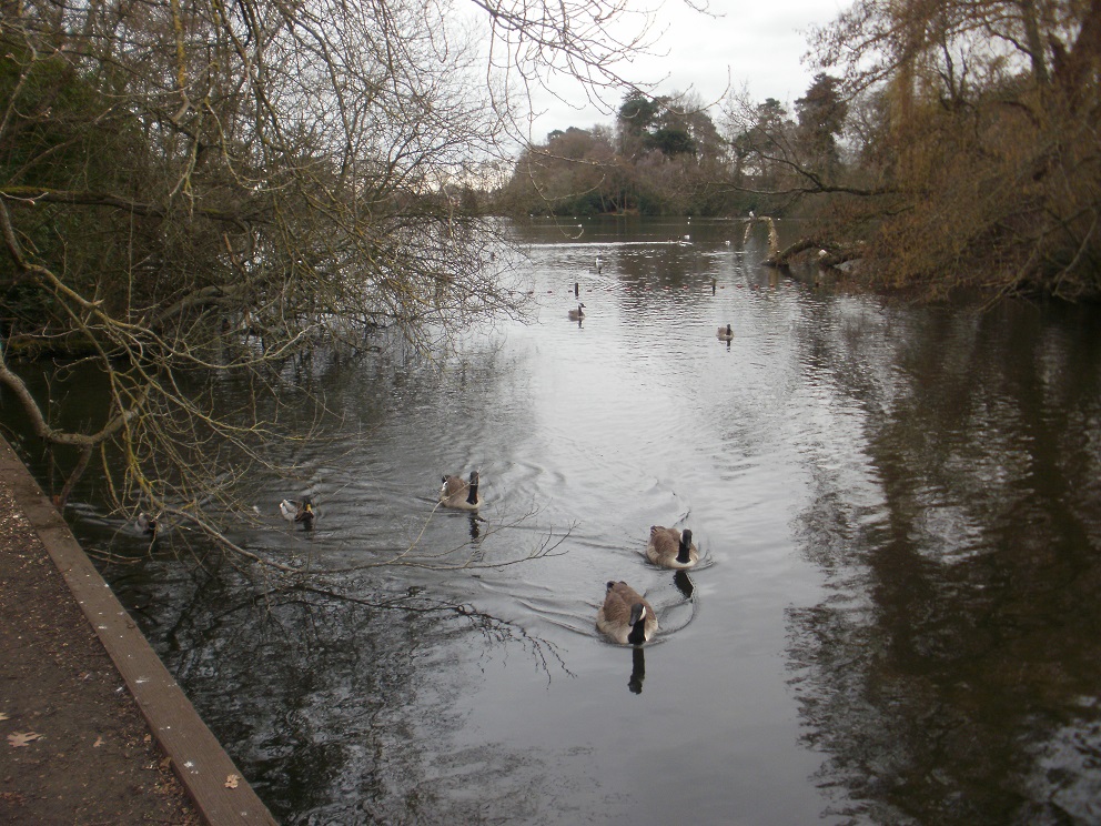
After finding a suburban cache near a church, we went for a stroll around South Lake. Even on a grey day in early spring, the lake looked great. Wildfowl of many species thronged the lake, and red kites mewed overhead – all very pleasant. And it’s popular with the locals, too, a lot of them seem to walk around the lake as their daily exercise.
The stroll had another purpose: we were collecting coordinates to find a Counting Vowels cache (assembling words and phrases from notices / signs /labels, you add up the vowels and arrive at a set of coordinates, where you hope to find a cache). The cache, and also our remaining targets for the morning, were to be found (we hoped) in the Highwood nature reserve, adjacent to the lake.
By now we were wondering why there was a chunk of lake and woodland amid what is quite a built-up area. Back at home, a bit of research told us that South Lake was originally a fish pond, and was enlarged into the current lake in the early 1800s. There was also a smaller lake, North Lake, a little way away, but that disappeared under housing about 50-60 years ago. And Highwood nature reserve used to be part of Woodley Lodge, which had an arboretum in the grounds, which explained why we saw some unusual trees in the woods. The Lodge has also disappeared; Bulmershe School was built on the site, also around 50-60 years ago.
Sequoia
We set off into the woods and followed clear paths back and forth to find the Counting Vowels cache, plus another, squirrel-themed cache (though we didn’t spot any squirrels). We’d been doing well so far, but our final cache was a total failure. We got to within a few paces of the cache, according to our GPS, and were looking for something like “a hole in a mossy stump”. We examined every likely object in the vicinity. Maybe we weren’t being observant enough, but we couldn’t spot it. We decided to give up when we started asking each other questions like … how tall does a stump have to be before it’s a tree?’ … ‘how much moss is mossy? … ‘how big/small does a hole have to be before it qualifies?’ … and we knew then that we weren’t going to succeed! (FYI the cache has now been moved.)
And that concluded our morning of work and geocaching. We went home to the “office” for lunch.
Holybourne is a delightful village just off the A31 a few miles North West of Alton.
Holybourne Church
The village has Roman connections as it was the crossing point of two major Roman roads (Winchester to London and Silchester to Chichester). The village takes its name from the stream which rises by the village Church, Church of Holy Rood.
We had about 8 caches to attempt in the village and the chalk downland to its North. Our first cache was close to the village theatre. Holybourne hosted a German prisoner-of-war camp, and the camp theatre is where the village theatre stands now. In the weeks before our arrival it had hosted a ‘Jeeves and Wooster’ play and a pantomime.
First cache of the day…outside Holybourne Theatre
The cache at the theatre, like many we were going to undertake, was a little bit out GPS wise, and we never quite understood why.
We walked through the village centre, admiring garden after garden of beautiful snowdrops, and another garden with a distinctly ursine twist. Our target was the Church, and the Church Multi-cache associated with it. Numbers were collected easily from a bench erected in 2000. As we calculated the waypoint for the cache’s hiding place, we counted at least 30 different birds on the Holybourne Pond by the church.
Isn’t amazing all the birds disappear when the camera comes out!
Counting complete, we headed along the St Swithun’s Way to find the cache. An easy find, and one which Mrs Hg137 spotted some yards from its host. The St Swithun’s Way is a ‘long’ distance path of about 34 miles linking Winchester to Farnham. We walked it, in our pre-caching days, in 2010.
At this point we were just on the outskirts of the village, but now we walked further away, gently climbing towards the top of Holybourne Down. Initially we were following a sunken track with trees on both sides, but after a while we arrived at a stile (and another cache). We paused for coffee, sitting on the stile, and reviewed the route ahead. A much steeper climb. We had two choices, one was a footpath over a soft grassy field, the other a permissive path with barbed wire on one side, and brambles on the other. Normally we would have taken the grassy path, but with a cache near to the permissive path we tackled the brambles. We were grateful it was February, as the brambles had receded during the winter, and didn’t impede too much on our ascent. The cache was found quite easily, and apart from a minor diversion avoiding a fallen tree, we soon re-joined the footpath at the top the hill.
We had views in most directions from the top, looking North East past Farnham and beyond, and the West to Alton and further afield.
Our descent down followed farm tracks, which we were a little wary of. The first few of these tracks were NOT marked as footpaths or bridleways, and there was a slight doubt in our minds that we were trespassing. But there were caches to find by these tracks, so we had to follow the tracks to find the caches.
The tracks led us around several farmer’s fields. Each field was separated from another by a thin ribbon of trees, perhaps 4 or 5 trees wide. Our next 3 caches were hidden in these ‘ribbons’. Caches were hidden variously in tree roots and boles, but always in the centre of the ‘ribbon’. We could search in peace, though this didn’t matter too much as we only saw 2 other walkers during our searches.
We eventually rejoined the sunken track that we had walked up earlier, but this time headed South back towards the village. A cunningly hidden cache, near a footpath sign was our final cache of the day.
We had arrived about half a mile from the car, and our pavement walk back gave us a chance to admire the village shops, and the former house of Elizabeth Gaskell (Author of ‘Cranford’ and ‘North and South’). Sadly on her first visit after buying the house, she died of a heart attack.
Elizabeth Gaskell’s House
A sad end to our walk, but a walk with history throughout, great scenery, and great caches too.
Donkey Town is a small village just south of Lightwater and just north of Bisley. To the West is an Army range and to the East the busy A322. Between Donkey Town and Lightwater is an area of heathland, known as Brentmoor Heath, owned by the Ministry of Defence, Surrey Wildlife Trust and 2 local councils.
Surrey Archivists are unclear how the unusual name ‘Donkey Town’ evolved. It may be that donkeys, a cheaper working animal than a horse, were kept there. It may also be the ‘donkeys’ was a slang term for ‘labour workers’. Either way the area of ‘Donkey Town’ first appeared on Ordnance Survey maps in the late 1800, possibly coined by locals.
Given this somewhat un-salubrious history, we were pleasantly surprised both by the area and the quality of caches.
We were attempting the LG series (LG being the initials of the cache owners, The Laing Gang). We parked in a small car park adjoining the A322. We took the last space at 9am Saturday morning (bad timing as this was peak dog walking time) avoiding the tree roots which straddle the car park.
We set off following the dog walkers. Some walkers kept their dogs on a lead, others the dog ran ahead, other dogs walked 20 yards behind their owners. To us, non-dog owners, sometimes it was tricky to see who owned which dog.
Eventually we arrived at cache one, Hidden in a tree hollow. Or a least should have been, all we found was a hole in a tree. However hard we poked and prodded the cache was missing. A bad start.
No cache on this hole – sadly!
We wandered on, following yet more dogs and their owners, arriving at a metal sign. With a hint of ‘magnetic’ it didn’t take us too long to locate the cache.
We had broadly been walking westwards, but now we headed South, to a curiously named cache called ‘Empale Lot’. The key here, is that the cache title is an anagram, which we managed to solve before arrival. Another cache in the series – surprisingly well hidden – well we took several minutes– was an anagram of ‘Scone Tips’.
This series not only had ingenious titled caches, but ingenious containers too. They included a skeleton hand, various insects and a 1970s radio!
After the first few caches, the dog walkers disappeared, and we saw few people. The one person of note, was a former networking colleague of Mr Hg137, who also performed very well on a previous series of “The Apprentice”. A brief chat ensued, but he was on a tight timescale, as he had tickets for the England-Scotland game at Twickenham later that day.
“You’re Fired” – a former Apprentice contestant runs into the distance
The heathland became less wooded, and more open and the Army ranges opened up beside us. We were about halfway round, and we had now accumulated a further DNF to add to our first attempt of the day.
We had had spent a few minutes at many of the caches to this point, but it was nothing compared to two caches on the second half. Hidden exactly as hinted… but… the GPS never settled, there were several host items. In the end we resorted to a phone’s GPS as well a standalone GPS, and a very, very close inspection of a few of the photographs placed on www.geocaching.com.
We turned North heading back to the car, and at this we point we crossed another caching route. We attempted one of the caches on this route ‘There’s no place like Gnome’. And indeed, in the third set of tree roots we looked at… was a Gnome! A great container.
We were chuckling to ourselves as we replaced the cache, and noticed a cyclist, going at no great speed behind us. He was clearly ‘unaware of his whereabouts’. We advised him on what we thought would be the quickest route for him, and watched him slowly pedal away.
We walked onto a footpath, picking up a cache under a bridge called ‘Welcome to Donkey Town’, given where we were walking we had to find this cache!
Another DNF soon followed – a puzzle cache placed near a stile/gate. We searched both thoroughly as well as a nearby tree. As we did so, the cyclist reappeared, his route finding hadn’t improved much and we set him on a different path. (Note, we were on a footpath, NOT a bridleway so technically he shouldn’t have been there).
The LG series was coming to an end, and we had one more ‘clever cache’, an insect to find as well as a fairly standard magnetic cache..
We arrived back to a much emptier car park, satisfied with our exploration of Donkey Town but slightly disappointed with 3 DNFs. The caches we did find were clever and varied and we wondered what we missed out on with those 3 DNFs.
Swinley Forest is an area of woodland to the South and East of Bracknell.
Today’s caching trip was in a ‘diamond’ shape bounded by 4 major roads (The A329 to the North, the A332 to the East, the A322 to the South and the B3430 to the West).
Our main aim was to visit 4 standard caches broadly close to each of those roads (and appropriately named North, East, South and West). We had solved a couple of puzzle caches which we hoped to find on route, as well as another cache in the centre of the forest diamond.
One of the puzzle caches we had solved was a simple picture identification task once the cache title ‘nice tours, erotic sun’ had been interpreted. The other was more obscurely titled ’30 / 7’. Within the puzzle we had to ascribe numbers to simple words like ‘PANS’, and ‘DANCE’. Once inspiration struck, the puzzle was quickly solved.
One of the puzzle caches was hidden in a holly tree. Deep in a holly tree. There were several at GZ, but one large specimen stood out. We circled it several times, peering into it to no avail. We decided the best way to locate the cache was to scramble into the tree, through lots of prickly leaves and look outwards. Mrs Hg137 volunteered (!), while Mr Hg137 re-read previous finder’s logs. One of the logs made mention of the many dog walkers, which indeed there were, but to find the cache, one had to ‘stand where you cant see the dog walkers’. Mr Hg137 sidled around the tree, hiding himself more and more from the footpath. He looked in… and found the cache. It was easier, just, for Mrs Hg137 to be directed to it..before she left the tree incurring a few more scratches.
Our second puzzle cache find, was in a much quieter location and trusting the GPS implicitly, Mrs Hg137 found the cache in an instant, and in a far less prickly place.
The Northernmost part of our route
Then onto the Compass Series.. North was nearby and we managed to find the cache and leave GZ before a dog walker came by. We even found a trackable too called Travel Toad.
To reach East, we had to cross the centre of the diamond passing another cache ‘Mr Jennison’s Fridge’. An intriguing title .It referred to the ice house of a former grand house in the forest. The cache description provides the following information :
The cache is placed very close to the site of an old ice house belonging to Swinley Lodge. Until the 1820’s (when it was demolished) this was the official residence of the Master of the Royal Buckhounds. It was the location for the monarch and his entourage to meet for breakfast when they were hunting in this area of the forest.
During the reign of George II the hunt’s master was a Mr Jennison. He was a thorough representative of the conviviality of the age, a “five bottle man” who would not allow his friends to walk away from the table.
The ice house was a deep, brick lined pit, surrounded by a circle of trees. In its shady depth food was kept fresh for as long as possible.
Part of a semi-circular entrance to Swinley Lodge
Sadly for us, the ice house has long gone and the cache seems to have disappeared too. After much searching we logged a Did Not Find. Always disappointing to log a DNF, but as there had been a couple of DNFs by other cachers in the weeks before our visit, not unexpected.
Up to now the paths had been dry, sandy heathland paths, but on our way to East the paths got muddier and muddier. Drainage ditches ran parallel to the paths, and we spent some time picking our way between less muddy sections.
East was quite cunningly hidden (well in Mr Hg137’s eyes). In the bole of a tree. A small bole. Mr Hg137 removed the ‘tiny barkoflage’ and found nothing. It was the only tree of note, so Mrs Hg137 had a feel. She discovered the bole had a kink in it, and the cache was hidden beyond the kink. Very clever!
The day was cold, and we were now at the furthest point from our car, with two caches still to find. South’s hint was ‘stickoflage’ and the GPS resolutely pointed to one particular tree – sadly for us, we couldn’t find the stickoflage or the cache. We did note though the cache had not been found since November, and since then there had been a substantial leafdrop covering the ground. Perhaps after a few more weeks the stickoflage will be visible, but for us, our second DNF of the day.
So we headed another back to our car passing West as we did so. Unlike the other caches, this was clearly visible, but protected by a large tree. It was only as we peered through the lower branches could we see the cache at ground level. An easy find, and another trackable too (The Tourist).
So 5 caches found of 7, but more importantly a great walk in a part of Swinley Forest we have barely explored.
We hadn’t been on a long geocaching trip for ages.
Beautiful Sussex Countryside
We noticed a 30 cache series about an hour’s drive away in North Sussex – called TACT. The cache owner AnTsInRpAnTs named the series The AnTs’ Caching Trail and abbreviated the full name to TACT. We had undertaken some of his(/her?) caches before and enjoyed what we encountered – we were expecting a great day out.
Let’s hope there isn’t a cache in there!
The 30 caches were mainly set in woodland. In each cache there was a bonus number, and using the bonus numbers we would be able to calculate the coordinates to locate a bonus cache, TACT31. Frequently bonus numbers are hidden randomly throughout the route, but this time the Cache Owner had hidden the same bonus number in caches 1-3, another number in caches 4-6, etc and the tenth number was in caches 28-30. This meant providing we found a reasonable number of consecutive caches, we should have the numbers for the bonus.
The entrance to the woodland near cache 9, fortunately we didn’t see any tree felling
The Cache Owner had suggested 2 car parking spaces. The first near cache 1, seemed very small when we checked it on Googlemaps, so we decided to park at the other suggested location which was closer to cache 9.
This gave is a problem as the bonus cache, cache 31, was likely to be close to cache 30 (the end of the series) or near to cache 1 (the recommended parking).
“A little deviation”… read “climb over a few branches”
But with a little deviation from the suggested route, we thought we could get most of the bonus numbers before arriving at the likely hiding spot for the bonus. Our route was cache 9, 10-14, a short diversion to cache 6, then continue from cache 15 to 30. This would mean we would only be missing the bonus number from caches 1-3.
Mrs Hg137 walking over a plank bridgeMr Hg137 undertaking some tree climbing
The woods are very quiet. Many cachers mention in their logs that they don’t see a soul all day. We weren’t quite that lucky, as we saw possibly 3-4 dog walkers and a couple of other ramblers. Most of the times we weren’t near any caches.
The first exception to this was when we were at the only multicache on the route. Most multis take you to a spot and then you collect some numbers to derive the further coordinates. This multi was different. Hidden deep in a fallen tree root were about 10 plastic carrots. We had to ‘pick’ each carrot, examine it and discover the hidden numbers inside. Of course, the carrots we initially ‘picked’ yielded nothing, and it was the final two carrots which were profitable. As were putting the new coordinates in our GPS we were we aware of some dog walkers about 40 yards away. Fortunately they didn’t ask what we were doing, as it would have been a tricky story to make up armed with a plastic carrot in our hand.
Pick a carrot, any carrot
Most of the hints were straightforward and yielded a relatively standard cache container. However, just occasionally the hint had to be ‘interpreted’. Two such hints were ‘in line with the bridge’ and ‘French starters’.
The first of these made sense as we walked over one of the many plank bridges as a large tree was directly opposite. ‘French starters’… yielded a snail!
The weather was very good for early October. We could still believe we were still in late Summer temperature-wise, but the brown leaves on many of the trees hinted to the correct season.
All but one the caches had been found a few weeks before our trip. We decided to have a good search for this previously ‘unfound’ cache. It had been logged as ‘Did not Find – too many brambles’, so we took heed of this comments and managed to find a small path which went behind most of the brambles and led to an easy find.
The Grounds of Rikkyo School
Shortly after the we joined the Sussex Border Path – a path we walked part of during our Sandhurst (Berkshire) to Sandhurst (Kent) walk in 2018. This section of the path cuts through the grounds of the Rikkyo school (A Japanese School), and shortly after a war memorial to a WWII plane crash overhead.
Our pause for reflection at the memorial stone, must have affected our navigational skills. As, shortly after leaving it, we totally lost the footpath ! The GPS pointed yards into a vast thicket of brambles, but no footpath could we see. Eventually we found something better than brambles, and it was a relief to find the cache too, which meant we were back on route!
We were approaching caches 28-30, which would yield the last of the bonus numbers we could find without recourse to caches 1-3. We did some quick calculations to verify the bonus cache was not in the vicinity of caches 29-30 (it wasn’t), and continued our walk to cache 30.
A rare section on tarmac
At this point we had found every cache we had attempted. (A rarity!) We didn’t want to DNF a cache this late in the trail.
But cache 30 caused us some angst. A familiar hiding place. A stile surrounded by bushes. The bushes lent themselves to ‘hanging’ a cache. But we couldn’t find the cache. We checked both sides, we checked the stile, we checked the GPS, we checked previous logs, we checked the stile again, the checked the bushes again… and eventually on our fourth check, we found the cache! Phew!
Having found cache 30, we had a good idea that the bonus – cache 31 – would be nearby. We were still missing one number (because we hadn’t found the number in caches 1-3), but we could make some appropriate guesses. We tried one number and drew a blank, We guessed at another. Another blank. At our third attempt we were pointed at a very reasonable hiding place. We both looked, and after a few seconds Mr Hg137 saw the cache – an ammo can! Well worth finding the bonus!
After our successful find, we had only a few more caches to find (1-3, 4,5, 6 and 7). Most were straightforward finds, though one did require walking some yards past the cache and walking back and going up a steep bank).
When we finished we had found 31 caches. This equalled our second highest number of caches found in a day. No wonder we were quite exhausted ! It took our total caches found to 3998. So close to 4000 !
The Puzzle Detectives series near Finchampstead was divided into 3 mini-routes of 6 caches. The 6 caches we had left to find were on the Finchampstead/Barkham border. The weather had got very, very hot, and just leaving the house was unbearable, so we waited a few days until the temperature had dropped to a tolerable level.
Like the original puzzles we had to answer simple questions about detective series to ascertain numbers to yield coordinates.
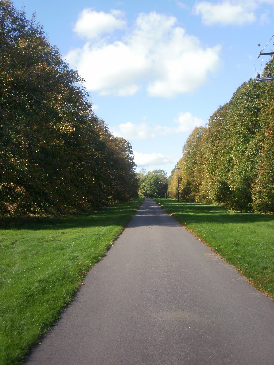
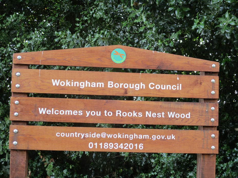
Today’s caches were hidden mainly in an area known as Rook’s Nest Wood and Country Park. The agricultural land was taken over by Wokingham District Council as a SANG (Suitable Alternative Natural Greenspace) in 2011 and boasts a myriad of paths, some streams and a pond.
We parked at the car park. One of the caches was near the car park and, with a very specific hint, we knew exactly where to search. Our quick inspection yielded nothing. We couldn’t search for longer as a dog walker returned with her two dogs and was half watching our antics. We left the cache for later.
After some discussion, we chose this path… it was wrong!
Several paths led away from the car park, and we had a minor dispute as to the correct one (we went with Mr Hg137s suggestion, but we later discovered Mrs Hg137 was correct!). As a result we took a slightly longer route than necessary to our next cache. As with all Mikes54 caches, the hints are very exact. All we had to do was find a silver birch and a beech tree and a mini birdbox would be the cache. Silver birches and beeches are easy to spot, but it still took us a bit a time, and the bird box was very small ! We extracted the log, signed it and moved on.
Shady woodland
We walked through woodland which provided some cool cover. Back in the open we followed a stream line, to a ‘lonely post’. Even though there had been little rain, the stream had orange traces, and we wondered why. The cache was attached to the ‘lonely post’, and a quick find.
Why is the stream and pond orange ?
We were heading in the direction of Barkham church, and just before we reached it, we turned through 90 degrees onto another footpath. The path narrowed, and just before a stile a large tree and excellent barkoflage provide the hiding place for our third find of the morning.
Barkham Church
Unfortunately the route is not circular so we returned the same way, taking a minor diversion for some sustenance in the churchyard.
Through the wood again, but this we exited in a different direction. We had two caches to find before reaching the car park. Mr Hg137 had loaded the coordinates in the GPS but had mislabelled the map. We thought we were walking to one cache, but in fact the GPS was saying another was much nearer ! Oops !
So after a quick recalibration of our thoughts, we found the ‘nearer’ cache ! Another bird box ! This one covered in false ivy. A very good hide.
So one more cache before returning to the car park. As we strode on, passing a lake, presumably used by cattle, we were aware of 2 people with dogs behind us. We arrived close to GZ, and pulled out our water bottles. It was beginning to get hot, so this action was not too suspicious. We waited for the dog walkers to go out of sight, before finding the cache.
We crossed a couple of bridges on the way to the Car Park discovering why the streams were an orange colour.
The Car Park was empty, and we had another attempt to find the first cache. This time we widened our search and found the cache quite quickly. We had solved the puzzle some time ago, and the hint had changed, so we had out of date information which explained why we struggled earlier..
So all 18 of the Finchampstead Detective series found over 3 attempts including some clever hides.