January 20 : Weybridge : our 800th blog post

Hello, Mrs Hg137 here.

Weybridge, Oatlands Palace Gate

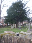
At last, a few days without rain!   Off we went to Weybridge, on the south-western edge of London, for some geocaching with firm, dry paths underfoot.   After finding some free street parking, we made our way towards the town centre, and the parish church, St James: we needed to count some objects in the churchyard and then to use them to derive coordinates giving us the location of the Church Micro cache nearby.

While in the churchyard, gazing at an impressive tomb, musing, we were approached by a passer-by, who stopped to give an enlightening talk about the town and its history, which gave us information we would use for the rest of the day.    The tomb is that of Princess Frederica Charlotte of Prussia – Duchess of York. A monument was erected to her – we’d visit that later, there’s another cache close by there.

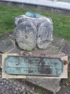
Anyway, we worked out some coordinates for the Church Micro cache, a little way away, and decided to return to them later.    We walked out of the busy town centre and through quiet residential streets, collecting some caches as we went.    Looping back towards the town, we reached Monument Green.  The monument commemorates the Duchess of York, whose grave we’d seen earlier.   It was originally topped by a sundial which came from Seven Dials, in central London.    This proved a bit top heavy, so it was removed and is now on display by the library; we saw it later, and it was waaay too heavy for that slender column.    The adjacent cache was a milestone cache for us – 4500 finds !!! – and it’s a good location, an interesting place we wouldn’t have visited otherwise.

Fancy entrance to Portmore Park

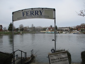
From the green, we headed north, passing some impressive pillars which used to lead to Portmore Park (it’s now a housing estate).  We soon reached the river, at the confluence of the rivers Wey and Thames.  Both rivers were high, just within their banks, and flowing fast.  Just downstream was the Shepperton Ferry.  This place brings back memories – back from 2015 when we walked the Thames Path (it’s the only ferry crossing on the whole, nearly 200-mile path). Actually, our main memory was of hanging around on the far side of the Thames for about 25 minutes, waiting while the ferryman finished his lunch (or whatever he was doing!).  As the river was much, much higher and faster today, the ferry wasn’t running, but still a great spot and much reminiscing.

Passing D’Oyly Carte Island, we turned away from the river and followed wooded paths and fields back into the town.   Once there, we realised we’d missed out one of the caches on our list (doh!), so back we went, to look for ‘Orinoco’s Favourite space’.  We were expecting something to do with litter and Wombles, but, no, it was much-loved by the cache owner’s dog.   While searching, we were hailed by a dog-walking muggle (non-cacher), wanting to know if we were doing ‘a survey’. Sort of, we said, and Mr Hg137 explained geocaching to him while Mrs Hg137 found the cache container.

D’Oyly Carte Island

Also, once here, we realised we were very close to the location of Oatlands Palace, now a housing estate, once home to Princess Frederica.   We asked directions from a passing local and soon found ourselves at the surviving walls and archways of the palace.   Very interesting, we wouldn’t have come here but for the local historian we’d met in the churchyard earlier.

Back to the church, to find the Church Micro we’d calculated the coordinates for at the very start of the day.  Those coordinates (oh dear): we made not one, but two, howling errors, while working out the numbers, and spent some while searching an entirely wrong place, not once, but twice. We eventually started again, read the description properly and came up with some correct numbers which finally, finally led us to the cache.   (One of us has a degree in ‘hard sums’: we should have done better!)

Close to the church is a park and allotments (unusual to have such a big open space so close to a town centre).  while walking across the park towards a geocache, Mr Hg137 suddenly slowed, saying … ‘watch that man’ … he was just ahead of us, heading for a spot oh-so-close to where we were going, too. He bent down and picked something up; we walked up to him. Aha! a cacher caught red-handed! Good to meet you, Flyingfox76 ! Also good to meet you, mummycherub, who appeared very soon to ask to be added to the log. We swapped tales of caching, then went on our separate caching ways.

mummycherub and Flyingfox76

Our caching was nearly done now: we followed peaceful suburban streets to the south of the town centre, finding our last few caches, and returning to the geocar.   We enjoyed Weybridge: it had far more to see than we were expecting, lots of history, attractive corners, rivers, parks, and glimpses of the past.   A good place for a winter walk!

Here are a few of the lots of geocaches we found:

September 30 : The Ridgeway : Coombe Hill to Wigginton

Hello, Mrs Hg137 here.

Coombe Hill

Our weekend trip to the Chilterns to finish walking the Ridgeway didn’t start well.   We had a 9:30 appointment, waited through a motorway traffic jam, drove round a diversion caused by the HS2 railway construction works, and didn’t start walking till about 11:30, much, much later than usual.   And the days are shortening fast at this time of year …

We retraced our steps to where we’d finished the previous walk, just short of Coombe Hill, and set off along the steep ridge overlooking the Vale of Aylesbury.   Very soon, it was time for the first geocache of the day, View from Coombe Hill.   We’d found this cache before in September 2012, on our very first ever day’s caching.   So – we’d already found it – why visit again?  It’s the oldest surviving cache in England, placed in January 2001, and has been logged almost 3000 times (and we didn’t realise this when we visited before).  It seemed only fitting to revisit it and pay our respects.

England’s oldest geocache

The cache is part way down a very steep slope.  We scrambled down; a family was walking along a path lower down the hill; we waited for them to go by … they didn’t, but instead began climbing the slope … we were heading for the same place.   We met up at the cache and swapped trackables and stories with them; nice to meet you, GeoHunter170, and we hope the cache lasts for many more years.

It’s not far from the geocache to the monument at Coombe Hill, with tremendous views all the way.   We spent far too long here, taking pictures, admiring the view, doing other caches, and having lunch.  Finally we set off down the long ridge which led to Wendover, which lies in a gap in the Chiltern ridge.   From this direction the view has changed, not necessarily for the better.  HS2 is being built across the valley with a massive, motorway-style construction site across our route.   It definitely wasn’t like this when we were here before!

We walked through Wendover town centre and turned onto a path beside a stream which led to the church.   The church was busy, bellringing practice was under way, so we wandered round the churchyard, listening to the bells and collecting coordinates for a Church Micro cache.  Having worked out the location, we decided it was too far off route: it was now mid-afternoon and we were well behind time.  Once out of town, we climbed up a very steep hill, through Wendover Woods and back onto the ridge.    We threaded our way across woods and fields – sadly,  the earlier views were missing – making our way towards the end of the day’s walk at Wigginton.   There weren’t many caches along here, and we couldn’t find a single one that we searched for, not one.    Each unsuccessful search took up time: if a cache is found quickly, you can move on quickly, but there is always the temptation to keep looking, keep looking, keep looking if a cache can’t be found.    It was now early evening and the light levels were dropping fast.

Having started late, we were now even further behind time; today had NOT gone to plan.  As we approached Tring Park, dusk was upon us.   We had a choice: a longer walk through the park, likely missing any caches in the gloom, arrive back at the car in the dark, and still have a drive back to get the car at the start point: or we could take a short cut back to Wigginton along a nice straight track (once part of the Ridgeway, now re-routed) and hope to finish a bit earlier.    We debated … then chose the short cut … ho hum, we’d have a longer walk the next day.

Reaching the end:  now back to our start point to collect the other car, via the several-mile-diversion round the HS2 works.  We had another problem: We’d booked an evening meal at our hotel and there was no way we would get there in time.   A fraught journey back in the dark, along narrow, unfamiliar roads (including a diversion to the hotel to rearrange the meal), and through roadworks, and we arrived back at Coombe Hill car park in complete darkness.  We finally reached our hotel two-and-a-half-hours later than planned, in total darkness, with 15 minutes to go to our meal, and scraped into the restaurant in a state of dishevelment. All in all: a day that started badly and didn’t get better!

The end of a looong day!

September 26 : Abbotsbury and the swans

Hello, Mrs Hg137 here.

On a sparkling bright Saturday, we were out to do touristy things in delightful Dorset. There would be a few caches too, of course!

Abbotsbury Swannery opened at 10am, and we were in the village earlier than that, with time for just one cache before opening time, the appropriately named ‘Swans’ – a puzzle cache that we had solved at a few days earlier. There was a cryptic paragraph of text to consider, then some sums, which made little sense at first. An ‘aha’ moment followed, and the equation below made sense:
N50 Young Swan . Cygnet/4 (Mute Swan + 1)
W002 (Mute Swan * 2) . (Young Swan – Eggs – Cygnet/4) (Swan&Cygnet – Cygnet/3)


Then it was off to see some swans. I’ve been to the Swannery before, most recently in the late ‘90s when I helped with the Swan Census. It is just such an extraordinary experience to be handed a live, wild swan. Here’s a video of the swan census

We spent a couple of hours at the Swannery, going around the swan-shaped maze (Covid restrictions have made it into a labyrinth, but it’s still good), then the swannery itself, the duck decoys, and the prototype bouncing bomb recovered from the Fleet.

Socially distanced maze

Socially distanced maze


Bouncing bomb

Bouncing bomb


As we watched the swans, I wondered if I had seen any of them before: wild mute swans can live almost 20 years and where they are looked after (as here) it can be longer. It’s possible that some of the swans here now are children (or grandchildren) of the ones I helped to count. Or … if they were very young at the time of ‘my’ census, and quite old now, swan-wise, some of the very same swans …

Next on our pre-booked list of things to do was the Abbotsbury subtropical gardens , but we had a little while till our timed ticket, so we headed for the beach.

Chesil Beach

Chesil Beach


It was Chesil Beach – where we sat on the shingle, enjoyed a picnic lunch, and watched the sea anglers. And then, just up the road, were the gardens, which were lush and jungly, with a walk out to a superb viewpoint over Chesil Beach, over to Portland to the east, and, in the distance, Start Point in Devon to the west. We went round twice just to make sure we didn’t miss anything.


Next, in mid-afternoon, we made our way back into Abbotsbury for a bit of geocaching. First of all: a Church Micro cache: the church is adjacent to the village car park so it was a very short walk into the churchyard to locate the answers to the coordinate clues, then another very short walk to the final location. Once there, the GPS didn’t seem to point to the correct place, and nothing very close by matched the hint, but widening the search a little and a ‘cacher’s eye’ soon spotted the hiding place. (Editor’s note: as you find more caches you get an idea of the kinds of places that caches might be hidden and tell-tale signs to look out for).
Abbotsbury Church

Abbotsbury Church


Abbotsbury village

Abbotsbury village


Our next cache lay along a disused railway line, the Abbotsbury branch line Who’d have thought it – a disused railway line in Abbotsbury! And we doubted it, too, as we walked up a farm track leading to the cache. Then we turned a corner, and were unmistakeably on an old railway line, flat and straight, a shape of a platform on the right and a railway shed ahead. A short distance further along the old line was the cache, cunningly hidden amongst some old railway items.
Railway shed - where are the trains?

Railway shed – where are the trains?


Our day in Abbotsbury was now done. On our way back to the hotel in Dorchester we climbed Portesham Hill onto the Wessex Ridgeway, topped by the Hardy Monument (Editor’s note: it’s not a monument to Thomas Hardy, the writer, but instead Thomas Masterman Hardy, one of the commanders at the Battle of Trafalgar.)
Hardy Monument, Black Down, Dorset

Hardy Monument, Black Down, Dorset


We had one final cache to find, Blackdown, named after the hill on which the monument stands. We parked a little way away from both monument and cache and walked along the top of the ridge, with wide views to both north and south, and belted Galloway cattle grazing on the heathland. We came upon a structure; at first I thought it was a ruined building, but I was wrong; it’s a new artwork, the Black Down stone circle
Black Down Stone Circle

Black Down Stone Circle


Arriving at the monument, we surveyed the view out to sea, past Weymouth and Portland to the dormant cruise ships parked in Weymouth Bay, and then worked out the coordinates for the cache from items nearby. From here, we set off downhill to the cache (everything is downhill from the monument, so that’s not much of a clue!) Arriving at our calculated position, we located the cache, then slogged back uphill to the road and our geocar.

A grand day out! And here are some caches:

June 28 – Southwood Country Park

Southwood Country Park is based on the grounds of the former Southwood Golf Course, just South of Farnborough. The Golf Course closed a couple of years ago, and the area was made into a country park shortly after. Well maintained paths surround and criss-cross the park and traces of the former golf course still remain.

10 caches have been placed around the park in a series entitled ‘Southwood Lost Links’. Many of the caches had ‘golfing names’ e.g T off, Water Hole, In the Rough etc..

Seven of the caches were traditional but there were three other cache types. The first a puzzle cache, where a jigsaw of the former golf course had to be solved, to reveal the final coordinates. Another cache was a straightforward multi, which we managed to work out the coordinates before we left home.

The third non-traditional cache type was a ‘letter box’ cache where there is an ink-stamp inside. This was also a ‘multi’ which we didn’t fully realise until we read the full cache description. (Actually the hint ‘tree roots’ made no sense when we were standing in front of a memorial bench!)

The walk around the park was very rural, we saw few houses, and nearby roads were surprisingly quiet. We were only a mile or so from Farnborough Airport, and occasional planes were taking off and landing. Between the trees we espied the Frank Whittle Monument, placed outside the parkland.

Sir Frank Whittle Memorial (Gloster Whittle Aircraft)

Many of the caches were very well hidden, and much thought had been given to ensure they weren’t muggled. The park is relatively busy, so a plastic box under a small pile of twigs would soon disappear. We were surprised by many of the caches including a magnetic cache which were expecting to be a small nano… but it was far, far larger! We didn’t find one of the caches – it was the second cache of the day – and a combination of not quite being the the ‘caching zone’ and probably taking the hint too literally meant the cache called ‘Lost Ball!’ wasn’t found by us!

The creative caches involved false tree-logs, and very imaginatively a bug hotel! The pictures below don’t do the caches justice, and of course we are not showing where they are!

August 29 : Quarr Abbey, Fishbourne and Tennyson’s Monument

Quarr Abbey

We were on week’s walking holiday on the Isle of Wight, but, as most of the walks were with largish walking parties, it wasn’t easy to cache as we walked.

Our day off enabled us to choose our own route, and select a few interesting caches.

We were staying at Freshwater Bay (on the South West of the Isle of Wight), and we had identified a small number of caches near the ferry terminal at Fishbourne (at the North East of the Island). We had originally thought about finding these while we waited for our homeward ferry, but we brought the expedition forward.

Our first target was at Quarr Abbey (useful free parking). Quarr Abbey is still a working Catholic Benedictine Monastery, but visitors are allowed to wander the grounds, and visit the stunning brick church. The Abbey was originally built in the 12th century, and destroyed during Henry VIII’s Reformation. Monks returned to Quarr in the early 1900s from a temporary home elsewhere on the Island, and over 25 years had the current monastic buildings erected. To enable a level of self-sufficiency there are vegetable plots, fruit trees, chickens and pigs. The monastery layout was shown on a numbered information board, which was the start point for the first multi-cache of the day. (Not many multis start with ‘Orchard – Church’ and ‘Abbey – Pigs’ !)

One of the many Quarr Abbey pigs


A quick solve and fortuitously enough the cache was in the direction of a couple of other caches we had come to collect.

These were part of the Ferry Distraction series of puzzle caches. (Each cache had a puzzle to solve with an Isle-of-Wight twist.) For one of the puzzles we had to find 32 Isle of Wight placenames and match them to pseudo-cryptic clues (‘Oriental Bovines = East Cowes’), another involved solving an online jigsaw puzzle and a third a logic puzzle involving five families, the places they visited and how they got around during their mythical holiday. These puzzles were supposed to be time-fillers for the ferry journey across to the Island, but we solved them before leaving home…(in much longer time than the ferry journey!!!).

Our first puzzle find was deep in a footpath near the Fishbourne Ferry terminal. A path we had driven by many times, and never spotted. The second was near the shore edge, and which took us some minutes to locate. The hint was very clear, and there was only one place to look, but the presence of a mother, a child and a dog made searching tricky. Most people turn right after leaving the Fishbourne Ferry terminal, but turn left and a very tranquil shoreline emerges. A place we would never have found without geocaching.

Fishbourne Ferry Terminal


We returned back to Quarr Abbey, to look around. Many other people were doing the same – the café was full – the stunning brick church was solemnly quiet (once a young family had left), and of course some very friendly pigs !

Our next cache – a relatively rare, standard cache was yards from the Abbey – but we failed to read the instructions and gleefully followed the GPS to a cacheless tree, rather than ‘walk 10 paces from the railings’ mentioned in the hint!

Our route then took as away from the 12th century ruins to the last of the puzzle caches (after vaulting a non-existing stream). An easy find.

One of the puzzle caches

Not so at our final Quarr cache. In an oak tree, in the middle of a field. A huge hole was checked and nothing found, then we spotted, high up at the rear of the tree a narrow hole with the cache poked inside.

Can you see the cache ?

It was 10 foot up with slippery bark as our only means of approach. Then we remembered the geo-pole! We extended it, and with great caution hooked it underneath the Tupperware container. Slowly, slowly we inched the container out until it fell to the grass.

Success.. now how to get back up!

A quick sign of the log and then… how to get it back up there? We sealed three side of the container, and balanced the geo-pole end into the fourth end’s locking mechanism. We slowly raised the pole until we were level and in the hole. Success!

Our caching at Quarr and Fishbourne were complete, so we headed back across the Island to find Tennyson’s Monument. We had the ‘Bee’ (Birthday Buzz) trackable to place, and we had told the trackable owner we would place it somewhere scenic on the Isle of Wight. We knew we would be passing the Monument in one of our walks, but wouldn’t have to time to undertake the multi set around it.

Tennyson Monument


We located a free car park at the foot of Tennyson Down. A steep, stepped ascent led us to the Monument – and the grassy slopes surrounding it. The views were well worth the climbing effort – they were stunning. We could see right across the Solent to the mainland, the tip of the Needles on the Isle of Wight and to the East much of the Island itself.

Looking West to the Needles (Chalk Cliff)


Looking East across the Isle of Wight


The poet Alfred, Lord, Tennyson lived for many years very close by and the monument was placed to commemorate his life. The hill we had climbed was also renamed in his honour too!

We had a quick look round for the necessary information for the multi. A strangely worded set of instructions and we couldn’t find anything matching the clues at all. We waited for a seat to clear, and we imbibed a coffee (at this point Mr Hg137 somehow angered a wasp and it fought back stinging him on his hand). The sting must have caused an adrenalin rush, as when we looked again at the monument the instructions for the multi became clear.

Was it a coincidence we had a ‘Bee’ trackable in our hand and a ‘Wasp’ attacked ? Who knows!

We discovered that the final was close to the car park from where we started so down we went and a quick find at GZ. Farewell ‘Bee’ – hope you enjoyed the view!

To the North : Fishbourne, the Solent, and the Mainland