February 16 : Elvetham Heath, Fleet

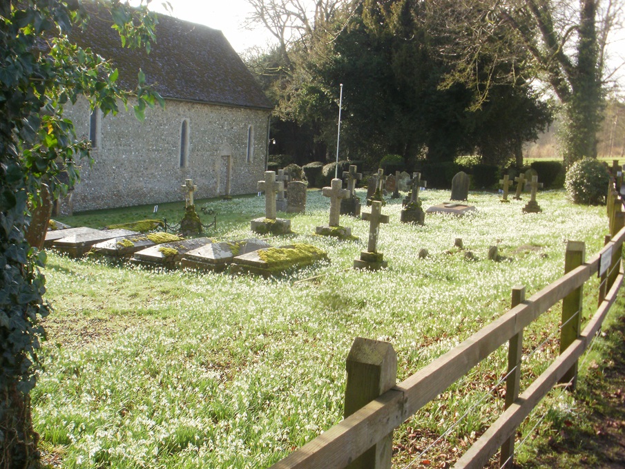
Elvetham Heath is a relatively new housing estate to the North West of Fleet. It comprises about 2000 dwellings with building work starting in 1999 and it was completed just 10 years later. To the north of the estate is the M3, to the south the main railway line to London. Despite these apparent ‘noisy neighbours’ Elvetham Heath is very pleasant, and surprisingly quiet.

In the centre of the estate is a supermarket, a village hall, a school, a church, a pub and many other facilities needed to support its 5000+ population.

The central car park is free for a limited time, but we thought (and we were right), our caching trip would be longer than the free car parking would permit, so we parked some distance from the centre in a residential road.

We planned on locating a cache on our way to the estate’s centre, attempt the multicaches set near the middle and return by visiting a few more caches.

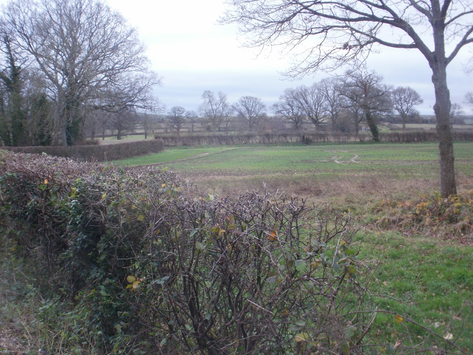
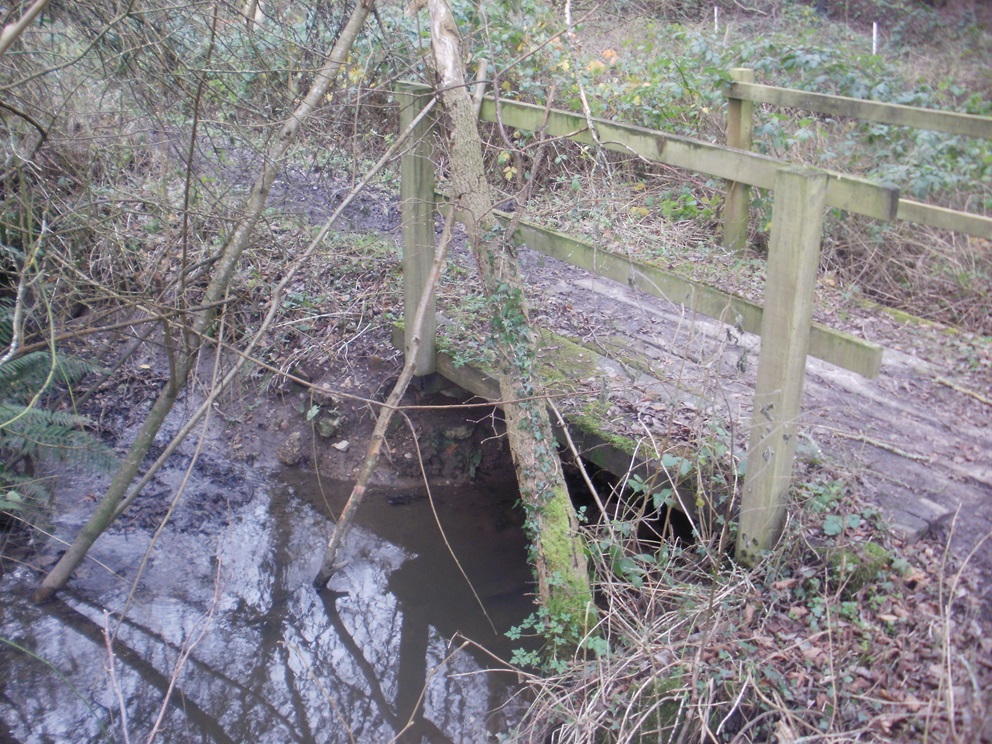
The first cache we attempted was a puzzle cache based on the TV series ‘Death in Paradise’.  We thoroughly enjoy this series, but as it turned out the puzzle didn’t require expert knowledge of the show. A swift google search, some straightforward calculations and the final coordinates were discovered. The cache was hidden on a long, straight track running parallel to the railway.

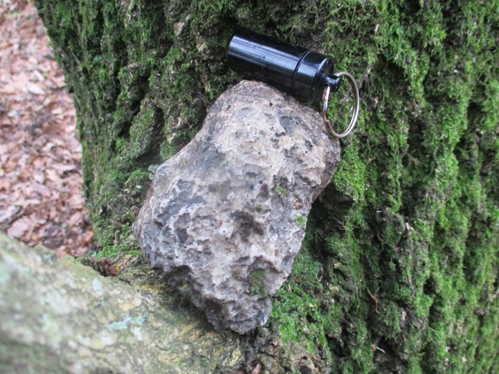
The cache was a well crafted ‘bird-box’ container hidden just behind rhododendron bushes.

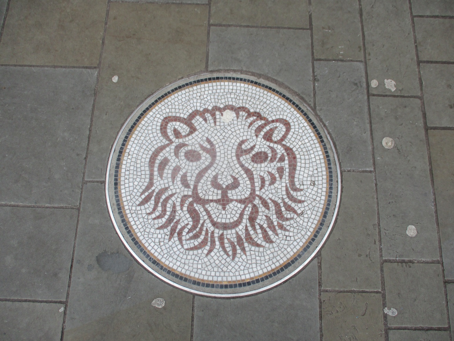
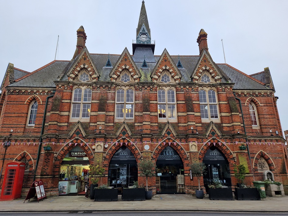
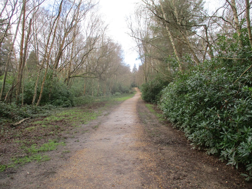
The path was surprisingly empty, we only saw a couple of dog walkers on our 10-15 minute walk to the village centre. We emerged from the quiet, tree-covered path to face the main centre. The supermarket car park was busy, people were crossing roads on errands… the quietness we had experienced had melted into a hubbub of people!

We had two multi-caches to find. We decided to collect the information for both caches, and then plan an optimal route to find the containers.

The first multi-cache entitled ‘My First Multi-cache’ required us to write down numbers from a parking restriction sign. The second multicache, part of the village hall series, required us to use digits from a phone number.

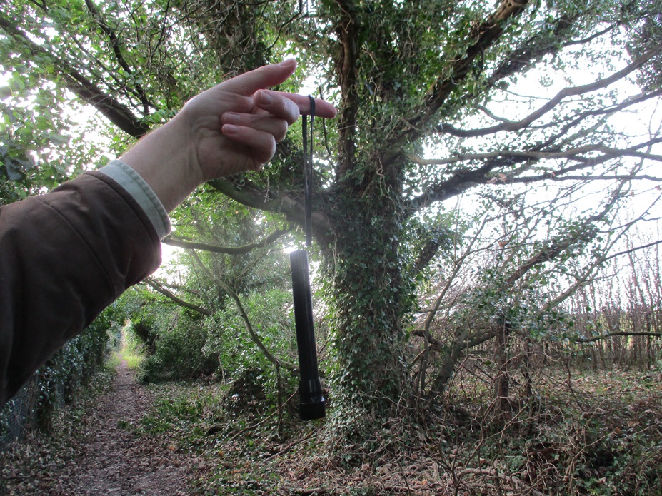
Both caches were in opposite directions! Before we set off to find the first cache, we found a simple cache close to the telephone box and post box – part of the Fine Pair Series. We first found a Fine Pair cache back in 2013 – that cache was number 64 in the National series – this cache was number 1435.

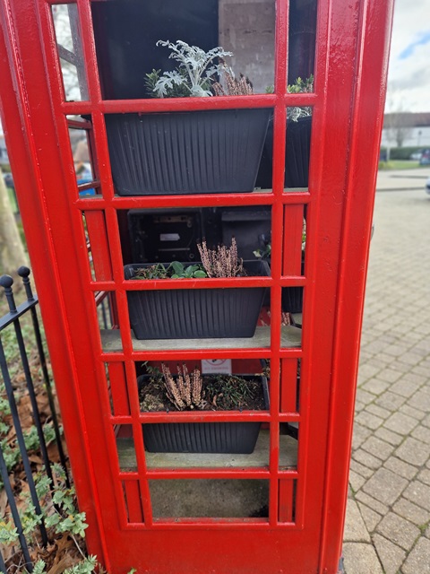
Interestingly the post box was an old George VI post box, so must have either been here 60 years ago, when the estate was a wooded area, or moved from another location. In keeping with the time-travelling nature of the post-box, it was topped with a Dalek, while the no-longer-used phone box, was a frostproof plant container!

With the Fine Pair cache, found, we headed North to find one of the multicaches. The final was a some distance away, and the twisty-turny nature of the roads and pavements, meant it took some time to reach Ground Zero. We were glad for a quick find, as the hiding place was very exposed in front of several houses, on a road junction.

We returned to the village centre and headed a little way south, picking up the other multi-cache.  Again another street sign was the host and a hint that confused Mrs Hg137, who seemingly never learnt the orientation of compass points based on the phrase.. “Never Eat Shredded Wheat” !

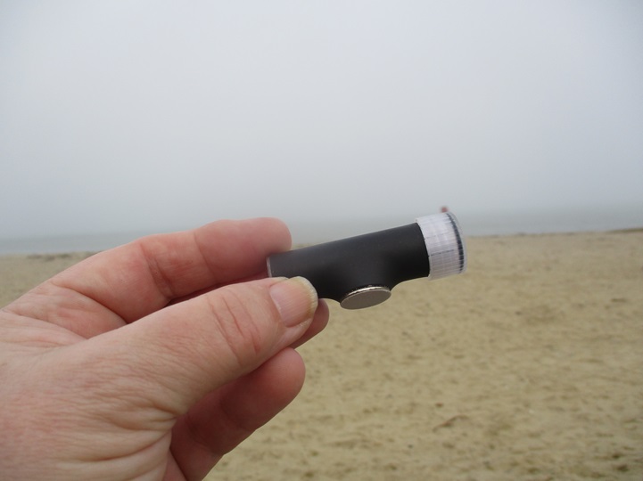
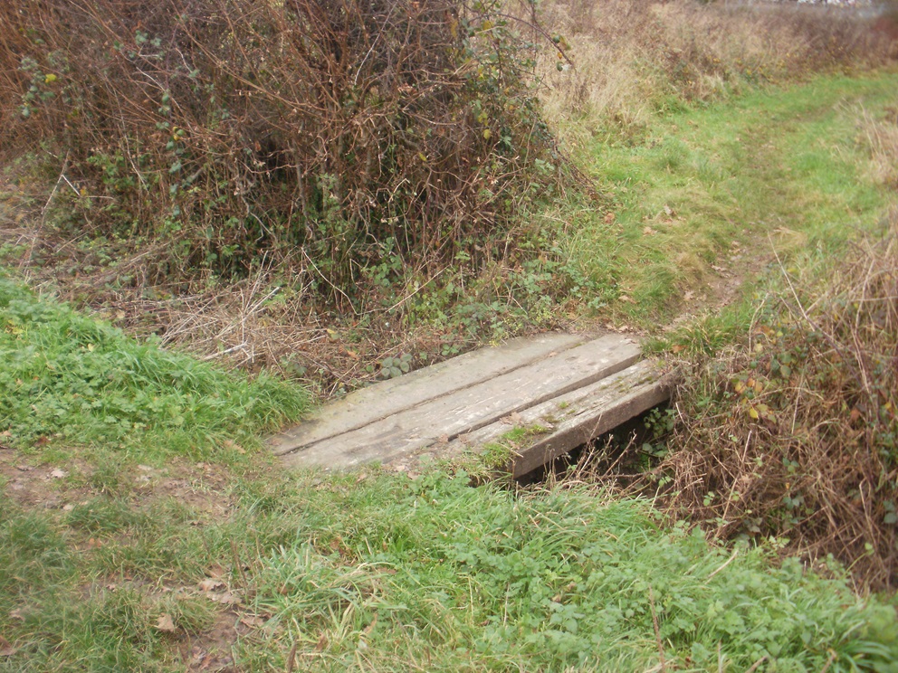
Time was pressing, and we limited our searching to one further cache. This was close to the car, but, at the time, many of roads and pavements were being dug up, and non-optimal alternatives meant we took longer than expected to arrive at GZ. The hint was magnetic, and it took us a few minutes to find the correct metal object, but once we did we had our largest container of the day.

There are still a few caches in the Elvetham Heath estate, which no doubt we will collect at some other time.

February 10 : Swyncombe and the snowdrops

Hello, Mrs Hg137 here.

St Botolph’s Church, Swyncombe

Today’s walk and geocaching adventure took us on a circular route, taking in parts of the Ridgeway and the Chiltern Way and, of course, the snowdrops at St Botolph’s Church. We’d passed the church while walking the Ridgeway back in the summer and had planned to return for the Snowdrop Festival.

There are lots of published snowdrop walks, but we decided to invent our own (similar) version to include some geocaches on our way.   Parking in a large layby on a country road, we set off south across Ewelme Downs.      We were caught up and passed by two lady muggles (non-geocachers) and their excitable spaniel, Banjo, so paused to give them an explanation of geocaching; otherwise, they might have wondered what on earth we were up to, poking around in bushes and behind trees!

We turned east, and climbed gently towards the edge of the Swyncombe Estate, and onto the bridleway known as Ladies Walk.   There were a surprising number of walkers about, and we had snowdrop themed chats with several of them.

Joining the Ridgeway, we reached Swyncombe Church.   Crikey, it was busy, we were glad we hadn’t tried to park here, there was no space on the narrow lane.    And the people … so many!  

But it was obvious why everyone was here.   The churchyard was carpeted by snowdrops and aconites.   We did several circuits of the churchyard, admiring both the tens of thousands of flowers, and the ginormous pieces of delicious cake on sale by the church.   It was lunchtime and we were tempted, very tempted … but we’d brought a picnic lunch with us, and removed ourselves to a quieter corner of the churchyard for a peaceful break.

After a few more circuits of the churchyard and many more pictures of the snowdrops, we moved off for the return leg of out walk.   Our morning’s caching had been part of the Ridgeway Ramble series of caches, while the afternoon was planned to be a number of puzzle caches that we’d solved over the previous few days.   Puzzle caches tend to be found less often than standard caches, and that also means they are harder to find (less logs to go on, no tell-tale ‘cacher’s path’ to the location).   We found five, distributed along a steep down-and-up section of the Ridgeway and the Chiltern Way

The Ridgeway

We stopped to chat to two walkers: yes, they’d seen the snowdrops (of course!) and they were also checking a route for a Ramblers walk in the next few days, which will, unsurprisingly, pass the snowdrops.    Our route now followed the wooded northern edge of Swyncombe Downs, along the line of a medieval earthwork, with expansive views across Oxfordshire to the north.    The woods gave way to a grassy hilltop, then we plunged down a steep descent through more woodland – skidding to a stop a couple of times to plunge into the undergrowth for a late cache or two – then we emerged back into full daylight at the start point of the walk.

A very old postbox

We’d saved one special cache for last: one from the ‘Victoria’s Post Box’ series, which celebrate the diminishing number of working postboxes from Queen Victoria’s reign.   We’d done copious online research and had come up with some coordinates, not too far from the box itself.   Parking close-ish to the final location, we went for a walk, and then spent a while crashing about in the undergrowth to no avail.  We read some old logs and came up with another location (well, exactly where we’d first looked). This time a more dedicated search and feel (and a torch) located the container. After the 30 minutes of angst locating the cache, this was our favourite for the day … apart from those fantastic snowdrops!

Here are some of the caches we found:

January 29 : Ryde

We have mentioned on this blog before, that as well as geocaching we both play competitive Scrabble. Every year, around late January there is a 20 game tournament held on the Isle of Wight. This year was no exception, and we duly attended, competed and failed to trouble to the prize-winners. On our way back, we treated ourselves to some geocaching.

The Isle of Wight has hundreds of caches and we tend to focus on simple urban caches somewhere between the Scrabble venue on the South Coast, and the ferry terminal of Fishbourne in the North. We stick to urban caches, as we don’t have walking boots with us, and urban caching provides a level of bad-weather protection too.

This year we cached in Ryde. We have cached in Ryde several times before, but this time we would approach from the South East, head towards the sea, hopefully collect a couple of promenade caches, before heading back to our car.

Our first cache was on a crossroads of two paved footpaths. A smallish cache hidden in a tree, but the endless dogwalkers made searching tricky. Fortunately there was a handy ‘tourist information board’ nearby, where we could stand, sign the log, and more importantly wait for passers-by to, er, pass by before replacing the cache.

Our main walk initially took us away from Ryde passing through Appley Park. Here a cache had been planted in some tree roots –  how we found and replaced the cache without being spotted by a couple of dog walkers we don’t know. We had to pass the dog walkers soon after, and one of the dogs knew how to interact with strangers. A ball was dropped by Mr Hg137’s feet. “Throw it” the dog begged. Without a plastic ball thrower, Mr Hg137 was not going to pick up a wet, dog-slathered, ball, so he kicked it. Perhaps a bit too strongly, but the ball ran away at great pace. The path was slightly downhill, and the ball gathered so much momentum the dog had to run a long way before retrieving it. This gave us a minute or two to head down a side path, to our next cache. Sadly we didn’t find it! It was supposed behind a road sign (of which there were two obvious candidates some distance apart). The local council had also undertaken some hedge clipping near one of the signs, and we suspect the cache had disappeared.

What was interesting about this non-cache was that it was originally placed by Robb-Inn, a caching couple who used to live near us, and who moved to the Isle of Wight some years ago. The cache is now looked after by someone else.

We were on our furthest point from Ryde and we looped back behind an archery field, revisiting the park we left earlier. The path descended to the shoreline, where there were a number of seats – one of which hosted a cache. Of course we scoured the wrong seats to start with and when we found the cache, decided to break for coffee whilst signing the log. Here more dog walkers appeared. We counted about 4-5 people and 7-8 dogs. All the humans were standing around chatting, with dogs getting more and more impatient. One dog had worked out how gravity worked, and walked slightly uphill (within the confined of its lead), dropped a ball, watched it roll downhill, and then walked down and collected it, before heading a few doggy paces uphill before dropping the ball again!

A good tarmac path led us to Ryde, but first we diverted into some woodland to find another cache. The cache was hidden near a ‘photo opportunity’ of Appley Tower, a folly built on the Appley estate by the then owners in the late 1870s. Sadly there was scaffolding around the tower, which rather diminished the photo opportunity!

Our next cache was our hardest of the day. Called “A Loo with a view”. We expected the cache to be in front of the public conveniences with a view overlooking the sea. We searched the front and sides of the building, and found nothing. Eventually we found the cache behind the loos attached to the outer drainage pipes. Hardly a view!

We then had our second DNF of the morning, A cache we had failed to find back in 2018 and we failed to find it yet again. The GPS took us to some trees, many of the photos on www.geocaching.com show a brick wall. We were totally flummoxed, maybe in a year or so… we will get third time lucky here!

A few yards back from the sea front in Ryde is an ornamental pond. The pond contained a variety of birdlife, and nearby a group of artists were busy sketching and painting. Having passed the lake, we crossed to the sea front, and to one of the pay-to-view telescopes you see at the seaside. A magnetic cache was hidden underneath. This location is quite exposed, and we imagine in the Summer, when the tourist season is in full swing, this cache is difficult to attempt without being seen.

Time was drawing on, and we headed inland following a footpath towards our car. Our route took us past one more cache. It should have been a magnetic nut-and-bolt cache, but only half remained – fortunately the half with the log in. This took a bit of searching, as there were several metal structures that a magnet could have been affixed to.

In all we found 7 Caches, had 2 DNFs, but more importantly a pleasant walk in Winter sunshine after a couple of days sitting down exercising our brain. Roll on next year!

January 20 : Trackable : Sharing a cup of tea trying to get to Canada

Hello, Mrs Hg137 here.

Sharing a cup of tea trying to get to Canada – not the snappiest title but very descriptive on the mission for this trackable:

Sharing a cup of tea trying to get to Canada

… “As I have a friend going to Thailand for a caching trip, she offered to take any trackables that were looking to go that way.  This is one of mine that I made to send with her. It would love to tour Thailand and area collecting lots of pictures along the way before eventually trying to get back to Hamilton, Ontario, Canada to me by the end of 2023. ”…

The story so far: setting off from Canada in October 2022, the trackable was duly taken to Asia, visiting Singapore and Indonesia, before being dropped off in January 2023 in a cache close to the Petronas Towers in Kuala Lumpur, Malaysia.   There it sat for some months, being discovered several times, but not picked up.   Finally, in November 2023, the trackable was picked up by TAROTHRUM, a geocacher from Singapore.   After another gap of two months, the trackable emerged in Weybridge, England, where we found it.   (I looked at TAROTHRUM‘s geocaching activity to see where they might have taken the trackable, but with few conclusions: he/she/they have only found about 200 caches in 10 years, but dotted all over the world – Singapore, the United States, Vietnam, the United Kingdom, Japan, Australia, Malaysia, Portugal, Greece, and Indonesia.  I wonder if they are a pilot, or cabin crew, to fit in all that globetrotting?)

The trackable is now well on its way back to Canada, even if it is a little late for its target arrival date of the end of 2023.   We’ll move it on soon, when we find a cache where it will fit!

January 20 : Trackable : Community Volunteer Tag

During our caching trip around Weybridge, we found two trackables. Finding one trackable is quite rare, finding two very rare indeed. Also, trackables tend to be found in rural caches, rather than the urban ones in Weybridge.

Community Volunteer Trackable Tag

The first trackable was a Community Volunteer Tag. We have found at least one of these tags before – we believe they are given to noteworthy cachers on an ad hoc basis. This tag started in Poland in March 2022 and in less than 2 years has had a varied journey.

Not surprisingly its first few caches were in Poland/Germany/central Europe. It quickly arrived in the UK. Here it was taken to some iconic London landmarks, including Big Ben and Kew Gardens. It travelled to Australia (via the Philippines) and has been pictured outside the Sydney Opera House and Melbourne Cricket Ground!

Returning to Europe, it toured France, Italy and Portugal, before another trip to Australia, before returning to the UK, and was placed in the Weybridge cache on Christmas Day 2023.

A well travelled trackable – good luck on your future adventures!

January 20 : Weybridge : our 800th blog post

Hello, Mrs Hg137 here.

Weybridge, Oatlands Palace Gate

At last, a few days without rain!   Off we went to Weybridge, on the south-western edge of London, for some geocaching with firm, dry paths underfoot.   After finding some free street parking, we made our way towards the town centre, and the parish church, St James: we needed to count some objects in the churchyard and then to use them to derive coordinates giving us the location of the Church Micro cache nearby.

While in the churchyard, gazing at an impressive tomb, musing, we were approached by a passer-by, who stopped to give an enlightening talk about the town and its history, which gave us information we would use for the rest of the day.    The tomb is that of Princess Frederica Charlotte of Prussia – Duchess of York. A monument was erected to her – we’d visit that later, there’s another cache close by there.

Anyway, we worked out some coordinates for the Church Micro cache, a little way away, and decided to return to them later.    We walked out of the busy town centre and through quiet residential streets, collecting some caches as we went.    Looping back towards the town, we reached Monument Green.  The monument commemorates the Duchess of York, whose grave we’d seen earlier.   It was originally topped by a sundial which came from Seven Dials, in central London.    This proved a bit top heavy, so it was removed and is now on display by the library; we saw it later, and it was waaay too heavy for that slender column.    The adjacent cache was a milestone cache for us – 4500 finds !!! – and it’s a good location, an interesting place we wouldn’t have visited otherwise.

Fancy entrance to Portmore Park

From the green, we headed north, passing some impressive pillars which used to lead to Portmore Park (it’s now a housing estate).  We soon reached the river, at the confluence of the rivers Wey and Thames.  Both rivers were high, just within their banks, and flowing fast.  Just downstream was the Shepperton Ferry.  This place brings back memories – back from 2015 when we walked the Thames Path (it’s the only ferry crossing on the whole, nearly 200-mile path). Actually, our main memory was of hanging around on the far side of the Thames for about 25 minutes, waiting while the ferryman finished his lunch (or whatever he was doing!).  As the river was much, much higher and faster today, the ferry wasn’t running, but still a great spot and much reminiscing.

Passing D’Oyly Carte Island, we turned away from the river and followed wooded paths and fields back into the town.   Once there, we realised we’d missed out one of the caches on our list (doh!), so back we went, to look for ‘Orinoco’s Favourite space’.  We were expecting something to do with litter and Wombles, but, no, it was much-loved by the cache owner’s dog.   While searching, we were hailed by a dog-walking muggle (non-cacher), wanting to know if we were doing ‘a survey’. Sort of, we said, and Mr Hg137 explained geocaching to him while Mrs Hg137 found the cache container.

D’Oyly Carte Island

Also, once here, we realised we were very close to the location of Oatlands Palace, now a housing estate, once home to Princess Frederica.   We asked directions from a passing local and soon found ourselves at the surviving walls and archways of the palace.   Very interesting, we wouldn’t have come here but for the local historian we’d met in the churchyard earlier.

Back to the church, to find the Church Micro we’d calculated the coordinates for at the very start of the day.  Those coordinates (oh dear): we made not one, but two, howling errors, while working out the numbers, and spent some while searching an entirely wrong place, not once, but twice. We eventually started again, read the description properly and came up with some correct numbers which finally, finally led us to the cache.   (One of us has a degree in ‘hard sums’: we should have done better!)

Close to the church is a park and allotments (unusual to have such a big open space so close to a town centre).  while walking across the park towards a geocache, Mr Hg137 suddenly slowed, saying … ‘watch that man’ … he was just ahead of us, heading for a spot oh-so-close to where we were going, too. He bent down and picked something up; we walked up to him. Aha! a cacher caught red-handed! Good to meet you, Flyingfox76 ! Also good to meet you, mummycherub, who appeared very soon to ask to be added to the log. We swapped tales of caching, then went on our separate caching ways.

mummycherub and Flyingfox76

Our caching was nearly done now: we followed peaceful suburban streets to the south of the town centre, finding our last few caches, and returning to the geocar.   We enjoyed Weybridge: it had far more to see than we were expecting, lots of history, attractive corners, rivers, parks, and glimpses of the past.   A good place for a winter walk!

Here are a few of the lots of geocaches we found:

January 13 : (Return to) Wokingham

Just five days previously we had visited Wokingham in perishingly cold weather and undertook an ad lab in Wokingham Town Centre.

Simultaneously, we tried to undertake two multi-caches which shared much of the ad lab’s route.

A combination of the cold, confusion over which cache we were doing, and the pressure to return to our car before our car parking charge ran out -left us annoyed and frustrated.

Mr Hg137 knew the Town Centre well – he’d lived in the town for 30+ years, Mrs Hg137 had a reasonable knowledge too. And we still messed up.

We decided once the temperature rose (admittedly it was only a degree or two), and some improved planning of a walking route we would return.

So five days later, we started again on the two multi-caches.

One of the two multis took us on a glorified pub crawl around the Town Centre. Wokingham was once famed for having the most pubs per head of population. Sadly a combination of Wokingham’s population growth and the economic downturn of pubs, has meant this title has been lost.

 Our caching walk took us to several pubs that remain and at each pub, we had to gather numbers from either a feature of the pub itself, or a nearby piece of street furniture.

Simultaneously we followed a trail of blue plaques. The ad lab we had completed visited 5 blue plaque locations, but the multi took us to many more. Indeed the cache owner didn’t let on that the waypoints were at ‘blue plaques’ as he referred to them as ‘Wotsits’ in the cache description. What made this multi harder, was that at every plaque/waypoint we had to find a number, and use that as a basis for the coordinates for the next plaque/waypoint. We had to take great care on checking every number we found, as we didn’t to miss a blue plaque.

In the end we collected a variety of numbers for both the pubs and plaques, calculated coordinates and found both ‘final’ caches. One was hidden in a set-back location, the other in a high visibility location within a car park.

As well as a pub crawl, and a blue plaque trail, Wokingham has a ‘mosaic’ trail with mosaic laid into the pavements. We are quite sure, that in that not-to-distant future, these mosaics may well form an opportunity for another caching trail in Wokingham.

Our only disappointment of the morning was spending 15 minutes looking for a standard cache in one of Wokingham’s Parks. Sadly for us, the cache has disappeared and we registered a did-not-find. It sort of summed up the last few days in Wokingham – hard work, for very little gain.

January 8 : Wokingham’s blue plaques

Hello, Mrs Hg137 here.

Wokingham Town Hall

Wokingham has many interesting old buildings dotted about the town centre.  Many are marked by blue plaques, which have their very own Blue Plaque Trail.  For the geocacher, the information on the plaques lends itself for setting multicaches and Adlab caches – those where numbers need to be found, or things are to be counted, to use to calculate coordinates.

On a bleak day in early January, we set off around Wokingham to find some of those caches.  Our initial plan was to look for two multicaches plus an Adlab and its associated bonus (physical) cache, since all were based around similar locations and some of the same blue plaques.   It didn’t go at all well; doing three caches at once, we got mixed up, then found one of the stages in one multicache had a problem: the clue item was damaged.  In the end, we said – finish the ad lab and go home and get warm.  And that’s what we did.

It all got easier once we were doing one thing, not three, and weren’t struggling to enter coordinates into the GPS with freezing fingers.    (FYI: AdLab caches work from a mobile phone and rely on proximity to the clue locations.)

The Tudor House, Wokingham

We started at the Tudor House, once a 16th century mansion; more recently, it was a doctor’s surgery: Mr Hg137 remembers it well from his days as a Wokingham resident.   Walking along Broad Street, we stopped at Nationwide Building Society.   This has a blue plaque, not for its current use, but for a previous incarnation as a cinema, the first in Wokingham.

A short way on is Wokingham Town Hall, a place where we’ve both attended special things: weddings, funeral wakes, Mayor Making ceremonies and much else.   Today we weren’t going inside, just inspecting the blue plaque and the water trough nearby (it’s now a planter).  

Leaving the Town Hall, we turned into Rose Street, wide and lined with historic buildings.  Another blue plaque awaited us near the far end, on a (small) residential house; this used to be a school with 12 pupils and a live-in teacher – it must have been quite crowded!

Just around the corner was the last blue plaque on our trail, placed to show off The Overhangs, some of Wokingham’s oldest buildings, which really do overhang one of the main roads through the town centre.   Once again, the location had memories for Mr Hg137, as he used to work there in the mid-1990s (he tells me it’s modernised inside, it’s just the façade that retains the Tudor layout).     

We sheltered from the wind and worked out the coordinates of the bonus geocache.   Our GPS gave us a direction to travel in, and we knew how far away it was in a straight line from us, but we didn’t know exactly where it was.   So we followed a not-so-straight line along paths, probably not the quickest way, through car parks, and along roads, to arrive at … a place near where a postman had chained his trolley!   Oops, we didn’t want to attract attention by rummaging there!    But all was well: a glance behind a nearby object showed us the cache, tucked away out of direct sight.   Time was pressing now, our parking time was running out, and it was a speedy walk back to the geocar, and home for a warming cup of tea.

Found it!

December 23 : Kingsclere and surrounding countryside

Hello, Mrs Hg137 here.

Two days before Christmas … the turkey was defrosting, the homemade Christmas pudding had been checked (a year old but fine), and all was pretty much under control, Christmas-wise.    On a dry, bright morning we made our way to Kingsclere in north Hampshire for some geocaching in the countryside around the village.   We planned to find the caches in the Kingsclere Kaper series, and maybe add in a few others as we went.

From the Fieldgate Centre on the edge of the village, we made our way uphill along a country lane and into the bare, wintry country, hearing the bangs of guns from a distant shoot ahead of us (luckily, not on our route, we don’t like being shot at).   Just before turning onto a bridleway, we were hailed by an elderly countryman, and stopped to pass the time of day. He said he was on his way home – from where? no idea. He was also clutching a laden carrier bag – we had suspicions that it contained pheasant(s) “obtained” from the shoot going on a little way ahead of us – but we can’t prove that!

Once off the tarmac, it was damper underfoot, but a lovely walk through trees, part of the Brenda Parker Way, a long-distance footpath.   We skirted a fishery, crossed a little bridge – there are lots of small footbridges on this route – and emerged onto fields.  Other people had the same idea as us and were out for a pre-Christmas walk: most were very clean and tidy and we wondered if that would still be so once they’d negotiated the muddy path!  Geocaching-wise, we were doing well, we’d already found eight caches, all but one from the Kaper series, and were making steady progress. 

We emerged onto the A339, the main road between Basingstoke and Newbury.   At the Star Inn, we saw that, again, other people were out for a pre-Christmas meal … but they weren’t watching us as we stopped to find a cache.

From here, we followed paths and field edges and made our way through the edge of the village.  It was lunchtime, so we found a seat in a quiet spot for a picnic.   (As an aside, this was one of our better lunch spots, overlooking the playground and allotments: we’ve previously had lunch in leaky bus shelters, industrial estates, graveyards …)  Afterwards, we walked back out into the country, passing the community orchard : much better seats here, we shouldn’t have stopped so soon!

We walked in a loop through the countryside to the north, crossing a few more of those little bridges on the way.   A brief furtle for a cache behind the postbox, then we made our way to the end of our walk along the delightfully named Frog’s Hole, following a little stream back up the hill; and a chance to cross yet more of those ‘little bridges’ that abound in Kingsclere.

Here are just a few of the many interesting caches we found:

December 21 : Buckhurst Meadow, Wokingham

A morning of reminiscing for Mr Hg137 who used to live about a mile or so from Buckhurst Meadow, on the outskirts of Wokingham. Back then the area was known as Buckhurst Farm and in the late 90s, the area could have been made the stadium for Wokingham Town FC. Instead local residents complained, the football club move was vetoed, and an estate of 620 houses was built.

As well as the housing estate much of the farmland has been turned into a 30-acre country park ideal for walking around and of course geocaching!

Normally our diaries are quite busy on a Thursday, but today, a few days before Christmas, our bookings had been cancelled – do we need a better excuse to go geocaching ?

Well the weather could have been better ! A misty, murky day greeted us as we set out. The December rain had made much of the grass very wet, but the paths otherwise were more or less good. Occasionally we stepped away from the path to find a cache.

The first cache brought back memories of the first cache we found just 5 days previously. Tucked near a post, behind a bramble bush. Fortunately this time the bush was relatively easy to lean over, yielding us a quick find.

Most of the caches we were looking for were set by local cacher, Mikes54, who gives very specific hints. We were grateful of this at the next cache where we had to find a cache at the base of a tree – the hint made sure we looked at the correct one from a choice of 4! We couldn’t grab this cache immediately as the tree was close to an intersection of footpaths, and a constant series of dogwalkers!

Fortunately our next cache took us away from the dog-friendly footpaths and into a hazel coppice. Here we had not only had to find a ‘knobbly tree’ but then count coppiced hazels to find the cache. We were grateful we hidden from prying eyes when we did this.

The Mikes54 caches had all been placed barely a month before our visit, but our next cache was much older having been placed in 2009. This was deep in area called ‘Big Wood’ which straddles the Wokingham and Bracknell boundary. We found some caches in the Bracknell side of Big Wood back in September 2022. The 2009 Wokingham cache was a quite easy find, albeit the GPS was 30 feet out. (We do find that the older the cache, the less accurate the GPS is – any ideas why ?)

We returned to Buckhurst Meadows and we should really have read the cache notes before we headed for cache 4 in the series. It advised, that after heavy rain, from cache 3 we should walk into the centre of the park via the central butterfly statue and take a different path to cache 4. We didn’t, and soon discovered the perimeter path was underwater. We waded through and around the puddle-cum-lake to arrive at a seat near Ground Zero. We gave a quick search for the cache but couldn’t find it. We saw a ‘cache-size hole’ at the front of a tree, and assumed the cache was missing. Then in the gloom, 300 yards away we saw a dog-walker approaching. Should we move on ? Continue searching ? The man turned away, and we resumed our search, and after few more minutes we had the cache in hand.

Our final cache in the Buckhurst Meadows series was closer to the car, so we took a path out of the meadows, passing a playground, a school and a pond. We arrived at Clay Lane – an enclosed wooded footpath Mr Hg137 remembered well as he sometimes walked their family dog there. Unsurprisingly, the lane had altered slightly in 40 years, many of the saplings had grown, the new estate provided less tree-cover on one side. On the other many of the gardens set back from the tree-line now had gates giving access to Clay Lane and Buckhurst Meadows.

In those intervening years, fairies have visited Clay Lane too. Their tiny houses nestled at the base of trees. We were admiring many of them… and walked by a cache. After walking a few yards, we retraced our steps, and after quite a lengthy search -found the cache. Another old cache as it placed in 2008!

We returned to Buckhurst Meadows and found the last cache snugly hidden behind a lifebuoy post, again near a junction of footpaths – so stealth was needed.

Close to Buckhurst Meadows were 2 more caches – both near the busy A329M. The first in a cul-de-sac that led to a hotel (in Mr Hg137’s time, the hotel was a nunnery!). The GPS wavered here but we soon found the tree the cache had been placed behind.

We crossed the A329 to find a most unusual cache called “It’s a Letterbox”. Letterbox caches, are named, after the ‘letterboxes’ found on Dartmoor. Geocaches of this type tend to have an ink stamp inside. The size of letterbox caches tends to be slightly larger than average, to accommodate the ink stamp, but the size of this cache caught us by surprise!

A highly unusual end, to a fun morning’s caching!